Grove Coppice

Wood, Forest in Worcestershire Malvern Hills

England

Grove Coppice

Yarhampton House Early 17th century timber-framed former farmhouse viewed from the passing road.
Yarhampton House Credit: Philip Halling

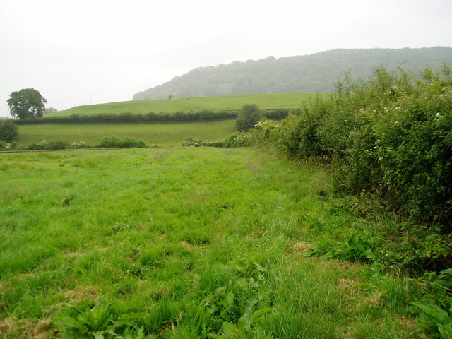
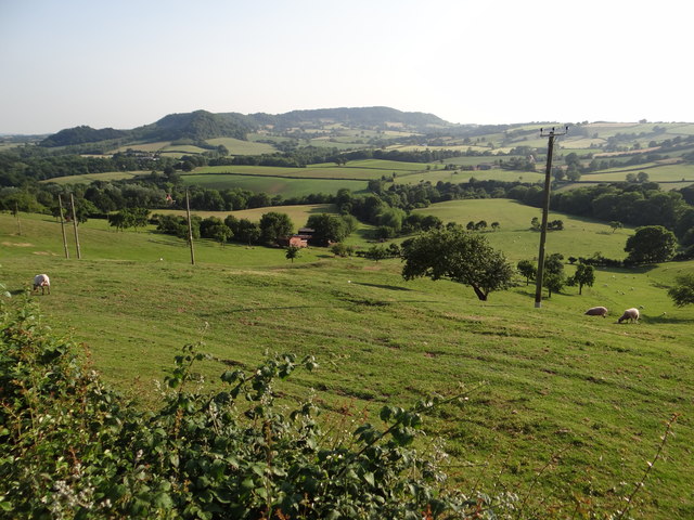
Grove Coppice is a picturesque woodland located in Worcestershire, England. Situated on the outskirts of the town, it covers an area of approximately 50 acres and is a popular destination for nature enthusiasts and outdoor enthusiasts alike.

The woodland is predominantly composed of a mixture of deciduous trees, including oak, birch, and ash, creating a diverse and visually appealing landscape. The forest floor is carpeted with a variety of wildflowers and ferns, adding to the natural beauty of the area.

Grove Coppice is known for its abundant wildlife. Visitors can often spot a range of bird species, including woodpeckers, buzzards, and owls. The woodland is also home to small mammals such as rabbits, squirrels, and foxes, providing a natural habitat for these creatures to thrive.

The woodland offers several walking trails, allowing visitors to explore the area at their own pace. These trails vary in length and difficulty, catering to both casual walkers and more experienced hikers. Along the way, visitors can enjoy scenic views, peaceful streams, and tranquil picnic areas.

Grove Coppice is managed by the local authorities, who ensure the preservation of its natural beauty and wildlife. They also organize educational events and workshops to raise awareness about the importance of conservation and sustainable practices.

Overall, Grove Coppice is a captivating woodland that offers a serene escape from the hustle and bustle of daily life. Its diverse flora and fauna, coupled with its well-maintained trails, make it an ideal destination for nature lovers and those seeking a tranquil retreat in Worcestershire.

If you have any feedback on the listing, please let us know in the comments section below.

Grove Coppice Images

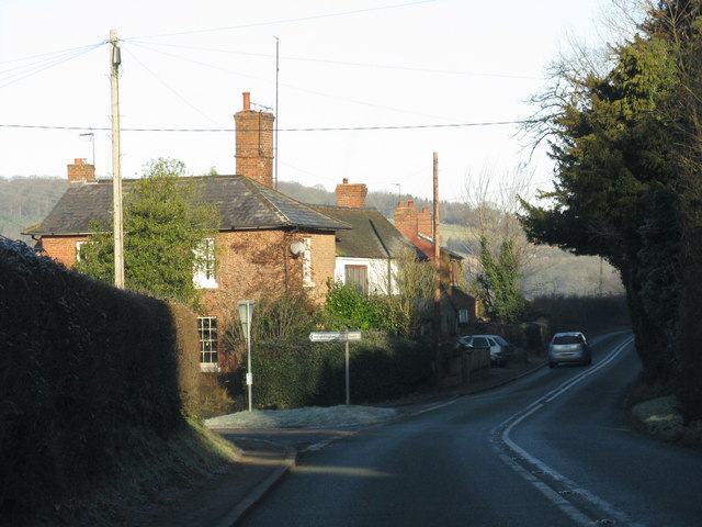
Images are sourced within 2km of 52.315498/-2.3287862 or Grid Reference SO7768. Thanks to Geograph Open Source API. All images are credited.

Yarhampton House Early 17th century timber-framed former farmhouse viewed from the passing road.
Yarhampton House
Early 17th century timber-framed former farmhouse viewed from the passing road.
Path from Haseland Farm Public footpath 527(C).
Path from Haseland Farm
Public footpath 527(C).
Path crossing field Public footpath 563(C) leading to Worcestershire Way.
Path crossing field
Public footpath 563(C) leading to Worcestershire Way.
Pond for cattle Spire of Abberley Church can be viewed on horizon.
Pond for cattle
Spire of Abberley Church can be viewed on horizon.
Reynolds Lane Looking towards The Hill Abberley.
Reynolds Lane
Looking towards The Hill Abberley.
Reynolds Lane Looking towards Reynolds Farm.
Reynolds Lane
Looking towards Reynolds Farm.
Breathtaking Quite a view from Hurtle Hill.
Breathtaking
Quite a view from Hurtle Hill.
The Dog, Dunley
The Dog, Dunley
Road junction in Dunley House on the corner by a road junction in Dunley.
Road junction in Dunley
House on the corner by a road junction in Dunley.
Access road to the church etc., Astley, Worcs The road on the left gives access to St. Peter's Church, its small car park and a couple of other properties. The road in the foreground is Church Lane.
Access road to the church etc., Astley, Worcs
The road on the left gives access to St. Peter's Church, its small car park and a couple of other properties. The road in the foreground is Church Lane.
St. Peter's Church, Astley, Worcs The church dates from Norman times, probably mid-12th century. The aisle was rebuilt and widened in 1837-8, and there was a major restoration with substantial alterations in the very early years of the 20th century. Currently the church is fund raising for essential works. The church was originally built as the church for a Benedictine priory which was attached to the Abbey of St. Taurin near Rouen in France. As an "alien" foundation, the priory was suppressed in 1414, over a hundred years before King Henry VIII closed all the other remaining religious houses. Fortunately the church survived and contains a number of interesting monuments.

<a href="https://www.geograph.org.uk/photo/3856068">SO7867 : Porch of St. Peter's Church, Astley, Worcs</a>.
St. Peter's Church, Astley, Worcs
The church dates from Norman times, probably mid-12th century. The aisle was rebuilt and widened in 1837-8, and there was a major restoration with substantial alterations in the very early years of the 20th century. Currently the church is fund raising for essential works. The church was originally built as the church for a Benedictine priory which was attached to the Abbey of St. Taurin near Rouen in France. As an "alien" foundation, the priory was suppressed in 1414, over a hundred years before King Henry VIII closed all the other remaining religious houses. Fortunately the church survived and contains a number of interesting monuments. SO7867 : Porch of St. Peter's Church, Astley, Worcs.
Porch of St. Peter's Church, Astley, Worcs The porch was rebuilt in 1903-4, at the time of a major restoration of the church by the rector, the Rev. Martin Brereton Buckle.

<a href="https://www.geograph.org.uk/photo/3855997">SO7867 : St. Peter's Church, Astley, Worcs</a>.
Porch of St. Peter's Church, Astley, Worcs
The porch was rebuilt in 1903-4, at the time of a major restoration of the church by the rector, the Rev. Martin Brereton Buckle. SO7867 : St. Peter's Church, Astley, Worcs.
Old graveyard at St. Peter's Church, Astley, Worcs The graves here seem quite old and are showing the ravages of time. It is located opposite the church and next to the car park.
Old graveyard at St. Peter's Church, Astley, Worcs
The graves here seem quite old and are showing the ravages of time. It is located opposite the church and next to the car park.
Looking towards Church Lane, Astley, Worcs Looking from the access road which serves the church and a couple of other properties.
Looking towards Church Lane, Astley, Worcs
Looking from the access road which serves the church and a couple of other properties.
St. Peter's Church Restoration Fund information board, Astley, Worcs Located at the side of the car park.
St. Peter's Church Restoration Fund information board, Astley, Worcs
Located at the side of the car park.
Church Lane, Astley, Worcs The main road in the straggly village of Astley.
Church Lane, Astley, Worcs
The main road in the straggly village of Astley.
End of access road, Astley, Worcs Just past St. Peter's Church the access road ends here, with entrances to two residential properties.

<a href="https://www.geograph.org.uk/photo/3855968">SO7867 : Access road to the church etc., Astley, Worcs</a>.
End of access road, Astley, Worcs
Just past St. Peter's Church the access road ends here, with entrances to two residential properties. SO7867 : Access road to the church etc., Astley, Worcs.
Prior's Mill and weir, Astley, Worcs Prior's Mill is a former seventeenth century timber-framed water mill, with twentieth century alterations, and now used as a private residence. Next to it is a very high weir on the Dick Brook. There used to be several mills on this stream long ago. The Prior's Mill would not have been connected to Astley Priory, as that was dissolved in 1414 as an "alien house" and demolished centuries ago. However it is possible that an earlier mill was on the site of the present one or near to it, and perhaps that belonged to the priory.

<a href="https://www.geograph.org.uk/photo/3859678">SO7867 : Weir on the Dick Brook, Astley, Worcs</a>.
Prior's Mill and weir, Astley, Worcs
Prior's Mill is a former seventeenth century timber-framed water mill, with twentieth century alterations, and now used as a private residence. Next to it is a very high weir on the Dick Brook. There used to be several mills on this stream long ago. The Prior's Mill would not have been connected to Astley Priory, as that was dissolved in 1414 as an "alien house" and demolished centuries ago. However it is possible that an earlier mill was on the site of the present one or near to it, and perhaps that belonged to the priory. SO7867 : Weir on the Dick Brook, Astley, Worcs.
Show me another place!

Grove Coppice is located at Grid Ref: SO7768 (Lat: 52.315498, Lng: -2.3287862)

Administrative County: Worcestershire

District: Malvern Hills

Police Authority: West Mercia

What 3 Words

///blueberry.resides.solo. Near Stourport-on-Severn, Worcestershire

Related Wikis

Dunley, Worcestershire

Dunley is a village, and a civil parish (with Astley), in the administrative district of Malvern Hills in the county of Worcestershire, England. ��2�...

Astley, Worcestershire

Astley is a village, and a civil parish (with Dunley) in Worcestershire, England, about two miles outside Stourport-on-Severn and seven miles south-west...

Astley Priory

Astley Priory was a Benedictine priory in Astley, Worcestershire, England.It was founded in the 11th century, probably by Ralph de Todeni, as a cell subject...

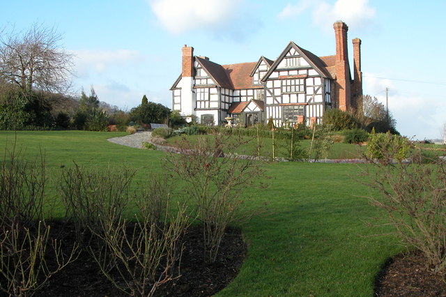
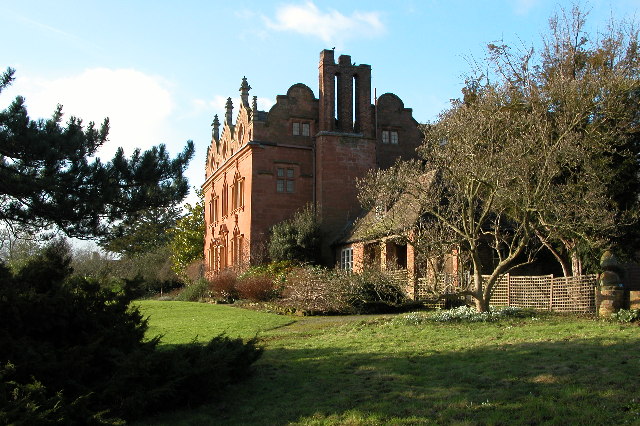
Pool House, Worcestershire

Pool House is a Grade II* listed house in Astley, in the county of Worcestershire, England.In the area close to Stourport-on-Severn, there are several...

Nearby Amenities

Located within 500m of 52.315498,-2.3287862
Power: tower
Lat/Long: 52.31477/-2.3327522
Power: tower
Lat/Long: 52.3155447/-2.3276173
Power: tower
Lat/Long: 52.3160749/-2.3240948
Power: pole
Lat/Long: 52.3113777/-2.3300504
Power: pole
Lat/Long: 52.3115467/-2.3307455
Power: pole
Lat/Long: 52.31188/-2.3320433
Power: pole
Lat/Long: 52.3123123/-2.3337507
Birchall Farm
Power: pole
Transformer: distribution
Voltage Primary: 11000
Lat/Long: 52.3195693/-2.3308933
Power: pole
Lat/Long: 52.3186069/-2.3319548
Power: pole
Lat/Long: 52.3179855/-2.3326541
Power: pole
Lat/Long: 52.3175391/-2.3331369
Power: pole
Lat/Long: 52.3169185/-2.333837
Wordley Farm
Power: pole
Transformer: distribution
Voltage Primary: 11000
Lat/Long: 52.3160458/-2.3332644
Power: pole
Lat/Long: 52.3163254/-2.3345022
Power: pole
Lat/Long: 52.3158405/-2.3350252
Power: pole
Lat/Long: 52.3153662/-2.3355442
Power: pole
Lat/Long: 52.3146579/-2.3351339
Power: pole
Lat/Long: 52.3139626/-2.3347295
Power: pole
Lat/Long: 52.3135572/-2.3345853
Power: pole
Lat/Long: 52.3129021/-2.3343265
Power: pole
Lat/Long: 52.3116624/-2.3258051
Grove Farm North
Power: pole
Transformer: distribution
Voltage Primary: 11000
Lat/Long: 52.3141639/-2.3218174
Power: pole
Lat/Long: 52.3144156/-2.3223504
Power: pole
Lat/Long: 52.3139106/-2.3234676
Power: pole
Lat/Long: 52.3132694/-2.3248838
Grove Farm
Power: pole
Transformer: distribution
Voltage Primary: 11000
Lat/Long: 52.3127381/-2.3245438
Power: pole
Lat/Long: 52.3127857/-2.3251648
Power: pole
Lat/Long: 52.3122306/-2.3254517
The data included in this document is from www.openstreetmap.org. The data is made available under ODbL.

Have you been to Grove Coppice?

Leave your review of Grove Coppice below (or comments, questions and feedback).