Avenue Wood

Wood, Forest in Northumberland

England

Avenue Wood

Shilla Hill Bastle Now somewhat overgrown <span class="nowrap"><a title="https://historicengland.org.uk/listing/the-list/list-entry/1008991" rel="nofollow ugc noopener" href="https://historicengland.org.uk/listing/the-list/list-entry/1008991">Link</a><img style="margin-left:2px;" alt="External link" title="External link - shift click to open in new window" src="https://s1.geograph.org.uk/img/external.png" width="10" height="10"/></span>
Shilla Hill Bastle Credit: Sandy Gerrard

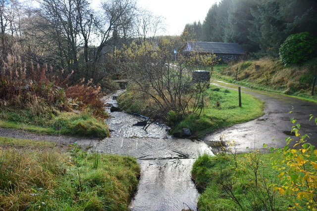
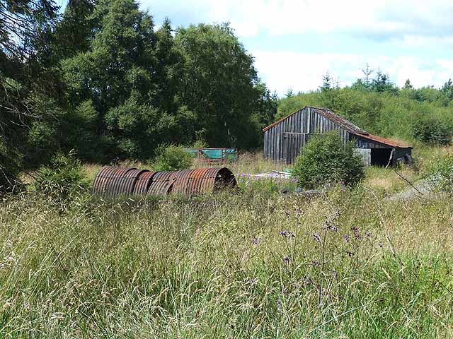
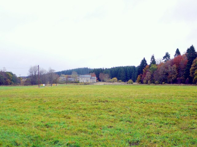
Avenue Wood is a charming forest located in the county of Northumberland, England. This woodland area covers a vast expanse of approximately 150 acres and is renowned for its natural beauty and diverse flora and fauna. Situated near the village of Wood, Avenue Wood is a popular destination for nature enthusiasts, hikers, and wildlife photographers.

The forest is characterized by its dense canopy of towering trees, including oak, beech, and birch, which provide ample shade and create a peaceful ambiance. The forest floor is adorned with a rich carpet of ferns, wildflowers, and moss, creating a picturesque landscape. A network of well-marked trails and paths meanders through the wood, allowing visitors to explore its depths while immersing themselves in the tranquility of nature.

Avenue Wood boasts a thriving ecosystem, providing a habitat for a wide variety of wildlife. Nature enthusiasts can expect to encounter native species such as red squirrels, deer, rabbits, and a diverse range of birdlife, including woodpeckers and owls. The forest is particularly renowned for its vibrant bird population, making it a haven for birdwatchers.

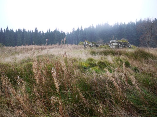
The wood is also home to several ancient archaeological sites, including burial mounds and remnants of prehistoric settlements, which add a historical element to the area's allure. For those seeking a peaceful retreat from the hustle and bustle of everyday life, Avenue Wood in Northumberland offers a serene and captivating natural environment to explore and enjoy.

If you have any feedback on the listing, please let us know in the comments section below.

Avenue Wood Images

Images are sourced within 2km of 55.194338/-2.352433 or Grid Reference NY7788. Thanks to Geograph Open Source API. All images are credited.

Shilla Hill Bastle Now somewhat overgrown <span class="nowrap"><a title="https://historicengland.org.uk/listing/the-list/list-entry/1008991" rel="nofollow ugc noopener" href="https://historicengland.org.uk/listing/the-list/list-entry/1008991">Link</a><img style="margin-left:2px;" alt="External link" title="External link - shift click to open in new window" src="https://s1.geograph.org.uk/img/external.png" width="10" height="10"/></span>
Shilla Hill Bastle
Now somewhat overgrown LinkExternal link
Northern Bastle at Black Middens Only the lower courses of this bastle survive.
Northern Bastle at Black Middens
Only the lower courses of this bastle survive.
Ford at Waterhead This ford on the Tarset Burn is found at Waterhead just beyond the ford at Shipley Shiels. The ford can also be seen at:
<a title="https://www.geograph.org.uk/photo/3608601" href="https://www.geograph.org.uk/photo/3608601">Link</a>
Ford at Waterhead
This ford on the Tarset Burn is found at Waterhead just beyond the ford at Shipley Shiels. The ford can also be seen at: Link
Moorland behind Black Middens Bastle House Land suitable only for sheep farming.
Moorland behind Black Middens Bastle House
Land suitable only for sheep farming.
Remains of Bastle In Kielder Forest.
Remains of Bastle
In Kielder Forest.
Ford and Footbridge, Tarset Burn
Ford on the Tarset Burn
Cottage near Tarset Burn
Shilla Hill Bastle These are the remains of a 16th or 17th century bastle standing on the summit of Shilla Hill, overlooking the valley of the Tarset Burn. The remains of the thick walls of the bastle can still be seen. Traces of other buildings can be seen nearby. This is a Scheduled Monument protected by law.
<span class="nowrap"><a title="http://www.keystothepast.info/Pages/pgDetail.aspx?PRN=N7067" rel="nofollow ugc noopener" href="http://www.keystothepast.info/Pages/pgDetail.aspx?PRN=N7067">Link</a><img style="margin-left:2px;" alt="External link" title="External link - shift click to open in new window" src="https://s1.geograph.org.uk/img/external.png" width="10" height="10"/></span>
Shilla Hill Bastle
These are the remains of a 16th or 17th century bastle standing on the summit of Shilla Hill, overlooking the valley of the Tarset Burn. The remains of the thick walls of the bastle can still be seen. Traces of other buildings can be seen nearby. This is a Scheduled Monument protected by law. LinkExternal link
Forest shed, Comb
Forest shed, Comb
Rope bridge over Tarset Burn Presumably one of the challenges provided by the Forest Lodge at Comb nearby which offers leadership and development courses. The bridge is not of much practical use - it leads straight into an impenetrable thicket.
Rope bridge over Tarset Burn
Presumably one of the challenges provided by the Forest Lodge at Comb nearby which offers leadership and development courses. The bridge is not of much practical use - it leads straight into an impenetrable thicket.
Ford at Waterhead Over the Black Linn Burn, a ford on the private road leading to Waterhead.
Ford at Waterhead
Over the Black Linn Burn, a ford on the private road leading to Waterhead.
Autumn colours on Black Burn Viewed from the top of the bastle steps.
Autumn colours on Black Burn
Viewed from the top of the bastle steps.
Black Middens from the north
Forest Lodge & Comb
Forest Lodge & Comb
Blacklinn Burn near Waterhead Cottage
Remains of Shilla Bastle
Footpath, Shilla Hill
Show me another place!

Avenue Wood is located at Grid Ref: NY7788 (Lat: 55.194338, Lng: -2.352433)

Unitary Authority: Northumberland

Police Authority: Northumbria

What 3 Words

///encoded.rooting.joystick. Near Bellingham, Northumberland

Related Wikis

Black Middens Bastle House

Black Middens Bastle House lies about 7 miles (11 km) northwest of Bellingham, Northumberland. It is a two-storey fortified stone farmhouse from the 16th...

Thorneyburn

Thorneyburn is a village and former civil parish, now in the parish of Tarset, in Northumberland, England, to the northwest of Bellingham. In 1951 the...

Thorneyburn railway station

Thorneyburn railway station served the village of Thorneyburn, Northumberland, England from 1861 to 1956 on the Border Counties Railway. == History... ==

Greystead

Greystead is a village and civil parish in Northumberland, England west of Bellingham. The population as of the 2011 census was less than 100. It shares...

Nearby Amenities

Located within 500m of 55.194338,-2.352433
Leisure: picnic_table
Source: survey
Lat/Long: 55.1952563/-2.3528361
Leisure: picnic_table
Source: survey
Lat/Long: 55.1951977/-2.3526814
The data included in this document is from www.openstreetmap.org. The data is made available under ODbL.

Have you been to Avenue Wood?

Leave your review of Avenue Wood below (or comments, questions and feedback).