Hayes Wood
Wood, Forest in Somerset
England
Hayes Wood

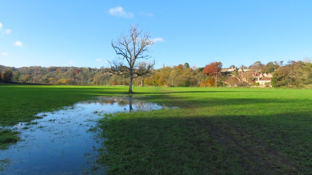
Hayes Wood is a picturesque forest located in Somerset, England. Covering an area of approximately 500 acres, this ancient woodland is a haven for nature enthusiasts and provides a tranquil escape from the hustle and bustle of everyday life.
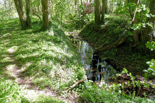
The wood is primarily made up of native broadleaf trees, including oak, beech, and ash, which have been growing here for centuries. These towering trees create a dense canopy, allowing only dappled sunlight to filter through to the forest floor. This creates a unique and enchanting atmosphere, where moss-covered logs and fallen leaves carpet the ground.
Hayes Wood is home to a diverse range of wildlife, making it a popular spot for birdwatchers and animal lovers. Visitors may spot various species of birds, such as woodpeckers, owls, and kestrels, as well as mammals like deer, foxes, and badgers. The forest also supports a rich variety of plant life, including bluebells, wild garlic, and ferns, which create a vibrant and ever-changing landscape throughout the seasons.
Walking trails wind their way through the forest, offering visitors the chance to explore and discover the hidden treasures within Hayes Wood. The paths are well-maintained and suitable for all levels of fitness, making it an ideal destination for families and individuals seeking a peaceful respite in nature.
Overall, Hayes Wood is a natural gem in Somerset, providing a sanctuary for wildlife and a place of tranquility for those who venture within its ancient boundaries. Its beauty and biodiversity make it a must-visit destination for nature lovers and outdoor enthusiasts alike.
If you have any feedback on the listing, please let us know in the comments section below.
Hayes Wood Images
Images are sourced within 2km of 51.345255/-2.3249637 or Grid Reference ST7760. Thanks to Geograph Open Source API. All images are credited.


Hayes Wood is located at Grid Ref: ST7760 (Lat: 51.345255, Lng: -2.3249637)
Unitary Authority: Bath and North East Somerset
Police Authority: Avon and Somerset
What 3 Words
///allows.vows.scans. Near Limpley Stoke, Wiltshire
Nearby Locations
Related Wikis

Limpley Stoke
Limpley Stoke is a village and civil parish in Wiltshire, England. It lies in the Avon valley between Bath and Freshford, and is both above and below the...

Midford Valley Woods
Midford Valley Woods (grid reference ST769611) is a 60-acre (24.6-hectare) biological Site of Special Scientific Interest between Midford and Limpley Stoke...
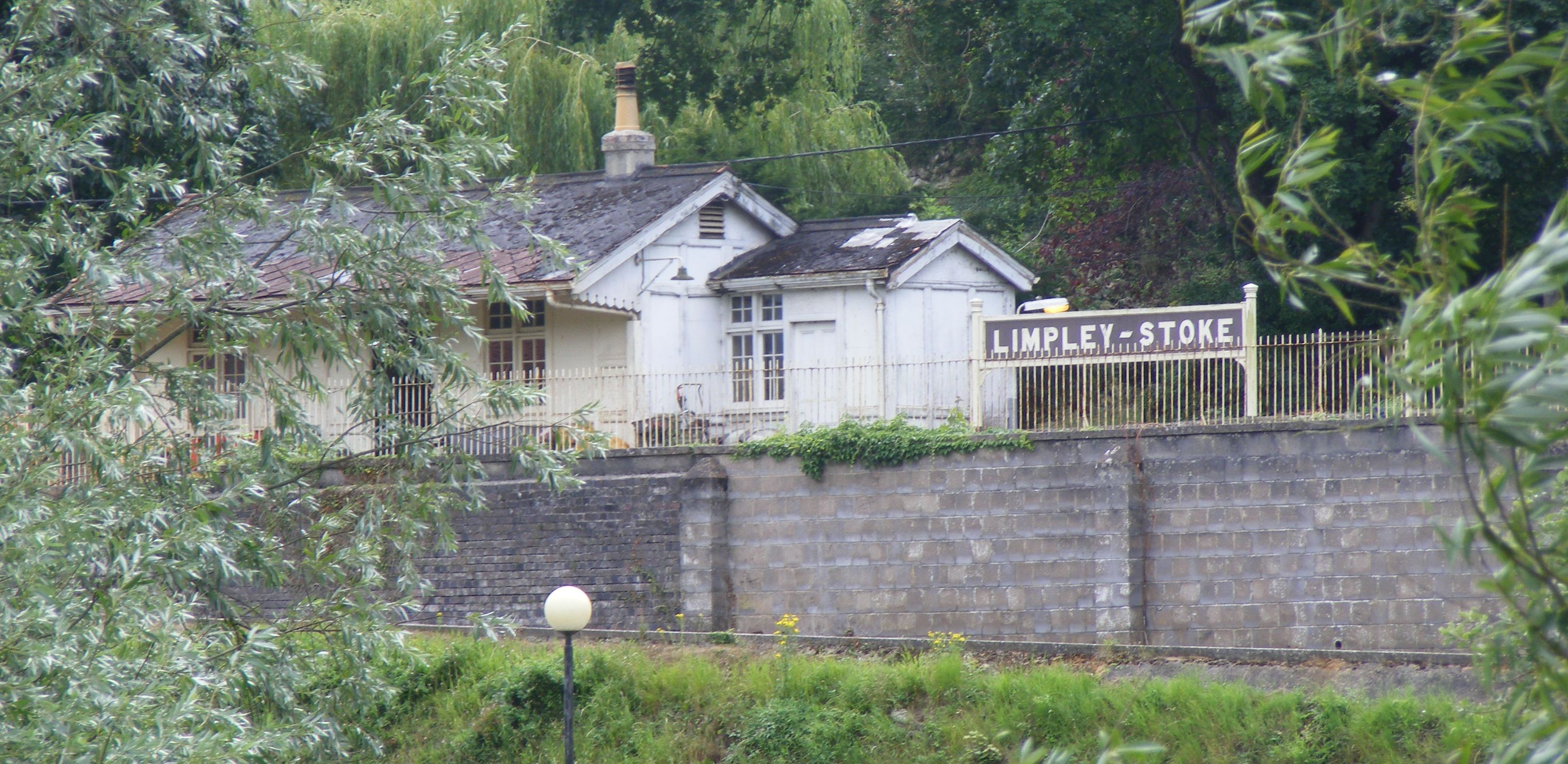
Limpley Stoke railway station
Limpley Stoke railway station is a former railway station in Limpley Stoke, Wiltshire, England, UK. The station was originally started by the Wilts, Somerset...

Tucking Mill
Tucking Mill is a small hamlet within the parish of Monkton Combe, Somerset, England. It lies on Midford Brook and was a key point on the now disused Somerset...
Related Videos

Might be Lost all girl hiking and camping group vs Dundas Aqueduct, Bath
The first ever Might be Lost meet up was a fantastic success. There were some slight navigational issues with vanishing bridges ...

Canal Virtual Run | Dundas Aqueduct to Avoncliff Aqueduct, England | 4K POV Treadmill Scenery
Starting from Dundas Aqueduct near Bath on a peaceful autumn evening, we run along the canal until Avoncliff near ...

Prostate Cancer: Consultants answer your questions
Consultant Urologists and Clinical Oncologists specialising in Prostate Cancer come together to answer common questions they ...

Nearby Amenities
Located within 500m of 51.345255,-2.3249637Have you been to Hayes Wood?
Leave your review of Hayes Wood below (or comments, questions and feedback).