Leawoodpits Plantation

Wood, Forest in Staffordshire Stafford

England

Leawoodpits Plantation

Shropshire Union Canal View from the High Bridge.
Shropshire Union Canal Credit: Richard Webb

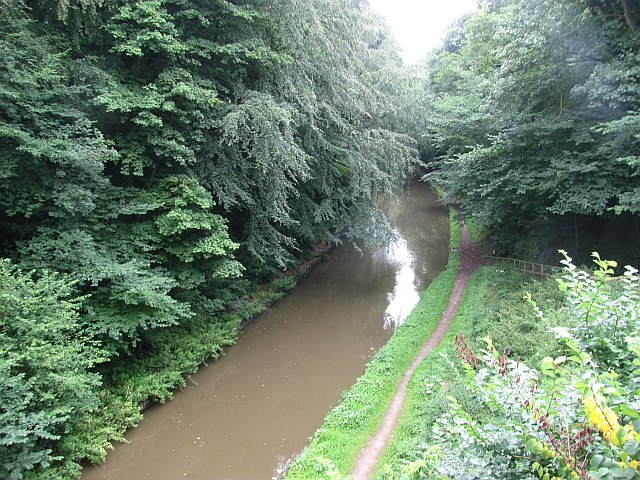
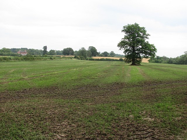
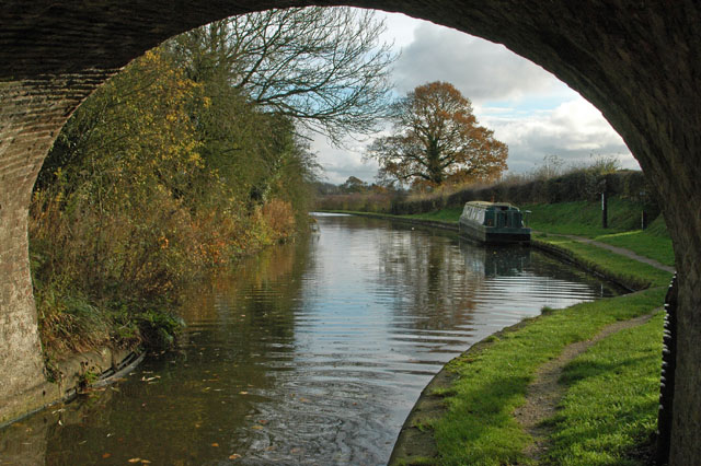
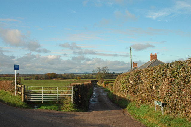
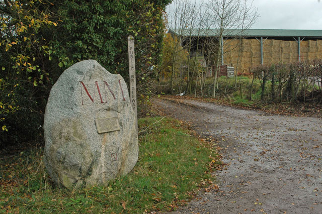
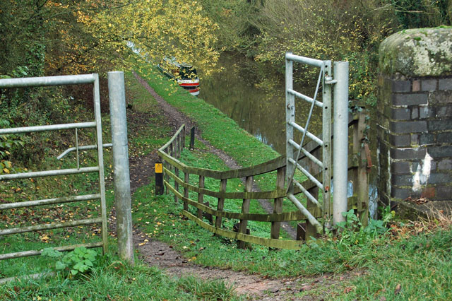
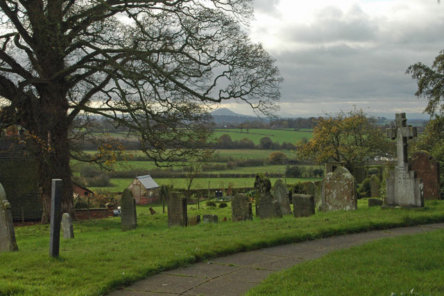
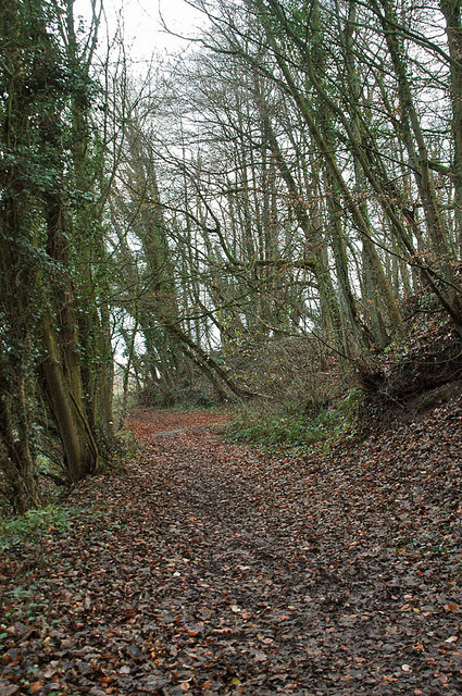
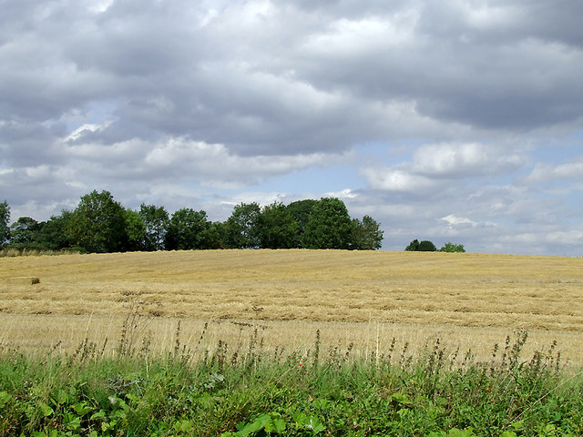
Leawoodpits Plantation is a beautiful woodland area located in Staffordshire, England. Spanning over a vast area, the plantation is known for its picturesque landscapes, lush greenery, and diverse wildlife. It is a popular destination for nature lovers, hikers, and birdwatchers.

The woodland is characterized by its rich biodiversity, housing a wide variety of flora and fauna. The plantation is home to several species of trees, including oak, birch, beech, and pine. These trees provide shelter and a habitat for numerous bird species, such as woodpeckers, owls, and thrushes. The plantation also attracts small mammals like squirrels, foxes, and rabbits.

Leawoodpits Plantation offers numerous walking trails and paths for visitors to explore and enjoy the natural beauty of the area. The well-maintained trails meander through the woodland, allowing visitors to immerse themselves in the serene atmosphere and enjoy the tranquility of the surroundings.

Nature enthusiasts can also indulge in birdwatching and wildlife spotting activities in Leawoodpits Plantation. The diverse range of bird species and other wildlife make it an ideal spot for observing and studying nature up close.

Overall, Leawoodpits Plantation is a hidden gem in Staffordshire, offering a peaceful retreat for those seeking solace in nature. Its breathtaking landscapes, thriving ecosystem, and recreational activities make it a must-visit destination for both locals and tourists alike.

If you have any feedback on the listing, please let us know in the comments section below.

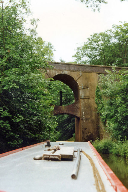
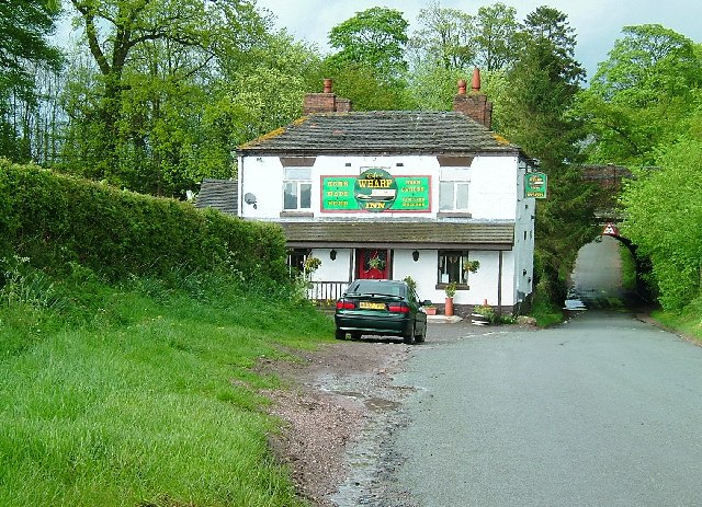
Leawoodpits Plantation Images

Images are sourced within 2km of 52.820715/-2.336581 or Grid Reference SJ7724. Thanks to Geograph Open Source API. All images are credited.

Shropshire Union Canal View from the High Bridge.
Shropshire Union Canal
View from the High Bridge.
A muddy field Silage has just been taken off this field, and vehicle movements have made things muddy. A lone tree in the middle of a field is often a sign that there was once a hedge there.
A muddy field
Silage has just been taken off this field, and vehicle movements have made things muddy. A lone tree in the middle of a field is often a sign that there was once a hedge there.
Stile on footpath to Leawood
Roadside 'greasy spoon' Look closely at the person in the 'cafe' and you will see him providing an unusual 'welcome' sign. I was going to purchase a buttie but not after that 'comment'.
Roadside 'greasy spoon'
Look closely at the person in the 'cafe' and you will see him providing an unusual 'welcome' sign. I was going to purchase a buttie but not after that 'comment'.
The Shroppie at the Anchor
Not suitable for motor vehicles - southern end of Tunstall Lane
A 'Millennium Stone' on Grubb Street
Gateway to the Shroppie
High Offley churchyard The high hill in the background is 'The Wrekin', just south of Wellington and the A5.
High Offley churchyard
The high hill in the background is 'The Wrekin', just south of Wellington and the A5.
Woodland near the Shropshire Union Canal
Bullock's Bridge near High Offley, Shropshire Bridge No 43 across the Shropshire Union Canal carries a farm track from Old Lea Farm (off to the left) and a bridleway.
Bullock's Bridge near High Offley, Shropshire
Bridge No 43 across the Shropshire Union Canal carries a farm track from Old Lea Farm (off to the left) and a bridleway.
Moorings by Bullock's Bridge near High Offley, Shropshire Bridge No 43 across the Shropshire Union Canal carries a farm track from Old Lea Farm (off to the left) and a bridleway.Private long-term moorings are on the right. Visitor moorings are good east of this bridge.
Moorings by Bullock's Bridge near High Offley, Shropshire
Bridge No 43 across the Shropshire Union Canal carries a farm track from Old Lea Farm (off to the left) and a bridleway.Private long-term moorings are on the right. Visitor moorings are good east of this bridge.
Arable field near Shebdon, Staffordshire Seen from the Shropshire Union Canal.
Arable field near Shebdon, Staffordshire
Seen from the Shropshire Union Canal.
Shropshire Union Canal near Shebdon, Staffordshire Shebdon Bridge (No 44) is ahead, which carries the lane from Tunstall.
Shropshire Union Canal near Shebdon, Staffordshire
Shebdon Bridge (No 44) is ahead, which carries the lane from Tunstall.
Shebdon Bridge south-east of Knighton, Staffordshire Shebdon Bridge (No 44) carries the lane from Tunstall. Private long-term moorings on the right are by Shebdon Farm. Past the bridge, the Shropshire Union Canal continues towards another embankment. About five hundred metres ahead on the left is The Wharf Inn* at the base of the embankment. The sign on the bridge advertises it. The current Google satellite hybrid image incorrectly labels Batchacre Park Cottage (no road access) as The Wharf Inn.

*update: closed 2013.
Shebdon Bridge south-east of Knighton, Staffordshire
Shebdon Bridge (No 44) carries the lane from Tunstall. Private long-term moorings on the right are by Shebdon Farm. Past the bridge, the Shropshire Union Canal continues towards another embankment. About five hundred metres ahead on the left is The Wharf Inn* at the base of the embankment. The sign on the bridge advertises it. The current Google satellite hybrid image incorrectly labels Batchacre Park Cottage (no road access) as The Wharf Inn. *update: closed 2013.
The north bar at the Anchor Inn, High Offley This legendary canalside public house has its two front rooms as bars, the rest of the building being the landlady's living accommodation. As can be seen here, the actual serving counter is very small (the same as in the other room), but has space for the recently installed hand pump for serving the Wadworth's 6x; until recently Olive (shown here) would fetch a jug of beer from the cellar and decant it into glasses - she still tops up using the jug, so you get a "full pint" of ale. There is also room on the bar for another pump which I believe dispenses a very cold liquid. There are two similar pumps in the other bar which has been redecorated recently.

Update: The Anchor was forced to close in 2020-21 because of the impossibility of operating indoor "social distancing" during during the Covid-19 pandemic.

Update: Olive Cliff, the landlady for over fifty years, passed away on 28 April 2021. Elaine will be reopening the pub after Covid-19 restrictions are lifted.

<a href="https://www.geograph.org.uk/photo/1394162">SJ7725 : The Anchor Inn at High Offley, Staffordshire</a>
<a href="https://www.geograph.org.uk/photo/1598513">SJ7725 : The Anchor Inn at High Offley, Staffordshire</a>
<a href="https://www.geograph.org.uk/photo/547982">SJ7725 : Floral narrowboat, The Anchor Inn, High Offley, Staffordshire</a>
<a href="https://www.geograph.org.uk/photo/547978">SJ7725 : A Floral Anchor Inn, High Offley, Staffordshire</a>
The north bar at the Anchor Inn, High Offley
This legendary canalside public house has its two front rooms as bars, the rest of the building being the landlady's living accommodation. As can be seen here, the actual serving counter is very small (the same as in the other room), but has space for the recently installed hand pump for serving the Wadworth's 6x; until recently Olive (shown here) would fetch a jug of beer from the cellar and decant it into glasses - she still tops up using the jug, so you get a "full pint" of ale. There is also room on the bar for another pump which I believe dispenses a very cold liquid. There are two similar pumps in the other bar which has been redecorated recently. Update: The Anchor was forced to close in 2020-21 because of the impossibility of operating indoor "social distancing" during during the Covid-19 pandemic. Update: Olive Cliff, the landlady for over fifty years, passed away on 28 April 2021. Elaine will be reopening the pub after Covid-19 restrictions are lifted. SJ7725 : The Anchor Inn at High Offley, Staffordshire SJ7725 : The Anchor Inn at High Offley, Staffordshire SJ7725 : Floral narrowboat, The Anchor Inn, High Offley, Staffordshire SJ7725 : A Floral Anchor Inn, High Offley, Staffordshire
Anchor Bridge near High Offley, Staffordshire Beyond the Bridge (No 42) across the Shropshire Union Canal is the renowned and antiquated Anchor Inn. Use it while you can. Too many of these little gems close down through lack of patronage (and various other government fueled discouragements)!
Anchor Bridge near High Offley, Staffordshire
Beyond the Bridge (No 42) across the Shropshire Union Canal is the renowned and antiquated Anchor Inn. Use it while you can. Too many of these little gems close down through lack of patronage (and various other government fueled discouragements)!
High Bridge 39 Shropshire Union Canal The Shropshire Union Canal (from Autherley to Nantwich) was engineered by Thomas Telford and opened in 1835. There are long straight sections of this canal which required either embankments or cuttings to avoid the need for locks. Although this was a more difficult procedure, the end route was shorter and the progress for horse drawn working boats could be maintained with (hopefully) no stoppages. The canal (formerly the Birmingham and Liverpool Junction Canal) was opened at a time when railways were making serious inroads into the canal companies' businesses. 

The current Shroppie north of Nantwich was formerly the Chester Canal, opened in 1779, and has wider locks and bridges. Boats up to nine feet in beam can still navigate this section; Telford's canal accommodates only narrowboats up to seven feet in beam.
High Bridge 39 Shropshire Union Canal
The Shropshire Union Canal (from Autherley to Nantwich) was engineered by Thomas Telford and opened in 1835. There are long straight sections of this canal which required either embankments or cuttings to avoid the need for locks. Although this was a more difficult procedure, the end route was shorter and the progress for horse drawn working boats could be maintained with (hopefully) no stoppages. The canal (formerly the Birmingham and Liverpool Junction Canal) was opened at a time when railways were making serious inroads into the canal companies' businesses. The current Shroppie north of Nantwich was formerly the Chester Canal, opened in 1779, and has wider locks and bridges. Boats up to nine feet in beam can still navigate this section; Telford's canal accommodates only narrowboats up to seven feet in beam.
Show me another place!

Leawoodpits Plantation is located at Grid Ref: SJ7724 (Lat: 52.820715, Lng: -2.336581)

Administrative County: Staffordshire

District: Stafford

Police Authority: Staffordshire

What 3 Words

///cabs.fired.order. Near Chetwynd, Shropshire

Nearby Locations

Leawoodpits Plantation

Related Wikis

Loynton Moss

Loynton Moss is a nature reserve of the Staffordshire Wildlife Trust, near the village of Woodseaves, in Staffordshire, England. It is adjacent to the...

High Offley

High Offley is a small village and civil parish in Staffordshire, England. It lies 3 miles southwest of the small town of Eccleshall and about 1 mile west...

Loynton

Loynton is a hamlet on the A519 near the villages of Norbury, and Woodseaves in Staffordshire, England. It lies in the civil parish of Norbury. Loynton...

Norbury, Staffordshire

Norbury is a village and civil parish in the Borough of Stafford, in west Staffordshire, England. The population as taken at the 2011 census was 371.It...

Shebdon

Shebdon is a hamlet in the county of Staffordshire, England. It is part of the parish of High Offley, a small village approximately 1.5 miles to the ENE...

Woodseaves

Woodseaves is a village in Staffordshire, England. It lies in the civil parish of High Offley and is situated on the A519 (Newport-Newcastle-under-Lyme...

Tunstall, Stafford

Tunstall is a hamlet near Eccleshall in the borough of Stafford in Staffordshire, England. In 1870–72 it had a population of 72. Tunstall was recorded...

Norbury Junction

Norbury Junction (grid reference SJ793228) is a hamlet and former canal junction which lies about 1 mile (1.6 km) to the south east of Norbury, in Staffordshire...

Nearby Amenities

Located within 500m of 52.820715,-2.336581
The data included in this document is from www.openstreetmap.org. The data is made available under ODbL.

Have you been to Leawoodpits Plantation?

Leave your review of Leawoodpits Plantation below (or comments, questions and feedback).