Main Wood

Wood, Forest in Yorkshire Ribble Valley

England

Main Wood

Ordnance Survey Cut Mark This mark can be found on the wall of a roadside barn at Grunsagill.
The benchmark has a recorded height of 175.6426 metres above sea level.
For more detail see : <span class="nowrap"><a title="https://www.bench-marks.org.uk/bm152220" rel="nofollow ugc noopener" href="https://www.bench-marks.org.uk/bm152220">Link</a><img style="margin-left:2px;" alt="External link" title="External link - shift click to open in new window" src="https://s1.geograph.org.uk/img/external.png" width="10" height="10"/></span>
Ordnance Survey Cut Mark Credit: Peter Wood

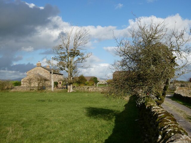
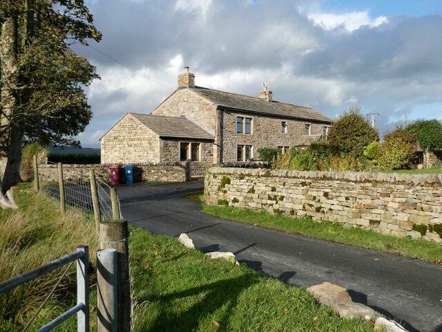
Main Wood is a picturesque woodland located in Yorkshire, England. Situated in the heart of the county, this forested area covers a vast expanse of approximately 100 acres. The wood is well-known for its diverse ecosystem and stunning natural beauty.

Main Wood is primarily composed of deciduous trees, with a mix of oak, beech, and birch dominating the landscape. The dense canopy created by these towering trees provides a cool and shaded environment, perfect for a leisurely stroll or a peaceful picnic. The forest floor is adorned with a vibrant carpet of wildflowers, adding bursts of color to the surroundings.

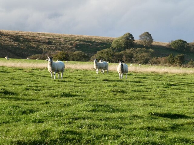
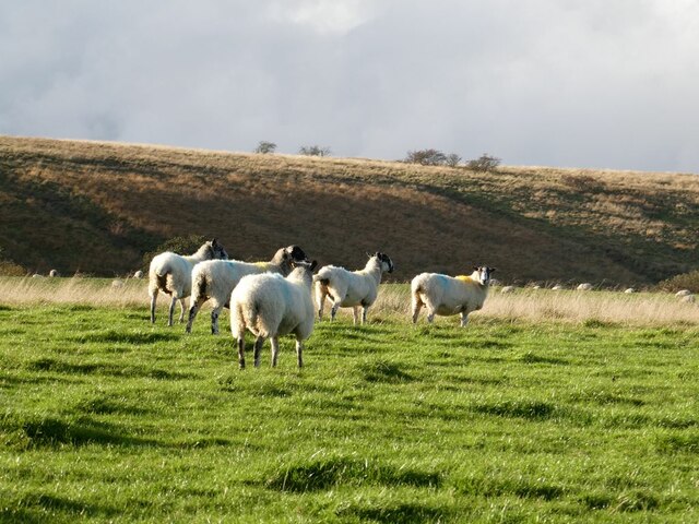
Wildlife thrives in Main Wood, with a variety of species calling it home. It is not uncommon to spot deer, foxes, and rabbits roaming freely among the trees. The bird population is also abundant, with species such as woodpeckers and robins frequently seen and heard fluttering about.

The wood is intersected by several well-maintained trails, allowing visitors to explore its depths and discover hidden gems within. These paths wind through the forest, leading to tranquil ponds, babbling brooks, and secluded clearings. Along the way, interpretive signs provide information about the local flora and fauna, enhancing the educational aspect of the visit.

Main Wood offers a serene and enchanting escape from the hustle and bustle of everyday life. Its natural beauty and diverse ecosystem make it a popular destination for nature enthusiasts, hikers, and families seeking a peaceful retreat. Whether exploring the trails, observing wildlife, or simply enjoying the tranquility, Main Wood is a true gem in the heart of Yorkshire.

If you have any feedback on the listing, please let us know in the comments section below.

Main Wood Images

Images are sourced within 2km of 53.979487/-2.3470783 or Grid Reference SD7753. Thanks to Geograph Open Source API. All images are credited.

Ordnance Survey Cut Mark This mark can be found on the wall of a roadside barn at Grunsagill.
The benchmark has a recorded height of 175.6426 metres above sea level.
For more detail see : <span class="nowrap"><a title="https://www.bench-marks.org.uk/bm152220" rel="nofollow ugc noopener" href="https://www.bench-marks.org.uk/bm152220">Link</a><img style="margin-left:2px;" alt="External link" title="External link - shift click to open in new window" src="https://s1.geograph.org.uk/img/external.png" width="10" height="10"/></span>
Ordnance Survey Cut Mark
This mark can be found on the wall of a roadside barn at Grunsagill. The benchmark has a recorded height of 175.6426 metres above sea level. For more detail see : LinkExternal link
Ordnance Survey Cut Mark This mark can be found on the parapet wall of a road bridge at Grunasgill.
The benchmark has a recorded height of 184.7302 metres above sea level.
For more detail see : <span class="nowrap"><a title="https://www.bench-marks.org.uk/bm152234" rel="nofollow ugc noopener" href="https://www.bench-marks.org.uk/bm152234">Link</a><img style="margin-left:2px;" alt="External link" title="External link - shift click to open in new window" src="https://s1.geograph.org.uk/img/external.png" width="10" height="10"/></span>
Ordnance Survey Cut Mark
This mark can be found on the parapet wall of a road bridge at Grunasgill. The benchmark has a recorded height of 184.7302 metres above sea level. For more detail see : LinkExternal link
Field near Pendle View Farm As its name implies, Pendle View Farm (shown on the map as Cracoe Hill Farm) has a cracking view of Pendle Hill <a href="https://www.geograph.org.uk/gridref/SD8041">SD8041</a> seen on the horizon.
Field near Pendle View Farm
As its name implies, Pendle View Farm (shown on the map as Cracoe Hill Farm) has a cracking view of Pendle Hill SD8041 seen on the horizon.
The road to Tosside Looking north.
The road to Tosside
Looking north.
Knotts Rest Self-catering accommodation in barn conversion at Knotts Farm.
Knotts Rest
Self-catering accommodation in barn conversion at Knotts Farm.
Field with sheep behind Knotts Farm Under a threatening sky.
Field with sheep behind Knotts Farm
Under a threatening sky.
Moor Stones Barn Farm On Knotts Lane, seen from the drive to Knotts Farm.
Moor Stones Barn Farm
On Knotts Lane, seen from the drive to Knotts Farm.
Moor Stones Barn Farm On Knotts Lane.
Moor Stones Barn Farm
On Knotts Lane.
Knotts Farm
Knotts Farm
Ash tree, cabin and sheep Near Springside Farm on Knotts Lane.
Ash tree, cabin and sheep
Near Springside Farm on Knotts Lane.
Sheep in field beside Knotts Lane Near Witton's Farm
Sheep in field beside Knotts Lane
Near Witton's Farm
Knotts Lane Sunny intervals and black clouds looming.
Knotts Lane
Sunny intervals and black clouds looming.
Field beside Knotts Lane On the lower slopes of Knotts Hill.
Field beside Knotts Lane
On the lower slopes of Knotts Hill.
Wary sheep In a field beside Knotts Lane.
Wary sheep
In a field beside Knotts Lane.
A very effective road block A hay bale has been strategically placed across the top of this footpath to Wittons Farm to prevent access by motor vehicles.
A very effective road block
A hay bale has been strategically placed across the top of this footpath to Wittons Farm to prevent access by motor vehicles.
Bin day At the head of the drive to Little Holme Farm and Big Holme Farm on Knotts Lane.
Bin day
At the head of the drive to Little Holme Farm and Big Holme Farm on Knotts Lane.
Wittons Farm Wittons Farm below the field. Ray Head Farm beyond and to the left.
Wittons Farm
Wittons Farm below the field. Ray Head Farm beyond and to the left.
View from Knotts Lane Looking across the broad valley of the Holden Beck.
View from Knotts Lane
Looking across the broad valley of the Holden Beck.
Show me another place!

Main Wood is located at Grid Ref: SD7753 (Lat: 53.979487, Lng: -2.3470783)

Division: West Riding

Administrative County: Lancashire

District: Ribble Valley

Police Authority: Lancashire

What 3 Words

///sniff.student.ogre. Near Hellifield, North Yorkshire

Related Wikis

Manor House, Gisburn Forest

Manor House is an historic building in Gisburn Forest, Lancashire, England. It was built in the early 18th century, but contains a section that is believed...

Gisburn Forest

Gisburn Forest is a civil parish in the Ribble Valley, in Lancashire, England. Mainly lying within the Forest of Bowland Area of Outstanding Natural Beauty...

Tosside

Tosside is a small village on the modern border of North Yorkshire and Lancashire in Northern England. It lies within the Forest of Bowland, and is between...

Easington, Lancashire

Easington () is a civil parish within the Ribble Valley district of Lancashire, England, with a population in 2001 of 52. The Census 2011 population details...

Bolton-by-Bowland

Bolton-by-Bowland is a village and civil parish in the Ribble Valley district of Lancashire, England. Before 1974, the village was part of Bowland Rural...

St Peter and St Paul's Church, Bolton-by-Bowland

St Peter and St Paul's Church is in Gisburn Road, Bolton-by-Bowland, Lancashire, England. It is an active Anglican parish church in the deanery of Whalley...

Stocks Reservoir

Stocks Reservoir is a reservoir situated at the head of the Hodder valley in the Forest of Bowland, Lancashire, England (historically in the West Riding...

Wigglesworth

Wigglesworth is a village and civil parish in the Craven district of North Yorkshire, England. The population of the civil parish taken at the 2011 Census...

Nearby Amenities

Located within 500m of 53.979487,-2.3470783
Power: pole
Lat/Long: 53.9805882/-2.3535123
Power: pole
Lat/Long: 53.97988/-2.3530349
Power: pole
Lat/Long: 53.9778105/-2.3516858
Power: pole
Lat/Long: 53.976864/-2.3510984
Power: pole
Lat/Long: 53.9759128/-2.3504573
The data included in this document is from www.openstreetmap.org. The data is made available under ODbL.

Have you been to Main Wood?

Leave your review of Main Wood below (or comments, questions and feedback).