Bowsey Wood
Wood, Forest in Staffordshire Newcastle-under-Lyme
England
Bowsey Wood

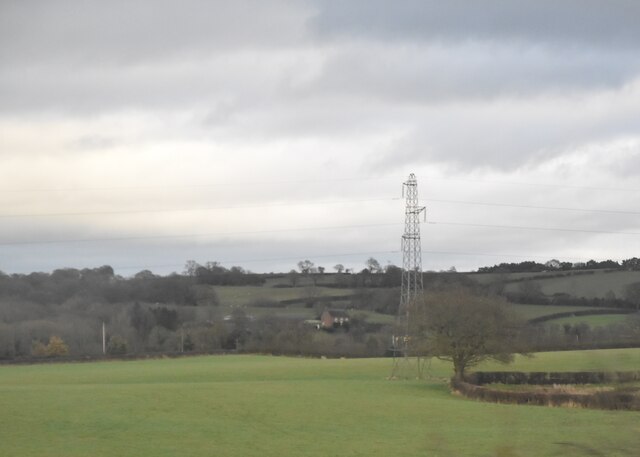
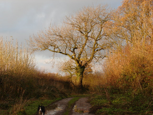
Bowsey Wood is a picturesque woodland located in the county of Staffordshire, England. Situated in the heart of the Cannock Chase Area of Outstanding Natural Beauty, this woodland covers an area of approximately 270 acres and is renowned for its natural beauty and tranquility.
The wood is predominantly composed of deciduous trees, including oak, birch, and beech, which create a dense canopy that shades the forest floor. This diverse ecosystem supports a wide range of flora and fauna, making it a haven for nature enthusiasts and wildlife lovers.
Visitors to Bowsey Wood can explore its well-maintained network of footpaths and trails, providing ample opportunities for hiking and walking amidst the enchanting surroundings. The wood is also home to numerous species of birds, making it a popular spot for birdwatching.
In addition to its natural beauty, Bowsey Wood has historical significance as well. It was once part of the extensive hunting grounds of the medieval Cannock Forest and retains remnants of its past, with ancient ditches and earthworks still visible.
Despite its remote location, Bowsey Wood is easily accessible by road, with ample parking available for visitors. The woodland is also well-served by public transport, with nearby bus stops and train stations providing convenient access.
Whether it's the vibrant colors of autumn, the delicate blossoms of spring, or the peaceful solitude of winter, Bowsey Wood offers a captivating experience throughout the year, making it a must-visit destination for nature enthusiasts and those seeking a tranquil escape in Staffordshire.
If you have any feedback on the listing, please let us know in the comments section below.
Bowsey Wood Images
Images are sourced within 2km of 53.017869/-2.3399628 or Grid Reference SJ7746. Thanks to Geograph Open Source API. All images are credited.


Bowsey Wood is located at Grid Ref: SJ7746 (Lat: 53.017869, Lng: -2.3399628)
Administrative County: Staffordshire
District: Newcastle-under-Lyme
Police Authority: Staffordshire
What 3 Words
///sports.unloading.dimes. Near Madeley, Staffordshire
Nearby Locations
Related Wikis

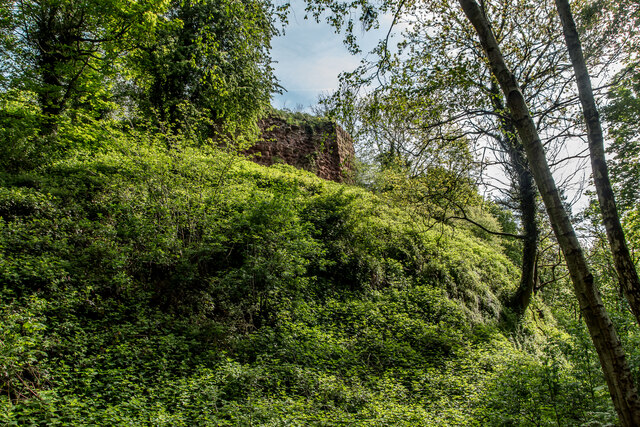
Heighley Castle
Heighley Castle (or Heleigh Castle) is a ruined medieval castle near Madeley, Staffordshire. The castle was completed by the Audley family in 1233 and...

Madeley High School
Madeley High School, established 1957, is a coeducational secondary school with academy status, located in the village of Madeley, Staffordshire, England...
Madeley, Staffordshire
Madeley is a village and ward in the Borough of Newcastle-under-Lyme, North Staffordshire, England. It is split into three parts: Madeley, Middle Madeley...
Leycett railway station
Leycett railway station is a disused railway station in Staffordshire, England. The station was situated on the North Staffordshire Railway (NSR) Audley...
Wrinehill
Wrinehill, also called Checkley cum Wrinehill, is a village in the north-west of Staffordshire on the A531 road lying adjacent to the southern border of...
Scot Hay
Scot Hay is a hamlet located outside the town of Newcastle-under-lyme, Staffordshire, England. It is located near Keele University and also the villages...

Madeley Old Hall
Madeley Old Hall is a black and white Elizabethan house, now a small hotel, in the village of Madeley in Staffordshire, England. It stands in 2 acres of...
Leycett
Leycett was a small mining village in Staffordshire in the Borough of Newcastle-under-Lyme which was built in the late eighteen sixties to accommodate...
Nearby Amenities
Located within 500m of 53.017869,-2.3399628Have you been to Bowsey Wood?
Leave your review of Bowsey Wood below (or comments, questions and feedback).