Greenlane Coppice

Wood, Forest in Staffordshire Stafford

England

Greenlane Coppice

Looking back to a road junction near the Ashley Road Plantation
Looking back to a road junction near the Ashley Road Plantation Credit: Mick Malpass

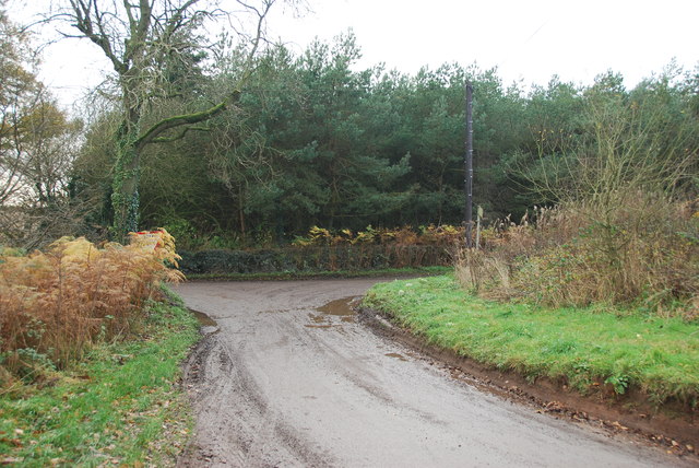
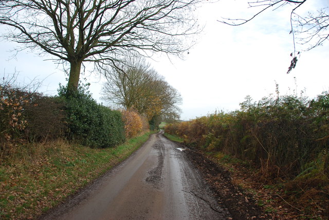
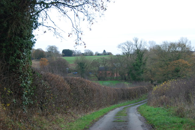
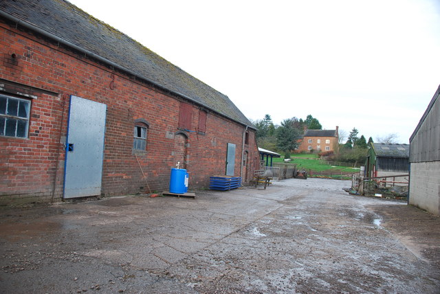
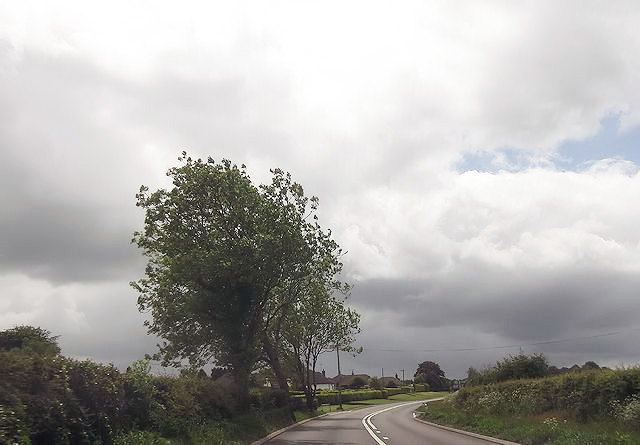
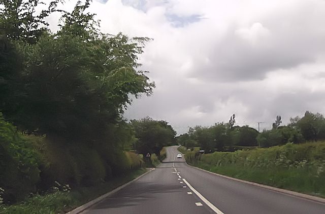
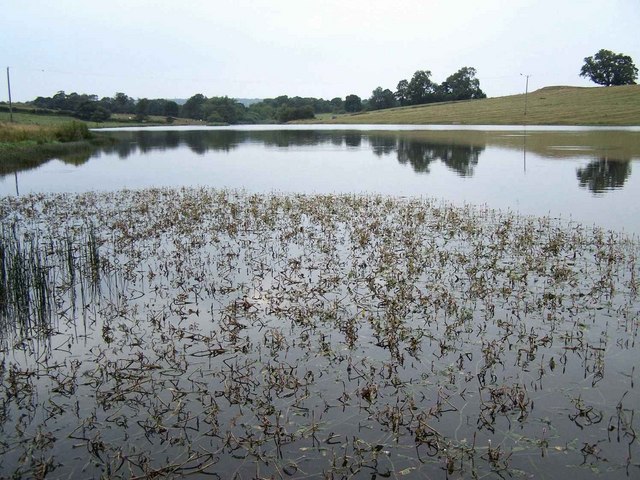
Greenlane Coppice is a picturesque woodland located in the county of Staffordshire, England. Situated in the heart of the countryside, it covers an area of approximately 50 acres and is renowned for its natural beauty and tranquility. The copse, also known as a wood or forest, is a haven for nature enthusiasts and offers a range of activities for visitors to enjoy.

The woodland is predominantly composed of native tree species, such as oak, birch, and beech, which create a diverse and vibrant ecosystem. The dense canopy provides shelter for a wide variety of wildlife, including birds, mammals, and insects. Visitors can observe and appreciate the flora and fauna that inhabit this natural habitat, making it an ideal location for birdwatching or wildlife photography.

Greenlane Coppice also boasts a network of well-maintained walking trails, allowing visitors to explore the woodland at their leisure. These paths meander through the trees and offer stunning views of the surrounding countryside. Along the way, visitors may stumble upon charming clearings, babbling brooks, and even a small pond, further enhancing the enchanting atmosphere of the copse.

In addition to its natural beauty, Greenlane Coppice offers educational and recreational activities for all ages. The wood is often used as an outdoor classroom, where school groups can learn about the local ecosystem and participate in interactive workshops. It is also a popular spot for family outings and picnics, providing ample space for children to play and explore.

Overall, Greenlane Coppice is a hidden gem in the Staffordshire countryside, providing a peaceful retreat and a valuable resource for both nature enthusiasts and the local community.

If you have any feedback on the listing, please let us know in the comments section below.

Greenlane Coppice Images

Images are sourced within 2km of 52.91899/-2.3419536 or Grid Reference SJ7735. Thanks to Geograph Open Source API. All images are credited.

Looking back to a road junction near the Ashley Road Plantation
Narrow roadway leading to Bromley Mill Farm
Roadway past Bromley Mill Farm I can't find any information about this mill, and mill pool, which is out of sight on the left of picture.
Roadway past Bromley Mill Farm
I can't find any information about this mill, and mill pool, which is out of sight on the left of picture.
Entrance drive to Bromley Mill Farm House
Looking down towards the Bromley Brook Ford
The yard at Bromley Mill Farm Bromley Mill farmhouse can be seen beyond the yard, it is in square SJ7835.
The yard at Bromley Mill Farm
Bromley Mill farmhouse can be seen beyond the yard, it is in square SJ7835.
Bend on A53 approaching Park Lane junction
A53 approaching School Lane junction
St John the Baptist Church, Ashley - monument to Sir Gilbert Gerard A very large monument to Sir Gilbert Gerard (†1592) and his wife (†1608). They are accompanied by two sons and six daughters.

<a href="https://www.geograph.org.uk/photo/4461166">SJ7636 : St John the Baptist Church, Ashley - monument to Sir Gilbert Gerard - detail (1)</a>
St John the Baptist Church, Ashley - monument to Sir Gilbert Gerard
A very large monument to Sir Gilbert Gerard (†1592) and his wife (†1608). They are accompanied by two sons and six daughters. SJ7636 : St John the Baptist Church, Ashley - monument to Sir Gilbert Gerard - detail (1)
St John the Baptist Church, Ashley - monument to Sir Gilbert Gerard - detail (1) Sir Gilbert Gerard (†1592) and his wife.

<a href="https://www.geograph.org.uk/photo/4461171">SJ7636 : St John the Baptist Church, Ashley - monument to Sir Gilbert Gerard - detail (2)</a>
St John the Baptist Church, Ashley - monument to Sir Gilbert Gerard - detail (1)
St John the Baptist Church, Ashley - monument to Sir Gilbert Gerard - detail (2) Sir Gilbert Gerard (†1592).
St John the Baptist Church, Ashley - monument to Sir Gilbert Gerard - detail (2)
Sir Gilbert Gerard (†1592).
St John the Baptist Church, Ashley View of the chancel with its painted ceiling and reredos.
St John the Baptist Church, Ashley
View of the chancel with its painted ceiling and reredos.
St John the Baptist Church, Ashley It has an early C17 tower, whilst the rest belongs to a restoration of 1861-62 by J. Ashdown of London.

<a href="https://www.geograph.org.uk/photo/4461175">SJ7636 : St John the Baptist Church, Ashley</a>
St John the Baptist Church, Ashley
It has an early C17 tower, whilst the rest belongs to a restoration of 1861-62 by J. Ashdown of London. SJ7636 : St John the Baptist Church, Ashley
Ashley (Staffs) St John the Baptist's Church
Bromley Mill Farm
Bromley Mill Farm
Bromley Pool
Bromley Pool
Bromley Mill Farm
Bromley Mill Farm
Ashley: The Robin Hood Public House A Banks's Brewery house in Lower Road.
Ashley: The Robin Hood Public House
A Banks's Brewery house in Lower Road.
Show me another place!

Greenlane Coppice is located at Grid Ref: SJ7735 (Lat: 52.91899, Lng: -2.3419536)

Administrative County: Staffordshire

District: Stafford

Police Authority: Staffordshire

What 3 Words

///teams.guilty.botanists. Near Standon, Staffordshire

Related Wikis

Ashley, Staffordshire

Ashley is a village and former civil parish, now in the parish of Loggerheads, in the Newcastle-under-Lyme district, in the county of Staffordshire, England...

Maer, Staffordshire

Maer is a rural village and civil parish in the Borough of Newcastle-under-Lyme, Staffordshire, England, to the west of the pottery manufacturing town...

Loggerheads, Staffordshire

Loggerheads is a village and civil parish in north-west Staffordshire, England, on the A53 between Market Drayton and Newcastle-under-Lyme. == Name... ==

Maer Hall

Maer Hall is a large Grade II listed 17th-century country house in Maer, Staffordshire, set in a park which is listed Grade II in Historic England's Register...

Berth Hill

Berth Hill is an Iron Age hillfort in Staffordshire, England, about 5 miles (8.0 km) south-west of Newcastle-under-Lyme, and near the village of Maer....

Coombesdale

Coombesdale is a small settlement in Staffordshire, England. It is near the A51 road and is 6 kilometres (4 mi) southwest of the city of Stoke-on-Trent...

Croxton, Staffordshire

Croxton is a village on the B5026 between Eccleshall and Loggerheads. Population details for the 2011 census can be found under Eccleshall. It is notable...

Bowers, Staffordshire

Bowers is a village in Staffordshire, England. For population details as taken in the 2011 census see Standon.

Nearby Amenities

Located within 500m of 52.91899,-2.3419536
Barrier: stile
Lat/Long: 52.9148106/-2.3429201
Barrier: stile
Lat/Long: 52.9149062/-2.3429718
Barrier: stile
Lat/Long: 52.9172454/-2.3456918
Power: pole
Source: Bing
Lat/Long: 52.9153533/-2.3425633
Power: pole
Source: Bing
Lat/Long: 52.9152653/-2.3445942
Power: pole
Source: Bing
Lat/Long: 52.9157991/-2.3419683
Power: pole
Source: Bing
Lat/Long: 52.9171963/-2.338798
Power: pole
Source: Bing
Lat/Long: 52.9182765/-2.3363464
Power: pole
Source: Bing
Lat/Long: 52.9176603/-2.3377439
Power: pole
Source: Bing
Lat/Long: 52.9158605/-2.3394953
Power: pole
Source: Bing
Lat/Long: 52.9156761/-2.3437735
Power: pole
Source: Bing
Lat/Long: 52.9188086/-2.335185
Power: pole
Source: Bing
Lat/Long: 52.9165252/-2.3403375
Power: pole
Source: Bing
Lat/Long: 52.9198193/-2.3449861
Power: pole
Source: Bing
Lat/Long: 52.9191626/-2.3452811
Power: pole
Source: Bing
Lat/Long: 52.9176456/-2.3461871
Power: pole
Source: Bing
Lat/Long: 52.9158798/-2.3466059
Power: pole
Source: Bing
Lat/Long: 52.9163549/-2.3364358
Power: pole
Source: Bing
Lat/Long: 52.9185094/-2.3457049
Power: pole
Source: Bing
Lat/Long: 52.9160804/-2.3381812
Barrier: stile
Lat/Long: 52.9218526/-2.3402666
Barrier: stile
Lat/Long: 52.9223135/-2.3420191
Barrier: kissing_gate
Lat/Long: 52.920829/-2.3351955
Power: pole
Lat/Long: 52.9167246/-2.3466971
Power: pole
Lat/Long: 52.9158865/-2.3466587
Source: Bing
Lat/Long: 52.9203174/-2.3445939
Source: Bing
Lat/Long: 52.9203763/-2.3447565
Source: Bing
Lat/Long: 52.920399/-2.3448191
Source: Bing
Lat/Long: 52.9202688/-2.3444597
Source: Bing
Lat/Long: 52.9203709/-2.344358
Source: Bing
Lat/Long: 52.9205011/-2.3447174
Source: Bing
Lat/Long: 52.920266/-2.3449075
Source: Bing
Lat/Long: 52.9202558/-2.3448802
Source: Bing
Lat/Long: 52.920227/-2.3449476
Source: Bing
Lat/Long: 52.9201566/-2.344759
Source: Bing
Lat/Long: 52.9200261/-2.3445448
Source: Bing
Lat/Long: 52.9198344/-2.3447352
Source: Bing
Lat/Long: 52.9199302/-2.3450004
Source: Bing
Lat/Long: 52.9201219/-2.3448099
Source: Bing
Lat/Long: 52.9220551/-2.345363
Source: Bing
Lat/Long: 52.9220786/-2.3453651
Source: Bing
Lat/Long: 52.9221005/-2.3453508
Source: Bing
Lat/Long: 52.922117/-2.3453228
Source: Bing
Lat/Long: 52.922125/-2.3452861
Source: Bing
Lat/Long: 52.9221149/-2.3452196
Source: Bing
Lat/Long: 52.9221018/-2.3451981
Source: Bing
Lat/Long: 52.9220851/-2.3451849
Source: Bing
Lat/Long: 52.9220667/-2.3451814
Source: Bing
Lat/Long: 52.9220297/-2.3452093
Source: Bing
Lat/Long: 52.9220175/-2.3452413
Source: Bing
Lat/Long: 52.922014/-2.3452788
Source: Bing
Lat/Long: 52.9220199/-2.3453154
Source: Bing
Lat/Long: 52.9220918/-2.3454368
Source: Bing
Lat/Long: 52.9220933/-2.3454763
Source: Bing
Lat/Long: 52.9221048/-2.345511
Source: Bing
Lat/Long: 52.922124/-2.3455344
Source: Bing
Lat/Long: 52.9221681/-2.3455346
Source: Bing
Lat/Long: 52.9221856/-2.3455146
Source: Bing
Lat/Long: 52.9221972/-2.3454851
Source: Bing
Lat/Long: 52.9222013/-2.3454505
Source: Bing
Lat/Long: 52.9221971/-2.345416
Source: Bing
Lat/Long: 52.9221695/-2.3453681
Source: Bing
Lat/Long: 52.9221507/-2.3453598
Source: Bing
Lat/Long: 52.9221314/-2.3453629
Source: Bing
Lat/Long: 52.9221139/-2.3453768
Source: Bing
Lat/Long: 52.9221004/-2.3454
Source: Bing
Lat/Long: 52.9221473/-2.3455422
Source: Bing
Lat/Long: 52.9221853/-2.3453866
Source: Bing
Lat/Long: 52.9220487/-2.3451881
Source: Bing
Lat/Long: 52.9220341/-2.345345
Source: Bing
Lat/Long: 52.9221231/-2.3452471
The data included in this document is from www.openstreetmap.org. The data is made available under ODbL.

Have you been to Greenlane Coppice?

Leave your review of Greenlane Coppice below (or comments, questions and feedback).