Baggotts Coppice
Wood, Forest in Worcestershire Malvern Hills
England
Baggotts Coppice

Baggotts Coppice is a picturesque woodland located in Worcestershire, England. Covering an area of approximately 25 hectares, this forested area is known for its diverse flora and fauna, making it a popular spot for nature enthusiasts and hikers.
The coppice is predominantly composed of deciduous trees, such as oak, ash, and birch, which provide a stunning display of colors during the autumn months. The dense canopy of these trees creates a peaceful and shaded environment, perfect for escaping the hustle and bustle of everyday life.
Numerous walking trails wind their way through Baggotts Coppice, allowing visitors to explore the beauty of the woodland at their own pace. These paths are well-maintained and provide access to various points of interest, including a small pond and a bird-watching hide, where visitors can observe the rich avian life that inhabits the area.
Wildlife is abundant in Baggotts Coppice. Deer, foxes, and rabbits can often be spotted roaming through the undergrowth, while a wide variety of birds, including woodpeckers and owls, can be heard and seen overhead. The woodland is also home to numerous insect species, making it a haven for nature lovers and photographers.
Baggotts Coppice is not only a sanctuary for wildlife but also an important site for conservation. The management of the woodland focuses on sustainable practices, including selective tree felling and the promotion of biodiversity. This ensures the long-term health and vitality of the forest ecosystem.
Overall, Baggotts Coppice offers a serene and enchanting escape into nature, providing visitors with a chance to immerse themselves in the beauty and tranquility of Worcestershire's woodlands.
If you have any feedback on the listing, please let us know in the comments section below.
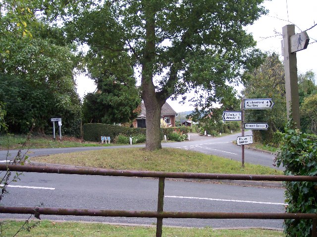
Baggotts Coppice Images
Images are sourced within 2km of 52.205186/-2.3414772 or Grid Reference SO7656. Thanks to Geograph Open Source API. All images are credited.


Baggotts Coppice is located at Grid Ref: SO7656 (Lat: 52.205186, Lng: -2.3414772)
Administrative County: Worcestershire
District: Malvern Hills
Police Authority: West Mercia
What 3 Words
///connects.lizard.bearable. Near Lower Broadheath, Worcestershire
Nearby Locations
Related Wikis
Broadwas
Broadwas, or Broadwas-on-Teme, is a village and civil parish (with Cotheridge) in the Malvern Hills district of Worcestershire, England. According to...

Doddenham
Doddenham is a hamlet and civil parish (with Knightwick) in the Malvern Hills district in the county of Worcestershire, England. Doddenham was in the...

Stanford with Orleton
Stanford with Orleton is a civil parish in the Malvern Hills district, in the county of Worcestershire, England. The parish comprises the villages of Stanford...

Cotheridge
Cotheridge is a village and civil parish in the district of Malvern Hills in the county of Worcestershire, England. It is 4 miles (6 km) west of the...
Lulsley
Lulsley is a village and civil parish in the Malvern Hills District of the county of Worcestershire, England, UK. == History == Lulsley was in the upper...

Cotheridge Court
Cotheridge Court is a Grade II* listed ancient manor house situated in the south-western part of Cotheridge, in the county of Worcestershire, England,...
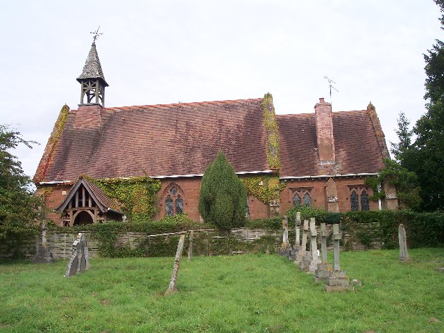
St Leonard's Church, Cotheridge
St. Leonard's Church is a small, 12th-century church located in the scattered village of Cotheridge in Worcestershire. It stands not far from the manor...

Berrow Green
Berrow Green is a village in Worcestershire, England. == Berrow Hill Camp == Berrow Green is situated just below Berrow Hill Camp, an Iron Age encampment...
Nearby Amenities
Located within 500m of 52.205186,-2.3414772Have you been to Baggotts Coppice?
Leave your review of Baggotts Coppice below (or comments, questions and feedback).