Ashburnside Plantation

Wood, Forest in Cumberland Eden

England

Ashburnside Plantation

Cotton-grass beside Fiddler Street The moorland with massed seed heads of cotton-grass, (which is a sedge and not a grass), is on the south side of Fiddler Street, the minor road connecting Nenthead with Garrigill.
Cross Fell is the distant mountain just right of centre. The two Dun Fells are left of it.
Cotton-grass beside Fiddler Street Credit: Trevor Littlewood

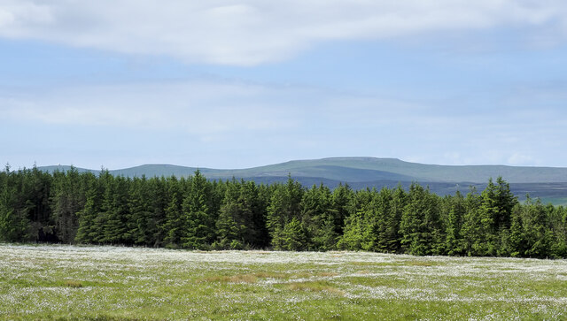
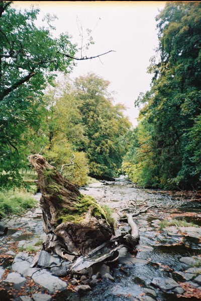
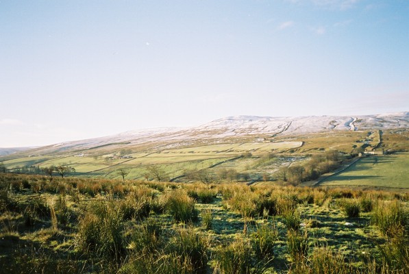
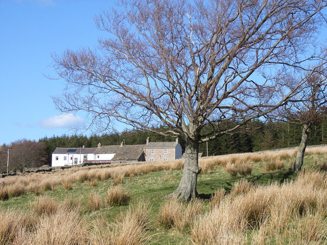
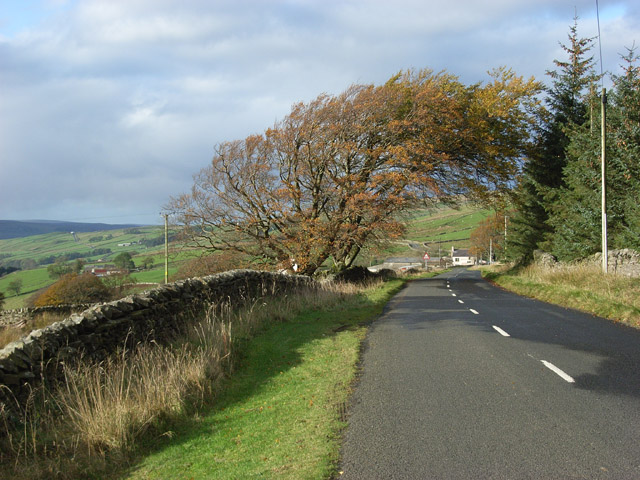
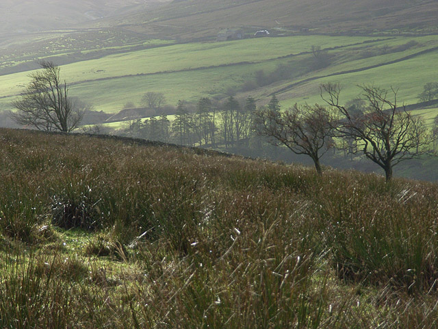
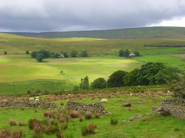
Ashburnside Plantation is a sprawling woodland located in Cumberland, a county known for its picturesque landscapes in the northwest of England. This vast plantation covers an area of approximately 500 acres, making it an expansive and diverse natural habitat. The plantation is predominantly composed of dense woodlands and forests, making it a haven for a variety of flora and fauna.

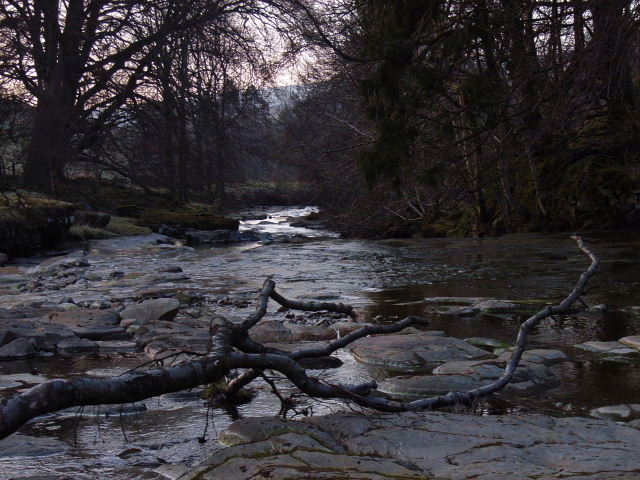
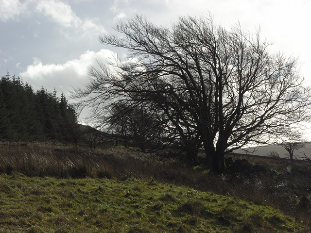
The woodlands of Ashburnside Plantation are characterized by towering oak, beech, and birch trees that create a thick canopy, allowing only dappled sunlight to filter through. The forest floor is covered in a lush carpet of ferns, moss, and wildflowers, adding to the enchanting ambiance of the plantation. The biodiversity of the area is further enhanced by the presence of several natural springs, which provide a constant water supply to the plants and animals that inhabit the plantation.

This woodland is a sanctuary for numerous species of birds, including woodpeckers, owls, and various songbirds. Small mammals like squirrels, rabbits, and foxes can also be spotted within the plantation. Additionally, Ashburnside Plantation is home to a plethora of insects, fungi, and other invertebrates that contribute to the rich ecosystem.

The plantation serves as a popular destination for nature enthusiasts and hikers who can explore its network of well-maintained walking trails. These trails offer visitors the opportunity to immerse themselves in the tranquility of the woodland and appreciate its natural beauty. Ashburnside Plantation is not only a cherished natural asset but also an important contributor to the region's ecological balance, making it a cherished part of Cumberland's landscape.

If you have any feedback on the listing, please let us know in the comments section below.

Ashburnside Plantation Images

Images are sourced within 2km of 54.759661/-2.3656596 or Grid Reference NY7640. Thanks to Geograph Open Source API. All images are credited.

Cotton-grass beside Fiddler Street The moorland with massed seed heads of cotton-grass, (which is a sedge and not a grass), is on the south side of Fiddler Street, the minor road connecting Nenthead with Garrigill.
Cross Fell is the distant mountain just right of centre. The two Dun Fells are left of it.
Cotton-grass beside Fiddler Street
The moorland with massed seed heads of cotton-grass, (which is a sedge and not a grass), is on the south side of Fiddler Street, the minor road connecting Nenthead with Garrigill. Cross Fell is the distant mountain just right of centre. The two Dun Fells are left of it.
Little Gill Hush Hushes were created by mineworkers in order to expose the underlying bedrock. Watercourses were diverted, dammed and then released to create a man-made ravine whereby the geology could be assessed. Just below this hush there is the entrance to a level.
Little Gill Hush
Hushes were created by mineworkers in order to expose the underlying bedrock. Watercourses were diverted, dammed and then released to create a man-made ravine whereby the geology could be assessed. Just below this hush there is the entrance to a level.
Little Gill in mist
Little Gill in mist
High Ashgill
High Ashgill
River South Tyne
River South Tyne
Noonstones Hill The view across the South Tyne valley from High Ashgill.
Noonstones Hill
The view across the South Tyne valley from High Ashgill.
River South Tyne From the footbridge on the footpath between High Ashgill and West Ashgill.
River South Tyne
From the footbridge on the footpath between High Ashgill and West Ashgill.
High Ashgill House and attached longbarn conversion.
High Ashgill
House and attached longbarn conversion.
River South Tyne The river, shallow here, tumbles over rapids and small waterfalls.
River South Tyne
The river, shallow here, tumbles over rapids and small waterfalls.
The B6277 Looking down to Ashgill Farm from High Ashgill.
The B6277
Looking down to Ashgill Farm from High Ashgill.
Pastures, High Ashgill Looking across the South Tyne valley - the silage bales and a barely visible barn are at Dorthgill.
Pastures, High Ashgill
Looking across the South Tyne valley - the silage bales and a barely visible barn are at Dorthgill.
Pasture and plantation, High Ashgill The deciduous trees are the remnants of more extensive woodland. The main road runs alongside the conifers.
Pasture and plantation, High Ashgill
The deciduous trees are the remnants of more extensive woodland. The main road runs alongside the conifers.
Pastures, High Ashgill With a view across the South Tyne valley to Noonstones Hill.
Pastures, High Ashgill
With a view across the South Tyne valley to Noonstones Hill.
Lambs, High Ashgill Not content with grass, this one has a taste for garden shrubbery.
Lambs, High Ashgill
Not content with grass, this one has a taste for garden shrubbery.
Residents of High Ashgill It was a miserable day outside and these chickens were jealously looking in from the cold. Cash in the Attic was on the television and they seemed engrossed. The glazing isn't traditional but helps a little to keep the elements at bay. The location is at an altitude of over 1400 feet and faces into the prevailing wind.
Residents of High Ashgill
It was a miserable day outside and these chickens were jealously looking in from the cold. Cash in the Attic was on the television and they seemed engrossed. The glazing isn't traditional but helps a little to keep the elements at bay. The location is at an altitude of over 1400 feet and faces into the prevailing wind.
The upper South Tyne valley A view across the roughish pasture on the eastern side of the valley at High Ashgill. On the opposite side are Hill House (centre) and Pasture House (just a barn, right) below Noonstones Hill.
The upper South Tyne valley
A view across the roughish pasture on the eastern side of the valley at High Ashgill. On the opposite side are Hill House (centre) and Pasture House (just a barn, right) below Noonstones Hill.
Pasture, High Ashgill The eastern side of the South Tyne valley. The land here is grazed by sheep and sometimes cattle. It is quite damp and a home to curlews especially during the spring. The gradient steepens as you descend to the river. The plantation is the other side of the road which makes a long gradual ascent on its way to Teesdale.
Pasture, High Ashgill
The eastern side of the South Tyne valley. The land here is grazed by sheep and sometimes cattle. It is quite damp and a home to curlews especially during the spring. The gradient steepens as you descend to the river. The plantation is the other side of the road which makes a long gradual ascent on its way to Teesdale.
The South Tyne valley above Garrigill Looking across the valley from High Ashgill towards Lee Houses and Middle Lee Cottage. Only a limited amount of the foreground is within the grid-square. Many walls have fallen into disrepair like this one.
The South Tyne valley above Garrigill
Looking across the valley from High Ashgill towards Lee Houses and Middle Lee Cottage. Only a limited amount of the foreground is within the grid-square. Many walls have fallen into disrepair like this one.
Show me another place!

Ashburnside Plantation is located at Grid Ref: NY7640 (Lat: 54.759661, Lng: -2.3656596)

Administrative County: Cumbria

District: Eden

Police Authority: Cumbria

What 3 Words

///punchy.dolls.media. Near Alston, Cumbria

Nearby Locations

Ashburnside Plantation

Related Wikis

Ashgill Force

Ashgill Force is a waterfall near Alston, Cumbria, England. The fall is located on Ashgill Beck and is reasonably easily accessible from the B6277 (which...

Garrigill

Garrigill, Cumbria is a small village in the North Pennine region of the UK, situated on the banks and close to the source of the River South Tyne. Historically...

Rampghill mine

Rampgill mine is a disused lead mine at Nenthead, Alston Moor, Cumbria, England UK Grid Reference: NY78184351It was one of the most extensive and productive...

Nenthead

Nenthead ( NENT-hed) in the county of Cumbria is one of England's highest villages, at around 1,437 feet (438 m). It was not built until the middle of...

Burnhope Seat

Burnhope Seat is a high moorland fell in the North Pennines Area of Outstanding Natural Beauty (AONB) in northern England. It lies between the heads of...

Killhope Cross

Killhope Cross (elevation 627 m; 2,057 ft) is a mountain pass in the English Pennines. The pass divides Weardale to the east and Cumbria to the west. The...

Moorhouse and Cross Fell

Moorhouse and Cross Fell is a Site of Special Scientific Interest covering an extensive area of moorland in the Wear Valley district of west County Durham...

Old Moss Lead Vein

Old Moss Lead Vein, also known as Killhope Head, is a Site of Special Scientific Interest in the Wear Valley district of County Durham, England. It consists...

Nearby Amenities

Located within 500m of 54.759661,-2.3656596
Seldom Seen
Place: locality
Source: NPE
Lat/Long: 54.7638051/-2.3643527
Natural: sinkhole
Lat/Long: 54.7641446/-2.3662712
Natural: sinkhole
Lat/Long: 54.7640843/-2.3664438
Generator Method: photovoltaic
Generator Output Electricity: yes
Generator Source: solar
Generator Type: solar_photovoltaic_panel
Location: roof
Power: generator
Lat/Long: 54.7586873/-2.3597614
Abandoned: yes
Historic: mine_shaft
Man Made: mineshaft
Lat/Long: 54.7618713/-2.3604734
Power: pole
Lat/Long: 54.7573837/-2.3722694
Power: pole
Lat/Long: 54.7577064/-2.3696936
Power: pole
Lat/Long: 54.7578349/-2.3687039
The data included in this document is from www.openstreetmap.org. The data is made available under ODbL.

Have you been to Ashburnside Plantation?

Leave your review of Ashburnside Plantation below (or comments, questions and feedback).