Aldermore

Wood, Forest in Dorset

England

Aldermore

Nordon Hill from private road to Higher Melcombe
Nordon Hill from private road to Higher Melcombe Credit: Becky Williamson

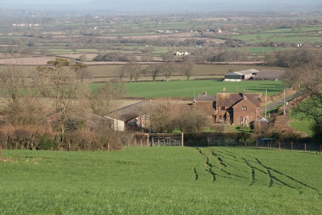
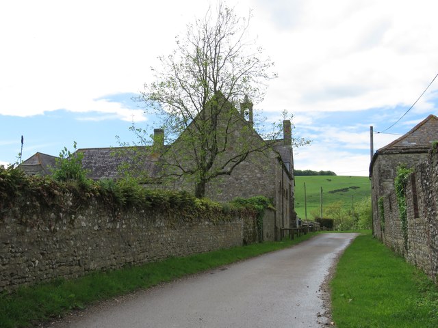
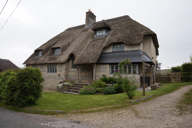
Aldermore is a picturesque village located in the county of Dorset, England. Nestled amidst a dense woodland, it is often referred to as Aldermore Wood or Aldermore Forest due to its abundant natural beauty. The village is situated on the outskirts of the larger town of Dorchester, offering residents a peaceful and tranquil escape from the hustle and bustle of city life.

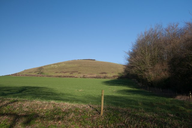
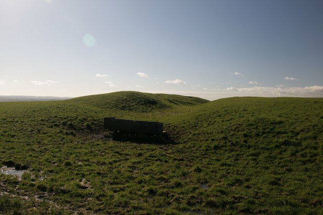
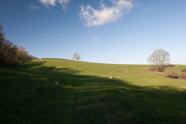
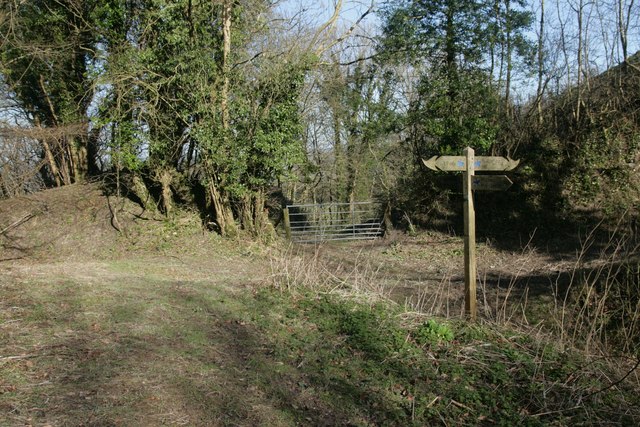
The main attraction of Aldermore is undoubtedly its stunning forested landscape. The village is surrounded by a lush canopy of trees, predominantly alder trees, which give the area its name. The forest provides an idyllic setting for nature enthusiasts, with numerous walking trails and pathways that meander through the verdant greenery. It is a haven for wildlife, offering the opportunity to spot a variety of bird species, deer, and other woodland creatures.

Despite its rural setting, Aldermore is well-connected to neighboring towns and cities. The village has excellent transport links, with the A35 road passing nearby, providing easy access to Dorchester and other major destinations in the region. Additionally, there are regular bus services that connect Aldermore to surrounding areas, making it convenient for residents and visitors to explore the wider region.

Aldermore itself is a small and close-knit community, with a handful of houses and local amenities such as a village hall and a small shop. The village exudes a friendly and welcoming atmosphere, with residents often organizing community events and gatherings. While it may lack the amenities of larger towns, Aldermore compensates with its natural beauty and a strong sense of community spirit.

If you have any feedback on the listing, please let us know in the comments section below.
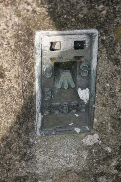
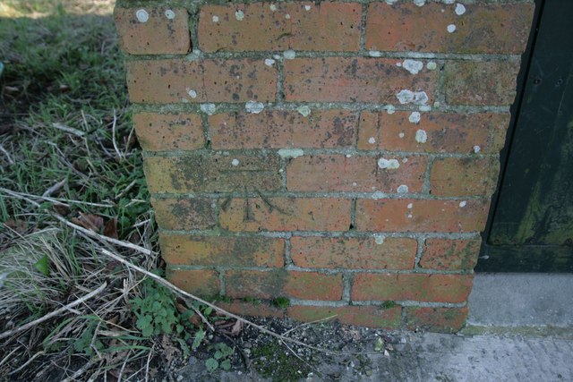
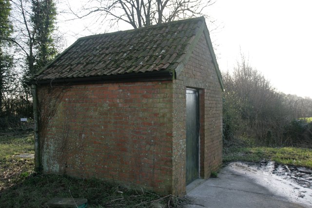
Aldermore Images

Images are sourced within 2km of 50.825699/-2.343489 or Grid Reference ST7502. Thanks to Geograph Open Source API. All images are credited.

Nordon Hill from private road to Higher Melcombe
Leading to Melcombe Park Farm from the south
Benchmark on St Andrew's Church, Bingham's Melcombe Ordnance Survey benchmark, described on database at <span class="nowrap"><a title="http://www.bench-marks.org.uk/bm72979" rel="nofollow ugc noopener" href="http://www.bench-marks.org.uk/bm72979">Link</a><img style="margin-left:2px;" alt="External link" title="External link - shift click to open in new window" src="https://s1.geograph.org.uk/img/external.png" width="10" height="10"/></span>. See also <a href="https://www.geograph.org.uk/photo/4807901">ST7702 : St Andrew's Church, Bingham's Melcombe</a>.
Benchmark on St Andrew's Church, Bingham's Melcombe
Ordnance Survey benchmark, described on database at LinkExternal link. See also ST7702 : St Andrew's Church, Bingham's Melcombe.
St Andrew's Church, Bingham's Melcombe There is an Ordnance Survey benchmark on this delightful country estate church. See <a href="https://www.geograph.org.uk/photo/4807899">ST7702 : Benchmark on St Andrew's Church, Bingham's Melcombe</a> for photo.
St Andrew's Church, Bingham's Melcombe
There is an Ordnance Survey benchmark on this delightful country estate church. See ST7702 : Benchmark on St Andrew's Church, Bingham's Melcombe for photo.
Lime kiln in Link's Plantation At least I think it is. I did a little research, which suggested the erstwhile existence of a lime kiln, or at least a kiln of some description at this grid reference.
Lime kiln in Link's Plantation
At least I think it is. I did a little research, which suggested the erstwhile existence of a lime kiln, or at least a kiln of some description at this grid reference.
Trig point on Henning Hill
Flush Bracket on Henning Hill trigpoint
Benchmark on Pump House, Cross Lanes Ordnance Survey benchmark, described on database at <span class="nowrap"><a title="http://www.bench-marks.org.uk/bm47096" rel="nofollow ugc noopener" href="http://www.bench-marks.org.uk/bm47096">Link</a><img style="margin-left:2px;" alt="External link" title="External link - shift click to open in new window" src="https://s1.geograph.org.uk/img/external.png" width="10" height="10"/></span>. See also <a href="https://www.geograph.org.uk/photo/4807920">ST7502 : Pump House, Cross Lanes</a>.
Benchmark on Pump House, Cross Lanes
Ordnance Survey benchmark, described on database at LinkExternal link. See also ST7502 : Pump House, Cross Lanes.
Pump House, Cross Lanes There is an Ordnance Survey benchmark on this building (left side of door). For photo, see <a href="https://www.geograph.org.uk/photo/4807918">ST7502 : Benchmark on Pump House, Cross Lanes</a>. For full description on database, see <span class="nowrap"><a title="http://www.bench-marks.org.uk/bm47096" rel="nofollow ugc noopener" href="http://www.bench-marks.org.uk/bm47096">Link</a><img style="margin-left:2px;" alt="External link" title="External link - shift click to open in new window" src="https://s1.geograph.org.uk/img/external.png" width="10" height="10"/></span>.
Pump House, Cross Lanes
There is an Ordnance Survey benchmark on this building (left side of door). For photo, see ST7502 : Benchmark on Pump House, Cross Lanes. For full description on database, see LinkExternal link.
Cross dyke near Higher Melcombe A prehistoric land boundary. There is a plethora of these in the area.
Cross dyke near Higher Melcombe
A prehistoric land boundary. There is a plethora of these in the area.
Eastern flanks of Nettlecombe Tout
Signpost at Dorsetshire Gap This ancient intersection has a visitors' book for passers-by to sign as they pass through.
Signpost at Dorsetshire Gap
This ancient intersection has a visitors' book for passers-by to sign as they pass through.
Higher Melcombe Farm There is a benchmark on the building on the right. See <a href="https://www.geograph.org.uk/photo/4963247">ST7402 : Benchmark on building, Higher Melcombe Farm</a>.
Higher Melcombe Farm
There is a benchmark on the building on the right. See ST7402 : Benchmark on building, Higher Melcombe Farm.
Benchmark on building, Higher Melcombe Farm Ordnance Survey benchmark, described on database at <span class="nowrap"><a title="http://www.bench-marks.org.uk/bm75743" rel="nofollow ugc noopener" href="http://www.bench-marks.org.uk/bm75743">Link</a><img style="margin-left:2px;" alt="External link" title="External link - shift click to open in new window" src="https://s1.geograph.org.uk/img/external.png" width="10" height="10"/></span>. See also <a href="https://www.geograph.org.uk/photo/4963245">ST7402 : Higher Melcombe Farm</a>.
Benchmark on building, Higher Melcombe Farm
Ordnance Survey benchmark, described on database at LinkExternal link. See also ST7402 : Higher Melcombe Farm.
House at Badger Lane, Cross Lanes
Cross Roads at Cross Lanes
Spring House On Hartfoot Lane, Melcombe Bingham.
Spring House
On Hartfoot Lane, Melcombe Bingham.
The Old Brewery Hall, Ansty
Show me another place!

Aldermore is located at Grid Ref: ST7502 (Lat: 50.825699, Lng: -2.343489)

Unitary Authority: Dorset

Police Authority: Dorset

What 3 Words

///obstruct.cheaper.broccoli. Near Milborne St Andrew, Dorset
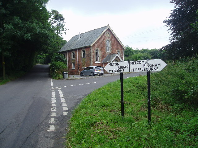
Nearby Locations

Cross Lanes Aldermore

Related Wikis

Melcombe Horsey

Melcombe Horsey is a civil parish in the county of Dorset in South West England. It contains the small settlements of Melcombe Bingham, Bingham's Melcombe...

Ansty, Dorset

Ansty is a village in Dorset, England, north of Cheselbourne and west of Milton Abbas. It consists of the settlements of Higher Ansty, Lower Ansty, Pleck...

Ansty Cross

Ansty Cross is a village in Dorset, England.

Aller, Dorset

Aller is a village in Dorset, England.

Lyscombe Hill

Lyscombe Hill (262 metres, 860 feet high) is a hill near Melcombe Bingham about 14 kilometres north-northeast of Dorchester in the county of Dorset, England...

Hilton, Dorset

Hilton is a village and civil parish in the county of Dorset in southern England. It is sited at an elevation of 135 metres (443 feet) in a small valley...

Bulbarrow Hill

Bulbarrow Hill is a 274 metres (899 ft) hill near Woolland, five miles west of Blandford Forum and ten miles (16 km) north of Dorchester in Dorset, England...

Cheselbourne

Cheselbourne (sometimes spelled Chesilborne or Cheselborne) is a village and civil parish in Dorset, England, situated in the Dorset Downs, 7 miles (11...

Related Videos

WALKS IN DORSET at ANSTY , BINGHAM's MELCOMBE & HILTON (4K)

In this episode of my series “ Walks in Dorset”, I take a 3.5 mile “circular” walk from the village of Ansty to the settlements at ...

WALKS IN DORSET at LYSCOMBE BOTTOM (AND EXPLORING THE DESERTED VILLAGE AT LYSCOMBE) (4K)

In this episode of my series “ Walks in Dorset” I explore around the valley at Lyscombe Bottom – located about 9 miles North of ...

Nearby Amenities

Located within 500m of 50.825699,-2.343489
Melcombe Bingham
Is In: Dorset, England, UK
Place: village
Wikidata: Q14956370
Lat/Long: 50.8224163/-2.3386687
Barrier: stile
Lat/Long: 50.8274905/-2.3423977
Ansty
Place: village
Wikidata: Q4770793
Lat/Long: 50.8242527/-2.3368695
Turning Circle
Lat/Long: 50.8244054/-2.3378608
Barrier: stile
Lat/Long: 50.8283764/-2.3400144
Material: wood
Power: pole
Source: bing
Lat/Long: 50.8218293/-2.3412478
Material: wood
Power: pole
Source: bing
Lat/Long: 50.8227782/-2.3406622
Material: wood
Power: pole
Source: bing
Lat/Long: 50.8234311/-2.3402992
Material: wood
Power: pole
Source: bing
Lat/Long: 50.8241282/-2.3398944
Material: wood
Power: pole
Source: bing
Lat/Long: 50.8261932/-2.3386673
Material: wood
Power: pole
Source: bing
Lat/Long: 50.826825/-2.3382576
Material: wood
Power: pole
Source: bing
Lat/Long: 50.8274749/-2.3378622
Post Box
Brand: Royal Mail
Brand Wikidata: Q638098
Collection Times: Mo-Fr 13:15; Sa 09:00
Operator: Royal Mail
Operator Wikidata: Q638098
Post Box Type: lamp
Ref: DT2 141
Royal Cypher: EIIR
Royal Cypher Wikidata: Q33102113
Lat/Long: 50.8236549/-2.3382714
Power: pole
Source: bing
Lat/Long: 50.8259935/-2.338783
Power: pole
Source: bing
Lat/Long: 50.8258732/-2.3389962
Power: pole
Source: bing
Lat/Long: 50.8254861/-2.3390807
Power: pole
Source: bing
Lat/Long: 50.8247965/-2.3394978
Power: pole
Source: bing
Lat/Long: 50.826268/-2.3369417
Power: pole
Source: bing
Lat/Long: 50.82624/-2.3377933
Fire Hydrant
Emergency: fire_hydrant
Fire Hydrant Diameter: 100
Fire Hydrant Type: underground
Source: survey
Lat/Long: 50.825112/-2.337744
Power: pole
Source: bing
Lat/Long: 50.8223201/-2.3409489
The data included in this document is from www.openstreetmap.org. The data is made available under ODbL.

Have you been to Aldermore?

Leave your review of Aldermore below (or comments, questions and feedback).