Brockhill Coppice

Wood, Forest in Herefordshire

England

Brockhill Coppice

Jubilee Hill A small, but distinct peak on the Malvern ridge.
It was one of the un-named peaks until Queen Elizabeth's golden jubilee in 2002.
Her son Prince Andrew walked to the top of the hill (which was adorned with a flagpole flying the union flag for the one day only) to name it.
Jubilee Hill Credit: Bob Embleton

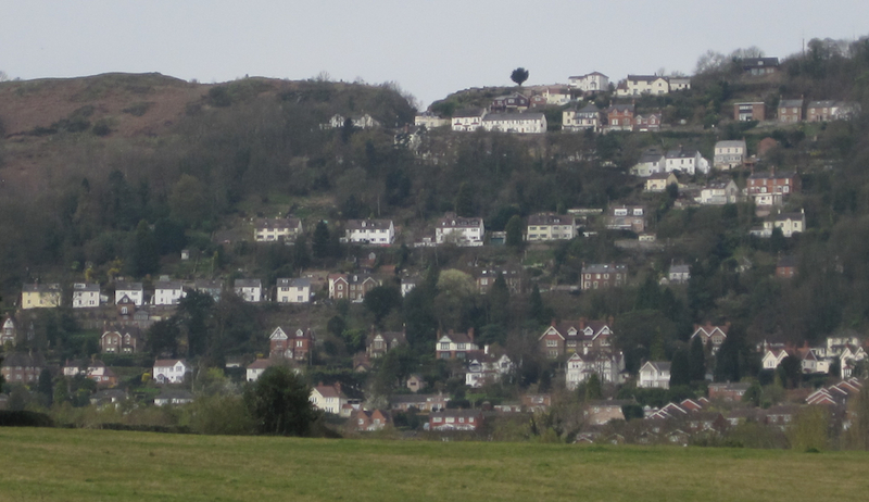
Brockhill Coppice is a picturesque woodland located in the county of Herefordshire, England. Covering an area of approximately 50 acres, this enchanting forest is a popular destination for nature enthusiasts and those seeking tranquility.

The coppice is characterized by its diverse range of tree species, including oak, beech, ash, and birch, which provide a stunning display of colors throughout the changing seasons. The forest floor is carpeted with a variety of wildflowers and ferns, creating a vibrant and biodiverse ecosystem.

Several walking trails wind their way through the coppice, allowing visitors to explore its beauty at their own pace. These paths are well-maintained and suitable for both casual strolls and more challenging hikes. Along the way, walkers may encounter wildlife such as squirrels, deer, and a wide array of bird species, making it a popular spot for birdwatching.

Brockhill Coppice is also home to a small pond, which serves as a habitat for frogs, newts, and dragonflies. This natural water feature adds to the overall charm of the woodland and provides a peaceful spot for visitors to relax and enjoy the sounds of nature.

The coppice is open to the public year-round, with no admission fees. It is easily accessible by car, with ample parking available nearby. Visitors are advised to wear appropriate footwear and clothing for outdoor activities, as the terrain can be uneven and muddy, particularly during wet weather.

Overall, Brockhill Coppice offers a serene and tranquil escape from the hustle and bustle of everyday life, providing visitors with a chance to connect with nature and experience the beauty of Herefordshire's woodlands.

If you have any feedback on the listing, please let us know in the comments section below.

Brockhill Coppice Images

Images are sourced within 2km of 52.092716/-2.3535057 or Grid Reference SO7543. Thanks to Geograph Open Source API. All images are credited.

Jubilee Hill A small, but distinct peak on the Malvern ridge.
It was one of the un-named peaks until Queen Elizabeth's golden jubilee in 2002.
Her son Prince Andrew walked to the top of the hill (which was adorned with a flagpole flying the union flag for the one day only) to name it.
Jubilee Hill
A small, but distinct peak on the Malvern ridge. It was one of the un-named peaks until Queen Elizabeth's golden jubilee in 2002. Her son Prince Andrew walked to the top of the hill (which was adorned with a flagpole flying the union flag for the one day only) to name it.
Pinnacle Hill Taken from the larch trees of Thirds Land by Jubilee Hill.
Pinnacle Hill
Taken from the larch trees of Thirds Land by Jubilee Hill.
Larch buds at Thirds Land Close to Jubilee Hill. 
The flowering buds will form into cones as the seasons pass.
The land got the name "Thirds Land" as it was part of the Malvern Chase common handed to King Charles II as compensation for the disafforestation of the Chase.
Larch buds at Thirds Land
Close to Jubilee Hill. The flowering buds will form into cones as the seasons pass. The land got the name "Thirds Land" as it was part of the Malvern Chase common handed to King Charles II as compensation for the disafforestation of the Chase.
The Wells Road near Ashdown Villa Looking in a southerly direction towards Little Malvern.
This stretch of the road is still lit by gas lamps.
On the right is the "Gothic Well" - not open to the public.
<span class="nowrap"><a title="http://www.malvern-hills.co.uk/malvernspa/well-info/gothic.html" rel="nofollow ugc noopener" href="http://www.malvern-hills.co.uk/malvernspa/well-info/gothic.html">Link</a><img style="margin-left:2px;" alt="External link" title="External link - shift click to open in new window" src="https://s1.geograph.org.uk/img/external.png" width="10" height="10"/></span>
The Wells Road near Ashdown Villa
Looking in a southerly direction towards Little Malvern. This stretch of the road is still lit by gas lamps. On the right is the "Gothic Well" - not open to the public. LinkExternal link
The Wells Road below Hanley Terrace Looking in a northerly direction towards Great Malvern.
The houses are on Hanley Terrace high above the main road.
On the left, built into the hillside, is the "Gothic Well".
<span class="nowrap"><a title="http://www.malvern-hills.co.uk/malvernspa/well-info/gothic.html" rel="nofollow ugc noopener" href="http://www.malvern-hills.co.uk/malvernspa/well-info/gothic.html">Link</a><img style="margin-left:2px;" alt="External link" title="External link - shift click to open in new window" src="https://s1.geograph.org.uk/img/external.png" width="10" height="10"/></span>
The Wells Road below Hanley Terrace
Looking in a northerly direction towards Great Malvern. The houses are on Hanley Terrace high above the main road. On the left, built into the hillside, is the "Gothic Well". LinkExternal link
The Gothic Well on Wells Road, Malvern An old wooden green door stood under the central arch until recently, but this has now been bricked up.
This gave access to a chamber going 30 feet into the hillside to the well which supplied 30,000 gallons of water per day. 
During the war the chamber was used as an air raid shelter. 
<span class="nowrap"><a title="http://www.malvern-hills.co.uk/malvernspa/well-info/gothic.html" rel="nofollow ugc noopener" href="http://www.malvern-hills.co.uk/malvernspa/well-info/gothic.html">Link</a><img style="margin-left:2px;" alt="External link" title="External link - shift click to open in new window" src="https://s1.geograph.org.uk/img/external.png" width="10" height="10"/></span>
The Gothic Well on Wells Road, Malvern
An old wooden green door stood under the central arch until recently, but this has now been bricked up. This gave access to a chamber going 30 feet into the hillside to the well which supplied 30,000 gallons of water per day. During the war the chamber was used as an air raid shelter. LinkExternal link
Wyche Spring - Well Dressing 2011 - Togetherness Sheila Maund dressed the spring using not only the royal wedding for this year's theme of "Togetherness", but also the May Day celebrations of the unions in nature.
Wyche Spring - Well Dressing 2011 - Togetherness
Sheila Maund dressed the spring using not only the royal wedding for this year's theme of "Togetherness", but also the May Day celebrations of the unions in nature.
Approaching Wyche Cutting View north to the Worcestershire Beacon from the ridge leading off Perseverance Hill. After a dry spell, the August sun has parched the grass.
Approaching Wyche Cutting
View north to the Worcestershire Beacon from the ridge leading off Perseverance Hill. After a dry spell, the August sun has parched the grass.
West of the Worcestershire Beacon This autumn view west from the ridge-top encompasses much of Herefordshire. On the left is Oyster Hill and beyond sticking out of the mist is the Marcle Ridge.
West of the Worcestershire Beacon
This autumn view west from the ridge-top encompasses much of Herefordshire. On the left is Oyster Hill and beyond sticking out of the mist is the Marcle Ridge.
The toposcope on the Worcester Beacon Looking north-west with Table Hill on the right. In the middle distance the Suckley Hills poke out of the mist and at the back are the Abberley Hills. The inscription reads "Erected in commemoration of the sixtieth year of Queen Victoria's reign 1897".
The toposcope on the Worcester Beacon
Looking north-west with Table Hill on the right. In the middle distance the Suckley Hills poke out of the mist and at the back are the Abberley Hills. The inscription reads "Erected in commemoration of the sixtieth year of Queen Victoria's reign 1897".
Overlooking Great Malvern Looking north-east from near the top of the Worcestershire Beacon on a misty November morning. The Seven Valley is completely covered in mist right up to the lower parts of Great Malvern. The higher part of the town and the Malvern Hills are bathed in sunlight. The brown patches below are bracken, which has been mowed by the Malvern Hills Conservators (the straight-line tractor tracks are still visible).
Overlooking Great Malvern
Looking north-east from near the top of the Worcestershire Beacon on a misty November morning. The Seven Valley is completely covered in mist right up to the lower parts of Great Malvern. The higher part of the town and the Malvern Hills are bathed in sunlight. The brown patches below are bracken, which has been mowed by the Malvern Hills Conservators (the straight-line tractor tracks are still visible).
60 Old Wyche Road, demolished
Worcestershire Beacon from Sugarloaf Hill Worcestershire Beacon, the highest hill in the Malvern range, beneath threatening cloud.
Worcestershire Beacon from Sugarloaf Hill
Worcestershire Beacon, the highest hill in the Malvern range, beneath threatening cloud.
The Hanley Terrace - Wells Road junction, Malvern Hanley Terrace is a cul-de-sac of Victorian houses.
The acuteness of the junction makes turning near impossible and causes long tailbacks when attempted in a long vehicle.
The Hanley Terrace - Wells Road junction, Malvern
Hanley Terrace is a cul-de-sac of Victorian houses. The acuteness of the junction makes turning near impossible and causes long tailbacks when attempted in a long vehicle.
The Pixie Path, Malvern Wells This steep section of the path joins Hanley Terrace to the Eaton Road -Westminster Road junction.
It continues on upwards to the Wyche Cutting and downwards to what is now the golf clubhouse.
The Pixie Path, Malvern Wells
This steep section of the path joins Hanley Terrace to the Eaton Road -Westminster Road junction. It continues on upwards to the Wyche Cutting and downwards to what is now the golf clubhouse.
The Pixie Path crosses Hanley Terrace. Malvern The path runs from the top of the Malvern Hills at the Wyche Cutting down to what is now the golf clubhouse.
Here it crosses Hanley Terrace then, using the ramp descends to the Wells Road.
The Pixie Path crosses Hanley Terrace. Malvern
The path runs from the top of the Malvern Hills at the Wyche Cutting down to what is now the golf clubhouse. Here it crosses Hanley Terrace then, using the ramp descends to the Wells Road.
George VI postbox on Hanley Terrace Close to where the Pixie Path crosses the road.
built into the Malvern granite stone wall.
George VI postbox on Hanley Terrace
Close to where the Pixie Path crosses the road. built into the Malvern granite stone wall.
Hanley Terrace Looking south along the level terrace above the Wells Road.
The large Victorian houses have commanding views over the Severn Plain to the Cotswolds.
Notice how the houses are of different designs.
The brick-walled house shows many Gothic influences (e.g. arches) often seen in Malvern perhaps reflecting on the fervour to restore the ancient priory church at this time.
Further down the houses are made of Malvern granite from the many quarries which threatened to destroy the Malvern Hills.
Hanley Terrace
Looking south along the level terrace above the Wells Road. The large Victorian houses have commanding views over the Severn Plain to the Cotswolds. Notice how the houses are of different designs. The brick-walled house shows many Gothic influences (e.g. arches) often seen in Malvern perhaps reflecting on the fervour to restore the ancient priory church at this time. Further down the houses are made of Malvern granite from the many quarries which threatened to destroy the Malvern Hills.
Show me another place!

Brockhill Coppice is located at Grid Ref: SO7543 (Lat: 52.092716, Lng: -2.3535057)

Unitary Authority: County of Herefordshire

Police Authority: West Mercia

What 3 Words

///fairness.thumps.villager. Near Great Malvern, Worcestershire

Nearby Locations

Brockhill Coppice

Related Wikis

Downs Light Railway

The Downs Light Railway is the world's oldest private miniature railway, with a track gauge of 9+1⁄2 in (241 mm). The railway is located within the grounds...

The Downs Malvern

The Downs Malvern is a private prep school in the United Kingdom, founded in 1900. It is located on a 55-acre (22 ha) site in Colwall in the County of...

Colwall Tunnels

The Colwall Tunnels are a pair of railway tunnels that connect Colwall and Malvern Wells on the Cotswold Line, passing under the Malvern Hills in the Welsh...

Wyche, Worcestershire

Wyche ( WITCH), often referred to locally as The Wyche, is a village and a suburb of the town of Malvern, Worcestershire, England, and part of the civil...

Malvern water

Malvern water is a natural spring water from the Malvern Hills on the border of the counties of Herefordshire and Worcestershire in England. The Hills...

Colwall

Colwall is a civil parish in Herefordshire, England, situated on the border with Worcestershire, nestling on the western side of the Malvern Hills at the...

Colwall railway station

Colwall railway station is a railway station on the Cotswold Line serving the village of Colwall in Herefordshire, England. The station has one platform...

Worcestershire Beacon

Worcestershire Beacon, also popularly known as Worcester Beacon, or locally simply as The Beacon, is a hill whose summit at 425 metres (1,394 ft) is the...

Nearby Amenities

Located within 500m of 52.092716,-2.3535057
Barrier: stile
Lat/Long: 52.0956298/-2.3492204
Post Box
Collection Plate: CP5
Collection Times: Mo-Fr 16:00; Sa 07:00
Historic Operator: none
Post Box Design: hovis
Post Box Mounting: wall
Post Box Type: lamp
Ref: WR13 63
Royal Cypher: EVIIR
Royal Cypher Wikidata: Q33102324
Source: survey
Lat/Long: 52.0910018/-2.360241
Fixme: incompleate
Lat/Long: 52.0889858/-2.3501275
Barrier: stile
Foot: yes
Lat/Long: 52.0892866/-2.3510845
Brockhill Farm
Power: pole
Transformer: distribution
Voltage Primary: 11000
Lat/Long: 52.0914017/-2.3600811
Power: pole
Lat/Long: 52.0917787/-2.3600549
Power: pole
Lat/Long: 52.0924618/-2.3599952
Power: pole
Lat/Long: 52.0921355/-2.3600234
The Hacketts
Power: pole
Transformer: distribution
Voltage Primary: 11000
Lat/Long: 52.0943869/-2.3600858
Power: pole
Lat/Long: 52.0938851/-2.3603238
Power: pole
Lat/Long: 52.093287/-2.3601763
Power: pole
Lat/Long: 52.0928004/-2.3600925
The data included in this document is from www.openstreetmap.org. The data is made available under ODbL.

Have you been to Brockhill Coppice?

Leave your review of Brockhill Coppice below (or comments, questions and feedback).