Cleaves Wood

Wood, Forest in Somerset

England

Cleaves Wood

Wellow Ford Ford on Mill Hill in Wellow, taken from the southern side of the ford.
Photograph taken during a dry spell in Summer; the ford is running very low.  Note that after heavy rainfall the ford can run much higher with a considerable force of water which can make crossing hazardous.
Wellow Ford Credit: Kevin Pearson

Cleaves Wood is a picturesque woodland located in Somerset, England. Covering an area of approximately 100 acres, it is a popular destination for nature enthusiasts and those seeking a tranquil retreat. The wood is nestled within the stunning countryside landscape of Somerset, offering visitors a serene and peaceful environment.

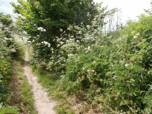
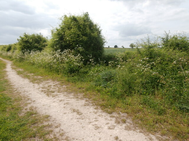
The woodland is characterized by its diverse range of tree species, including oak, beech, and ash, which create a rich and vibrant canopy. The forest floor is adorned with a variety of wildflowers, adding bursts of color to the lush green surroundings. Cleaves Wood is particularly renowned for its bluebells, which create a stunning carpet of purple during the springtime.

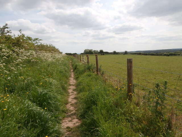
Pathways wind their way through the wood, providing visitors with the opportunity to explore and discover the hidden corners of this enchanting forest. The trails are well-maintained, making it accessible for both walkers and cyclists. Along the paths, there are several benches strategically placed, providing visitors with the perfect spot to rest and take in the beauty of the surroundings.

Cleaves Wood is also home to a rich and diverse array of wildlife. Birdwatchers can spot a variety of species, including woodpeckers, robins, and owls, while nature enthusiasts may encounter squirrels, deer, and foxes. The wood provides a sanctuary for these creatures, creating a harmonious balance between nature and visitors.

Overall, Cleaves Wood offers a tranquil and breathtaking escape for those seeking to immerse themselves in the beauty of nature. Whether it be for a leisurely stroll, a picnic, or wildlife spotting, this woodland is a must-visit destination for anyone in Somerset.

If you have any feedback on the listing, please let us know in the comments section below.
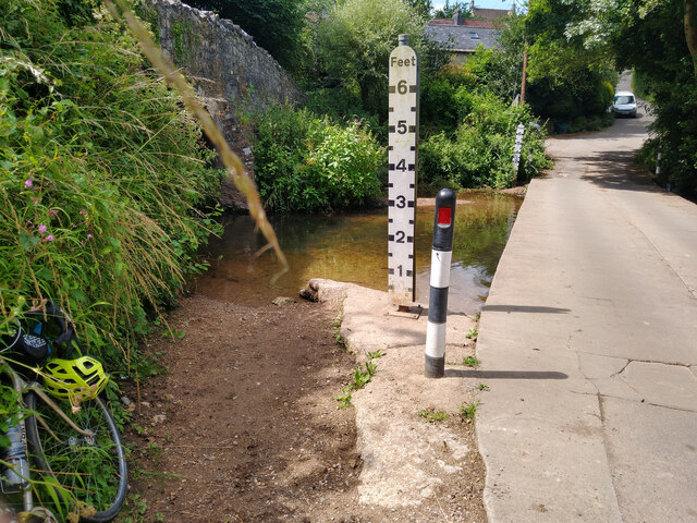
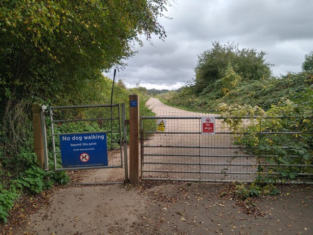
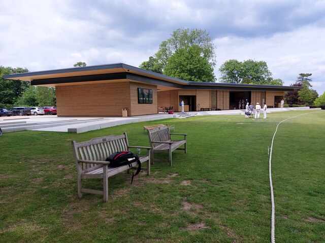
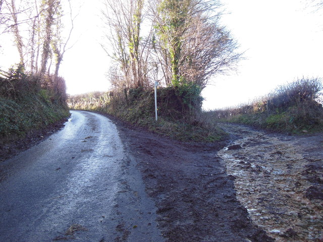
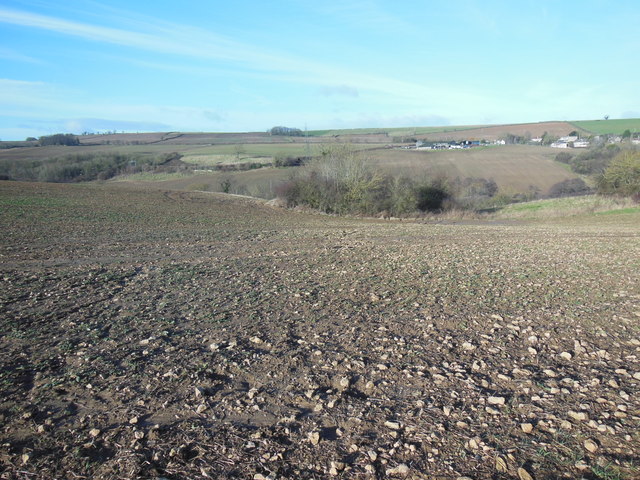
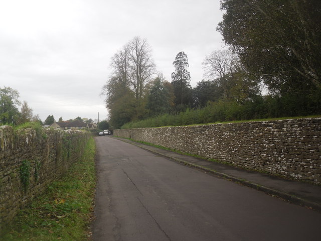
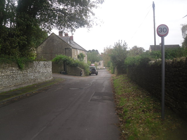
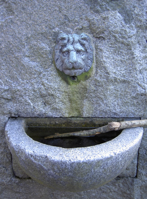
Cleaves Wood Images

Images are sourced within 2km of 51.317832/-2.3493067 or Grid Reference ST7557. Thanks to Geograph Open Source API. All images are credited.

Wellow Ford Ford on Mill Hill in Wellow, taken from the southern side of the ford.
Photograph taken during a dry spell in Summer; the ford is running very low.  Note that after heavy rainfall the ford can run much higher with a considerable force of water which can make crossing hazardous.
Wellow Ford
Ford on Mill Hill in Wellow, taken from the southern side of the ford. Photograph taken during a dry spell in Summer; the ford is running very low. Note that after heavy rainfall the ford can run much higher with a considerable force of water which can make crossing hazardous.
Gate on NCN24 Two Tunnels Greenway near Wellow The second of four swing gates on the NCN24 heading from Wellow to the Two Tunnels.  Springs on some of the gates are very stiff, especially on the first gate off Ford Road in Wellow.
Path here is compacted gravel in generally good condition, with a few potholes, and muddy/rutted patches in wet weather.  The path changes to tarmac past Midford.
Gate on NCN24 Two Tunnels Greenway near Wellow
The second of four swing gates on the NCN24 heading from Wellow to the Two Tunnels. Springs on some of the gates are very stiff, especially on the first gate off Ford Road in Wellow. Path here is compacted gravel in generally good condition, with a few potholes, and muddy/rutted patches in wet weather. The path changes to tarmac past Midford.
Pavilion, Hinton Charterhouse CC The new pavilion of Hinton Charterhouse Cricket Club <span class="nowrap"><a title="https://hccc.play-cricket.com/home" rel="nofollow ugc noopener" href="https://hccc.play-cricket.com/home">Link</a><img style="margin-left:2px;" alt="External link" title="External link - shift click to open in new window" src="https://s1.geograph.org.uk/img/external.png" width="10" height="10"/></span> , used for the first time in the 2023 season.  The spacious pavilion includes a bar, an indoor area for cricket teas, an open-sided but covered area for the scorer and other spectators to sit, and an electronic scoreboard which allows the par score according to the Duckworth-Lewis-Stern system to be displayed. The ground is on private land belonging to Hinton House.  A match is about to begin between Hinton Charterhouse CC Veterans XI and the Somerset Allsorts <span class="nowrap"><a title="https://hccc.play-cricket.com/match_details?id=5525607" rel="nofollow ugc noopener" href="https://hccc.play-cricket.com/match_details?id=5525607">Link</a><img style="margin-left:2px;" alt="External link" title="External link - shift click to open in new window" src="https://s1.geograph.org.uk/img/external.png" width="10" height="10"/></span> .
Pavilion, Hinton Charterhouse CC
The new pavilion of Hinton Charterhouse Cricket Club LinkExternal link , used for the first time in the 2023 season. The spacious pavilion includes a bar, an indoor area for cricket teas, an open-sided but covered area for the scorer and other spectators to sit, and an electronic scoreboard which allows the par score according to the Duckworth-Lewis-Stern system to be displayed. The ground is on private land belonging to Hinton House. A match is about to begin between Hinton Charterhouse CC Veterans XI and the Somerset Allsorts LinkExternal link .
Path towards Norton Barn A network of footpaths extends from the west of the village of Hinton Charterhouse, in varying states of upkeep.  This one is carefully fenced off from the adjacent field containing cattle and well trodden, though a little further on it becomes far less passable.
Path towards Norton Barn
A network of footpaths extends from the west of the village of Hinton Charterhouse, in varying states of upkeep. This one is carefully fenced off from the adjacent field containing cattle and well trodden, though a little further on it becomes far less passable.
A junction of two footpaths Barely visible in the hedge is a kissing gate which is where another footpath - in theory - branches off towards Wellow Lane from the well-marked one from the west side of Hinton Charterhouse across Hinton Farm.
A junction of two footpaths
Barely visible in the hedge is a kissing gate which is where another footpath - in theory - branches off towards Wellow Lane from the well-marked one from the west side of Hinton Charterhouse across Hinton Farm.
Maize field, Hinton Farm This bridleway heading towards Cleaves Wood crosses Hinton Farm <span class="nowrap"><a title="https://www.bigbarn.co.uk/producer/hinton-charterhouse/beeswax-dyson-farming-ltd-28496/" rel="nofollow ugc noopener" href="https://www.bigbarn.co.uk/producer/hinton-charterhouse/beeswax-dyson-farming-ltd-28496/">Link</a><img style="margin-left:2px;" alt="External link" title="External link - shift click to open in new window" src="https://s1.geograph.org.uk/img/external.png" width="10" height="10"/></span> which like much around Hinton Charterhouse is now connected to the Dyson family.  A field of maize can be glimpsed through the hedge.
Maize field, Hinton Farm
This bridleway heading towards Cleaves Wood crosses Hinton Farm LinkExternal link which like much around Hinton Charterhouse is now connected to the Dyson family. A field of maize can be glimpsed through the hedge.
Old Direction Sign - Signpost by Bath Hill, Wellow parish Located on the northwest side of the junction of Bath Hill and The Square in Wellow parish. 3 arms and pyramid finial. See also <a title="https://www.geograph.org.uk/photo/6049279" href="https://www.geograph.org.uk/photo/6049279">Link</a> and <a title="https://www.geograph.org.uk/photo/3860827" href="https://www.geograph.org.uk/photo/3860827">Link</a>.

Milestone Society National ID: SO_ST7358
Old Direction Sign - Signpost by Bath Hill, Wellow parish
Located on the northwest side of the junction of Bath Hill and The Square in Wellow parish. 3 arms and pyramid finial. See also Link and Link. Milestone Society National ID: SO_ST7358
The ford in spate After heavy rainfall in the preceding days and weeks, the water was nearly a foot deep, according to the marker. A bridge provides an alternative for pedestrians.
The ford in spate
After heavy rainfall in the preceding days and weeks, the water was nearly a foot deep, according to the marker. A bridge provides an alternative for pedestrians.
Site of railway bridge The railway line, here running alongside Wellow Brook, crossed the road here.
Site of railway bridge
The railway line, here running alongside Wellow Brook, crossed the road here.
Beginning of the bridleway The bridleway to Stoney Littleton starts here. The muddy conditions here gave only a hint of the quagmire which awaited further along.
Beginning of the bridleway
The bridleway to Stoney Littleton starts here. The muddy conditions here gave only a hint of the quagmire which awaited further along.
View towards Willow Farm The steep-sided little valley between here and the farm buildings is well hidden from this viewpoint.
View towards Willow Farm
The steep-sided little valley between here and the farm buildings is well hidden from this viewpoint.
Green Lane, Hinton Charterhouse A typical dull British day in October. Nothing special going on, however the road does somehow seem wider than it actually is in this photo.
Green Lane, Hinton Charterhouse
A typical dull British day in October. Nothing special going on, however the road does somehow seem wider than it actually is in this photo.
Green Lane, Hinton Charterhouse The leaves are taking a while to fall, as there was bad weather around the UK in March <a href="https://www.geograph.org.uk/photo/3395093">NX5956 : Gatehouse of Fleet in the snow</a>
Green Lane, Hinton Charterhouse
The leaves are taking a while to fall, as there was bad weather around the UK in March NX5956 : Gatehouse of Fleet in the snow
Wet seat A small fountain on one side, a bench on the other. See <a href="https://www.geograph.org.uk/photo/3860824">ST7358 : You can't drink that!</a> for a closer look at the face.
Wet seat
A small fountain on one side, a bench on the other. See ST7358 : You can't drink that! for a closer look at the face.
You can't drink that! A stick, left in the little drinking fountain in Wellow. See <a href="https://www.geograph.org.uk/photo/3860821">ST7358 : Wet seat</a> for a wider view of this combined fountain and seat.
You can't drink that!
A stick, left in the little drinking fountain in Wellow. See ST7358 : Wet seat for a wider view of this combined fountain and seat.
Rusty rustic A Somerset County Council signpost, showing a few signs of weathering.
Rusty rustic
A Somerset County Council signpost, showing a few signs of weathering.
Business hasn't been good A small shop beside the Fox and Badger pub in Wellow; judging by the emptiness it looks like it closed some time ago. See <a href="https://www.geograph.org.uk/photo/3860839">ST7458 : Rotten frames and rotten sills</a> for a closer look.
Business hasn't been good
A small shop beside the Fox and Badger pub in Wellow; judging by the emptiness it looks like it closed some time ago. See ST7458 : Rotten frames and rotten sills for a closer look.
Rotten frames and rotten sills A shop in Wellow has seen better days. However, among the dead leaves in the sill was a peacock butterfly (in late February!) that was desperately trying to get out. See <a href="https://www.geograph.org.uk/photo/3860841">ST7458 : A door in need</a> for the door.
Rotten frames and rotten sills
A shop in Wellow has seen better days. However, among the dead leaves in the sill was a peacock butterfly (in late February!) that was desperately trying to get out. See ST7458 : A door in need for the door.
Show me another place!

Cleaves Wood is located at Grid Ref: ST7557 (Lat: 51.317832, Lng: -2.3493067)

Unitary Authority: Bath and North East Somerset

Police Authority: Avon and Somerset

What 3 Words

///stable.endearing.tries. Near Hinton Charterhouse, Somerset

Related Wikis

Cleaves Wood

Cleaves Wood (grid reference ST758576) is a 40.38 hectare biological Site of Special Scientific Interest (SSSI) near the village of Wellow in Bath and...

Hinton Hill, Wellow

Hinton Hill, Wellow (grid reference ST757582) is a 0.25 hectare geological Site of Special Scientific Interest (SSSI) near the village of Wellow in Somerset...

Hinton Charterhouse Field

Hinton Charterhouse Field (grid reference ST764574) is a 0.32 hectare biological Site of Special Scientific Interest (SSSI) near the village of Hinton...

Norton Brook

Norton Brook is a small stream in Somerset, United Kingdom. The stream is a tributary of Wellow Brook. The body of water is located near Norton St Philip...

Hinton Charterhouse Pit

Hinton Charterhouse Pit (grid reference ST772573) is a 0.4 hectare geological Site of Special Scientific Interest near the village of Hinton Charterhouse...

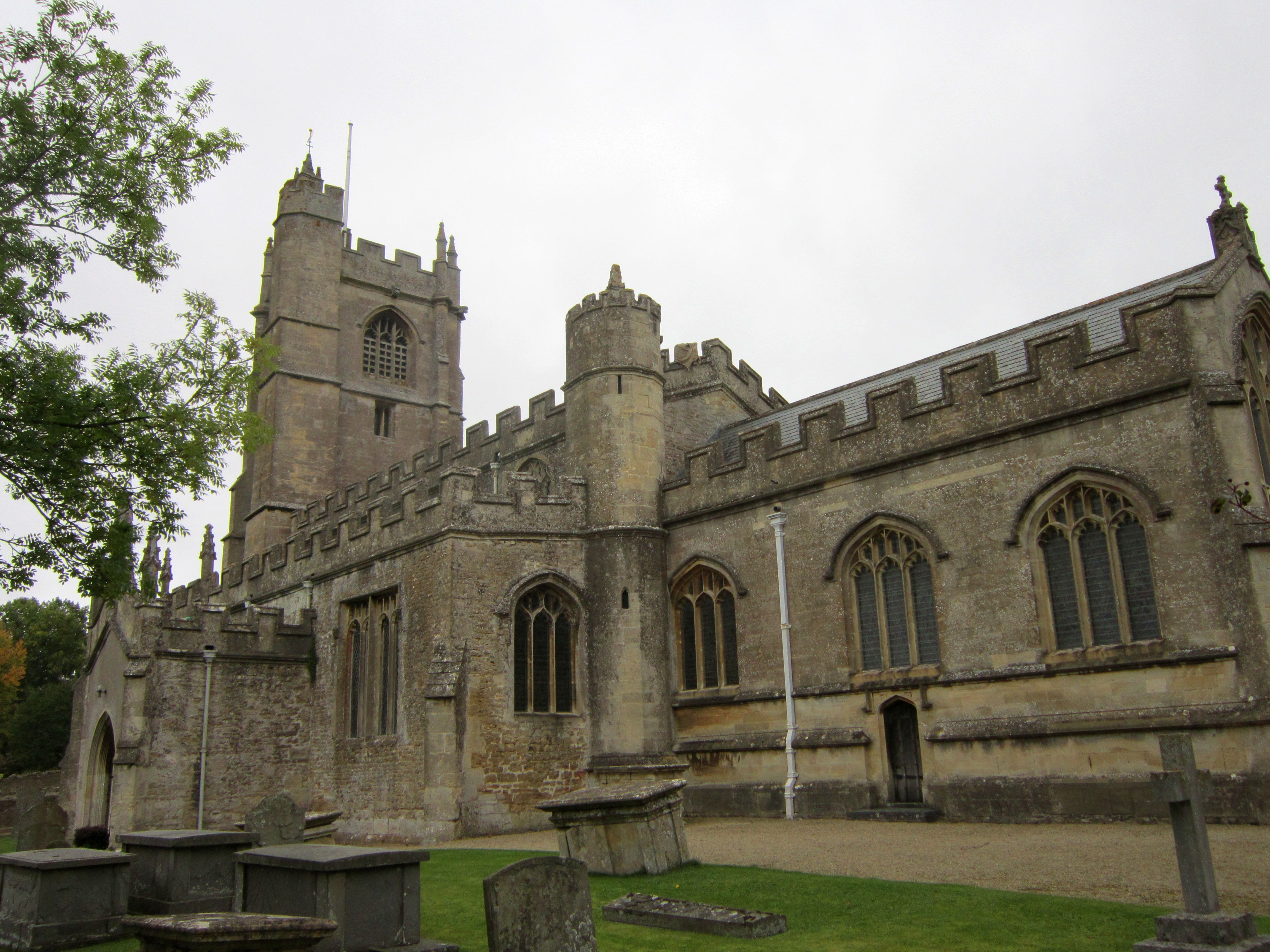
Church of St Julian, Wellow

The Church of St Julian in Wellow, Somerset, England has origins before the 12th century although the present building dates from 1372. It has been designated...

Wellow, Somerset

Wellow is a village and civil parish in Somerset, England, about 5 miles (8.0 km) south of Bath. The parish, which includes the hamlets of Twinhoe, White...

Hinton House, Hinton Charterhouse

Hinton House in Hinton Charterhouse, Somerset, England was built around 1700. It is a Grade II* listed building. == History == The house was built around...

Have you been to Cleaves Wood?

Leave your review of Cleaves Wood below (or comments, questions and feedback).