Sanctuary Moor

Wood, Forest in Cheshire

England

Sanctuary Moor

Gaskell Memorial Tower, Knutsford, Cheshire A view of the Memorial Tower on King Street, in remembrance of Elizabeth Gaskell an outstanding Victorian novelist.  She lived in Knutsford with her aunt and was later married to William Gaskell at Knutsford Parish Church.  The titles of her novels are listed on the side of the tower.
Gaskell Memorial Tower, Knutsford, Cheshire Credit: Marion Dutcher

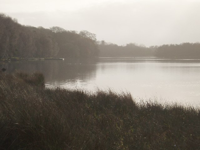
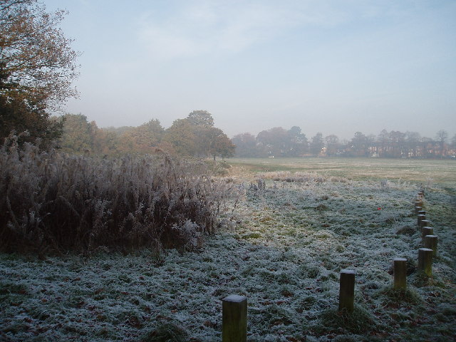
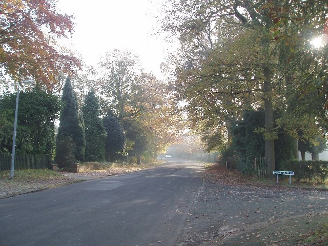
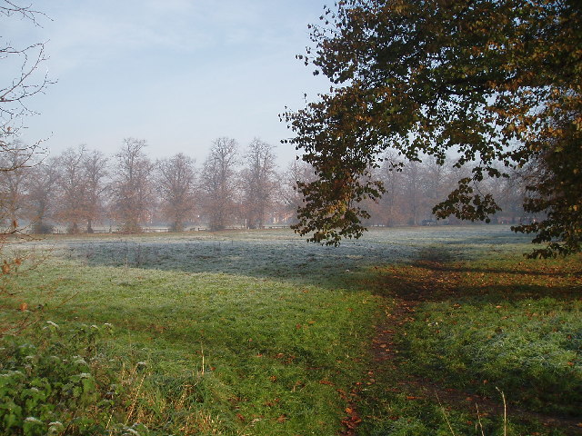
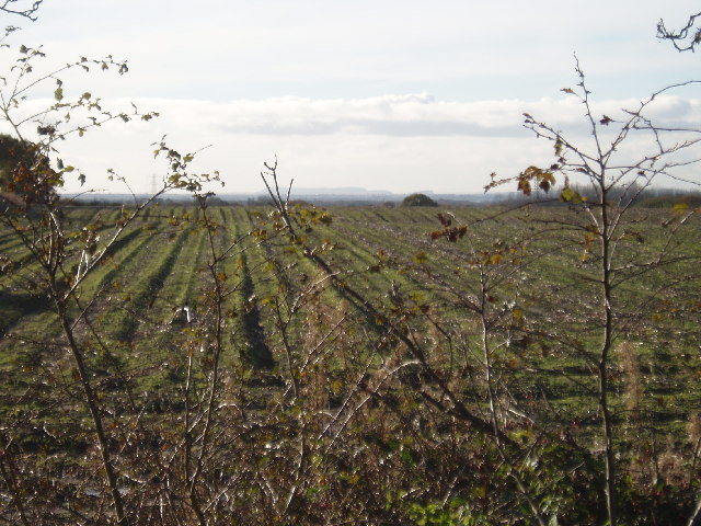
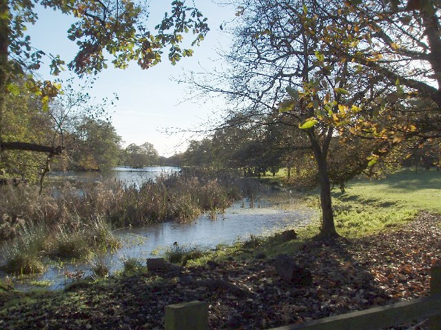
Sanctuary Moor, located in Cheshire, England, is a picturesque wood or forest area that offers a peaceful retreat for nature enthusiasts and outdoor adventurers alike. Spanning over an expansive area, the moor is characterized by its diverse range of flora and fauna, making it an important natural habitat and a popular destination for wildlife enthusiasts.

The woodlands of Sanctuary Moor are predominantly composed of deciduous trees, including oak, beech, and birch, which create a stunning display of colors during the autumn months. The forest floor is blanketed with an array of wildflowers, such as bluebells and primroses, adding to the area's natural beauty. Walking along the well-maintained trails, visitors can admire the ancient trees, listen to the melodic songs of birds, and occasionally spot elusive wildlife like deer, foxes, and rabbits.

The moor also features a network of streams and ponds, which provide a vital water source for the local wildlife. These water bodies are home to a variety of aquatic species, including frogs, newts, and dragonflies, adding to the biodiversity of the area.

Sanctuary Moor offers visitors a chance to connect with nature and escape the hustle and bustle of urban life. The serene ambiance and tranquil surroundings make it an ideal spot for activities such as hiking, birdwatching, and photography. With its rich natural heritage and stunning landscapes, Sanctuary Moor is a true gem for nature lovers and a must-visit destination for anyone seeking solace in the beauty of the great outdoors.

If you have any feedback on the listing, please let us know in the comments section below.

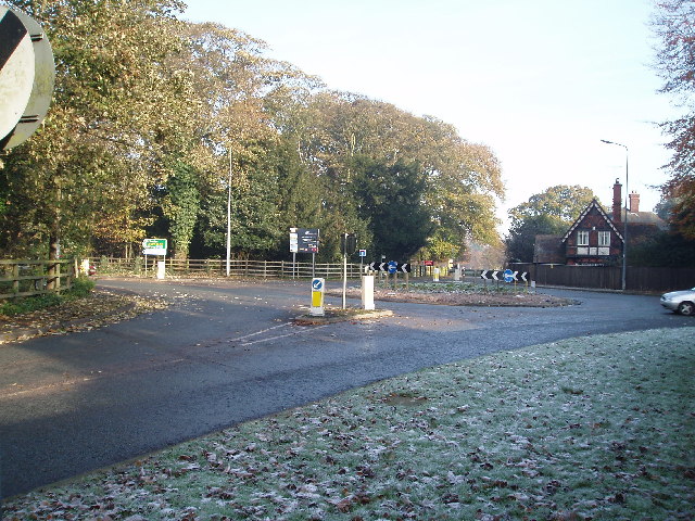
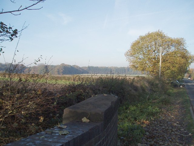
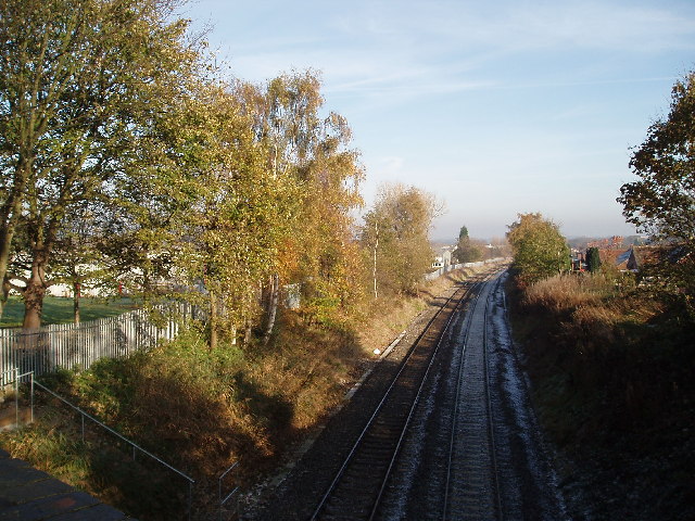
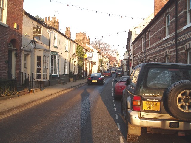
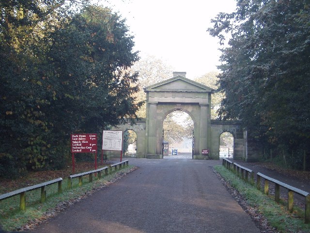
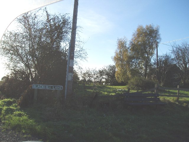
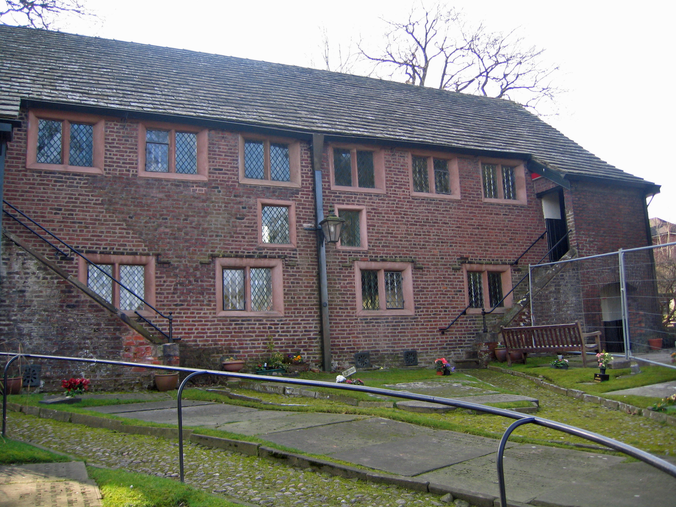
Sanctuary Moor Images

Images are sourced within 2km of 53.297848/-2.3671802 or Grid Reference SJ7577. Thanks to Geograph Open Source API. All images are credited.

Gaskell Memorial Tower, Knutsford, Cheshire A view of the Memorial Tower on King Street, in remembrance of Elizabeth Gaskell an outstanding Victorian novelist.  She lived in Knutsford with her aunt and was later married to William Gaskell at Knutsford Parish Church.  The titles of her novels are listed on the side of the tower.
Gaskell Memorial Tower, Knutsford, Cheshire
A view of the Memorial Tower on King Street, in remembrance of Elizabeth Gaskell an outstanding Victorian novelist. She lived in Knutsford with her aunt and was later married to William Gaskell at Knutsford Parish Church. The titles of her novels are listed on the side of the tower.
Tatton Mere (Tatton Park) Looking south, Crosstown Church visible above trees
Tatton Mere (Tatton Park)
Looking south, Crosstown Church visible above trees
Egerton Youth Club Situated opposite Knutsford Golf Club on Mereheath Lane, the youth club benefits from spacious playing fields.
Egerton Youth Club
Situated opposite Knutsford Golf Club on Mereheath Lane, the youth club benefits from spacious playing fields.
Knutsford Heath Normally referred to as "The Heath". Bordered by Manchester road, Northwich road, Ladies Mile & Tabley road. Popular for walking dogs. Used for Knutsford's Royal May Day event and the fair.
Photo taken from Northwich road (near junction with Stanley Road).
Knutsford Heath
Normally referred to as "The Heath". Bordered by Manchester road, Northwich road, Ladies Mile & Tabley road. Popular for walking dogs. Used for Knutsford's Royal May Day event and the fair. Photo taken from Northwich road (near junction with Stanley Road).
Elizabeth Gaskells House This famous house, on Gaskell avenue looks out across the "Little Heath" and also the larger Heath
Elizabeth Gaskells House
This famous house, on Gaskell avenue looks out across the "Little Heath" and also the larger Heath
Legh Road (Lovat drive on right) Looking towards south west towards Goughs lane
Legh Road (Lovat drive on right)
Looking towards south west towards Goughs lane
Booths Hall Roundabout Taken from Goughs lane where it joins the A537.The house on right is one of the lodges to Booths Hall
Booths Hall Roundabout
Taken from Goughs lane where it joins the A537.The house on right is one of the lodges to Booths Hall
Booths Mere In the Grounds of Booths Hall
Booths Mere
In the Grounds of Booths Hall
View from Parkgate Lane Railway Bridge Looking west towards Dog Wood (Tatton Park). Parkgate lane is the only access road to Knutsford Industrial Estate
View from Parkgate Lane Railway Bridge
Looking west towards Dog Wood (Tatton Park). Parkgate lane is the only access road to Knutsford Industrial Estate
View NE from Parkgate Lane Railway Bridge Knutsford Industrial Estate on left
View NE from Parkgate Lane Railway Bridge
Knutsford Industrial Estate on left
King Street Knutsford Photo taken just beyond the railway bridge
King Street Knutsford
Photo taken just beyond the railway bridge
Knutsford Entrance to Tatton Park This entrance to Tatton Park is close to the junction of Garden road & Mereheath lane
Knutsford Entrance to Tatton Park
This entrance to Tatton Park is close to the junction of Garden road & Mereheath lane
Little Heath Knutsford Photo taken from junction of Gaskell avenue and Stanley road looking across to 'The Heath' The row of trees (Middle distance) line Northwich road
Little Heath Knutsford
Photo taken from junction of Gaskell avenue and Stanley road looking across to 'The Heath' The row of trees (Middle distance) line Northwich road
Black Hill Lane Blackhill Farm just visible to right
Black Hill Lane
Blackhill Farm just visible to right
View across farmland Taken close to Blackhill Lane railway bridge, looking SW, hills on the horizon are the Peckforton Hills and the "mound" to the right Beeston Castle.
View across farmland
Taken close to Blackhill Lane railway bridge, looking SW, hills on the horizon are the Peckforton Hills and the "mound" to the right Beeston Castle.
Toft Hall Mere looking south Taken from the drive to Toft Hall (just off Holmes Chapel Road, A50).
Toft Hall Mere looking south
Taken from the drive to Toft Hall (just off Holmes Chapel Road, A50).
Church of St John the Evangelist Founded in 1855 as the parish church for Toft and parts of Bexton and Knutsford Inferior
Church of St John the Evangelist
Founded in 1855 as the parish church for Toft and parts of Bexton and Knutsford Inferior
Windmill Wood Taken from the footpath between Goughs lane and Seven Sisters Lane looking N
Windmill Wood
Taken from the footpath between Goughs lane and Seven Sisters Lane looking N
Show me another place!

Sanctuary Moor is located at Grid Ref: SJ7577 (Lat: 53.297848, Lng: -2.3671802)

Unitary Authority: Cheshire East

Police Authority: Cheshire

What 3 Words

///sweeter.fancy.swoop. Near Knutsford, Cheshire

Related Wikis

River Lily

River Lily is a small stream that flows through Knutsford, England. It has been claimed that it is the smallest river in Europe. It enters Tatton Mere...

Brook Street Chapel, Knutsford

Brook Street Chapel, is in the town of Knutsford, Cheshire, England. It is recorded in the National Heritage List for England as a designated Grade I...

Knutsford railway station

Knutsford railway station serves the town of Knutsford in Cheshire, England. The station is 21+3⁄4 miles (35.0 km) south of Manchester Piccadilly on the...

Knutsford

Knutsford () is a market town in Cheshire, England; it is located 14 miles (23 km) south-west of Manchester, 9 miles (14 km) north-west of Macclesfield...

Nearby Amenities

Located within 500m of 53.297848,-2.3671802
Traffic Signals
Lat/Long: 53.3014212/-2.3680021
Pub
Builders Arms
Addr City: Knutsford
Addr Postcode: WA16 8EQ
Addr Street: Mobberley Road
Brand: Marston's
Brand Wikidata: Q6773982
Fhrs Id: 1076240
Source Addr: FHRS Open Data
Website: https://www.buildersarmsknutsford.co.uk/
Lat/Long: 53.3021086/-2.3659049
Turning Circle
Lat/Long: 53.3000962/-2.3620319
Turning Circle
Lat/Long: 53.2986153/-2.3609968
Turning Circle
Lat/Long: 53.2994426/-2.3611223
Post Box
Operator: Royal Mail
Operator Wikidata: Q638098
Post Box Type: wall
Ref: WA16 28
Lat/Long: 53.299672/-2.3715915
Post Box
Brand: Royal Mail
Brand Wikidata: Q638098
Mapillary: 505926377422557
Operator: Royal Mail
Operator Wikidata: Q638098
Post Box Mounting: pier
Post Box Type: lamp
Ref: WA16 1
Royal Cypher: EIIR
Survey Date: 2020-03-27
Lat/Long: 53.2974647/-2.3608726
Post Box
Operator: Royal Mail
Operator Wikidata: Q638098
Post Box Type: wall
Ref: WA16 18
Royal Cypher: GR
Royal Cypher Wikidata: Q33102273
Lat/Long: 53.3003135/-2.3653281
Pub
Legh Arms
Addr City: Knutsford
Addr Postcode: WA16 8EB
Addr Street: Brook Street
Fhrs Id: 891752
Source Addr: FHRS Open Data
Lat/Long: 53.3000562/-2.3655229
Post Box
Operator: Royal Mail
Operator Wikidata: Q638098
Post Box Type: lamp
Ref: WA16 26
Royal Cypher: EIIR
Lat/Long: 53.2952433/-2.3647699
Booth: K6
Covered: booth
Description: seed exchange and library
Disused Amenity: telephone
Man Made: telephone_box
Operator: Knutsford Town Council
Lat/Long: 53.3002416/-2.3652979
Bus Stop
Knutsford, Toft Road / Grove Park
Bus: yes
Naptan AtcoCode: 0600MA0174
Naptan Bearing: S
Naptan CommonName: Grove Park
Naptan Crossing: Grove Park
Naptan Indicator: nr
Naptan Landmark: Chellaston House
Naptan LocalityName: Knutsford
Naptan NaptanCode: chemjdp
Naptan ShortCommonName: Grove Park
Naptan Street: Toft Road
Naptan Verified: no
Network: Cheshire East Council
Operator: Ansa Transport
Public Transport: platform
Source: naptan_import
Lat/Long: 53.3003216/-2.3721581
Bus Stop
Knutsford, Toft Road / Grove Park
Bus: yes
Naptan AtcoCode: 0600MA0175
Naptan Bearing: N
Naptan BusStopType: CUS
Naptan CommonName: Grove Park
Naptan Crossing: Grove Park
Naptan Indicator: opp
Naptan Landmark: Chellaston House
Naptan LocalityName: Knutsford
Naptan NaptanCode: chemjdt
Naptan ShortCommonName: Grove Park
Naptan Street: Toft Road
Naptan Verified: no
Network: Cheshire East Council
Operator: Ansa Transport
Public Transport: platform
Source: naptan_import
Lat/Long: 53.3001682/-2.3723218
Bus Stop
Knutsford, Chelford Road / Carrwood
Bus: yes
Naptan AtcoCode: 0600MA0180
Naptan Bearing: NW
Naptan CommonName: Carrwood
Naptan Crossing: Carrwood
Naptan Indicator: opp
Naptan Landmark: Southside
Naptan LocalityName: Knutsford
Naptan NaptanCode: chemjgd
Naptan ShortCommonName: Carrwood
Naptan Street: Chelford Road
Naptan Verified: no
Network: Cheshire East Council
Operator: Ansa Transport
Public Transport: platform
Source: naptan_import
Lat/Long: 53.2978637/-2.3617237
Bus Stop
Knutsford, Chelford Road / Carrwood
Bus: yes
Naptan AtcoCode: 0600MA0181
Naptan Bearing: SE
Naptan BusStopType: CUS
Naptan CommonName: Carrwood
Naptan Crossing: Carrwood
Naptan Indicator: cnr
Naptan Landmark: Southside
Naptan LocalityName: Knutsford
Naptan NaptanCode: chemjgj
Naptan ShortCommonName: Carrwood
Naptan Street: Chelford Road
Naptan Verified: no
Network: Cheshire East Council
Operator: Ansa Transport
Public Transport: platform
Source: naptan_import
Lat/Long: 53.2979542/-2.3615144
Bus Stop
Knutsford, Brook Street / Legh Arms PH
Bus: yes
Naptan AtcoCode: 0600MA0183
Naptan Bearing: SE
Naptan BusStopType: CUS
Naptan CommonName: Legh Arms PH
Naptan Crossing: Legh Road
Naptan Indicator: nr
Naptan Landmark: Legh Arms PH
Naptan LocalityName: Knutsford
Naptan NaptanCode: chemjgp
Naptan ShortCommonName: Legh Arms PH
Naptan Street: Brook Street
Naptan Verified: no
Network: Cheshire East Council
Operator: Ansa Transport
Public Transport: platform
Source: naptan_import
Lat/Long: 53.3000855/-2.365103
Bus Stop
Knutsford, Brook Street / Legh Arms PH
Bus: yes
Naptan AtcoCode: 0600MA0184
Naptan Bearing: NW
Naptan BusStopType: CUS
Naptan CommonName: Legh Arms PH
Naptan Crossing: Legh Road
Naptan Indicator: o/s
Naptan Landmark: Legh Arms PH
Naptan LocalityName: Knutsford
Naptan NaptanCode: chemjgt
Naptan ShortCommonName: Legh Arms PH
Naptan Street: Brook Street
Naptan Verified: no
Network: Cheshire East Council
Operator: Ansa Transport
Public Transport: platform
Source: naptan_import
Lat/Long: 53.3000817/-2.3654187
Bus Stop
Knutsford, Adams Hill / Railway Station
Alt Name: Knutsford Railway Station
Bus: yes
Naptan AltCommonName: Knutsford Railway Station
Naptan AltCommonName2: Knutsford Train Station
Naptan AtcoCode: 0600MA19064
Naptan Bearing: SW
Naptan CommonName: Railway Station
Naptan Indicator: opp
Naptan Landmark: Station
Naptan LocalityName: Knutsford
Naptan NaptanCode: chewjgt
Naptan ShortCommonName: Knutsford Station
Naptan Street: Adams Hill
Naptan Verified: no
Network: Cheshire East Council
Operator: Ansa Transport
Public Transport: platform
Source: naptan_import
Lat/Long: 53.3017098/-2.3708947
Addr Housenumber: 21
Addr Street: Bracken Way
Lat/Long: 53.2941446/-2.3710114
Addr Housenumber: 1
Addr Street: Bracken Way
Lat/Long: 53.2938034/-2.3696867
Addr Housenumber: 1
Addr Street: Comber Way
Lat/Long: 53.2940899/-2.3698913
Addr Housenumber: 14
Addr Street: Comber Way
Lat/Long: 53.2944987/-2.3694766
Addr Housenumber: 6
Addr Street: Comber Way
Lat/Long: 53.2939998/-2.369202
Addr Housenumber: 12
Addr Street: Comber Way
Lat/Long: 53.294254/-2.369342
Addr Housenumber: 2
Addr Street: Seymour Chase
Lat/Long: 53.294283/-2.3690297
Addr Housenumber: 37
Addr Street: Summers Way
Lat/Long: 53.2936914/-2.3689127
Addr Housenumber: 8
Addr Street: Seymour Chase
Lat/Long: 53.2945437/-2.3684804
Addr Housenumber: 10
Addr Street: Seymour Chase
Lat/Long: 53.294658/-2.3683062
Addr Housenumber: 15
Addr Street: Rowley Way
Lat/Long: 53.293539/-2.3672177
Addr Housenumber: 17
Addr Street: Comber Way
Lat/Long: 53.2948012/-2.3701875
Addr Housenumber: 19
Addr Street: Comber Way
Lat/Long: 53.2949525/-2.3701444
Addr Housenumber: 24
Addr Street: Comber Way
Lat/Long: 53.2949911/-2.3698428
Addr Housenumber: 22
Addr Street: Comber Way
Lat/Long: 53.2948817/-2.3696382
Addr Housenumber: 12
Addr Street: Seymour Chase
Lat/Long: 53.2947713/-2.3683958
Addr Housenumber: 5
Addr Street: Grassfield Way
Lat/Long: 53.294433/-2.3719668
Addr Housenumber: 7
Addr Street: Grassfield Way
Lat/Long: 53.2945254/-2.3718189
Power: substation
Lat/Long: 53.294552/-2.371703
Addr Housenumber: 25
Addr Street: Grassfield Way
Lat/Long: 53.2954243/-2.3717958
Addr Housenumber: 27
Addr Street: Grassfield Way
Lat/Long: 53.2954694/-2.3720897
Addr Housenumber: 29
Addr Street: Grassfield Way
Lat/Long: 53.2955096/-2.3723669
Addr Housenumber: 9
Addr Street: Grassfield Way
Lat/Long: 53.2946793/-2.3715012
Addr Housenumber: 44
Addr Street: Grassfield Way
Lat/Long: 53.2958911/-2.3708888
Addr Housenumber: 46
Addr Street: Grassfield Way
Lat/Long: 53.2959463/-2.3711743
Addr Housenumber: 23
Addr Street: Grassfield Way
Lat/Long: 53.2953755/-2.3713715
Addr Housenumber: 42
Addr Street: Grassfield Way
Lat/Long: 53.2957455/-2.370872
Addr Housenumber: 125
Addr Street: Ashworth Park
Lat/Long: 53.2967722/-2.3744645
Addr Housenumber: 115
Addr Street: Ashworth Park
Lat/Long: 53.2962374/-2.373596
Addr Housenumber: 113
Addr Street: Ashworth Park
Lat/Long: 53.2962269/-2.3733766
Addr Housenumber: 111
Addr Street: Ashworth Park
Lat/Long: 53.296531/-2.3733152
Addr Housenumber: 117
Addr Street: Ashworth Park
Lat/Long: 53.2964367/-2.3738065
Addr Housenumber: 85
Addr Street: Ashworth Park
Lat/Long: 53.2978969/-2.3743087
Addr Housenumber: 184
Addr Street: Grove Park
Lat/Long: 53.2987577/-2.3707875
Addr Housenumber: 59
Addr Street: Grove Park
Lat/Long: 53.2991263/-2.3703546
Addr Housenumber: 61
Addr Street: Grove Park
Lat/Long: 53.2991027/-2.3705345
Addr Housenumber: 63
Addr Street: Grove Park
Lat/Long: 53.2992914/-2.3705871
Addr Housenumber: 65
Addr Street: Grove Park
Lat/Long: 53.2994067/-2.3705783
Addr Housenumber: 200
Addr Street: Grove Park
Lat/Long: 53.2996553/-2.3712226
Addr Housenumber: 69
Addr Street: Grove Park
Lat/Long: 53.2997737/-2.3705959
Addr Housenumber: 67
Addr Street: Grove Park
Lat/Long: 53.2995273/-2.3705959
Addr Housenumber: 1
Addr Street: Grove Park
Lat/Long: 53.3001145/-2.370745
Addr Housenumber: 55
Addr Street: Grove Park
Lat/Long: 53.299218/-2.3697888
Addr Housenumber: 57
Addr Street: Grove Park
Lat/Long: 53.2991498/-2.3701748
Addr Housenumber: 170
Addr Street: Grove Park
Lat/Long: 53.2989297/-2.3695102
Addr Housenumber: 142
Addr Street: Grove Park
Lat/Long: 53.2992702/-2.3691294
Addr Housenumber: 140
Addr Street: Grove Park
Lat/Long: 53.2992694/-2.3693137
Addr Housenumber: 138
Addr Street: Grove Park
Lat/Long: 53.299475/-2.3693979
Addr Housenumber: 136
Addr Street: Grove Park
Lat/Long: 53.2995261/-2.3692347
Addr Housenumber: 114
Addr Street: Grove Park
Lat/Long: 53.2997861/-2.369354
Addr Housenumber: 108
Addr Street: Grove Park
Lat/Long: 53.3000168/-2.3694803
Addr Housenumber: 43
Addr Street: Grove Park
Lat/Long: 53.2998681/-2.3701046
Addr Housenumber: 112
Addr Street: Grove Park
Lat/Long: 53.2997769/-2.3695593
Addr Housenumber: 110
Addr Street: Grove Park
Lat/Long: 53.2999615/-2.3696365
Addr Housenumber: 156
Addr Street: Grove Park
Lat/Long: 53.2991059/-2.3683381
Addr Housenumber: 150
Addr Street: Grove Park
Lat/Long: 53.2993835/-2.3684557
Addr Housenumber: 152
Addr Street: Grove Park
Lat/Long: 53.2993365/-2.368296
Addr Housenumber: 154
Addr Street: Grove Park
Lat/Long: 53.2992191/-2.368268
Addr Housenumber: 126
Addr Street: Grove Park
Lat/Long: 53.2997442/-2.3684767
Addr Housenumber: 128
Addr Street: Grove Park
Lat/Long: 53.2996267/-2.368575
Addr Housenumber: 124
Addr Street: Grove Park
Lat/Long: 53.2998448/-2.3685329
Addr Housenumber: 122
Addr Street: Grove Park
Lat/Long: 53.2998868/-2.3687154
Addr Housenumber: 102
Addr Street: Grove Park
Lat/Long: 53.3001133/-2.3688978
Addr Housenumber: 13
Addr Street: Grove Park
Lat/Long: 53.3007989/-2.3714661
Addr Housenumber: 3
Addr Street: Grove Park
Lat/Long: 53.3002537/-2.3709222
Addr Housenumber: 25
Addr Street: Grove Park
Lat/Long: 53.3010582/-2.3706573
Addr Housenumber: 15
Addr Street: Grove Park
Lat/Long: 53.3009376/-2.3715258
Addr Housenumber: 23
Addr Street: Grove Park
Lat/Long: 53.3010844/-2.3708766
Addr Housenumber: 76
Addr Street: Grove Park
Lat/Long: 53.3008556/-2.3691926
Addr Housenumber: 68
Addr Street: Grove Park
Lat/Long: 53.3008389/-2.3698523
Addr Housenumber: 98
Addr Street: Grove Park
Lat/Long: 53.3003733/-2.3690873
Addr Housenumber: 92
Addr Street: Grove Park
Lat/Long: 53.3002936/-2.3695997
Addr Housenumber: 86
Addr Street: Grove Park
Lat/Long: 53.300562/-2.369733
Addr Housenumber: 80
Addr Street: Grove Park
Lat/Long: 53.3006459/-2.3692347
Addr Housenumber: 41
Addr Street: Grove Park
Lat/Long: 53.3002037/-2.3702713
Addr Housenumber: 90
Addr Street: Grove Park
Lat/Long: 53.300297/-2.369812
Addr Housenumber: 66
Addr Street: Grove Park
Lat/Long: 53.3008255/-2.3700576
Addr Housenumber: 88
Addr Street: Grove Park
Lat/Long: 53.3005151/-2.3698962
Addr Housenumber: 74
Addr Street: Grove Park
Lat/Long: 53.300906/-2.3693961
Addr Housenumber: 56
Addr Street: Grove Park
Lat/Long: 53.3011534/-2.3694944
Addr Housenumber: 62
Addr Street: Grove Park
Lat/Long: 53.3010737/-2.3699786
Addr Housenumber: 52
Addr Street: Grove Park
Lat/Long: 53.3013463/-2.3695154
Addr Housenumber: 54
Addr Street: Grove Park
Lat/Long: 53.301275/-2.3694803
Addr Housenumber: 42
Lat/Long: 53.3013212/-2.3702874
Addr Housenumber: 50
Addr Street: Grove Park
Lat/Long: 53.3014218/-2.3696277
Addr Housenumber: 64
Addr Street: Grove Park
Lat/Long: 53.301031/-2.3701418
Addr Housenumber: 100
Addr Street: Grove Park
Lat/Long: 53.3002391/-2.3688627
Power: tower
Lat/Long: 53.2976851/-2.3740885
Addr Housenumber: 168
Lat/Long: 53.2989601/-2.3693678
Addr Housenumber: 58
Addr Street: Glebelands Road
Lat/Long: 53.2983674/-2.3737974
Addr Housenumber: 29
Addr Street: Glebelands Road
Lat/Long: 53.2986505/-2.374315
Addr Housenumber: 84
Addr Street: Glebelands Road
Lat/Long: 53.2987921/-2.3737185
Addr Housenumber: 82
Lat/Long: 53.298682/-2.3734027
Addr Housenumber: 60
Addr Street: Glebelands Road
Lat/Long: 53.2983989/-2.3735167
Addr Housenumber: 31
Addr Street: Glebelands Road
Lat/Long: 53.2988917/-2.3744554
Addr Housenumber: 10
Addr Street: Trevone Close
Lat/Long: 53.298963/-2.3733189
Addr Housenumber: 8
Addr Street: Trevone Close
Lat/Long: 53.2992042/-2.373547
Addr Housenumber: 9
Addr Street: Glebelands Road
Lat/Long: 53.2998249/-2.3736803
Addr Housenumber: 5
Addr Street: Glebelands Road
Lat/Long: 53.2999717/-2.373182
Addr Housenumber: 5
Addr Street: Trevone Close
Lat/Long: 53.2995083/-2.373082
Addr Housenumber: 3
Addr Street: Trevone Close
Lat/Long: 53.2996026/-2.3735294
Addr Housenumber: 2
Addr Street: Trevone Close
Lat/Long: 53.2996341/-2.3740032
Addr Housenumber: 74
Addr Street: Glebelands Road
Lat/Long: 53.2986558/-2.3722096
Addr Housenumber: 68
Lat/Long: 53.2981577/-2.3722885
Addr Housenumber: 76
Lat/Long: 53.2986138/-2.3727009
Addr Housenumber: 66
Addr Street: Glebelands Road
Lat/Long: 53.2983045/-2.3727447
Addr Housenumber: 7
Addr Street: Trevone Close
Lat/Long: 53.2993248/-2.3729943
Addr Housenumber: 11
Addr Street: Trevone Close
Lat/Long: 53.2990102/-2.3730382
Addr Housenumber: 9
Addr Street: Trevone Close
Lat/Long: 53.2990207/-2.3727487
Camera Direction: 40
Camera Mount: traffic_signals
Camera Type: fixed
Man Made: surveillance
Surveillance: outdoor
Surveillance Type: camera
Lat/Long: 53.3014434/-2.3679629
Camera Direction: 150
Camera Mount: traffic_signals
Camera Type: fixed
Man Made: surveillance
Surveillance: outdoor
Surveillance Type: camera
Lat/Long: 53.3014413/-2.3679632
Camera Direction: 280
Camera Mount: traffic_signals
Camera Type: fixed
Man Made: surveillance
Surveillance: outdoor
Surveillance Type: camera
Lat/Long: 53.301443/-2.367967
Bus Stop
Knutsford, Brook Street / Aldi
Alt Name: Knutsford Old Library
Bus: yes
Naptan AltCommonName: Knutsford Old Library
Naptan AtcoCode: 0600MA0179
Naptan Bearing: NW
Naptan CommonName: Aldi
Naptan Crossing: Holford Crescent
Naptan Indicator: opp
Naptan Landmark: Aldi
Naptan LocalityName: Knutsford
Naptan NaptanCode: chemjga
Naptan ShortCommonName: Knutsford Aldi
Naptan Street: Brook Street
Network: Cheshire East Council
Operator: Ansa Transport
Public Transport: platform
Source: naptan_import
Lat/Long: 53.301744/-2.369284
Asda Express
Addr City: Knutsford
Addr Country: GB
Addr Housename: Knutsford Service Station
Addr Postcode: WA16 8QJ
Addr Street: Toft Road
Branch: Knutsford
Brand: Asda Express
Brand Wikidata: Q114826023
Fhrs Id: 891712
Shop: convenience
Website: https://storelocator.asda.com/north-west/knutsford/toft-road
Lat/Long: 53.2933865/-2.3664192
Fuel
Lat/Long: 53.2935332/-2.3664983
The data included in this document is from www.openstreetmap.org. The data is made available under ODbL.

Have you been to Sanctuary Moor?

Leave your review of Sanctuary Moor below (or comments, questions and feedback).