Sandfield Wood

Wood, Forest in Cheshire

England

Sandfield Wood

Gaskell Memorial Tower, Knutsford, Cheshire A view of the Memorial Tower on King Street, in remembrance of Elizabeth Gaskell an outstanding Victorian novelist.  She lived in Knutsford with her aunt and was later married to William Gaskell at Knutsford Parish Church.  The titles of her novels are listed on the side of the tower.
Gaskell Memorial Tower, Knutsford, Cheshire Credit: Marion Dutcher

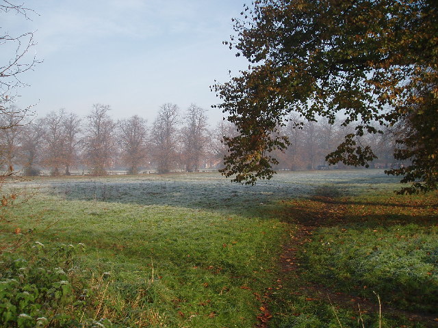
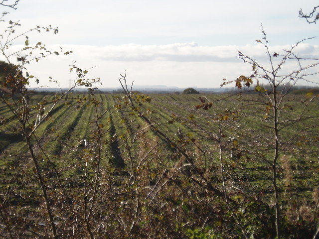
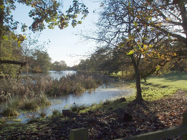
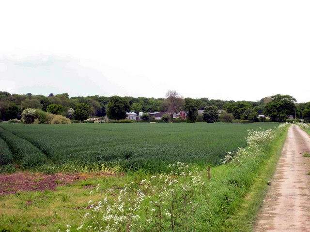
Sandfield Wood is a picturesque woodland located in the county of Cheshire, England. Stretching over an area of approximately 50 acres, this enchanting forest is nestled in the rural countryside, offering a serene and tranquil escape from the bustling city life.

The wood boasts a diverse range of flora and fauna, making it an ideal location for nature enthusiasts and wildlife lovers. Walking through the wood, visitors can admire the majestic oak, beech, and birch trees that dominate the landscape, providing a lush canopy and shelter for a variety of bird species. Bluebells, daffodils, and other wildflowers add vibrant splashes of color to the forest floor during the spring months.

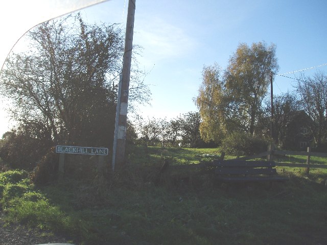
A network of well-maintained footpaths allows visitors to explore the wood at their own pace, while also providing access to several hidden gems within the forest. One of the highlights is a small pond, teeming with aquatic life and surrounded by reeds and ferns, creating a tranquil oasis within the woodland.

Sandfield Wood is also home to a rich variety of wildlife, including rabbits, squirrels, and foxes. Keen-eyed visitors may even catch a glimpse of the elusive deer that roam freely in the area.

For those seeking a peaceful retreat or a place to reconnect with nature, Sandfield Wood offers a haven of tranquility. Whether it's a leisurely stroll, birdwatching, or simply enjoying the fresh air, this woodland gem provides a delightful escape into nature's embrace.

If you have any feedback on the listing, please let us know in the comments section below.

Sandfield Wood Images

Images are sourced within 2km of 53.289571/-2.3697493 or Grid Reference SJ7577. Thanks to Geograph Open Source API. All images are credited.

Gaskell Memorial Tower, Knutsford, Cheshire A view of the Memorial Tower on King Street, in remembrance of Elizabeth Gaskell an outstanding Victorian novelist.  She lived in Knutsford with her aunt and was later married to William Gaskell at Knutsford Parish Church.  The titles of her novels are listed on the side of the tower.
Gaskell Memorial Tower, Knutsford, Cheshire
A view of the Memorial Tower on King Street, in remembrance of Elizabeth Gaskell an outstanding Victorian novelist. She lived in Knutsford with her aunt and was later married to William Gaskell at Knutsford Parish Church. The titles of her novels are listed on the side of the tower.
Elizabeth Gaskells House This famous house, on Gaskell avenue looks out across the "Little Heath" and also the larger Heath
Elizabeth Gaskells House
This famous house, on Gaskell avenue looks out across the "Little Heath" and also the larger Heath
Legh Road (Lovat drive on right) Looking towards south west towards Goughs lane
Legh Road (Lovat drive on right)
Looking towards south west towards Goughs lane
Booths Hall Roundabout Taken from Goughs lane where it joins the A537.The house on right is one of the lodges to Booths Hall
Booths Hall Roundabout
Taken from Goughs lane where it joins the A537.The house on right is one of the lodges to Booths Hall
King Street Knutsford Photo taken just beyond the railway bridge
King Street Knutsford
Photo taken just beyond the railway bridge
Little Heath Knutsford Photo taken from junction of Gaskell avenue and Stanley road looking across to 'The Heath' The row of trees (Middle distance) line Northwich road
Little Heath Knutsford
Photo taken from junction of Gaskell avenue and Stanley road looking across to 'The Heath' The row of trees (Middle distance) line Northwich road
Black Hill Lane Blackhill Farm just visible to right
Black Hill Lane
Blackhill Farm just visible to right
View across farmland Taken close to Blackhill Lane railway bridge, looking SW, hills on the horizon are the Peckforton Hills and the "mound" to the right Beeston Castle.
View across farmland
Taken close to Blackhill Lane railway bridge, looking SW, hills on the horizon are the Peckforton Hills and the "mound" to the right Beeston Castle.
Toft Hall Mere looking south Taken from the drive to Toft Hall (just off Holmes Chapel Road, A50).
Toft Hall Mere looking south
Taken from the drive to Toft Hall (just off Holmes Chapel Road, A50).
Church of St John the Evangelist Founded in 1855 as the parish church for Toft and parts of Bexton and Knutsford Inferior
Church of St John the Evangelist
Founded in 1855 as the parish church for Toft and parts of Bexton and Knutsford Inferior
Windmill Wood Taken from the footpath between Goughs lane and Seven Sisters Lane looking N
Windmill Wood
Taken from the footpath between Goughs lane and Seven Sisters Lane looking N
Kerfield House On the A537 SW of Knutsford. A difficult one to pin point on the map,(is it top right of SJ7676 or top left of 7776 ??)
Kerfield House
On the A537 SW of Knutsford. A difficult one to pin point on the map,(is it top right of SJ7676 or top left of 7776 ??)
Moss Wood, Seven Sisters Lane (Looking S) The end of the Goughs lane to Seven Sisters lane footpath is about 50m from this stile.
Moss Wood, Seven Sisters Lane (Looking S)
The end of the Goughs lane to Seven Sisters lane footpath is about 50m from this stile.
Ollerton Grange About 1/2km west of Dun Cow Inn on A537
Ollerton Grange
About 1/2km west of Dun Cow Inn on A537
Booths Hall
Booths Hall
Row of Cottages in Knutsford Taken near the entrance to Tatton Park
Row of Cottages in Knutsford
Taken near the entrance to Tatton Park
Hollyhedge Farm, Middlewich Road, Knutsford
Ash Farm, near Knutsford Looking SE down the bridleway-cum-farm track. Photo taken from near the junction with Seven Sisters Lane.
Ash Farm, near Knutsford
Looking SE down the bridleway-cum-farm track. Photo taken from near the junction with Seven Sisters Lane.
Show me another place!

Sandfield Wood is located at Grid Ref: SJ7577 (Lat: 53.289571, Lng: -2.3697493)

Unitary Authority: Cheshire East

Police Authority: Cheshire

What 3 Words

///junior.explained.storeroom. Near Knutsford, Cheshire

Related Wikis

Toft, Cheshire

Toft is a village and civil parish in the unitary authority of Cheshire East and the ceremonial county of Cheshire, England. It is located immediately...

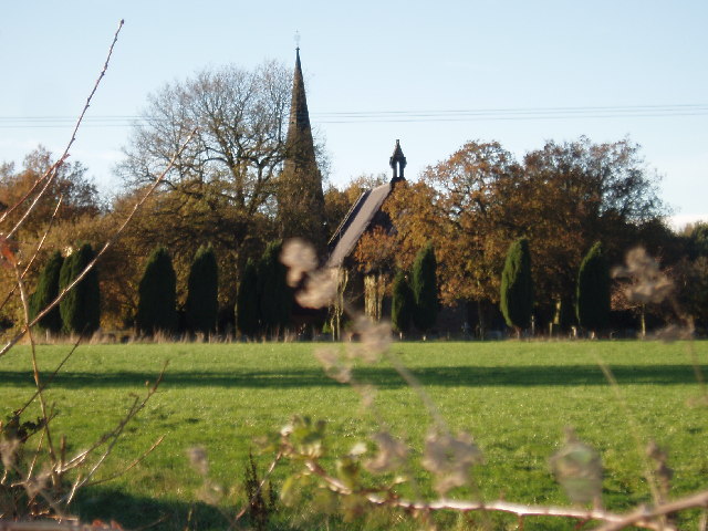
St John the Evangelist's Church, Toft

St John the Evangelist's Church is in Toft Road, Toft, Cheshire, England. It is an active Anglican parish church in the deanery of Knutsford, the archdeaconry...
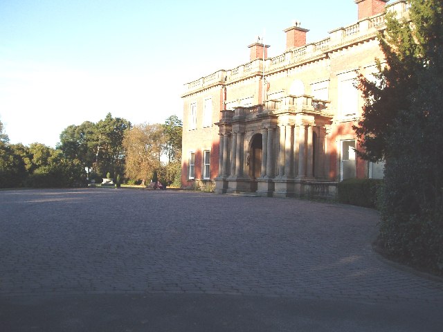
Bexton Hall

Bexton Hall is a country house in the village of Bexton to the southwest of Knutsford, Cheshire, England. It is a square, symmetrical house of five bays...
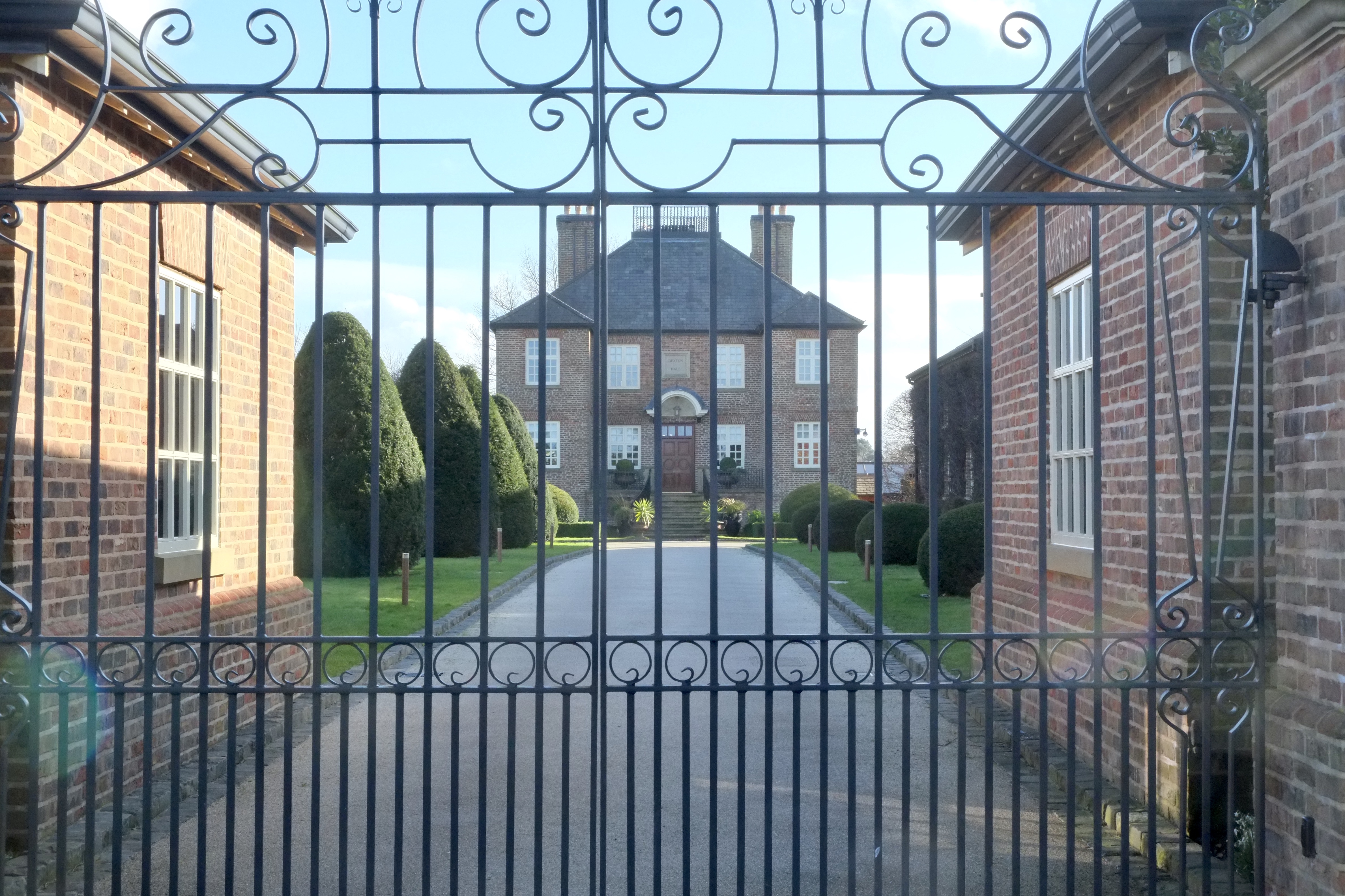
Toft Hall

Toft Hall is a 17th-century country house in Toft, Cheshire, England to which additions and alterations have been made during the following three centuries...

River Lily

River Lily is a small stream that flows through Knutsford, England. It has been claimed that it is the smallest river in Europe. It enters Tatton Mere...
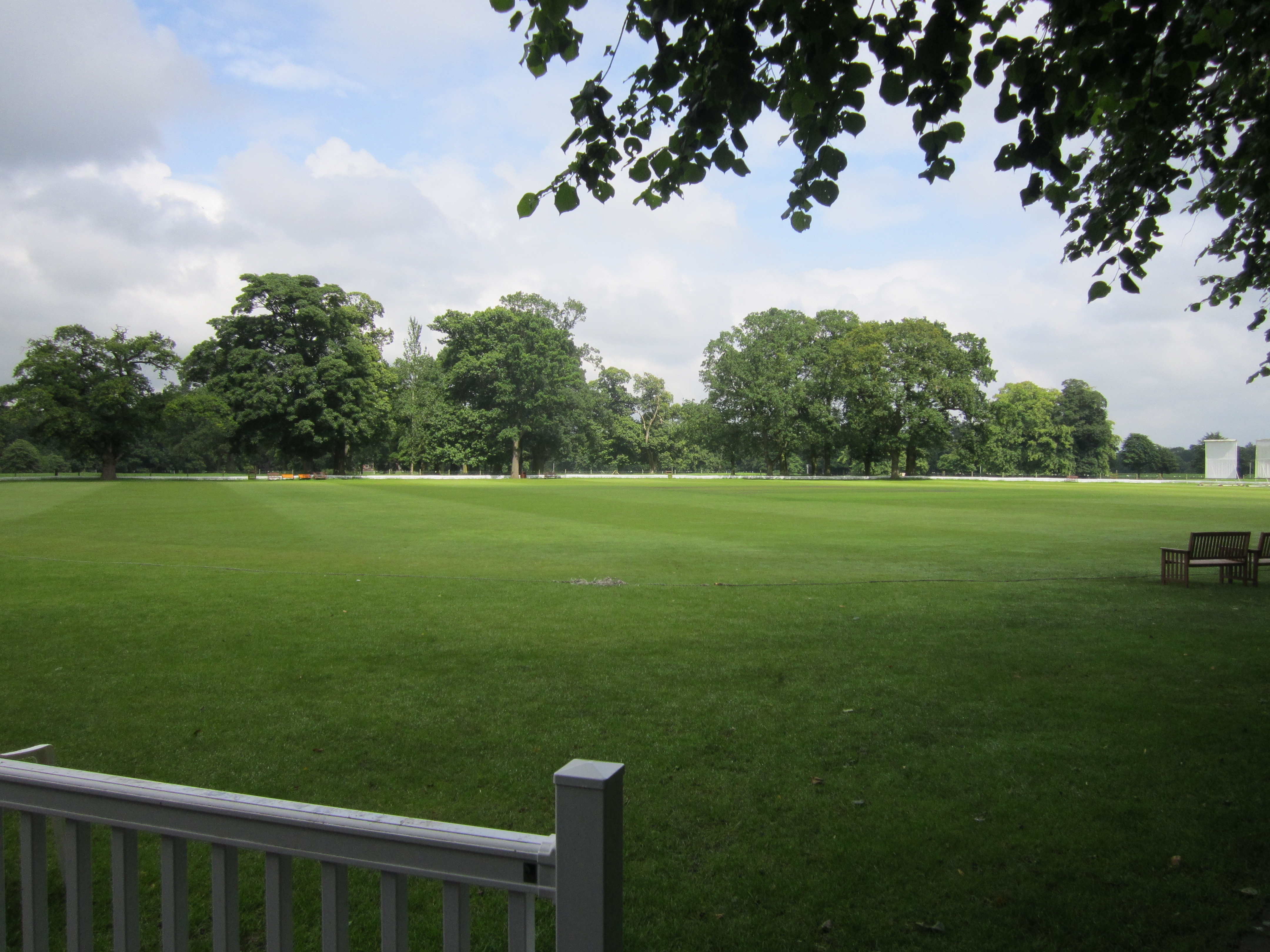
Booth Park

Booth Park is a cricket ground in Chelford Road, Toft, Cheshire. The ground lies within the grounds of Booths Park, which surrounds the east and south...

Bexton

Bexton is a civil parish to the south west of Knutsford, in the unitary authority of Cheshire East, England. According to the 2001 census it had a population...

Governor's House, Knutsford

The former Governor's House is located in Toft Road, Knutsford, Cheshire, England. It was built for the governor of Knutsford Gaol, and has later been...

Nearby Amenities

Located within 500m of 53.289571,-2.3697493
Post Box
Operator: Royal Mail
Operator Wikidata: Q638098
Post Box Type: lamp
Ref: WA16 15
Royal Cypher: EIIR
Lat/Long: 53.292467/-2.3664066
Bus Stop
Bexton, Beggarman's Lane / Highland Way
Bus: yes
Naptan AtcoCode: 0600MA0176
Naptan Bearing: SE
Naptan CommonName: Highland Way
Naptan Crossing: Highland Way
Naptan Indicator: cnr
Naptan Landmark: Highland Way
Naptan LocalityName: Bexton
Naptan NaptanCode: cheatmt
Naptan ShortCommonName: Highland Way
Naptan Street: Beggarman's Lane
Naptan Verified: no
Network: Cheshire East Council
Operator: Ansa Transport
Public Transport: platform
Source: naptan_import
Lat/Long: 53.2919395/-2.3735255
Bus Stop
Bexton, Beggarman's Lane / Highland Way
Bus: yes
Naptan AtcoCode: 0600MA19015
Naptan Bearing: NW
Naptan BusStopType: CUS
Naptan CommonName: Highland Way
Naptan Crossing: Highland Way
Naptan Indicator: opp
Naptan Landmark: Highland Way
Naptan LocalityName: Bexton
Naptan NaptanCode: chetwdg
Naptan ShortCommonName: Highland Way
Naptan Street: Beggarman's Lane
Naptan Verified: no
Network: Cheshire East Council
Operator: Ansa Transport
Public Transport: platform
Source: naptan_import
Lat/Long: 53.2918131/-2.3737044
Post Box
Operator: Royal Mail
Operator Wikidata: Q638098
Post Box Type: lamp
Ref: WA16 4
Royal Cypher: EIIR
Lat/Long: 53.2923363/-2.3738625
Addr Housenumber: 2
Addr Street: Roxby Way
Lat/Long: 53.291761/-2.3700504
Addr Housenumber: 44
Addr Street: Summers Way
Lat/Long: 53.2918737/-2.3681049
Addr Housenumber: 4
Addr Street: Summers Way
Lat/Long: 53.2931331/-2.3717333
Addr Housenumber: 2
Addr Street: Summers Way
Lat/Long: 53.2930044/-2.3718006
Addr Housenumber: 1
Addr Street: Summers Way
Lat/Long: 53.2928947/-2.3724603
Addr Housenumber: 6
Addr Street: Summers Way
Lat/Long: 53.2932619/-2.3714909
Addr Housenumber: 20
Addr Street: Summers Way
Lat/Long: 53.2930386/-2.3704761
Addr Housenumber: 2
Addr Street: Summers Close
Lat/Long: 53.2929033/-2.3703938
Addr Housenumber: 11
Addr Street: Summers Way
Lat/Long: 53.2933896/-2.3721439
Addr Housenumber: 15
Addr Street: Summers Way
Lat/Long: 53.2935155/-2.3711394
Addr Housenumber: 11
Addr Street: Bracken Way
Lat/Long: 53.2936618/-2.3703921
Addr Housenumber: 13
Addr Street: Bracken Way
Lat/Long: 53.293694/-2.3706829
Addr Housenumber: 9
Addr Street: Roxby Way
Lat/Long: 53.2923404/-2.369256
Addr Housenumber: 1
Addr Street: Roxby Way
Lat/Long: 53.2921634/-2.3700773
Addr Housenumber: 40
Addr Street: Summers Way
Lat/Long: 53.2925778/-2.3689464
Addr Housenumber: 8
Addr Street: Summers Close
Lat/Long: 53.2924909/-2.3702592
Addr Housenumber: 7
Addr Street: Summers Close
Lat/Long: 53.2924658/-2.3698637
Addr Housenumber: 5
Addr Street: Summers Close
Lat/Long: 53.2925412/-2.3694851
Addr Housenumber: 22
Addr Street: Summers Way
Lat/Long: 53.2929963/-2.3698282
Addr Housenumber: 30
Addr Street: Summers Way
Lat/Long: 53.2930969/-2.3691753
Addr Housenumber: 32
Addr Street: Summers Way
Lat/Long: 53.2929641/-2.3691349
Addr Housenumber: 1
Addr Street: Summers Close
Lat/Long: 53.2928178/-2.3696197
Addr Housenumber: 3
Addr Street: Summers Close
Lat/Long: 53.292682/-2.3695692
Addr Housenumber: 11
Addr Street: Roxby Way
Lat/Long: 53.2924209/-2.3688858
Addr Housenumber: 22
Addr Street: Roxby Way
Lat/Long: 53.2920668/-2.3686839
Addr Housenumber: 42
Addr Street: Summers Way
Lat/Long: 53.2920829/-2.3684415
Addr Housenumber: 55
Addr Street: Summers Way
Lat/Long: 53.2923073/-2.3679434
Addr Housenumber: 10
Addr Street: Rowley Way
Lat/Long: 53.2925508/-2.3677616
Addr Housenumber: 12
Addr Street: Rowley Way
Lat/Long: 53.2924703/-2.3676
Addr Housenumber: 2
Addr Street: Rowley Way
Lat/Long: 53.2925701/-2.3683594
Addr Housenumber: 53
Addr Street: Summers Way
Lat/Long: 53.2928746/-2.3684617
Addr Housenumber: 1
Addr Street: Rowley Way
Lat/Long: 53.2929467/-2.3681924
Addr Housenumber: 22
Addr Street: Rowley Way
Lat/Long: 53.2928405/-2.3675893
Addr Housenumber: 8
Addr Street: Rowley Way
Lat/Long: 53.2926795/-2.3679178
Addr Housenumber: 33
Addr Street: Summers Way
Lat/Long: 53.2933574/-2.3694176
Addr Housenumber: 35
Addr Street: Summers Way
Lat/Long: 53.2935506/-2.3694715
Addr Housenumber: 1
Addr Street: Bracken Way
Lat/Long: 53.2938034/-2.3696867
Addr Housenumber: 6
Addr Street: Comber Way
Lat/Long: 53.2939998/-2.369202
Addr Housenumber: 43
Addr Street: Summers Way
Lat/Long: 53.2933454/-2.368731
Addr Housenumber: 37
Addr Street: Summers Way
Lat/Long: 53.2936914/-2.3689127
Addr Housenumber: 61
Addr Street: Summers Way
Lat/Long: 53.2920923/-2.3675999
Addr Housenumber: 16
Addr Street: Rowley Way
Lat/Long: 53.2925604/-2.367013
Addr Housenumber: 14
Addr Street: Rowley Way
Lat/Long: 53.2923737/-2.3674492
Addr Housenumber: 32
Addr Street: Rowley Way
Lat/Long: 53.2932525/-2.3669861
Addr Housenumber: 20
Addr Street: Rowley Way
Lat/Long: 53.2927375/-2.3673254
Addr Housenumber: 18
Addr Street: Rowley Way
Lat/Long: 53.292657/-2.3671638
Addr Housenumber: 15
Addr Street: Rowley Way
Lat/Long: 53.293539/-2.3672177
Addr Housenumber: 10
Addr Street: Valley Way
Lat/Long: 53.2929174/-2.3745914
Addr Housenumber: 8
Addr Street: Tree Way
Lat/Long: 53.2924699/-2.373986
Addr Housenumber: 7
Addr Street: Tree Way
Lat/Long: 53.2923221/-2.3735184
Addr Housenumber: 28
Addr Street: Highland Way
Lat/Long: 53.2920333/-2.3732129
Addr Housenumber: 14
Addr Street: Valley Way
Lat/Long: 53.2928435/-2.3740755
Addr Housenumber: 16
Addr Street: Valley Way
Lat/Long: 53.2929238/-2.3739357
Addr Housenumber: 12
Addr Street: Valley Way
Lat/Long: 53.2928243/-2.3743334
Addr Housenumber: 8
Addr Street: Valley Way
Lat/Long: 53.2930781/-2.3743442
Addr Housenumber: 2
Addr Street: Tree Way
Lat/Long: 53.2927751/-2.3736205
Addr Housenumber: 1
Addr Street: Tree Way
Lat/Long: 53.2926658/-2.3731207
Addr Housenumber: 11
Addr Street: Valley Way
Lat/Long: 53.2932804/-2.373667
Addr Housenumber: 18
Addr Street: Lowland Way
Lat/Long: 53.2935215/-2.3731357
Addr Housenumber: 7
Addr Street: Valley Close
Lat/Long: 53.2916745/-2.3717338
Addr Housenumber: 11
Addr Street: Valley Close
Lat/Long: 53.2918673/-2.3718628
Addr Housenumber: 9
Addr Street: Valley Close
Lat/Long: 53.2917709/-2.3717983
Addr Housenumber: 42
Addr Street: Valley Way
Lat/Long: 53.2916635/-2.3706322
Addr Housenumber: 40
Addr Street: Valley Way
Lat/Long: 53.2917663/-2.370686
Addr Housenumber: 38
Addr Street: Valley Way
Lat/Long: 53.2918691/-2.3707504
Addr Housenumber: 1
Addr Street: Valley Close
Lat/Long: 53.2917491/-2.3710201
Addr Housenumber: 3
Addr Street: Valley Close
Lat/Long: 53.2917131/-2.3711921
Addr Housenumber: 5
Addr Street: Valley Close
Lat/Long: 53.2916771/-2.371377
Addr Housenumber: 9
Addr Street: Highland Way
Lat/Long: 53.2920076/-2.3724282
Addr Housenumber: 26
Addr Street: Valley Way
Lat/Long: 53.2925791/-2.3719598
Addr Housenumber: 2
Addr Street: Highland Way
Lat/Long: 53.2925569/-2.3717832
Addr Housenumber: 4
Addr Street: Highland Way
Lat/Long: 53.2923866/-2.3719713
Addr Housenumber: 21
Addr Street: Valley Way
Lat/Long: 53.2928757/-2.3728662
Addr Housenumber: 18
Addr Street: Valley Way
Lat/Long: 53.2926209/-2.3728412
Addr Housenumber: 23
Addr Street: Valley Way
Lat/Long: 53.2928112/-2.3719797
Addr Housenumber: 2
Addr Street: Valley Close
Lat/Long: 53.2919932/-2.3711706
Addr Housenumber: 4
Addr Street: Valley Close
Lat/Long: 53.2919418/-2.371377
Addr Housenumber: 28
Addr Street: Valley Way
Lat/Long: 53.2924827/-2.3714169
Addr Housenumber: 1
Addr Street: Highland Way
Lat/Long: 53.2922774/-2.3715252
Addr Housenumber: 47
Addr Street: Valley Way
Lat/Long: 53.2920787/-2.3703458
Addr Housenumber: 36
Addr Street: Valley Way
Lat/Long: 53.29211/-2.3708418
Addr Housenumber: 29
Addr Street: Valley Way
Lat/Long: 53.2927315/-2.3713519
Addr Housenumber: 33
Addr Street: Valley Way
Lat/Long: 53.2928651/-2.3708101
Addr Housenumber: 31
Addr Street: Valley Way
Lat/Long: 53.2929448/-2.3713261
Addr Housenumber: 35
Addr Street: Valley Way
Lat/Long: 53.2926313/-2.3709434
Addr Housenumber: 1
Addr Street: Lowland Way
Lat/Long: 53.2938307/-2.3720339
Addr Housenumber: 11
Addr Street: Lowland Way
Lat/Long: 53.2933167/-2.3725781
Addr Housenumber: 1
Addr Street: Grassfield Way
Lat/Long: 53.2936138/-2.3719399
Addr Housenumber: 2
Addr Street: Grassfield Way
Lat/Long: 53.2936223/-2.3713759
Addr Housenumber: 11
Addr Street: Beggarmans Lane
Lat/Long: 53.2922728/-2.3741046
Addr Housenumber: 13
Addr Street: Beggarmans Lane
Lat/Long: 53.2921251/-2.3736956
Addr Housenumber: 15
Addr Street: Beggarmans Lane
Lat/Long: 53.2916048/-2.3725429
Addr Housenumber: 27
Addr Street: Beggarmans Lane
Lat/Long: 53.2913095/-2.3712138
Addr Housenumber: 25
Addr Street: Beggarmans Lane
Lat/Long: 53.2913166/-2.3714961
Addr Housenumber: 33
Addr Street: Beggarmans Lane
Lat/Long: 53.2914009/-2.3705433
Addr Housenumber: 35
Addr Street: Beggarmans Lane
Lat/Long: 53.2914923/-2.3700375
Addr Housenumber: 55
Addr Street: Beggarmans Lane
Lat/Long: 53.2917736/-2.3678145
Addr Housenumber: 57
Addr Street: Beggarmans Lane
Lat/Long: 53.2919325/-2.367524
Addr Housenumber: 69
Addr Street: Beggarmans Lane
Lat/Long: 53.2924095/-2.366854
Building: residential
Lat/Long: 53.2921089/-2.3733235
Asda Express
Addr City: Knutsford
Addr Country: GB
Addr Housename: Knutsford Service Station
Addr Postcode: WA16 8QJ
Addr Street: Toft Road
Branch: Knutsford
Brand: Asda Express
Brand Wikidata: Q114826023
Fhrs Id: 891712
Shop: convenience
Website: https://storelocator.asda.com/north-west/knutsford/toft-road
Lat/Long: 53.2933865/-2.3664192
Fuel
Lat/Long: 53.2935332/-2.3664983
The data included in this document is from www.openstreetmap.org. The data is made available under ODbL.

Have you been to Sandfield Wood?

Leave your review of Sandfield Wood below (or comments, questions and feedback).