Ardgay
Settlement in Ross-shire
Scotland
Ardgay

Ardgay is a small village located in the county of Ross-shire, in the Highlands of Scotland. Situated on the eastern bank of the Kyle of Sutherland, it is nestled within the picturesque and tranquil surroundings of the Scottish countryside. The village lies about 40 miles north of Inverness, the capital city of the Highlands.
Ardgay is known for its stunning natural beauty and rich history. It offers breathtaking views of the surrounding hills and mountains, making it an ideal destination for outdoor enthusiasts and nature lovers. The nearby Dornoch Firth also provides opportunities for fishing and boating.
The village itself has a small but close-knit community, with a population of approximately 400 people. It boasts a range of amenities including a local convenience store, a post office, and a primary school. For further amenities and services, residents can easily access the nearby towns of Bonar Bridge and Tain.
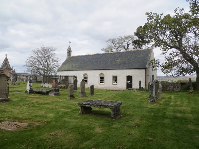
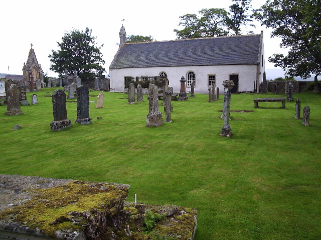
Historically, Ardgay was an important transportation hub, with a railway station that served as a key link between Inverness and the northern regions. Today, the village retains its charm and character, with traditional stone cottages and well-preserved historic buildings.
Overall, Ardgay offers a peaceful and idyllic setting, perfect for those seeking a slower pace of life and a close connection to nature. Its rich history, stunning landscapes, and welcoming community make it a hidden gem in the heart of the Scottish Highlands.
If you have any feedback on the listing, please let us know in the comments section below.
Ardgay Images
Images are sourced within 2km of 57.882081/-4.36342 or Grid Reference NH5990. Thanks to Geograph Open Source API. All images are credited.


Ardgay is located at Grid Ref: NH5990 (Lat: 57.882081, Lng: -4.36342)
Unitary Authority: Highland
Police Authority: Highlands and Islands
What 3 Words
///strain.prouder.absent. Near Lairg, Highland
Nearby Locations
Related Wikis
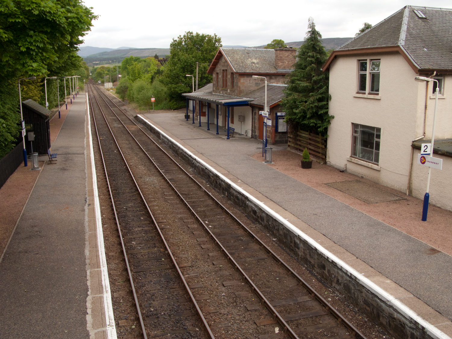
Ardgay railway station
Ardgay railway station is a railway station serving the village of Ardgay and its neighbour Bonar Bridge in the Highland council area of Scotland. The...

Ardgay
Ardgay ard-GY (Scottish Gaelic: Àird Gaoith or Àird Ghaoithe) ["high wind"] is a small Scottish village on the south west shore of the Dornoch Firth,...

River Carron, Sutherland
The River Carron (Scottish Gaelic: Carrann) is an east coast river in Sutherland, in the Highlands of Scotland. It begins as Abhainn a' Ghlinne Mhòir...
Kincardine, Sutherland
Kincardine (Scottish Gaelic: Cinn Chàrdainn) is a small hamlet in Sutherland, situated on the west end of the south shore of the Dornoch Firth. The village...
Nearby Amenities
Located within 500m of 57.882081,-4.36342Have you been to Ardgay?
Leave your review of Ardgay below (or comments, questions and feedback).