Offley Wood

Wood, Forest in Cheshire

England

Offley Wood

Crewe Hall farm
Crewe Hall farm Credit: John Naisbitt

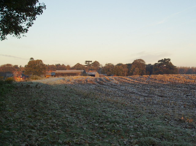
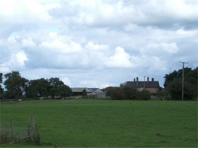
Offley Wood is a picturesque woodland located in the county of Cheshire, England. Situated near the village of Offleyhay, this enchanting forest spans across an area of approximately 50 acres. It is renowned for its natural beauty, offering visitors a tranquil and serene environment.

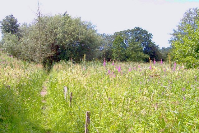
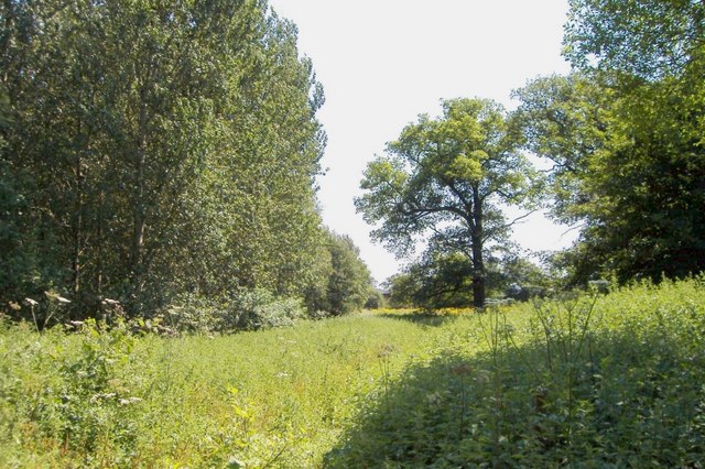
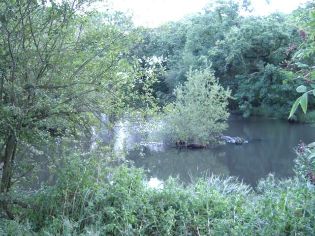
The woodland is predominantly composed of a variety of deciduous trees, including oak, beech, and ash. These majestic trees create a dense canopy, providing shade and shelter to a wide range of flora and fauna. The forest floor is adorned with a carpet of wildflowers during the spring and summer months, adding vibrant colors to the landscape.

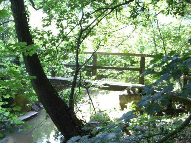
Offley Wood is intersected by a network of well-maintained footpaths, allowing visitors to explore its depths and enjoy leisurely walks. These trails meander through the forest, offering glimpses of its diverse wildlife, such as deer, squirrels, and a plethora of bird species. Nature enthusiasts can also find several bird hides strategically placed throughout the wood, providing ideal observation points for birdwatching.

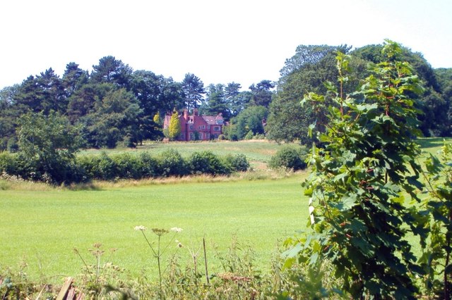
The wood has a rich history, dating back centuries. It was once a popular hunting ground for local nobility, and remnants of old hunting lodges can be found within its boundaries. Today, Offley Wood is protected and managed by the local authorities, ensuring its conservation and preservation for future generations to enjoy.

With its idyllic setting, diverse flora and fauna, and historical significance, Offley Wood is a true gem in the Cheshire countryside. Whether for a leisurely stroll, birdwatching, or simply immersing oneself in nature's beauty, this woodland offers a peaceful retreat from the hustle and bustle of everyday life.

If you have any feedback on the listing, please let us know in the comments section below.

Offley Wood Images

Images are sourced within 2km of 53.083838/-2.3677289 or Grid Reference SJ7554. Thanks to Geograph Open Source API. All images are credited.

Crewe Hall farm
Crewe Hall farm
Haslington Hall - the drive and lake Taken from the main drive to the hall looking south across the lake. The hall itself is just visible in the right background and lies in the adjacent square <a href="https://www.geograph.org.uk/gridref/SJ7455">SJ7455</a>; the lake is mostly in SJ7456 as is the photographer's position. A cold and misty autumn day.
Haslington Hall - the drive and lake
Taken from the main drive to the hall looking south across the lake. The hall itself is just visible in the right background and lies in the adjacent square SJ7455; the lake is mostly in SJ7456 as is the photographer's position. A cold and misty autumn day.
B5077 at Oakhanger The building in the centre is Oakhanger Primitive Methodist Chapel.
B5077 at Oakhanger
The building in the centre is Oakhanger Primitive Methodist Chapel.
St Luke's, Oakhanger Oakhanger is a small rural village in South Cheshire with no shop or pub but it does have both this church and a Primitive Methodist Chapel.
St Luke's, Oakhanger
Oakhanger is a small rural village in South Cheshire with no shop or pub but it does have both this church and a Primitive Methodist Chapel.
Hall o' the Heath Farm, Haslington The farmhouse, taken from the driveway, marked on the map as a footpath. From the name of this farm and the one next to it, Heathfields Farm, it seems likely that this area was once heathland.
Hall o' the Heath Farm, Haslington
The farmhouse, taken from the driveway, marked on the map as a footpath. From the name of this farm and the one next to it, Heathfields Farm, it seems likely that this area was once heathland.
Rose Tree Farm
Rose Tree Farm
Footbridge over Valley Brook This bridge forms part of the South Cheshire Way where it passes over Valley Brook.
Footbridge over Valley Brook
This bridge forms part of the South Cheshire Way where it passes over Valley Brook.
M6 Bridge at Radway Green The B5077 goes under the M6 at Radway Green. The large radio mast on the right is also shown on OS maps.
M6 Bridge at Radway Green
The B5077 goes under the M6 at Radway Green. The large radio mast on the right is also shown on OS maps.
South Cheshire Way, Crewe Green Crewe Green. South Cheshire Way,crossing marsh near Henbury Lee.
South Cheshire Way, Crewe Green
Crewe Green. South Cheshire Way,crossing marsh near Henbury Lee.
Englesea House from Barthomley Road Crewe Green. South Cheshire Way, Barthomley Road near Gravel Farm. View towards Englesea House.
Englesea House from Barthomley Road
Crewe Green. South Cheshire Way, Barthomley Road near Gravel Farm. View towards Englesea House.
Lees Wood, Weston Weston. Footpath through edge of Lees Wood.
Lees Wood, Weston
Weston. Footpath through edge of Lees Wood.
Railway Crossing, Mill Lane, Oakhanger Manually operated crossing with just a green and red light to show if it's safe to open the two gates and drive through.
Railway Crossing, Mill Lane, Oakhanger
Manually operated crossing with just a green and red light to show if it's safe to open the two gates and drive through.
Crossing instructions
Mill Farm, Barthomley Taken from Mill Lane.
Mill Farm, Barthomley
Taken from Mill Lane.
M6 from Radway Green Road Across the fields you can just about see the farm buildings at the delightfully named Toad Hole Farm.
M6 from Radway Green Road
Across the fields you can just about see the farm buildings at the delightfully named Toad Hole Farm.
Pond just off Butterton Lane There is supposed to be a permissive path here running parallel to Butterton Lane but although there are stiles there is no sign that anyone has every penetrated the jungle round the pond itself
Pond just off Butterton Lane
There is supposed to be a permissive path here running parallel to Butterton Lane but although there are stiles there is no sign that anyone has every penetrated the jungle round the pond itself
Butterton Lane Farm View across fields from permitted path running parallel to Butterton Lane
Butterton Lane Farm
View across fields from permitted path running parallel to Butterton Lane
Gate Farm, Oakhanger View across fields from Taylors Lane. Gate Farm was presumably so named because it is next to the main gate for the Oakhanger Hall Estate.
Gate Farm, Oakhanger
View across fields from Taylors Lane. Gate Farm was presumably so named because it is next to the main gate for the Oakhanger Hall Estate.
Show me another place!

Offley Wood is located at Grid Ref: SJ7554 (Lat: 53.083838, Lng: -2.3677289)

Unitary Authority: Cheshire East

Police Authority: Cheshire

What 3 Words

///younger.started.jaundice. Near Weston, Cheshire

Nearby Locations

Offley Wood

Related Wikis

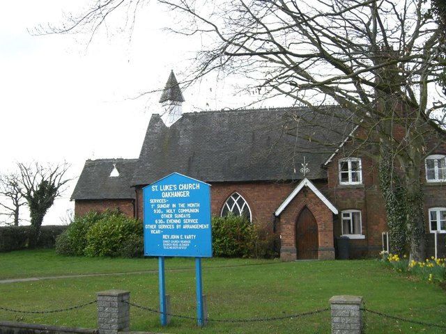
St Luke's Church, Oakhanger

St Luke's Church is in Church Lane, Oakhanger, Cheshire, England. It is an active Anglican mission church in the parish of Christ Church, Alsager, the...
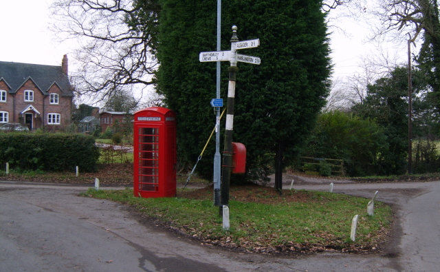
Oakhanger, Cheshire

Oakhanger is a village in Cheshire, England, within the civil parish of Haslington and the Borough of Cheshire East, located off the B5077 road between...

Haslington Hall

Haslington Hall is a country house located in open countryside 1 km east of the village of Haslington, Cheshire, England. It is recorded in the National...

Crewe Hall

Crewe Hall is a Jacobean mansion located near Crewe Green, east of Crewe, in Cheshire, England. Described by Nikolaus Pevsner as one of the two finest...

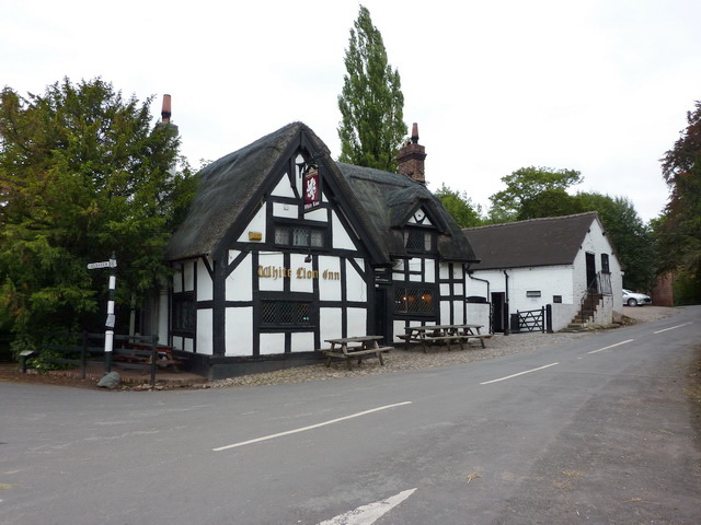
White Lion, Barthomley

The White Lion is a public house in Barthomley, Cheshire, England, just off junction 16 of the M6. It was built in 1614, and is recorded in the National...

Barthomley

Barthomley is a village and ancient parish, and is now a civil parish in the unitary authority of Cheshire East and the ceremonial county of Cheshire...

Radway Green & Barthomley railway station

Radway Green & Barthomley railway station was built by the North Staffordshire Railway (NSR) and served the small Cheshire communities of Radway Green...

St Bertoline's Church, Barthomley

St Bertoline's Church is in the village of Barthomley, Cheshire, England. The church is recorded in the National Heritage List for England as a designated...

Nearby Amenities

Located within 500m of 53.083838,-2.3677289
Bus Stop
Oakhanger, Butterton Lane / Offley Ley Farm
Bus: yes
Naptan AtcoCode: 0600CR005
Naptan Bearing: W
Naptan CommonName: Offley Ley Farm
Naptan Crossing: Butterton Lane
Naptan Indicator: nr
Naptan Landmark: Offley Ley Farm
Naptan LocalityName: Oakhanger
Naptan NaptanCode: chegpmw
Naptan ShortCommonName: Offley Ley Farm
Naptan Street: Butterton Lane
Naptan Verified: no
Network: Cheshire East Council
Operator: Ansa Transport
Public Transport: platform
Source: naptan_import
Lat/Long: 53.0874151/-2.3641315
Bus Stop
Oakhanger, Butterton Lane / The Nursery
Bus: yes
Naptan AtcoCode: 0600CR006
Naptan Bearing: SW
Naptan CommonName: The Nursery
Naptan Indicator: opp
Naptan Landmark: The Nursery
Naptan LocalityName: Oakhanger
Naptan NaptanCode: chejapt
Naptan ShortCommonName: The Nursery
Naptan Street: Butterton Lane
Naptan Verified: no
Network: Cheshire East Council
Operator: Ansa Transport
Public Transport: platform
Source: naptan_import
Lat/Long: 53.086666/-2.372352
Bus Stop
Oakhanger, Butterton Lane / The Nursery
Bus: yes
Naptan AtcoCode: 0600CR411
Naptan Bearing: E
Naptan CommonName: The Nursery
Naptan Indicator: adj
Naptan Landmark: The Nursery
Naptan LocalityName: Oakhanger
Naptan NaptanCode: chejtpj
Naptan ShortCommonName: The Nursery
Naptan Street: Butterton Lane
Naptan Verified: no
Network: Cheshire East Council
Operator: Ansa Transport
Public Transport: platform
Source: naptan_import
Lat/Long: 53.0869776/-2.3721646
Bus Stop
Oakhanger, Butterton Lane / Offley Ley Farm
Bus: yes
Naptan AtcoCode: 0600CR413
Naptan Bearing: E
Naptan BusStopType: CUS
Naptan CommonName: Offley Ley Farm
Naptan Crossing: Butterton Lane
Naptan Indicator: opp
Naptan Landmark: Offley Ley Farm
Naptan LocalityName: Oakhanger
Naptan NaptanCode: chejtpm
Naptan ShortCommonName: Offley Ley Farm
Naptan Street: Butterton Lane
Naptan Verified: no
Network: Cheshire East Council
Operator: Ansa Transport
Public Transport: platform
Source: naptan_import
Lat/Long: 53.0876498/-2.3640356
Bridge House Farm
Alt Name: Bridgehouse Farm
Place: farm
Source: Bing
Lat/Long: 53.0805151/-2.3726272
Top End Farm
Alt Name: Barthomley Road Farm
Place: farm
Source: Bing
Lat/Long: 53.081434/-2.3679574
The data included in this document is from www.openstreetmap.org. The data is made available under ODbL.

Have you been to Offley Wood?

Leave your review of Offley Wood below (or comments, questions and feedback).