Batchacre Wood

Wood, Forest in Staffordshire Stafford

England

Batchacre Wood

Stile on footpath to Leawood
Stile on footpath to Leawood Credit: Row17

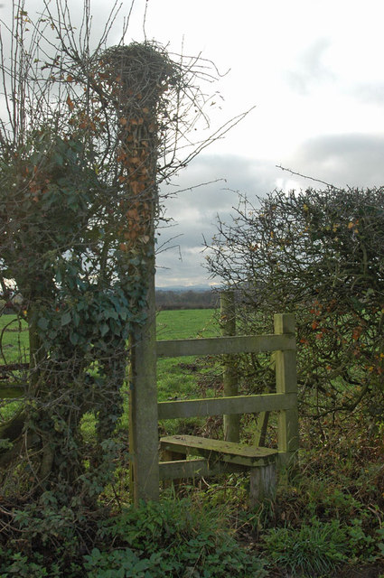
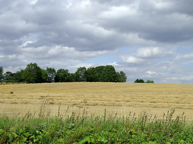
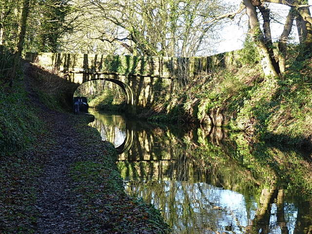
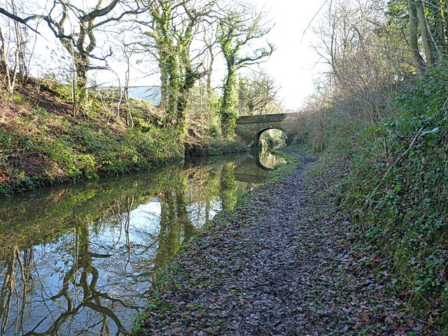
Batchacre Wood is a picturesque woodland located in Staffordshire, England. Covering an area of approximately 100 acres, this enchanting forest offers a serene and tranquil retreat for nature lovers and outdoor enthusiasts alike.

The wood is primarily composed of broad-leaved trees, including oak, ash, and beech, which create a dense canopy, providing shade and shelter to the diverse flora and fauna that call this woodland home. The forest floor is adorned with a rich carpet of bluebells and wildflowers during the spring, adding a burst of color and fragrance to the surroundings.

Visitors to Batchacre Wood can enjoy a variety of activities, such as walking, cycling, and birdwatching. The woodland boasts a network of well-maintained trails, allowing visitors to explore its hidden gems and discover its natural wonders. The peaceful atmosphere and the soothing sound of birdsong provide a perfect backdrop for relaxation and contemplation.

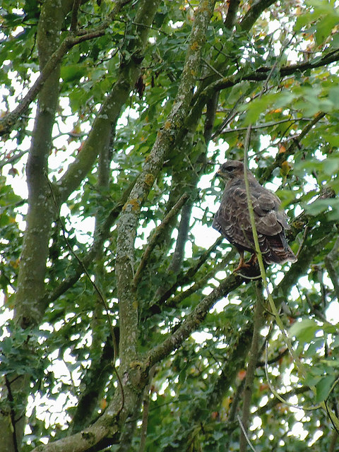
Wildlife enthusiasts will be delighted to spot a range of native species, including deer, foxes, badgers, and a plethora of bird species. The wood is especially renowned for its birdlife, with sightings of woodpeckers, owls, and various songbirds being common.

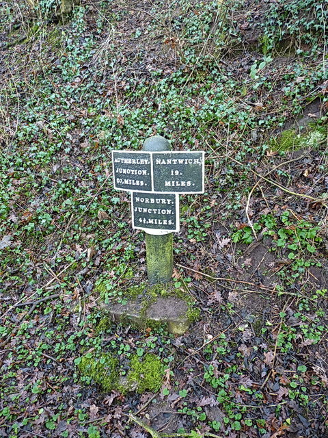
Batchacre Wood is well-connected to the surrounding area, with convenient access points and ample parking facilities. It offers a wonderful opportunity to escape the hustle and bustle of everyday life and immerse oneself in the beauty of nature. Whether visiting for a leisurely stroll, a family picnic, or simply to enjoy the serenity of the woods, Batchacre Wood is a true gem of Staffordshire's natural landscape.

If you have any feedback on the listing, please let us know in the comments section below.

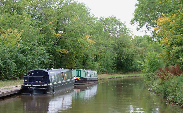
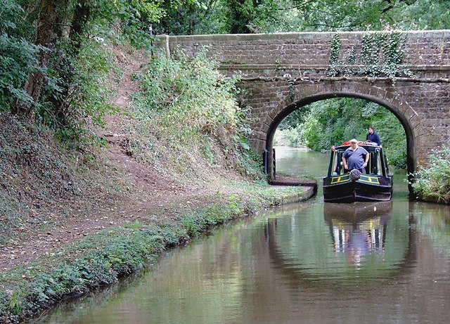
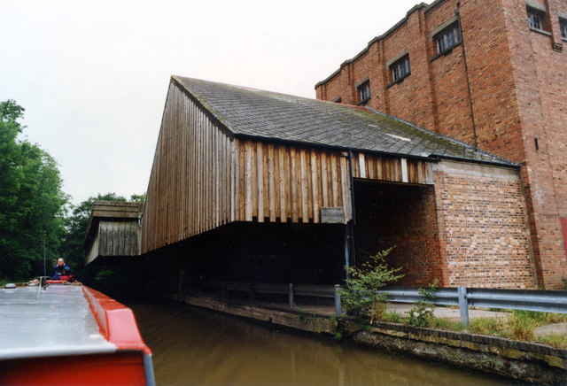
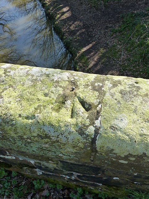
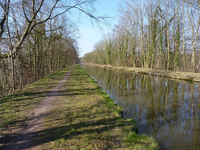
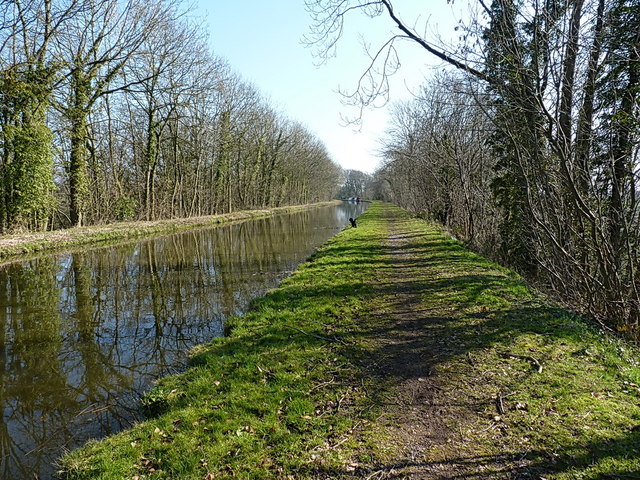
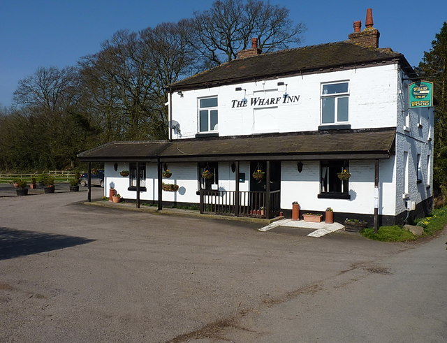
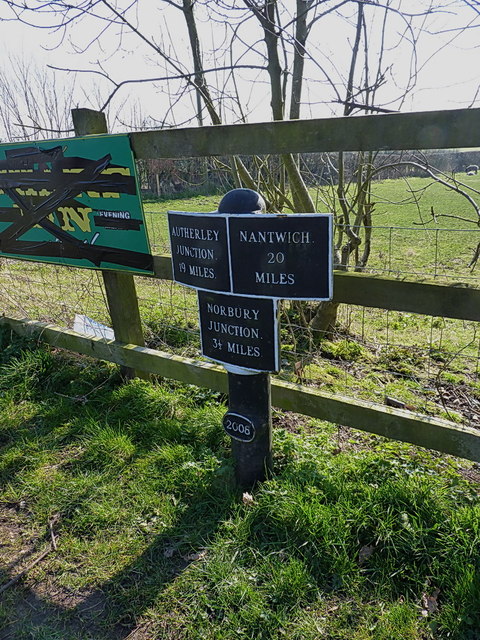
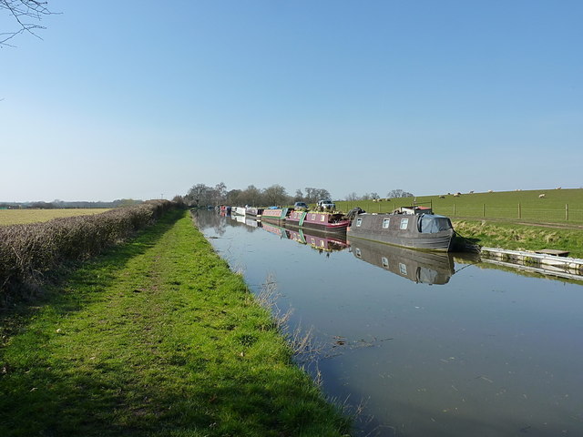
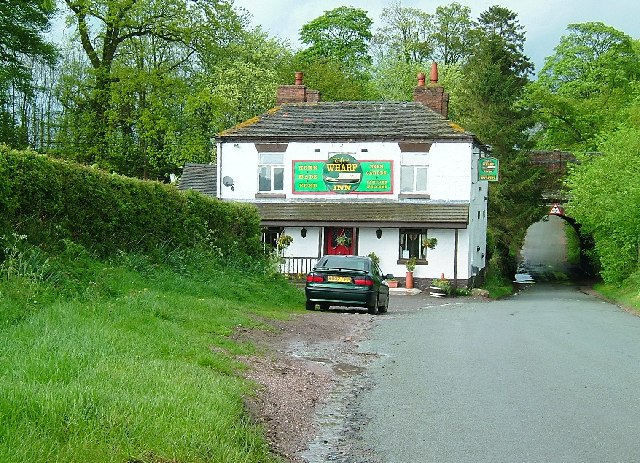
Batchacre Wood Images

Images are sourced within 2km of 52.823415/-2.3689827 or Grid Reference SJ7525. Thanks to Geograph Open Source API. All images are credited.

Stile on footpath to Leawood
Arable field near Shebdon, Staffordshire Seen from the Shropshire Union Canal.
Arable field near Shebdon, Staffordshire
Seen from the Shropshire Union Canal.
Shropshire Union Canal near Shebdon, Staffordshire Shebdon Bridge (No 44) is ahead, which carries the lane from Tunstall.
Shropshire Union Canal near Shebdon, Staffordshire
Shebdon Bridge (No 44) is ahead, which carries the lane from Tunstall.
Shebdon Bridge south-east of Knighton, Staffordshire Shebdon Bridge (No 44) carries the lane from Tunstall. Private long-term moorings on the right are by Shebdon Farm. Past the bridge, the Shropshire Union Canal continues towards another embankment. About five hundred metres ahead on the left is The Wharf Inn* at the base of the embankment. The sign on the bridge advertises it. The current Google satellite hybrid image incorrectly labels Batchacre Park Cottage (no road access) as The Wharf Inn.

*update: closed 2013.
Shebdon Bridge south-east of Knighton, Staffordshire
Shebdon Bridge (No 44) carries the lane from Tunstall. Private long-term moorings on the right are by Shebdon Farm. Past the bridge, the Shropshire Union Canal continues towards another embankment. About five hundred metres ahead on the left is The Wharf Inn* at the base of the embankment. The sign on the bridge advertises it. The current Google satellite hybrid image incorrectly labels Batchacre Park Cottage (no road access) as The Wharf Inn. *update: closed 2013.
Moorings by the pub at Shebdon, Staffordshire Here the Shropshire Union Canal has been built on another tree covered embankment. The Wharf Inn is at the base of the embankment here, down a stepped path through the trees. The current Google satellite hybrid image incorrectly labels Batchacre Park Cottage (no road access) as The Wharf Inn.

<a href="https://www.geograph.org.uk/photo/1835683">SJ7526 : The Wharf Inn Pub, Shebdon</a>

Update: The Wharf Inn closed permanently in 2013.
Moorings by the pub at Shebdon, Staffordshire
Here the Shropshire Union Canal has been built on another tree covered embankment. The Wharf Inn is at the base of the embankment here, down a stepped path through the trees. The current Google satellite hybrid image incorrectly labels Batchacre Park Cottage (no road access) as The Wharf Inn. SJ7526 : The Wharf Inn Pub, Shebdon Update: The Wharf Inn closed permanently in 2013.
Buzzard near Shebdon Wharf, Staffordshire This bird of prey was keeping an eye on the canal and the fields behind the trees.
Buzzard near Shebdon Wharf, Staffordshire
This bird of prey was keeping an eye on the canal and the fields behind the trees.
Shropshire Union canal at Knighton, Staffordshire Knighton Bridge (No 46) carries a bridleway and farm track.
Shropshire Union canal at Knighton, Staffordshire
Knighton Bridge (No 46) carries a bridleway and farm track.
Premier Foods Knighton Wharf Adbaston I don't know how old the information is but the Knighton factory reportedly produces around 29,000 tonnes of powder per annum. Main brands include Cadbury's Drinking Chocolate, Highlights, Marvel, Angel Delight, Birds Custard Powder, Hartley's powder Jelly and others. In 1660 Knighton was exempted from the payment of all civil and military taxes. Cadburys’ built a milk processing factory at Knighton in 1911, attracted by the rates exemption. Cadbury operated the wharf up to the 1960s and the exemption from rates for Knighton continued as late as the 1970s although this also meant that not all local public services were supplied to the village.
Premier Foods Knighton Wharf Adbaston
I don't know how old the information is but the Knighton factory reportedly produces around 29,000 tonnes of powder per annum. Main brands include Cadbury's Drinking Chocolate, Highlights, Marvel, Angel Delight, Birds Custard Powder, Hartley's powder Jelly and others. In 1660 Knighton was exempted from the payment of all civil and military taxes. Cadburys’ built a milk processing factory at Knighton in 1911, attracted by the rates exemption. Cadbury operated the wharf up to the 1960s and the exemption from rates for Knighton continued as late as the 1970s although this also meant that not all local public services were supplied to the village.
Bridge 46 and the Shroppy Just west of Knighton, the minor bridge 46 carries a farm track, and gives pedestrian access to the towpath, which is currently closed off at the adjacent road bridge 45.
Bridge 46 and the Shroppy
Just west of Knighton, the minor bridge 46 carries a farm track, and gives pedestrian access to the towpath, which is currently closed off at the adjacent road bridge 45.
Knighton road bridge (45) on the Shroppy Access from the road bridge to the (rather muddy) towpath is closed off at the moment, so a quick stroll along a field edge to the adjacent bridge 46 is required.
Knighton road bridge (45) on the Shroppy
Access from the road bridge to the (rather muddy) towpath is closed off at the moment, so a quick stroll along a field edge to the adjacent bridge 46 is required.
Canal milepost at Knighton A cast iron milepost, one of several along this length of the cut; the next one to the northwest is <a href="https://www.geograph.org.uk/photo/3819016">SJ7327 : Canal milepost at Park Heath</a>
Canal milepost at Knighton
A cast iron milepost, one of several along this length of the cut; the next one to the northwest is SJ7327 : Canal milepost at Park Heath
OS benchmark - Newport Road bridge An OS cutmark on the wall of the bridge over the Shropshire Union Canal; originally levelled at 106.88m above Ordnance Datum Newlyn.
OS benchmark - Newport Road bridge
An OS cutmark on the wall of the bridge over the Shropshire Union Canal; originally levelled at 106.88m above Ordnance Datum Newlyn.
OS benchmark & rivet - Knighton canal bridge An OS rivet in the parapet of the accommodation bridge carrying the bridleway to Kingswell; originally levelled at 106.75m above Ordnance Datum Newlyn.
OS benchmark & rivet - Knighton canal bridge
An OS rivet in the parapet of the accommodation bridge carrying the bridleway to Kingswell; originally levelled at 106.75m above Ordnance Datum Newlyn.
The Shroppy, east of Knighton A fine, sunny March day to walk up the canal for lunch.
The Shroppy, east of Knighton
A fine, sunny March day to walk up the canal for lunch.
Heading for Shebdon Walking along the towpath of the Shroppy towards the former Wharf Inn at Shebdon (it closed in 2013)
Heading for Shebdon
Walking along the towpath of the Shroppy towards the former Wharf Inn at Shebdon (it closed in 2013)
The former Wharf Inn Don't be fooled by the signage on the wall; the Wharf is no more a public house, having closed in 2013, and planning permission is in hand to convert to a private residence.
The former Wharf Inn
Don't be fooled by the signage on the wall; the Wharf is no more a public house, having closed in 2013, and planning permission is in hand to convert to a private residence.
Canal milepost at Shebdon A replacement milepost (cast in 2006, it says at the base of the pillar), but very much in the style of others along the Shropshire Union canal such as <a href="https://www.geograph.org.uk/photo/3819006">SJ7426 : Canal milepost at Knighton</a> & <a href="https://www.geograph.org.uk/photo/3819019">SJ7128 : Canal milepost at Little Soudley</a>
Canal milepost at Shebdon
A replacement milepost (cast in 2006, it says at the base of the pillar), but very much in the style of others along the Shropshire Union canal such as SJ7426 : Canal milepost at Knighton & SJ7128 : Canal milepost at Little Soudley
Moorings at Shebdon Semi-permanent moorings on the Shroppy at Shebdon Farm.
Moorings at Shebdon
Semi-permanent moorings on the Shroppy at Shebdon Farm.
Show me another place!

Batchacre Wood is located at Grid Ref: SJ7525 (Lat: 52.823415, Lng: -2.3689827)

Administrative County: Staffordshire

District: Stafford

Police Authority: Staffordshire

What 3 Words

///multiple.catapult.herbs. Near Chetwynd, Shropshire

Nearby Locations

Batchacre Wood

Related Wikis

Shebdon

Shebdon is a hamlet in the county of Staffordshire, England. It is part of the parish of High Offley, a small village approximately 1.5 miles to the ENE...

Knighton, Stafford

Knighton is a hamlet part of the parish of Adbaston in the county of Staffordshire, England. Knighton is situated close to the Staffordshire/Shropshire...

RAF Chetwynd

Royal Air Force Chetwynd or more simply RAF Chetwynd is a former Royal Air Force satellite station located in Chetwynd, Shropshire, England. The following...

Adbaston

Adbaston is a village and a civil parish in the English county of Staffordshire. == Location == The village is 13 miles (20.9 km) north east of the town...

Tunstall, Stafford

Tunstall is a hamlet near Eccleshall in the borough of Stafford in Staffordshire, England. In 1870–72 it had a population of 72. Tunstall was recorded...

Pickstock

Pickstock is a hamlet in the civil parish of Chetwynd, in the Telford and Wrekin district, in the ceremonial county of Shropshire, England. It is near...

High Offley

High Offley is a small village and civil parish in Staffordshire, England. It lies 3 miles southwest of the small town of Eccleshall and about 1 mile west...

Norbury, Staffordshire

Norbury is a village and civil parish in the Borough of Stafford, in west Staffordshire, England. The population as taken at the 2011 census was 371.It...

Have you been to Batchacre Wood?

Leave your review of Batchacre Wood below (or comments, questions and feedback).