Shooter's Coppice

Wood, Forest in Worcestershire Malvern Hills

England

Shooter's Coppice

Track (footpath) off the A44, Darbys Green
Track (footpath) off the A44, Darbys Green Credit: JThomas

Shooter's Coppice is a picturesque woodland located in the county of Worcestershire, England. Covering an area of approximately 50 acres, this enchanting forest is nestled within the heart of the county, near the village of Callow Hill. It is a cherished natural gem for both locals and visitors alike.

The coppice is predominantly composed of a diverse range of deciduous trees, including oak, ash, birch, and beech, which create a rich tapestry of colors throughout the seasons. The woodland floor is carpeted with a myriad of wildflowers, such as bluebells and primroses, adding to the area's natural beauty.

The forest's name, Shooter's Coppice, is believed to have originated from its historical association with hunting. In the past, the area was frequented by gamekeepers and hunters, who would utilize the dense cover and abundant wildlife for their sport.

Today, Shooter's Coppice serves as a haven for nature enthusiasts, walkers, and wildlife observers. The woodland is crisscrossed by a network of well-maintained footpaths, allowing visitors to explore its hidden corners and discover its treasures. It is not uncommon to spot a variety of woodland creatures, including deer, foxes, and a plethora of bird species.

The tranquil ambiance of Shooter's Coppice makes it an ideal spot for relaxation and contemplation. Visitors can enjoy a picnic amidst the rustling leaves or find a secluded spot to sit and listen to the gentle sounds of nature.

Managed by local authorities, Shooter's Coppice provides a valuable habitat for wildlife and serves as an educational resource for schools and nature conservation organizations. Its beauty and tranquility make it a cherished destination for those seeking solace in nature.

If you have any feedback on the listing, please let us know in the comments section below.

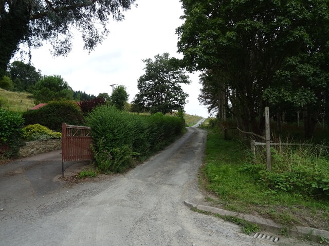
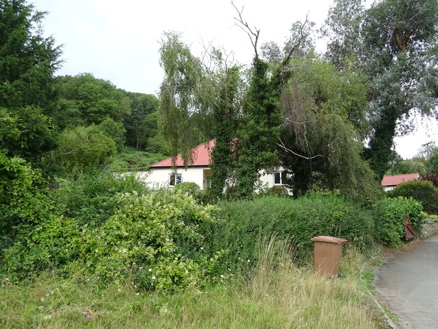
Shooter's Coppice Images

Images are sourced within 2km of 52.214322/-2.3649944 or Grid Reference SO7557. Thanks to Geograph Open Source API. All images are credited.

Track (footpath) off the A44, Darbys Green
Shortlands House on the A44, Darbys Green.
Shortlands
House on the A44, Darbys Green.
Barn, Darbys Green
Barn, Darbys Green
Bend in the A44, Darbys Green Towards Worcester.
Bend in the A44, Darbys Green
Towards Worcester.
Houses, Doddenham
Houses, Doddenham
Band in the A44, Doddenham Towards Worcester.
Band in the A44, Doddenham
Towards Worcester.
Footpath off the A44 south of Doddenham
Orchard near the River Teme
A44 towards Worcester
Direction Sign – Signpost on Easinghope Lane in Doddenham Located in the village on the north side of the T junction with Easinghope Lane, Doddenham parish. 1 modern arm and pawn finial. 

Milestone Society National ID: WO_SO7556
Direction Sign – Signpost on Easinghope Lane in Doddenham
Located in the village on the north side of the T junction with Easinghope Lane, Doddenham parish. 1 modern arm and pawn finial. Milestone Society National ID: WO_SO7556
Sheep with lambs in a field near Newhouse Farm
Pond near Newhouse Farm
Pond near Great Hopehouse Coppice
Stile off Hollins Lane With Great Hopehouse Coppice in the distance.
Stile off Hollins Lane
With Great Hopehouse Coppice in the distance.
Upper Holling Farmhouse, Hollins Lane There was an archaeological survey of the house done in 2021. <span class="nowrap"><a title="https://archaeologydataservice.ac.uk/archives/view/110archa1-379197/index.cfm" rel="nofollow ugc noopener" href="https://archaeologydataservice.ac.uk/archives/view/110archa1-379197/index.cfm">Link</a><img style="margin-left:2px;" alt="External link" title="External link - shift click to open in new window" src="https://s1.geograph.org.uk/img/external.png" width="10" height="10"/></span>
Upper Holling Farmhouse, Hollins Lane
There was an archaeological survey of the house done in 2021. LinkExternal link
Farm building at Upper Holling Farm, Hollins Lane
Timber farm building at Upper Holling Farm, Hollins Lane
Lower Hollins Farm from the fields Strange that this is Lower Hollins Farm at it is Upper Holling Farm.
Lower Hollins Farm from the fields
Strange that this is Lower Hollins Farm at it is Upper Holling Farm.
Show me another place!

Shooter's Coppice is located at Grid Ref: SO7557 (Lat: 52.214322, Lng: -2.3649944)

Administrative County: Worcestershire

District: Malvern Hills

Police Authority: West Mercia

What 3 Words

///smiles.truffles.superbly. Near Lower Broadheath, Worcestershire

Nearby Locations

Newtown Shooter's Coppice

Related Wikis

Berrow Green

Berrow Green is a village in Worcestershire, England. == Berrow Hill Camp == Berrow Green is situated just below Berrow Hill Camp, an Iron Age encampment...

Doddenham

Doddenham is a hamlet and civil parish (with Knightwick) in the Malvern Hills district in the county of Worcestershire, England. Doddenham was in the...

Stanford with Orleton

Stanford with Orleton is a civil parish in the Malvern Hills district, in the county of Worcestershire, England. The parish comprises the villages of Stanford...

Horsham, Worcestershire

Horsham is a village in Worcestershire, England. Remains of an old Iron Age fort are located within the village. == External links ==

Nearby Amenities

Located within 500m of 52.214322,-2.3649944
Power: pole
Lat/Long: 52.2150599/-2.3711872
Gurnox Farm
Power: pole
Transformer: distribution
Voltage Primary: 11000
Lat/Long: 52.2155716/-2.3696961
Power: pole
Lat/Long: 52.2157591/-2.367947
Power: pole
Lat/Long: 52.2159628/-2.366119
Barrier: stile
Foot: yes
Lat/Long: 52.2167752/-2.3674004
Hypsmoor Cottage
Power: pole
Transformer: distribution
Voltage Primary: 11000
Lat/Long: 52.2181692/-2.3651821
Power: pole
Lat/Long: 52.2176653/-2.3643638
Power: pole
Lat/Long: 52.2167759/-2.3636114
Power: pole
Lat/Long: 52.2172481/-2.3638146
Hypsmoor Farm
Power: pole
Transformer: distribution
Voltage Primary: 11000
Lat/Long: 52.2162686/-2.3633984
Power: pole
Lat/Long: 52.2161905/-2.3640808
Power: pole
Lat/Long: 52.2161055/-2.3648192
Power: pole
Lat/Long: 52.2160261/-2.3655562
Astlays
Power: pole
Transformer: distribution
Voltage Primary: 11000
Lat/Long: 52.2108528/-2.3631562
Power: pole
Lat/Long: 52.2108918/-2.3624568
Power: pole
Lat/Long: 52.2109378/-2.361616
Haynes Green Farm
Power: pole
Transformer: distribution
Voltage Primary: 11000
Lat/Long: 52.2106786/-2.3608871
Power: pole
Lat/Long: 52.2109798/-2.3608247
The data included in this document is from www.openstreetmap.org. The data is made available under ODbL.

Have you been to Shooter's Coppice?

Leave your review of Shooter's Coppice below (or comments, questions and feedback).