Pen Forest

Wood, Forest in Somerset South Somerset

England

Pen Forest

Old Milestone by road, Leigh Common; 20m East entrance Leigh Farm The Milestone is located in tarmac in front of disused building on verge on the North of the road.  Parish of Pen Selwood (South Somerset District). Metal plate attached to stone post, Wincanton iron plate design, erected by the Wincanton turnpike trust in the 19th Century, 12cm stump only. An earlier photograph can be found here: <a title="https://www.geograph.org.uk/photo/6102803" href="https://www.geograph.org.uk/photo/6102803">Link</a> 

Inscription reads:-   
(Wincanton / 2 / Hindon / 12 /) 

Milestone Society National ID: SO_WCHD02
Old Milestone by road, Leigh Common; 20m East entrance Leigh Farm Credit: Janet Dowding

Pen Forest is a charming woodland located in Somerset, England. Situated near the village of Pen and nestled in the picturesque countryside, it covers an area of approximately 100 acres. The forest is a popular destination for nature enthusiasts, hikers, and those seeking tranquility and relaxation.

Characterized by a diverse range of tree species, Pen Forest offers a captivating display of lush greenery throughout the year. Visitors can expect to encounter towering oak, beech, and ash trees, among others, creating a rich and varied ecosystem. The forest floor is adorned with a vibrant carpet of ferns, bluebells, and wildflowers, providing a delightful sight during the spring and summer months.

Walking trails wind their way through the forest, offering visitors the opportunity to explore its enchanting beauty at their own pace. The well-maintained paths are suitable for all ages and fitness levels, making it an ideal destination for families and individuals alike. Along the way, visitors may stumble upon hidden clearings, babbling brooks, and even a small pond, adding to the sense of discovery and wonder.

Wildlife is abundant in Pen Forest, with various species calling it home. Keen-eyed visitors may spot elusive woodland creatures such as deer, foxes, and rabbits, while bird enthusiasts can expect to see a range of species, including woodpeckers, owls, and thrushes.

Overall, Pen Forest offers a peaceful and captivating retreat, allowing visitors to immerse themselves in the beauty of nature. Whether it's a leisurely stroll, a picnic under the shade of a tree, or simply enjoying the serenity of the surroundings, Pen Forest provides a welcome escape from the hustle and bustle of everyday life.

If you have any feedback on the listing, please let us know in the comments section below.

Pen Forest Images

Images are sourced within 2km of 51.077421/-2.361524 or Grid Reference ST7430. Thanks to Geograph Open Source API. All images are credited.

Old Milestone by road, Leigh Common; 20m East entrance Leigh Farm The Milestone is located in tarmac in front of disused building on verge on the North of the road.  Parish of Pen Selwood (South Somerset District). Metal plate attached to stone post, Wincanton iron plate design, erected by the Wincanton turnpike trust in the 19th Century, 12cm stump only. An earlier photograph can be found here: <a title="https://www.geograph.org.uk/photo/6102803" href="https://www.geograph.org.uk/photo/6102803">Link</a> 

Inscription reads:-   
(Wincanton / 2 / Hindon / 12 /) 

Milestone Society National ID: SO_WCHD02
Old Milestone by road, Leigh Common; 20m East entrance Leigh Farm
The Milestone is located in tarmac in front of disused building on verge on the North of the road.  Parish of Pen Selwood (South Somerset District). Metal plate attached to stone post, Wincanton iron plate design, erected by the Wincanton turnpike trust in the 19th Century, 12cm stump only. An earlier photograph can be found here: Link  Inscription reads:- (Wincanton / 2 / Hindon / 12 /) Milestone Society National ID: SO_WCHD02
A303, eastbound The A303 is a main trunk road running 92 miles between Basingstoke and Honiton. Along with the A30 and M3 it forms a major route between London and the South West. Much of the road is dual carriageway, but some stretches remain single and prone to congestion.

Wikipedia: <span class="nowrap"><a title="http://en.wikipedia.org/wiki/A303_road" rel="nofollow ugc noopener" href="http://en.wikipedia.org/wiki/A303_road">Link</a><img style="margin-left:2px;" alt="External link" title="External link - shift click to open in new window" src="https://s1.geograph.org.uk/img/external.png" width="10" height="10"/></span>
A303, eastbound
The A303 is a main trunk road running 92 miles between Basingstoke and Honiton. Along with the A30 and M3 it forms a major route between London and the South West. Much of the road is dual carriageway, but some stretches remain single and prone to congestion. Wikipedia: LinkExternal link
Footbridge, A303 The A303 is a main trunk road running 92 miles between Basingstoke and Honiton. Along with the A30 and M3 it forms a major route between London and the South West. Much of the road is dual carriageway, but some stretches remain single and prone to congestion.

Wikipedia: <span class="nowrap"><a title="http://en.wikipedia.org/wiki/A303_road" rel="nofollow ugc noopener" href="http://en.wikipedia.org/wiki/A303_road">Link</a><img style="margin-left:2px;" alt="External link" title="External link - shift click to open in new window" src="https://s1.geograph.org.uk/img/external.png" width="10" height="10"/></span>
Footbridge, A303
The A303 is a main trunk road running 92 miles between Basingstoke and Honiton. Along with the A30 and M3 it forms a major route between London and the South West. Much of the road is dual carriageway, but some stretches remain single and prone to congestion. Wikipedia: LinkExternal link
Entering Somerset, A303 The A303 is a main trunk road running 92 miles between Basingstoke and Honiton. Along with the A30 and M3 it forms a major route between London and the South West. Much of the road is dual carriageway, but some stretches remain single and prone to congestion.

Wikipedia: <span class="nowrap"><a title="http://en.wikipedia.org/wiki/A303_road" rel="nofollow ugc noopener" href="http://en.wikipedia.org/wiki/A303_road">Link</a><img style="margin-left:2px;" alt="External link" title="External link - shift click to open in new window" src="https://s1.geograph.org.uk/img/external.png" width="10" height="10"/></span>
Entering Somerset, A303
The A303 is a main trunk road running 92 miles between Basingstoke and Honiton. Along with the A30 and M3 it forms a major route between London and the South West. Much of the road is dual carriageway, but some stretches remain single and prone to congestion. Wikipedia: LinkExternal link
B3081 off the A303 The A303 is a main trunk road running 92 miles between Basingstoke and Honiton. Along with the A30 and M3 it forms a major route between London and the South West. Much of the road is dual carriageway, but some stretches remain single and prone to congestion.

Wikipedia: <span class="nowrap"><a title="http://en.wikipedia.org/wiki/A303_road" rel="nofollow ugc noopener" href="http://en.wikipedia.org/wiki/A303_road">Link</a><img style="margin-left:2px;" alt="External link" title="External link - shift click to open in new window" src="https://s1.geograph.org.uk/img/external.png" width="10" height="10"/></span>
B3081 off the A303
The A303 is a main trunk road running 92 miles between Basingstoke and Honiton. Along with the A30 and M3 it forms a major route between London and the South West. Much of the road is dual carriageway, but some stretches remain single and prone to congestion. Wikipedia: LinkExternal link
A303, Leigh Common The A303 is a main trunk road running 92 miles between Basingstoke and Honiton. Along with the A30 and M3 it forms a major route between London and the South West. Much of the road is dual carriageway, but some stretches remain single and prone to congestion.

Wikipedia: <span class="nowrap"><a title="http://en.wikipedia.org/wiki/A303_road" rel="nofollow ugc noopener" href="http://en.wikipedia.org/wiki/A303_road">Link</a><img style="margin-left:2px;" alt="External link" title="External link - shift click to open in new window" src="https://s1.geograph.org.uk/img/external.png" width="10" height="10"/></span>
A303, Leigh Common
The A303 is a main trunk road running 92 miles between Basingstoke and Honiton. Along with the A30 and M3 it forms a major route between London and the South West. Much of the road is dual carriageway, but some stretches remain single and prone to congestion. Wikipedia: LinkExternal link
Layby, A303 The A303 is a main trunk road running 92 miles between Basingstoke and Honiton. Along with the A30 and M3 it forms a major route between London and the South West. Much of the road is dual carriageway, but some stretches remain single and prone to congestion.

Wikipedia: <span class="nowrap"><a title="http://en.wikipedia.org/wiki/A303_road" rel="nofollow ugc noopener" href="http://en.wikipedia.org/wiki/A303_road">Link</a><img style="margin-left:2px;" alt="External link" title="External link - shift click to open in new window" src="https://s1.geograph.org.uk/img/external.png" width="10" height="10"/></span>
Layby, A303
The A303 is a main trunk road running 92 miles between Basingstoke and Honiton. Along with the A30 and M3 it forms a major route between London and the South West. Much of the road is dual carriageway, but some stretches remain single and prone to congestion. Wikipedia: LinkExternal link
A wet entry to Wiltshire, A303 The A303 is a main trunk road running 92 miles between Basingstoke and Honiton. Along with the A30 and M3 it forms a major route between London and the South West. Much of the road is dual carriageway, but some stretches remain single and prone to congestion.

Wikipedia: <span class="nowrap"><a title="http://en.wikipedia.org/wiki/A303_road" rel="nofollow ugc noopener" href="http://en.wikipedia.org/wiki/A303_road">Link</a><img style="margin-left:2px;" alt="External link" title="External link - shift click to open in new window" src="https://s1.geograph.org.uk/img/external.png" width="10" height="10"/></span>
A wet entry to Wiltshire, A303
The A303 is a main trunk road running 92 miles between Basingstoke and Honiton. Along with the A30 and M3 it forms a major route between London and the South West. Much of the road is dual carriageway, but some stretches remain single and prone to congestion. Wikipedia: LinkExternal link
A303 bridge over B3081 There is interchange in all directions here, but not via Beech Lane on the left, which is a local road.
A303 bridge over B3081
There is interchange in all directions here, but not via Beech Lane on the left, which is a local road.
B3081 towards Bruton Here running closely parallel to the A303, which is behind the hedge on the left.
B3081 towards Bruton
Here running closely parallel to the A303, which is behind the hedge on the left.
The A303, Riding Gate
The A303, West Bourton
Layby on the A303, Riding Gate
The A303, Riding Gate
Drain by the A303, West Bourton This is not a normal rain catcher on the kerb (like the one next to it) but the sort which normally supplies an underground stream.
Drain by the A303, West Bourton
This is not a normal rain catcher on the kerb (like the one next to it) but the sort which normally supplies an underground stream.
Old Milestone on Leigh Common Metal plate attached to stone post by the UC road, in parish of Pen Selwood (South Somerset District), Leigh Common; 20m East of entrance to Leigh Farm, in tarmac in front of disused petrol filling station, on verge, on North side of road. Wincanton iron plate, erected by the Wincanton turnpike trust in the 19th century. 

Inscription once read:-
(Wincanton)
(2)
(Hindon)
(12)   

Milestone Society National ID: SO_WCHD02
Old Milestone on Leigh Common
Metal plate attached to stone post by the UC road, in parish of Pen Selwood (South Somerset District), Leigh Common; 20m East of entrance to Leigh Farm, in tarmac in front of disused petrol filling station, on verge, on North side of road. Wincanton iron plate, erected by the Wincanton turnpike trust in the 19th century. Inscription once read:- (Wincanton) (2) (Hindon) (12) Milestone Society National ID: SO_WCHD02
Leigh Common: The B3081 soon to join the A303
Leigh Common: The approach to a field used for grazing
Show me another place!

Pen Forest is located at Grid Ref: ST7430 (Lat: 51.077421, Lng: -2.361524)

Administrative County: Somerset

District: South Somerset

Police Authority: Avon and Somerset

What 3 Words

///parkway.hooked.satellite. Near Bourton, Dorset

Nearby Locations

Pen Forest

Related Wikis

Ballands Castle

Ballands Castle was a castle near the village of Penselwood, Somerset, England. == History == Balland Castle was a motte and bailey castle, probably built...

Penselwood

Penselwood is a village and civil parish in the English county of Somerset. It is located 4 miles (6.4 km) north east of Wincanton, 4 miles (6.4 km) south...

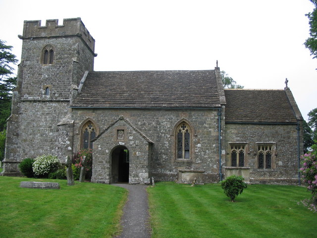
Church of St Michael and All Angels, Penselwood

The Anglican Church of St Michael and All Angels in Penselwood, Somerset, England was built in the 15th century. It is a Grade II* listed building. �...

Cockroad Wood Castle

Cockroad Wood Castle was a castle near Wincanton but now in the parish of Charlton Musgrove, Somerset, England. == History == Cockroad Wood Castle was...

Stavordale Priory

Stavordale Priory near Charlton Musgrove, Somerset, England was built as a priory of Augustinian canons in the 13th century and was converted into a private...

Bourton, Dorset

Bourton is a village and civil parish in north Dorset, England, situated north of the A303 road on the border with Somerset and Wiltshire between Mere...

Charlton Musgrove

Charlton Musgrove is a village and civil parish in Somerset, England, situated 1 mile (1.6 km) north east of Wincanton in the South Somerset district....

Kenwalch's Castle

Kenwalch's Castle is probably an Iron Age hill fort that may have been converted into a Roman fortress, near Penselwood, Somerset, England, 6.6 kilometres...

Nearby Amenities

Located within 500m of 51.077421,-2.361524
The data included in this document is from www.openstreetmap.org. The data is made available under ODbL.

Have you been to Pen Forest?

Leave your review of Pen Forest below (or comments, questions and feedback).