Whitman's Hill Coppice

Wood, Forest in Herefordshire

England

Whitman's Hill Coppice

Norrest Wood from the footpath The footpath entrance stile was somewhat overgrown when visited, but can just about be negotiated by those with long legs or decent balance.  Look for a small gap in the hedge back from the road surface.
Norrest Wood from the footpath Credit: Peter Whatley

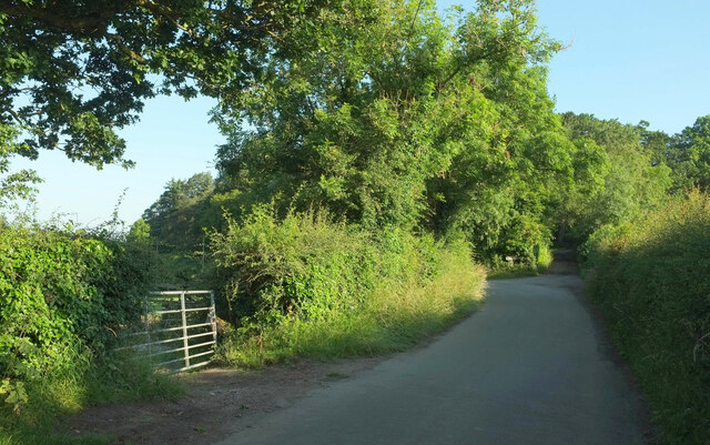
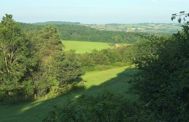
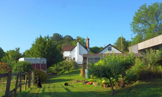
Whitman's Hill Coppice is a picturesque woodland located in Herefordshire, England. Nestled in the heart of the county, this captivating forest spans over a vast area, making it a popular destination for nature enthusiasts and hikers alike.

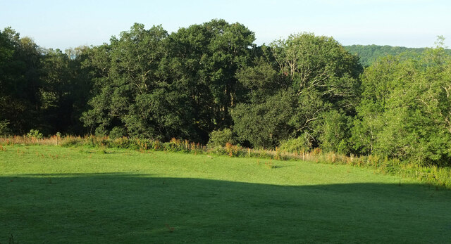
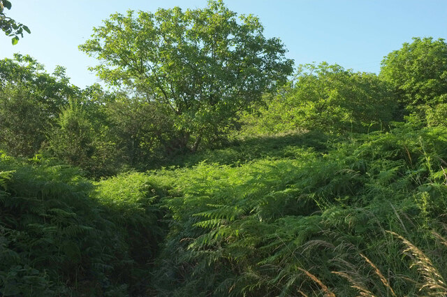
The coppice is characterized by its diverse ecosystem, boasting a rich variety of plant and animal species. Towering oak, beech, and ash trees dominate the landscape, creating a dense canopy that offers shade and shelter to the woodland floor below. Lush ferns, bluebells, and wild garlic carpet the ground, adding a vibrant burst of color to the forest during the spring and summer months.

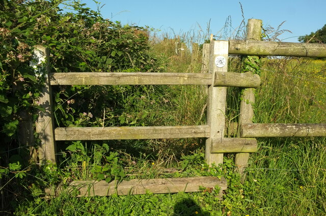
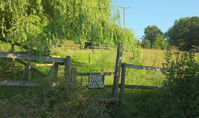
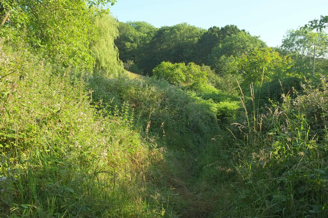
Visitors to Whitman's Hill Coppice can enjoy a tranquil and serene atmosphere as they meander through the well-maintained pathways that traverse the woodland. Along the way, they may encounter an array of wildlife, including deer, foxes, and a plethora of bird species, making it a haven for birdwatchers.

The coppice also holds historical significance, serving as a remnant of the ancient woodlands that once covered the region. Its age-old trees bear witness to centuries of human activity, and remnants of old charcoal kilns can still be found, serving as a reminder of the area's past use for charcoal production.

Overall, Whitman's Hill Coppice is a stunning natural gem that showcases the beauty and diversity of Herefordshire's woodlands. Whether one seeks solitude, nature exploration, or a glimpse into the area's past, this enchanting forest offers an unforgettable experience for all who venture within its leafy embrace.

If you have any feedback on the listing, please let us know in the comments section below.

Whitman's Hill Coppice Images

Images are sourced within 2km of 52.131304/-2.3707723 or Grid Reference SO7448. Thanks to Geograph Open Source API. All images are credited.

Norrest Wood from the footpath The footpath entrance stile was somewhat overgrown when visited, but can just about be negotiated by those with long legs or decent balance.  Look for a small gap in the hedge back from the road surface.
Norrest Wood from the footpath
The footpath entrance stile was somewhat overgrown when visited, but can just about be negotiated by those with long legs or decent balance. Look for a small gap in the hedge back from the road surface.
Driveway to Birchwood House
Birchwood Common from Birchwood Lane
Birchwood Lane This shows the 40 metre stretch of the lane used by the Geopark Way, which has just joined from the right, and turns right into a field at the track junction ahead, although it rejoins the lane for a while about a kilometre ahead.
Birchwood Lane
This shows the 40 metre stretch of the lane used by the Geopark Way, which has just joined from the right, and turns right into a field at the track junction ahead, although it rejoins the lane for a while about a kilometre ahead.
Geopark Way leaves Birchwood Lane Larger sizes of this may reveal the pencil of light coming through the right-hand hedge where the Way follows Cradley footpath CD64 rather than the track to Birchwood House.
Geopark Way leaves Birchwood Lane
Larger sizes of this may reveal the pencil of light coming through the right-hand hedge where the Way follows Cradley footpath CD64 rather than the track to Birchwood House.
Birchwood Common From the junction where the Geopark Way leaves the lane as shown in <a href="https://www.geograph.org.uk/photo/7266435">SO7550 : Geopark Way leaves Birchwood Lane</a>. This field is on a ridge.
Birchwood Common
From the junction where the Geopark Way leaves the lane as shown in SO7550 : Geopark Way leaves Birchwood Lane. This field is on a ridge.
Birchwood Common The field and trees are seen from a different direction in <a href="https://www.geograph.org.uk/photo/7266462">SO7450 : Birchwood Common</a>.
Birchwood Common
The field and trees are seen from a different direction in SO7450 : Birchwood Common.
Birchwood Common Looking right from <a href="https://www.geograph.org.uk/photo/7266532">SO7450 : Birchwood Common</a>. The clump of tree on the left hides a pond.
Birchwood Common
Looking right from SO7450 : Birchwood Common. The clump of tree on the left hides a pond.
Birchwood Lane Looking right from <a href="https://www.geograph.org.uk/photo/7266548">SO7450 : Birchwood Common</a> along a lane in shadow from the wooded grounds of Birchwood Hall.
Birchwood Lane
Looking right from SO7450 : Birchwood Common along a lane in shadow from the wooded grounds of Birchwood Hall.
Field on Geopark Way Taken looking right from <a href="https://www.geograph.org.uk/photo/7266638">SO7549 : Stile on Geopark Way</a>, on Cradley footpath CD62. The Way, having followed Birchwood lane for 40 metres (see <a href="https://www.geograph.org.uk/photo/7266211">SO7550 : Birchwood Lane</a> and <a href="https://www.geograph.org.uk/photo/7266435">SO7550 : Geopark Way leaves Birchwood Lane</a>), re-enters the same field on Cradley footpath CD64. However, electric fencing suggests that it is not permissible to take a short cut across the field.
Field on Geopark Way
Taken looking right from SO7549 : Stile on Geopark Way, on Cradley footpath CD62. The Way, having followed Birchwood lane for 40 metres (see SO7550 : Birchwood Lane and SO7550 : Geopark Way leaves Birchwood Lane), re-enters the same field on Cradley footpath CD64. However, electric fencing suggests that it is not permissible to take a short cut across the field.
Stile on Geopark Way On Cradley footpath CD62, with the Geopark Way logo visible on the waymark.
Stile on Geopark Way
On Cradley footpath CD62, with the Geopark Way logo visible on the waymark.
Geopark Way at Old Norrest The Way takes a rather eccentric course as it follows Cradley footpath CD62 around Old Norrest; see <a href="https://www.geograph.org.uk/photo/7268709">SO7550 : Geopark Way at Old Norrest</a>, for instance.
Geopark Way at Old Norrest
The Way takes a rather eccentric course as it follows Cradley footpath CD62 around Old Norrest; see SO7550 : Geopark Way at Old Norrest, for instance.
Geopark Way at Old Norrest A reverse view of <a href="https://www.geograph.org.uk/photo/7268625">SO7550 : Geopark Way at Old Norrest</a>. A damaged Geopark Way gives some semblance of authority to this route, the hand-painted directions over a stile lacking a cross-piece perhaps less so. This is Cradley footpath CD62.
Geopark Way at Old Norrest
A reverse view of SO7550 : Geopark Way at Old Norrest. A damaged Geopark Way gives some semblance of authority to this route, the hand-painted directions over a stile lacking a cross-piece perhaps less so. This is Cradley footpath CD62.
Old Norrest The listed cottage <span class="nowrap"><a title="https://historicengland.org.uk/listing/the-list/list-entry/1177082" rel="nofollow ugc noopener" href="https://historicengland.org.uk/listing/the-list/list-entry/1177082">Link</a><img style="margin-left:2px;" alt="External link" title="External link - shift click to open in new window" src="https://s1.geograph.org.uk/img/external.png" width="10" height="10"/></span> is also seen in <a href="https://www.geograph.org.uk/photo/6899038">SO7550 : Old Norrest</a>.
Old Norrest
The listed cottage LinkExternal link is also seen in SO7550 : Old Norrest.
Geopark Way at Old Norrest The Way follows painted arrows along Cradley footpath CD62.
Geopark Way at Old Norrest
The Way follows painted arrows along Cradley footpath CD62.
Geopark Way at Old Norrest Looking right from <a href="https://www.geograph.org.uk/photo/6899038">SO7550 : Old Norrest</a> past a willow as Cradley footpath CD62 - or 61, not quite sure which here - makes its way around the farm.
Geopark Way at Old Norrest
Looking right from SO7550 : Old Norrest past a willow as Cradley footpath CD62 - or 61, not quite sure which here - makes its way around the farm.
Geopark Way at Old Norrest Looking right from <a href="https://www.geograph.org.uk/photo/7268791">SO7550 : Geopark Way at Old Norrest</a>, as the Way, following Cradley footpath CD61, seems to vanish in a sea of bracken. Ahead is a walnut grove.
Geopark Way at Old Norrest
Looking right from SO7550 : Geopark Way at Old Norrest, as the Way, following Cradley footpath CD61, seems to vanish in a sea of bracken. Ahead is a walnut grove.
Geopark Way approaching Old Norrest Early morning on Cradley footpath CD61.
Geopark Way approaching Old Norrest
Early morning on Cradley footpath CD61.
Show me another place!

Whitman's Hill Coppice is located at Grid Ref: SO7448 (Lat: 52.131304, Lng: -2.3707723)

Unitary Authority: County of Herefordshire

Police Authority: West Mercia

What 3 Words

///mourner.ready.baked. Near Great Malvern, Worcestershire

Nearby Locations

Whitman's Hill Coppice

Related Wikis

Cradley, Herefordshire

Cradley () is a village in the civil parish of Cradley and Storridge, in Herefordshire, England. The nearest Herefordshire to Cradley towns are Ledbury...

Church of St Peter, Cowleigh

The Church of St Peter, Cowleigh, is a Grade II listed Anglican church in the parish of Malvern Link and Cowleigh. It was built in 1865, and was designed...

West Malvern

West Malvern is a village and a civil parish on the west side of the north part of the Malvern Hills, on the western edge of Worcestershire, England. It...

End Hill

End Hill is the northernmost top of the Malvern Hills that runs approximately 13 kilometres (8 mi) north-south along the Herefordshire-Worcestershire border...

Nearby Amenities

Located within 500m of 52.131304,-2.3707723
Post Box
Collection Plate: CP7
Collection Times: Mo-Fr 16:15; Sa 09:15
Historic Operator: Post Office
Post Box Type: lamp
Ref: WR13 23
Royal Cypher: EIIR
Royal Cypher Wikidata: Q33102113
Lat/Long: 52.1354845/-2.3704481
Telephone
Booth: K6
Covered: booth
Operator: BT
Phone: +44 1886 880411
Lat/Long: 52.1354982/-2.3703931
Barrier: stile
Lat/Long: 52.1301627/-2.3650175
Barrier: stile
Lat/Long: 52.1306709/-2.3658151
Whitmans Hill Farm
Power: pole
Transformer: distribution
Voltage Primary: 11000
Lat/Long: 52.1318383/-2.3639958
Brook House Farm Storridge
Power: pole
Transformer: distribution
Voltage Primary: 11000
Lat/Long: 52.1327196/-2.3776153
Power: pole
Lat/Long: 52.1328892/-2.3770943
Power: pole
Lat/Long: 52.1331559/-2.376572
Power: pole
Lat/Long: 52.1334193/-2.376065
Power: pole
Lat/Long: 52.1338988/-2.3752758
Rose Garth
Power: pole
Transformer: distribution
Voltage Primary: 11000
Lat/Long: 52.1345792/-2.3741707
Power: pole
Lat/Long: 52.1346998/-2.3738743
Power: pole
Lat/Long: 52.13505/-2.3730683
Power: pole
Lat/Long: 52.1355065/-2.3720028
Woodside
Power: pole
Transformer: distribution
Voltage Primary: 11000
Lat/Long: 52.1350957/-2.3703318
Power: pole
Lat/Long: 52.1354398/-2.3706999
Power: pole
Lat/Long: 52.1356617/-2.370936
Whitmans Hill
Power: pole
Transformer: distribution
Voltage Primary: 11000
Lat/Long: 52.1333567/-2.3685106
Power: pole
Lat/Long: 52.1341227/-2.3676234
Hillwyn
Power: pole
Transformer: distribution
Voltage Primary: 11000
Lat/Long: 52.1344565/-2.3663514
Power: pole
Lat/Long: 52.1346759/-2.3670153
Power: pole
Lat/Long: 52.1349122/-2.3677435
The data included in this document is from www.openstreetmap.org. The data is made available under ODbL.

Have you been to Whitman's Hill Coppice?

Leave your review of Whitman's Hill Coppice below (or comments, questions and feedback).