Mason's Covert

Wood, Forest in Worcestershire Malvern Hills

England

Mason's Covert

Meadow in the Teme valley Meadow in the Teme valley near Ham Farm.
Meadow in the Teme valley Credit: Philip Halling

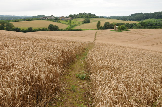
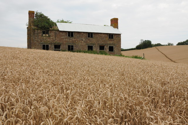
Mason's Covert, Worcestershire, also known as Mason's Wood or Mason's Forest, is a picturesque woodland located in the county of Worcestershire, England. Spread across an approximate area of 200 acres, this enchanting forest offers a peaceful and serene retreat for nature lovers and outdoor enthusiasts.

The woodland is characterized by its dense canopy of trees, predominantly composed of oak, beech, and ash, which provide a vibrant display of colors throughout the seasons. The forest floor is covered with a rich carpet of wildflowers, ferns, and moss, creating a diverse and thriving ecosystem. Ancient pathways meander through the woods, inviting visitors to explore and discover the beauty hidden within.

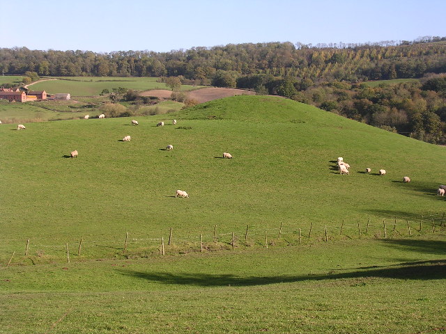
Mason's Covert is home to a variety of wildlife, making it a haven for nature enthusiasts. Visitors may spot deer gracefully roaming through the undergrowth, squirrels scurrying up the trees, and a plethora of bird species filling the air with their melodious songs. The forest is also known to harbor a range of smaller mammals, such as badgers, foxes, and hedgehogs.

The woodland offers numerous recreational opportunities for visitors. Hiking trails wind through the forest, allowing adventurers to immerse themselves in the tranquil surroundings. Additionally, there are designated picnic areas where visitors can enjoy a leisurely meal amidst the natural beauty. The forest is also a popular location for birdwatching, photography, and nature study.

Mason's Covert, Worcestershire, is a captivating woodland that offers a peaceful escape from the bustle of everyday life. Whether one seeks solace in nature, wishes to explore the diverse wildlife, or simply desires a rejuvenating outdoor experience, this forest is sure to leave visitors with lasting memories of its enchanting beauty.

If you have any feedback on the listing, please let us know in the comments section below.

Mason's Covert Images

Images are sourced within 2km of 52.239192/-2.3729747 or Grid Reference SO7460. Thanks to Geograph Open Source API. All images are credited.

Meadow in the Teme valley Meadow in the Teme valley near Ham Farm.
Meadow in the Teme valley
Meadow in the Teme valley near Ham Farm.
Timber framed barn, Ham Farm A traditional old timber-framed barn at Ham Farm in the Teme valley near Clifton upon Teme.
Timber framed barn, Ham Farm
A traditional old timber-framed barn at Ham Farm in the Teme valley near Clifton upon Teme.
Old farm building, Ham Farm Until recently a partial roof was still intact above the wall on the left of the red-brick building, see: <a href="https://www.geograph.org.uk/photo/62881">SO7359 : Ham Farm</a>
Old farm building, Ham Farm
Until recently a partial roof was still intact above the wall on the left of the red-brick building, see: SO7359 : Ham Farm
Footpath through a wheat field Footpath through a wheat field in the Teme valley with the farm at Tedney House in the near distance.
Footpath through a wheat field
Footpath through a wheat field in the Teme valley with the farm at Tedney House in the near distance.
Abandoned Hillhouse Cottages Now completely surrounded by a crop of wheat, even now Hillhouse Cottages display a robustness.  They echo the feeling that they belong on a windswept Bronte moorland.
Abandoned Hillhouse Cottages
Now completely surrounded by a crop of wheat, even now Hillhouse Cottages display a robustness. They echo the feeling that they belong on a windswept Bronte moorland.
Berrow Hill Walked north from the pub then made may through tracks or gaps in woodland to gain summit field. Beacon bagged first then headed south to next knoll to bag trig.
Name: Berrow Hill
Hill number: 5377
Height: 183m / 600ft
Area: 38B: West Gloucestershire, Hereford & Worcester
Class: Hu
Grid ref: SO 74462 58607
Summit feature: beacon
Drop: 105m
Col: 78m  SO745595
Berrow Hill
Walked north from the pub then made may through tracks or gaps in woodland to gain summit field. Beacon bagged first then headed south to next knoll to bag trig. Name: Berrow Hill Hill number: 5377 Height: 183m / 600ft Area: 38B: West Gloucestershire, Hereford & Worcester Class: Hu Grid ref: SO 74462 58607 Summit feature: beacon Drop: 105m Col: 78m SO745595
Admiral Rodney (1), Berrow Green near Martley, Worcs A popular pub, with accommodation, on the B4197 road in the small village of Berrow Green.

<a href="https://www.geograph.org.uk/photo/3426621">SO7458 : Admiral Rodney (2) - sign, Berrow Green near Martley, Worcs</a>.
Admiral Rodney (1), Berrow Green near Martley, Worcs
A popular pub, with accommodation, on the B4197 road in the small village of Berrow Green. SO7458 : Admiral Rodney (2) - sign, Berrow Green near Martley, Worcs.
Admiral Rodney (2) - sign, Berrow Green near Martley, Worcs There are several public houses in England named after Admiral Rodney, who was a famous naval figure in the late 18th century. George Brydges Rodney, 1st Baron Rodney, KB (baptised 13 February 1718; died 24 May 1792) is particularly remembered for his commands in the American War of Independence, and especially for his victory over the French at the Battle of the Saintes in 1782. The use of Rodney as a first name for boys was due to the Admiral's fame. It became a popular name at the end of the 18th century.

The sign for this pub, as with most, has changed over the years. The present one, which is fairly recent, is virtually a copy of the well-known portrait by Thomas Gainsborough of 1782. It depicts the Admiral at the Battle of the Saintes, and behind him is the French Fleur de Lys naval ensign from the captured ship "Ville de Paris".

<a href="https://www.geograph.org.uk/photo/3426573">SO7458 : Admiral Rodney (1), Berrow Green near Martley, Worcs</a>.
Admiral Rodney (2) - sign, Berrow Green near Martley, Worcs
There are several public houses in England named after Admiral Rodney, who was a famous naval figure in the late 18th century. George Brydges Rodney, 1st Baron Rodney, KB (baptised 13 February 1718; died 24 May 1792) is particularly remembered for his commands in the American War of Independence, and especially for his victory over the French at the Battle of the Saintes in 1782. The use of Rodney as a first name for boys was due to the Admiral's fame. It became a popular name at the end of the 18th century. The sign for this pub, as with most, has changed over the years. The present one, which is fairly recent, is virtually a copy of the well-known portrait by Thomas Gainsborough of 1782. It depicts the Admiral at the Battle of the Saintes, and behind him is the French Fleur de Lys naval ensign from the captured ship "Ville de Paris". SO7458 : Admiral Rodney (1), Berrow Green near Martley, Worcs.
The Crown (1), Martley, Worcs The Crown is a large and much extended public house and restaurant in the village of Martley, on the B4197 road. Photographed early on a Saturday afternoon, the pub looked firmly closed but apparently on most days it does not open until 6pm, and on Mondays it doesn't open at all.

<a href="https://www.geograph.org.uk/photo/3426691">SO7559 : The Crown (2) - sign, Martley, Worcs</a>.
<a href="https://www.geograph.org.uk/photo/3426723">SO7559 : The Crown (3), Martley, Worcs</a>.
The Crown (1), Martley, Worcs
The Crown is a large and much extended public house and restaurant in the village of Martley, on the B4197 road. Photographed early on a Saturday afternoon, the pub looked firmly closed but apparently on most days it does not open until 6pm, and on Mondays it doesn't open at all. SO7559 : The Crown (2) - sign, Martley, Worcs. SO7559 : The Crown (3), Martley, Worcs.
The Crown (2) - sign, Martley, Worcs The pub is not a Marston's house, according to the brewery website, although it may well sell their beer.

The name of the Crown indicates loyalty to the reigning monarch. It has been used as an inn or pub sign for hundreds of years. In the past, when most people were illiterate, the sign was easily recognised by people. The Crown is almost as popular as the Red Lion as a pub name.

<a href="https://www.geograph.org.uk/photo/3426671">SO7559 : The Crown (1), Martley, Worcs</a>.
<a href="https://www.geograph.org.uk/photo/3426723">SO7559 : The Crown (3), Martley, Worcs</a>.
The Crown (2) - sign, Martley, Worcs
The pub is not a Marston's house, according to the brewery website, although it may well sell their beer. The name of the Crown indicates loyalty to the reigning monarch. It has been used as an inn or pub sign for hundreds of years. In the past, when most people were illiterate, the sign was easily recognised by people. The Crown is almost as popular as the Red Lion as a pub name. SO7559 : The Crown (1), Martley, Worcs. SO7559 : The Crown (3), Martley, Worcs.
The Crown (3), Martley, Worcs Viewed from this side, the considerable extension to the original building can clearly be seen. The pub is adjacent to some farmland. There is currently a very controversial planning application to build fifty one houses on some of this.

<a href="https://www.geograph.org.uk/photo/3426671">SO7559 : The Crown (1), Martley, Worcs</a>.
<a href="https://www.geograph.org.uk/photo/3426691">SO7559 : The Crown (2) - sign, Martley, Worcs</a>.
The Crown (3), Martley, Worcs
Viewed from this side, the considerable extension to the original building can clearly be seen. The pub is adjacent to some farmland. There is currently a very controversial planning application to build fifty one houses on some of this. SO7559 : The Crown (1), Martley, Worcs. SO7559 : The Crown (2) - sign, Martley, Worcs.
Martley Post Office and Off-licence, Martley, Worcs The Post Office and Off-licence is next door to the garage and petrol station, and opposite to the junction of the B4197 and B4204 roads.
Martley Post Office and Off-licence, Martley, Worcs
The Post Office and Off-licence is next door to the garage and petrol station, and opposite to the junction of the B4197 and B4204 roads.
Admiral Rodney at dusk on New Year's Eve
Oast House at Hope House Farm, Martley
House along Hopehouse Lane near Martley
Footpath through the crops to Martley
Hopehouse Lane towards Hopehouse Farm
Hopehouse Lane towards Martley
Show me another place!

Mason's Covert is located at Grid Ref: SO7460 (Lat: 52.239192, Lng: -2.3729747)

Administrative County: Worcestershire

District: Malvern Hills

Police Authority: West Mercia

What 3 Words

///lavished.pronouns.chitchat. Near Lower Broadheath, Worcestershire

Related Wikis

Martley

Martley is a village and civil parish in the Malvern Hills district of the English county of Worcestershire. It is approximately nine miles north-west...

The Chantry School

The Chantry School is a mixed gender secondary school with academy status located in Martley, Worcestershire, England. The school has about 700 students...

Ham Castle

Ham Castle (also known as Home or Homme Castle) is located in Worcestershire at the bottom of a wooded escarpment (and close to the River Teme), within...

Berrow Green

Berrow Green is a village in Worcestershire, England. == Berrow Hill Camp == Berrow Green is situated just below Berrow Hill Camp, an Iron Age encampment...

Horsham, Worcestershire

Horsham is a village in Worcestershire, England. Remains of an old Iron Age fort are located within the village. == External links ==

Shelsley Beauchamp

Shelsley Beauchamp or Great Shelsley is a village and civil parish 9 miles (14 km) north west of Worcester, in the Malvern Hills district, in the county...

Doddenham

Doddenham is a hamlet and civil parish (with Knightwick) in the Malvern Hills district in the county of Worcestershire, England. Doddenham was in the...

Stanford with Orleton

Stanford with Orleton is a civil parish in the Malvern Hills district, in the county of Worcestershire, England. The parish comprises the villages of Stanford...

Related Videos

The Rodney hotel dogs friendly place travelling around Malvern hills

Amazing hotel if you travel with dog a lot of walking places around new refurbished rooms all very clean it's definitely worth every ...

A WILD CAMP on The Worcestershire Way - PUBS, PINTS and a LEG BREAKING WALK

Marc and Matt do a 15 mile pub crawl on the Worcestershire Way, starting from Martley to Bringstey Common and back. They then ...

It's that time of year again! Wild garlic, Eggs and spring sunshine. #wildgarlic #ramps #SRP

It's the simple pleasures... Join me as I forage for the first free ingredient of the season, the wonderfully fragrant and versatile wild ...

Why I Left my Hometown | My Good & Bad Experiences

Leaving your hometown can be quite a daunting prospect, however, I believe there is a lot of personal growth and development to ...

Nearby Amenities

Located within 500m of 52.239192,-2.3729747
Barrier: kissing_gate
Foot: yes
Lat/Long: 52.236642/-2.3750981
Barrier: stile
Foot: yes
Lat/Long: 52.2415898/-2.376462
Information: guidepost
Tourism: information
Lat/Long: 52.2389765/-2.3675439
Barrier: stile
Foot: yes
Lat/Long: 52.2370559/-2.3729584
Power: pole
Lat/Long: 52.2354473/-2.3694174
Power: pole
Lat/Long: 52.2359605/-2.3703911
Power: pole
Lat/Long: 52.236366/-2.3711126
Kingswood Common
Power: pole
Transformer: distribution
Voltage Primary: 11000
Lat/Long: 52.2364083/-2.3750172
Barrier: kissing_gate
Foot: yes
Lat/Long: 52.2364851/-2.375199
Barrier: stile
Foot: yes
Lat/Long: 52.2366119/-2.3750815
Power: pole
Lat/Long: 52.2367743/-2.3718774
Power: pole
Lat/Long: 52.237169/-2.3736372
Power: pole
Lat/Long: 52.2372545/-2.3722043
Power: pole
Lat/Long: 52.2377639/-2.3725764
Power: pole
Lat/Long: 52.2381954/-2.3728096
Bench
Lat/Long: 52.2397249/-2.3745146
Fixme: continue
Lat/Long: 52.238875/-2.37435
Power: pole
Lat/Long: 52.2390831/-2.3719273
Power: pole
Lat/Long: 52.2391768/-2.3795214
Power: pole
Lat/Long: 52.2395871/-2.3789805
Barrier: stile
Foot: yes
Lat/Long: 52.2397917/-2.3744195
Barrier: stile
Foot: yes
Lat/Long: 52.2398429/-2.3744301
Power: pole
Lat/Long: 52.2399324/-2.3710163
Power: pole
Lat/Long: 52.2400356/-2.3784016
Ham Mill Farm
Power: pole
Transformer: distribution
Voltage Primary: 11000
Lat/Long: 52.2402644/-2.3780993
Bench
Lat/Long: 52.2403797/-2.3750424
Power: pole
Lat/Long: 52.2404881/-2.3716163
Power: pole
Lat/Long: 52.2407669/-2.3774166
Power: pole
Lat/Long: 52.2408578/-2.3758985
Power: pole
Lat/Long: 52.2409572/-2.3748292
Power: pole
Lat/Long: 52.2410974/-2.3732286
Power: pole
Lat/Long: 52.2411831/-2.3723867
Power: pole
Lat/Long: 52.2416019/-2.3779714
Power: pole
Lat/Long: 52.2412036/-2.3768596
Power: pole
Lat/Long: 52.2428353/-2.3697813
Power: pole
Lat/Long: 52.2422662/-2.370075
Power: pole
Lat/Long: 52.2415501/-2.3704612
Power: pole
Lat/Long: 52.2410266/-2.3710292
The data included in this document is from www.openstreetmap.org. The data is made available under ODbL.

Have you been to Mason's Covert?

Leave your review of Mason's Covert below (or comments, questions and feedback).