Charlcombe Wood

Wood, Forest in Somerset

England

Charlcombe Wood

Farmland at Tadwick Farmland in a valley at Tadwick.
Farmland at Tadwick Credit: Philip Halling

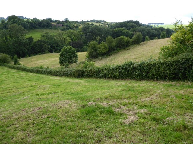
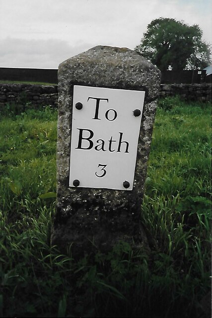
Charlcombe Wood is a picturesque woodland located in Somerset, England. Situated just two miles north of Bath, it covers an area of approximately 26 acres and is a popular destination for nature lovers and outdoor enthusiasts.

The woodland is predominantly composed of broadleaved trees, including oak, beech, and ash, which create a lush and vibrant canopy that stretches across the landscape. This diverse range of tree species provides a rich habitat for a variety of wildlife, including birds, mammals, and insects.

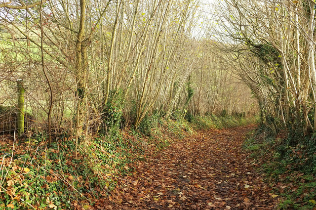
Visitors to Charlcombe Wood can explore a network of well-maintained footpaths that wind their way through the woodland, offering stunning views and opportunities for peaceful walks and hikes. The paths are clearly marked, making navigation easy for visitors of all ages and abilities.

The wood is also home to an abundance of wildflowers, particularly in the spring and summer months. Bluebells, primroses, and wood anemones carpet the forest floor, creating a breathtaking display of colors and scents.

In addition to its natural beauty, Charlcombe Wood has historical significance. It is believed to have been part of the ancient Forest of Selwood, which once covered a vast area of Somerset. The wood has been managed as a nature reserve by the Avon Wildlife Trust since 1985, ensuring its preservation for future generations.

Overall, Charlcombe Wood offers a tranquil and enchanting escape from the bustling city, providing a haven for both nature enthusiasts and those seeking a peaceful retreat amidst the beauty of the Somerset countryside.

If you have any feedback on the listing, please let us know in the comments section below.

Charlcombe Wood Images

Images are sourced within 2km of 51.412237/-2.3693942 or Grid Reference ST7468. Thanks to Geograph Open Source API. All images are credited.

Farmland at Tadwick Farmland in a valley at Tadwick.
Farmland at Tadwick
Farmland in a valley at Tadwick.
2008 : Manor Farm near Tadwick Looking west from Tadwick Lane. The Battle of Lansdown took place near the top of the far hill in 1643.
2008 : Manor Farm near Tadwick
Looking west from Tadwick Lane. The Battle of Lansdown took place near the top of the far hill in 1643.
Path on Manor Farm The path descends steeply in the direction of Tadwick.  The gate looks new, like many around here.
Path on Manor Farm
The path descends steeply in the direction of Tadwick. The gate looks new, like many around here.
Sheep, Manor Farm From footpath BA 5/24, looking across the steep valley of a headwater of the Lam Brook. At upper left is the listed Manor Farm <span class="nowrap"><a title="https://historicengland.org.uk/listing/the-list/list-entry/1276985" rel="nofollow ugc noopener" href="https://historicengland.org.uk/listing/the-list/list-entry/1276985">Link</a><img style="margin-left:2px;" alt="External link" title="External link - shift click to open in new window" src="https://s1.geograph.org.uk/img/external.png" width="10" height="10"/></span> , with three gables on the facade - also shown at <a href="https://www.geograph.org.uk/photo/2618551">ST7470 : Manor Farm, Tadwick</a>. Most farms around these parts seem to be called "Manor Farm"; the one referred to in the title of this image is not the one pictured.
Sheep, Manor Farm
From footpath BA 5/24, looking across the steep valley of a headwater of the Lam Brook. At upper left is the listed Manor Farm LinkExternal link , with three gables on the facade - also shown at ST7470 : Manor Farm, Tadwick. Most farms around these parts seem to be called "Manor Farm"; the one referred to in the title of this image is not the one pictured.
Bridleway near Manor Farm The path turns a corner and will very soon cross into <a href="https://www.geograph.org.uk/gridref/ST7469">ST7469</a> as it raches the stretch shown in <a href="https://www.geograph.org.uk/photo/6342974">ST7469 : Bridleway near Manor Farm</a>.
Bridleway near Manor Farm
The path turns a corner and will very soon cross into ST7469 as it raches the stretch shown in ST7469 : Bridleway near Manor Farm.
Bridleway to Lansdown From a little further along this stretch of bridleway BA 5/52, the images at <a title="https://www.geograph.org.uk/search.php?i=107118551" href="https://www.geograph.org.uk/search.php?i=107118551">Link</a> were taken, looking right.
Bridleway to Lansdown
From a little further along this stretch of bridleway BA 5/52, the images at Link were taken, looking right.
Chapel Farm at Lansdown
Old Milestone, Lansdown Lane, near Bath Race Course The milestone is located opposite Lansdown Golf Club, on the wide grass verge on the east side of road. Parish of Charlcombe (Bath and North East Somerset District). Stone post with metal plate, Bath incised iron plate design, erected by the Bath turnpike trust in the 19th century. See also <a title="https://www.geograph.org.uk/photo/6076610" href="https://www.geograph.org.uk/photo/6076610">Link</a>. Plate was removed in 2002 and recovered and restored by the Council in 2006.

Inscription reads:- To / Bath / 3

Grade II Listed by Historic England, List Entry Number: 1214433 
<span class="nowrap"><a title="https://historicengland.org.uk/listing/the-list/list-entry/1214433" rel="nofollow ugc noopener" href="https://historicengland.org.uk/listing/the-list/list-entry/1214433">Link</a><img style="margin-left:2px;" alt="External link" title="External link - shift click to open in new window" src="https://s1.geograph.org.uk/img/external.png" width="10" height="10"/></span>

Milestone Society National ID: SO_BAWK03
Old Milestone, Lansdown Lane, near Bath Race Course
The milestone is located opposite Lansdown Golf Club, on the wide grass verge on the east side of road. Parish of Charlcombe (Bath and North East Somerset District). Stone post with metal plate, Bath incised iron plate design, erected by the Bath turnpike trust in the 19th century. See also Link. Plate was removed in 2002 and recovered and restored by the Council in 2006. Inscription reads:- To / Bath / 3 Grade II Listed by Historic England, List Entry Number: 1214433 LinkExternal link Milestone Society National ID: SO_BAWK03
Court Farm Court Farm in Langridge.
Court Farm
Court Farm in Langridge.
Barn at Court Farm Barn at Court Farm on Langridge Lane.  A similar view of this barn to this picture from 2019 <a href="https://www.geograph.org.uk/photo/6342994">ST7369 : Barn, Court Farm, Langridge</a>.
Barn at Court Farm
Barn at Court Farm on Langridge Lane. A similar view of this barn to this picture from 2019 ST7369 : Barn, Court Farm, Langridge.
Field opposite Court Farm Field opposite Court Farm with Aldermoor Wood beyond the field.
Field opposite Court Farm
Field opposite Court Farm with Aldermoor Wood beyond the field.
Langridge Church Langridge church is dedicated to St Mary Magdalene.  The church is Grade I listed, see: <span class="nowrap"><a title="https://historicengland.org.uk/listing/the-list/list-entry/1214262?section=official-listing" rel="nofollow ugc noopener" href="https://historicengland.org.uk/listing/the-list/list-entry/1214262?section=official-listing">Link</a><img style="margin-left:2px;" alt="External link" title="External link - shift click to open in new window" src="https://s1.geograph.org.uk/img/external.png" width="10" height="10"/></span>
Langridge Church
Langridge church is dedicated to St Mary Magdalene. The church is Grade I listed, see: LinkExternal link
Norman chancel arch Norman chancel arch in Langridge church.
Norman chancel arch
Norman chancel arch in Langridge church.
Upper Swainswick church Upper Swainswick church is dedicated to st Mary and is Grade II* listed, see: <span class="nowrap"><a title="https://historicengland.org.uk/listing/the-list/list-entry/1232679?section=official-listing" rel="nofollow ugc noopener" href="https://historicengland.org.uk/listing/the-list/list-entry/1232679?section=official-listing">Link</a><img style="margin-left:2px;" alt="External link" title="External link - shift click to open in new window" src="https://s1.geograph.org.uk/img/external.png" width="10" height="10"/></span>
Upper Swainswick church
Upper Swainswick church is dedicated to st Mary and is Grade II* listed, see: LinkExternal link
The road outside Upper Swainswick church The road outside Upper Swainswick church, the tower of the church can be seen on the right through the trees.
The road outside Upper Swainswick church
The road outside Upper Swainswick church, the tower of the church can be seen on the right through the trees.
Road entering Upper Swainswick The road entering the village of Upper Swainswick from the A49 junction.
Road entering Upper Swainswick
The road entering the village of Upper Swainswick from the A49 junction.
Show me another place!

Charlcombe Wood is located at Grid Ref: ST7468 (Lat: 51.412237, Lng: -2.3693942)

Unitary Authority: Bath and North East Somerset

Police Authority: Avon and Somerset

What 3 Words

///tennis.exit.vote. Near Bath, Somerset

Nearby Locations

Charlcombe Wood Woolley

Related Wikis

All Saints Church, Woolley

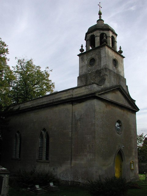
All Saints Church at Woolley in the parish of Charlcombe, Somerset, England, dates from 1761 and was built by John Wood, the Younger replacing an earlier...

Beckford's Tower

Beckford's Tower, originally known as Lansdown Tower, is an architectural folly built in neo-classical style on Lansdown Hill, just outside Bath, Somerset...

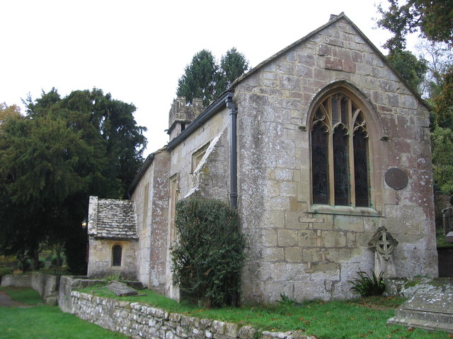
Church of St Mary, Charlcombe

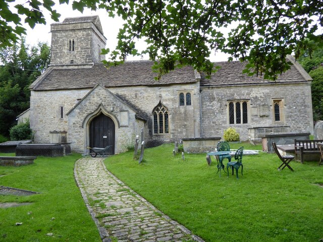
The Anglican Church of St Mary in Charlcombe within the English county of Somerset was built in the 12th century. It is a Grade II* listed building.The...

Charlcombe

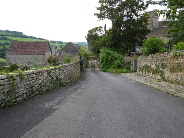
Charlcombe is a civil parish and small village just north of Bath in the Bath and North East Somerset unitary authority, Somerset, England. The parish...

Swainswick

Swainswick is a small village and civil parish, 3 miles (4.8 km) northeast of Bath, on the A46 in the Bath and North East Somerset unitary authority, Somerset...

Church of St Mary, Swainswick

The Anglican Church of St Mary in Swainswick within the English county of Somerset dates from the 12th century. It is a Grade II* listed building.Vestiges...

St Mary Magdalene's Church, Langridge

St Mary Magdalene's Church at Langridge in the parish of Charlcombe, Somerset, England dates from the 12th century and has been designated as a Grade I...

Ashcombe House, Somerset

Ashcombe House at Swainswick, north-east of Bath in Somerset, England is a Gothic revival country house. It is a Grade II listed building. Ashcombe House...

Nearby Amenities

Located within 500m of 51.412237,-2.3693942
Barrier: stile
Lat/Long: 51.4130735/-2.3715813
Barrier: kissing_gate
Lat/Long: 51.4137278/-2.3683371
Barrier: kissing_gate
Lat/Long: 51.4146872/-2.3639045
Barrier: stile
Lat/Long: 51.4131271/-2.3752186
Bench
Lat/Long: 51.4136594/-2.367814
Man Made: water_well
Lat/Long: 51.4130469/-2.3716481
Barrier: bollard
Lat/Long: 51.4086352/-2.3727525
Bench
Lat/Long: 51.4082727/-2.3702951
Access: no
Barrier: bollard
Bicycle: yes
Bollard: removable
Colour: black
Foot: yes
Horse: yes
Material: metal
Motor Vehicle: no
Lat/Long: 51.4085376/-2.3710459
Waste Basket
Lat/Long: 51.4082825/-2.3703529
The data included in this document is from www.openstreetmap.org. The data is made available under ODbL.

Have you been to Charlcombe Wood?

Leave your review of Charlcombe Wood below (or comments, questions and feedback).