Bottoms Wood

Wood, Forest in Yorkshire Ribble Valley

England

Bottoms Wood

Ordnance Survey Cut Mark This mark can be found on the wall of Walker Barn at Gisburn Forest.
The benchmark has a recorded height of 300.545 metres above sea level.
For more detail see : <span class="nowrap"><a title="https://www.bench-marks.org.uk/bm97542" rel="nofollow ugc noopener" href="https://www.bench-marks.org.uk/bm97542">Link</a><img style="margin-left:2px;" alt="External link" title="External link - shift click to open in new window" src="https://s1.geograph.org.uk/img/external.png" width="10" height="10"/></span>
Ordnance Survey Cut Mark Credit: Peter Wood

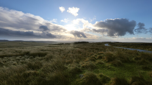
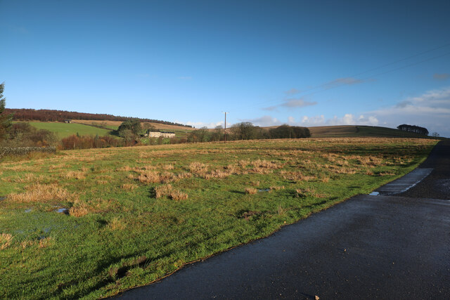
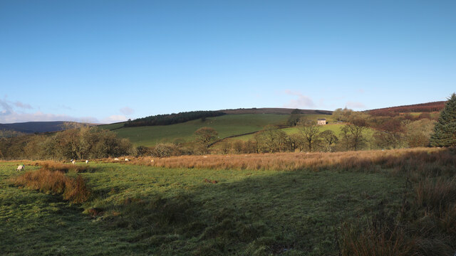
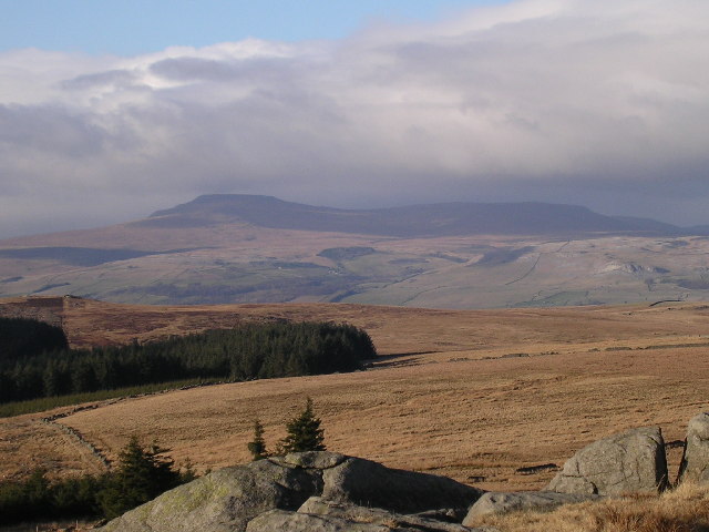
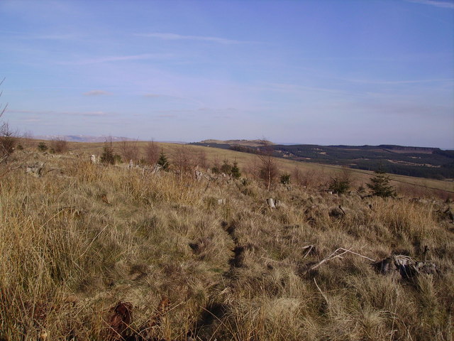
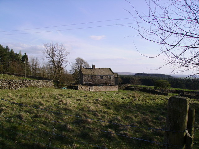
Bottoms Wood is a picturesque woodland located in the county of Yorkshire, England. Covering an area of approximately 100 acres, this captivating forest is nestled in the heart of the countryside, offering visitors a tranquil and enchanting escape from the bustling urban life.

The wood boasts a diverse range of trees, including oak, beech, and birch, which create a stunning canopy overhead. The forest floor is covered in a rich carpet of moss, ferns, and wildflowers, providing a haven for a variety of fauna.

Bottoms Wood is home to a plethora of wildlife, making it a popular spot for nature enthusiasts and birdwatchers. Visitors may catch a glimpse of woodland creatures such as deer, foxes, and squirrels, as well as a multitude of bird species, including woodpeckers, owls, and songbirds.

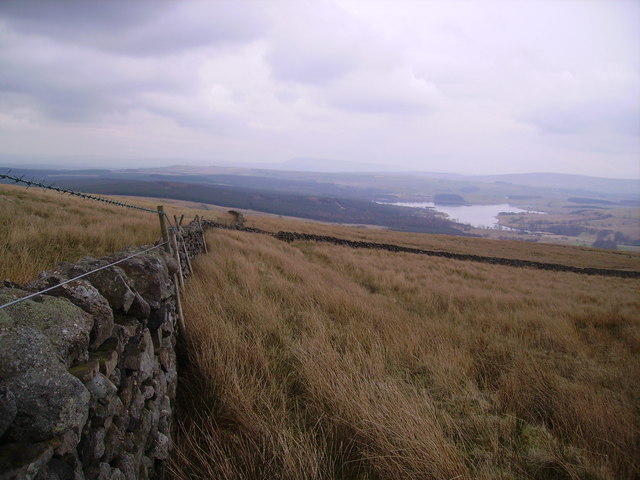
A network of well-maintained footpaths weaves through the wood, allowing visitors to explore the beauty of the forest at their own pace. These trails open up to breathtaking vistas and hidden clearings, providing ample opportunities for picnics, photography, and reflection.

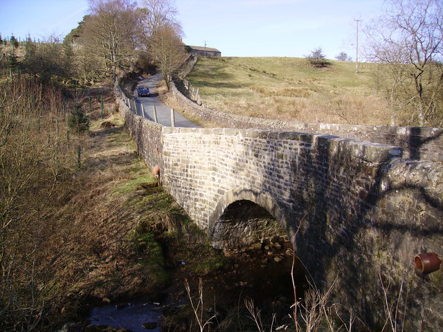
The wood also features a small stream that meanders through its heart, adding to its charm and providing a soothing soundtrack for those seeking solace in nature.

Bottoms Wood is a year-round destination, with each season bringing its own unique beauty. In spring, the forest bursts into life with vibrant blossoms and birdsong, while autumn paints the woodland in hues of gold and red as the leaves change color.

Whether one seeks a peaceful stroll, a place to connect with nature, or simply a break from the demands of everyday life, Bottoms Wood offers a truly captivating experience for visitors of all ages and interests.

If you have any feedback on the listing, please let us know in the comments section below.
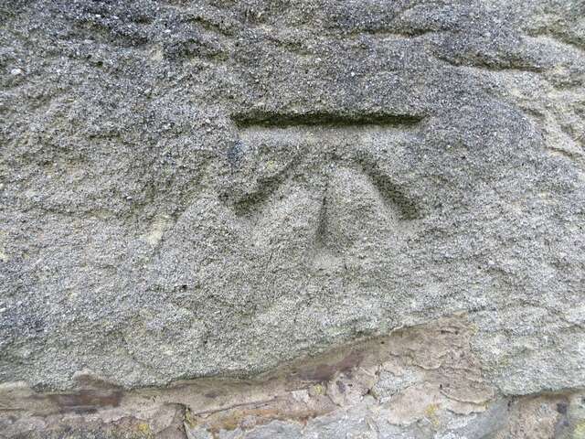
Bottoms Wood Images

Images are sourced within 2km of 54.023604/-2.3921843 or Grid Reference SD7458. Thanks to Geograph Open Source API. All images are credited.

Ordnance Survey Cut Mark This mark can be found on the wall of Walker Barn at Gisburn Forest.
The benchmark has a recorded height of 300.545 metres above sea level.
For more detail see : <span class="nowrap"><a title="https://www.bench-marks.org.uk/bm97542" rel="nofollow ugc noopener" href="https://www.bench-marks.org.uk/bm97542">Link</a><img style="margin-left:2px;" alt="External link" title="External link - shift click to open in new window" src="https://s1.geograph.org.uk/img/external.png" width="10" height="10"/></span>
Ordnance Survey Cut Mark
This mark can be found on the wall of Walker Barn at Gisburn Forest. The benchmark has a recorded height of 300.545 metres above sea level. For more detail see : LinkExternal link
The northern marches of Gisburn Forest The most recently planted part of Gisburn Forest is also the most northerly and forms an isolated outpost not visited by the main mountain bike trails. The Keasden road descends to it over Crutchenber Fell, passing through it to reach the more mature and popular sections around Stocks reservoir.
The northern marches of Gisburn Forest
The most recently planted part of Gisburn Forest is also the most northerly and forms an isolated outpost not visited by the main mountain bike trails. The Keasden road descends to it over Crutchenber Fell, passing through it to reach the more mature and popular sections around Stocks reservoir.
Looking over Coat Rakes to Dale House Dale House is just by the road north from Gisburn Forest towards Clapham in the Yorkshire Dales. The track here goes to Halsteads Farm, whilst a rougher track to the right goes to Cocklick End, not a place to mention in social media posts, as an AI is likely to take exception...
Looking over Coat Rakes to Dale House
Dale House is just by the road north from Gisburn Forest towards Clapham in the Yorkshire Dales. The track here goes to Halsteads Farm, whilst a rougher track to the right goes to Cocklick End, not a place to mention in social media posts, as an AI is likely to take exception...
Higher Clough On the west side of the Keasden road, land rises to Green Pike above Higher Clough (the farmhouse in the sun). The moor on the far horizon is CROW Access Land, but most of what is visible in this view has no public access.
Higher Clough
On the west side of the Keasden road, land rises to Green Pike above Higher Clough (the farmhouse in the sun). The moor on the far horizon is CROW Access Land, but most of what is visible in this view has no public access.
Gisburn Forest track A left turn to the north makes this easy-going teack a little harder as it is now gently uphill. Most of the forestry tracks are like this - low gradient and not too challenging for those on mountain bikes so old that suspension was not deemed necessary (at my age I want all the power I can generate to go into actual forward progress, not into compressing shock absorbers).
Gisburn Forest track
A left turn to the north makes this easy-going teack a little harder as it is now gently uphill. Most of the forestry tracks are like this - low gradient and not too challenging for those on mountain bikes so old that suspension was not deemed necessary (at my age I want all the power I can generate to go into actual forward progress, not into compressing shock absorbers).
Looking over Bottoms Beck A gap in the trees to the east of the track allows a view over Bottoms Beck to the clearing morning mists towards Hesbert Hall.
Looking over Bottoms Beck
A gap in the trees to the east of the track allows a view over Bottoms Beck to the clearing morning mists towards Hesbert Hall.
Hesbert Hall The forest track runs alongside a seriously thistle-infested field at Hesbert Hall with the extensive Gisburn Forest surrounding it - a few colouring larches, but mostly evergreen non-native conifers (Sitka spruce, Picea sitchensis, being the majority).
Hesbert Hall
The forest track runs alongside a seriously thistle-infested field at Hesbert Hall with the extensive Gisburn Forest surrounding it - a few colouring larches, but mostly evergreen non-native conifers (Sitka spruce, Picea sitchensis, being the majority).
Footpath to White Hill House A small car park on a corner of School Lane (room for four cars, maybe five if carefully packed) serves this rather wet and muddy footpath heading into Gisburn Forest. The forest is popular with off-road cyclists, but this trail is one of those explicitly signed with a cycling prohibition which suited me fine - I wanted a nice wide track, thanks, and headed a little further south for my ride.
Footpath to White Hill House
A small car park on a corner of School Lane (room for four cars, maybe five if carefully packed) serves this rather wet and muddy footpath heading into Gisburn Forest. The forest is popular with off-road cyclists, but this trail is one of those explicitly signed with a cycling prohibition which suited me fine - I wanted a nice wide track, thanks, and headed a little further south for my ride.
No School - School Lane No sign of a school in sight!  This just seems to be a pleasant forest drive!
No School - School Lane
No sign of a school in sight! This just seems to be a pleasant forest drive!
View of Ingleborough from Whelp Stone Crag From the Millstone Grit south of the Craven fault to the  Carboniferous Limestone to the north. Fell Beck can just be made out terminating in Gaping Gill.
View of Ingleborough from Whelp Stone Crag
From the Millstone Grit south of the Craven fault to the Carboniferous Limestone to the north. Fell Beck can just be made out terminating in Gaping Gill.
Crutchenber Fell Looking towards Gisburn Forest
Crutchenber Fell
Looking towards Gisburn Forest
Coat Rakes Bridge On Hasgill Beck
Coat Rakes Bridge
On Hasgill Beck
Path to Bottoms Beck In Gisburn Forest
Path to Bottoms Beck
In Gisburn Forest
Walls Just in the north edge of the square looking down towards Stock Reservoir
Walls
Just in the north edge of the square looking down towards Stock Reservoir
Path and Owl In Gisburn Forest on the path to School Lane from Bottoms Beck 8 pm. The Owl sat looking at me for some time.
Path and Owl
In Gisburn Forest on the path to School Lane from Bottoms Beck 8 pm. The Owl sat looking at me for some time.
Wall Arch The old walls are now redundant in Gisburn Forest this one gracefully crosses a feeder of Bottoms Beck.
Wall Arch
The old walls are now redundant in Gisburn Forest this one gracefully crosses a feeder of Bottoms Beck.
Hesbert Hall Grand title for a small farm now in the midst of Gisburn Forest
Hesbert Hall
Grand title for a small farm now in the midst of Gisburn Forest
Gisburn Forest Claimed to be the biggest in Lancashire. The Barn at Geldard Laithe in view in the centre of the picture is engulfed by trees.
Gisburn Forest
Claimed to be the biggest in Lancashire. The Barn at Geldard Laithe in view in the centre of the picture is engulfed by trees.
Show me another place!

Bottoms Wood is located at Grid Ref: SD7458 (Lat: 54.023604, Lng: -2.3921843)

Division: West Riding

Administrative County: Lancashire

District: Ribble Valley

Police Authority: Lancashire

What 3 Words

///dabbled.newsprint.sleepy. Near Settle, North Yorkshire

Related Wikis

Easington, Lancashire

Easington () is a civil parish within the Ribble Valley district of Lancashire, England, with a population in 2001 of 52. The Census 2011 population details...

Stocks Reservoir

Stocks Reservoir is a reservoir situated at the head of the Hodder valley in the Forest of Bowland, Lancashire, England (historically in the West Riding...

Tosside

Tosside is a small village on the modern border of North Yorkshire and Lancashire in Northern England. It lies within the Forest of Bowland, and is between...

Gisburn Forest

Gisburn Forest is a civil parish in the Ribble Valley, in Lancashire, England. Mainly lying within the Forest of Bowland Area of Outstanding Natural Beauty...

Manor House, Gisburn Forest

Manor House is an historic building in Gisburn Forest, Lancashire, England. It was built in the early 18th century, but contains a section that is believed...

Rathmell

Rathmell is a village and civil parish in the Craven district of North Yorkshire, England. The population of the civil parish in the 2011 census was 305...

Wigglesworth

Wigglesworth is a village and civil parish in the Craven district of North Yorkshire, England. The population of the civil parish taken at the 2011 Census...

Lancashire Witches Walk

The Lancashire Witches Walk is a 51-mile (82 km) long-distance footpath opened in 2012, between Barrowford and Lancaster, all in Lancashire, England. It...

Nearby Amenities

Located within 500m of 54.023604,-2.3921843
Power: pole
Lat/Long: 54.0269587/-2.3971108
Power: pole
Lat/Long: 54.0274536/-2.3961109
The data included in this document is from www.openstreetmap.org. The data is made available under ODbL.

Have you been to Bottoms Wood?

Leave your review of Bottoms Wood below (or comments, questions and feedback).