Conduit Belt

Wood, Forest in Somerset Mendip

England

Conduit Belt

Old Milestone by A362, Buckland Down, North of Lodge to Ammerdown Park The Milestone is located on grass verge on the West of the road.  Parish of Hemington (Mendip  District). Metal plate attached to stone post, Radstock iron plate design, erected by the Radstock turnpike trust in the 18th century. Re-erected after being uprooted in 2001; repainted by a member of the public. An earlier photograph can be found here: <a title="https://www.geograph.org.uk/photo/6060915" href="https://www.geograph.org.uk/photo/6060915">Link</a> 

Inscription reads:-   
FROME / 5 / RADSTOCK / 3 

Grade II listed. List Entry Number: 1175774 <span class="nowrap"><a title="https://historicengland.org.uk/listing/the-list/list-entry/1175774" rel="nofollow ugc noopener" href="https://historicengland.org.uk/listing/the-list/list-entry/1175774">Link</a><img style="margin-left:2px;" alt="External link" title="External link - shift click to open in new window" src="https://s1.geograph.org.uk/img/external.png" width="10" height="10"/></span> 

Milestone Society National ID: SO_FRRS05
Old Milestone by A362, Buckland Down, North of Lodge to Ammerdown Park Credit: Janet Dowding

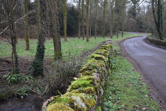
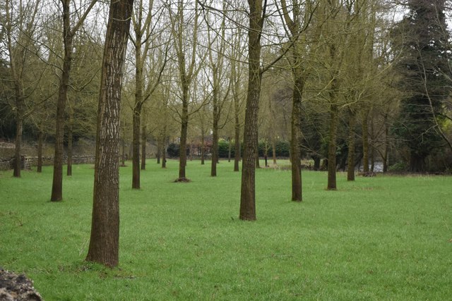
Conduit Belt, Somerset, also known as Wood or Forest, is a picturesque area located in the county of Somerset, England. Covering an expansive area, this woodland paradise is a haven for nature lovers and outdoor enthusiasts alike.

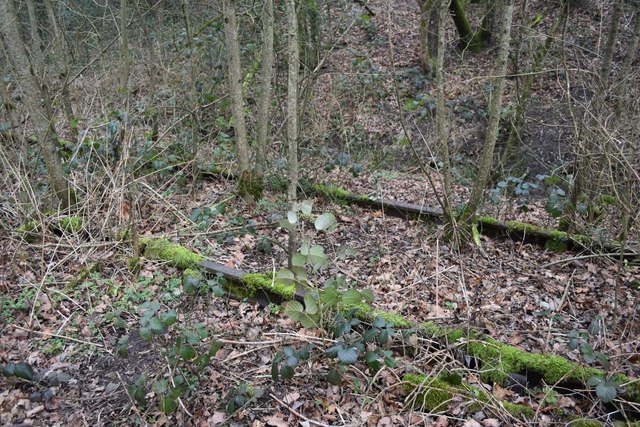
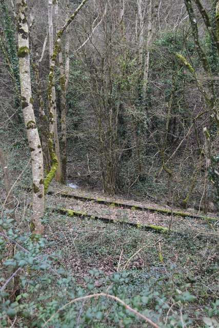
Conduit Belt is characterized by its diverse range of flora and fauna, making it a significant ecological hotspot. The forest is home to a variety of tree species, including oak, beech, and birch, creating a beautiful tapestry of colors throughout the seasons. The dense foliage provides ample shelter for a plethora of wildlife, such as deer, birds, and small mammals, enhancing the area's biodiversity.

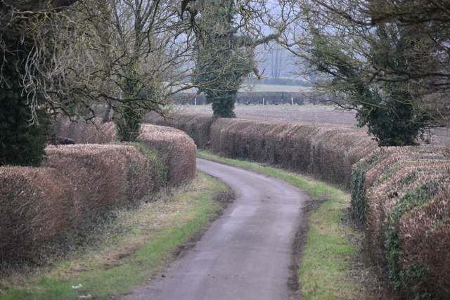
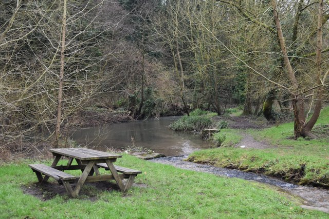
The forest is traversed by numerous trails and footpaths, enabling visitors to explore its natural wonders. Whether it's a leisurely stroll or a more challenging hike, there are routes suitable for all abilities. As you wander through the woodland, you may stumble upon hidden gems such as babbling brooks, enchanting glades, and even ancient ruins.

Moreover, Conduit Belt offers a range of recreational activities, ensuring there is something for everyone. Camping and picnicking areas are available, allowing visitors to immerse themselves in the serene surroundings. Additionally, the forest is a popular spot for birdwatching, photography, and nature study, attracting enthusiasts from near and far.

Conduit Belt, Somerset (Wood, Forest) is a captivating destination for those seeking solace in nature. With its breathtaking scenery, abundant wildlife, and diverse recreational opportunities, this woodland sanctuary is truly a gem within the heart of Somerset.

If you have any feedback on the listing, please let us know in the comments section below.
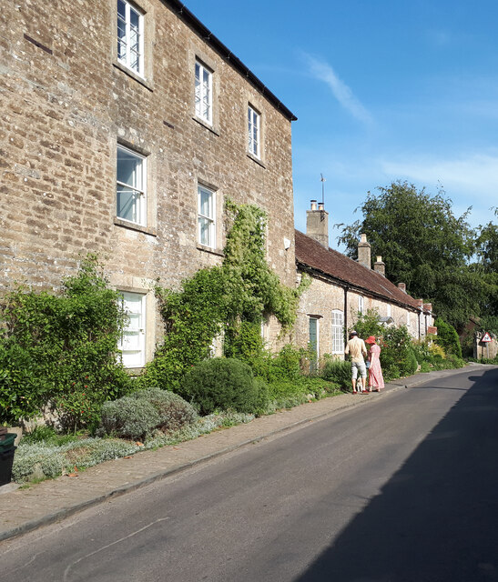
Conduit Belt Images

Images are sourced within 2km of 51.254664/-2.3891791 or Grid Reference ST7250. Thanks to Geograph Open Source API. All images are credited.

Old Milestone by A362, Buckland Down, North of Lodge to Ammerdown Park The Milestone is located on grass verge on the West of the road.  Parish of Hemington (Mendip  District). Metal plate attached to stone post, Radstock iron plate design, erected by the Radstock turnpike trust in the 18th century. Re-erected after being uprooted in 2001; repainted by a member of the public. An earlier photograph can be found here: <a title="https://www.geograph.org.uk/photo/6060915" href="https://www.geograph.org.uk/photo/6060915">Link</a> 

Inscription reads:-   
FROME / 5 / RADSTOCK / 3 

Grade II listed. List Entry Number: 1175774 <span class="nowrap"><a title="https://historicengland.org.uk/listing/the-list/list-entry/1175774" rel="nofollow ugc noopener" href="https://historicengland.org.uk/listing/the-list/list-entry/1175774">Link</a><img style="margin-left:2px;" alt="External link" title="External link - shift click to open in new window" src="https://s1.geograph.org.uk/img/external.png" width="10" height="10"/></span> 

Milestone Society National ID: SO_FRRS05
Old Milestone by A362, Buckland Down, North of Lodge to Ammerdown Park
The Milestone is located on grass verge on the West of the road.  Parish of Hemington (Mendip District). Metal plate attached to stone post, Radstock iron plate design, erected by the Radstock turnpike trust in the 18th century. Re-erected after being uprooted in 2001; repainted by a member of the public. An earlier photograph can be found here: Link  Inscription reads:- FROME / 5 / RADSTOCK / 3 Grade II listed. List Entry Number: 1175774 LinkExternal link Milestone Society National ID: SO_FRRS05
Flowers Farm Bridge Disused railway bridge, beside the Colliers Way, a cycling and walking route which follows the railway from Frome to Radstock. At this point, it is above and tobthe south of the former trackbed.
Flowers Farm Bridge
Disused railway bridge, beside the Colliers Way, a cycling and walking route which follows the railway from Frome to Radstock. At this point, it is above and tobthe south of the former trackbed.
On the Colliers Way Cycling and walking route on the former railway trackbed. Interestingly only one set of rails has been lifted and the other is still in place to the right, gradually being absorbed into the wood: see <a href="https://www.geograph.org.uk/photo/7699443">ST7350 : Abandoned railway track beside the Colliers Way</a> for a closer look.
On the Colliers Way
Cycling and walking route on the former railway trackbed. Interestingly only one set of rails has been lifted and the other is still in place to the right, gradually being absorbed into the wood: see ST7350 : Abandoned railway track beside the Colliers Way for a closer look.
Abandoned railway track beside the Colliers Way The northernmost of the two running lines has been left in place, alongside the cycling and walking path, seen in <a href="https://www.geograph.org.uk/photo/7699441">ST7350 : On the Colliers Way</a> at the same point.
Abandoned railway track beside the Colliers Way
The northernmost of the two running lines has been left in place, alongside the cycling and walking path, seen in ST7350 : On the Colliers Way at the same point.
Railway track in the woods Abandoned rails still in situ beside the Colliers Way.
Railway track in the woods
Abandoned rails still in situ beside the Colliers Way.
Abandoned railway cutting Surprisingly well-preserved trackbed with rails still in place near <a href="https://www.geograph.org.uk/photo/7699439">ST7450 : Flowers Farm Bridge</a>.
Abandoned railway cutting
Surprisingly well-preserved trackbed with rails still in place near ST7450 : Flowers Farm Bridge.
Conduit Bridge, over the Colliers Way The one surviving set of rails can be seen on the far side: the cycle and walking path has been laid in place of the nearer track. For the view from below, see <a href="https://www.geograph.org.uk/photo/7699452">ST7350 : Conduit Bridge, from the Colliers Way</a>.
Conduit Bridge, over the Colliers Way
The one surviving set of rails can be seen on the far side: the cycle and walking path has been laid in place of the nearer track. For the view from below, see ST7350 : Conduit Bridge, from the Colliers Way.
Conduit Bridge, from the Colliers Way Bridge on the former Frome to Radstock railway route.
Conduit Bridge, from the Colliers Way
Bridge on the former Frome to Radstock railway route.
Colliers Way sign Next to the access point at <a href="https://www.geograph.org.uk/photo/7699451">ST7350 : Conduit Bridge, over the Colliers Way</a>.
Colliers Way sign
Next to the access point at ST7350 : Conduit Bridge, over the Colliers Way.
Conduit Hill Lane from Conduit Bridge to Mells.
Conduit Hill
Lane from Conduit Bridge to Mells.
Cottages in Selwood Street
Moss-covered bridge over the Mells Stream
Neatly planted wood beside the Mells Stream
Picnic tables by the Mells Stream On the riverside opposite <a href="https://www.geograph.org.uk/photo/7699264">ST7349 : Mells Village Shop, Post Office & Cafe</a>.
Picnic tables by the Mells Stream
Track into the Wadbury Valley
Mells Village Shop, Post Office & Cafe For the view across the road, see <a href="https://www.geograph.org.uk/photo/7699262">ST7348 : Picnic tables by the Mells Stream</a>.
Mells Village Shop, Post Office & Cafe
For the view across the road, see ST7348 : Picnic tables by the Mells Stream.
Old sluice gate, Wadbury Valley The valley was massively industrialised by the construction of Fussell's iron works in the late 18th and early 19th centuries.  The remains of many sluices, channels, wheel pits, furnaces and buildings can still be seen.
Old sluice gate, Wadbury Valley
The valley was massively industrialised by the construction of Fussell's iron works in the late 18th and early 19th centuries. The remains of many sluices, channels, wheel pits, furnaces and buildings can still be seen.
Ivy-covered chimney, Wadbury Valley The valley was massively industrialised by the construction of Fussell's iron works in the late 18th and early 19th centuries.  The remains of many sluices, channels, wheel pits, furnaces and buildings can still be seen.
Ivy-covered chimney, Wadbury Valley
The valley was massively industrialised by the construction of Fussell's iron works in the late 18th and early 19th centuries. The remains of many sluices, channels, wheel pits, furnaces and buildings can still be seen.
Show me another place!

Conduit Belt is located at Grid Ref: ST7250 (Lat: 51.254664, Lng: -2.3891791)

Administrative County: Somerset

District: Mendip

Police Authority: Avon and Somerset

What 3 Words

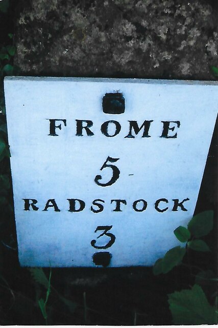
///hint.dockers.printers. Near Frome, Somerset

Nearby Locations

Conduit Belt

Related Wikis

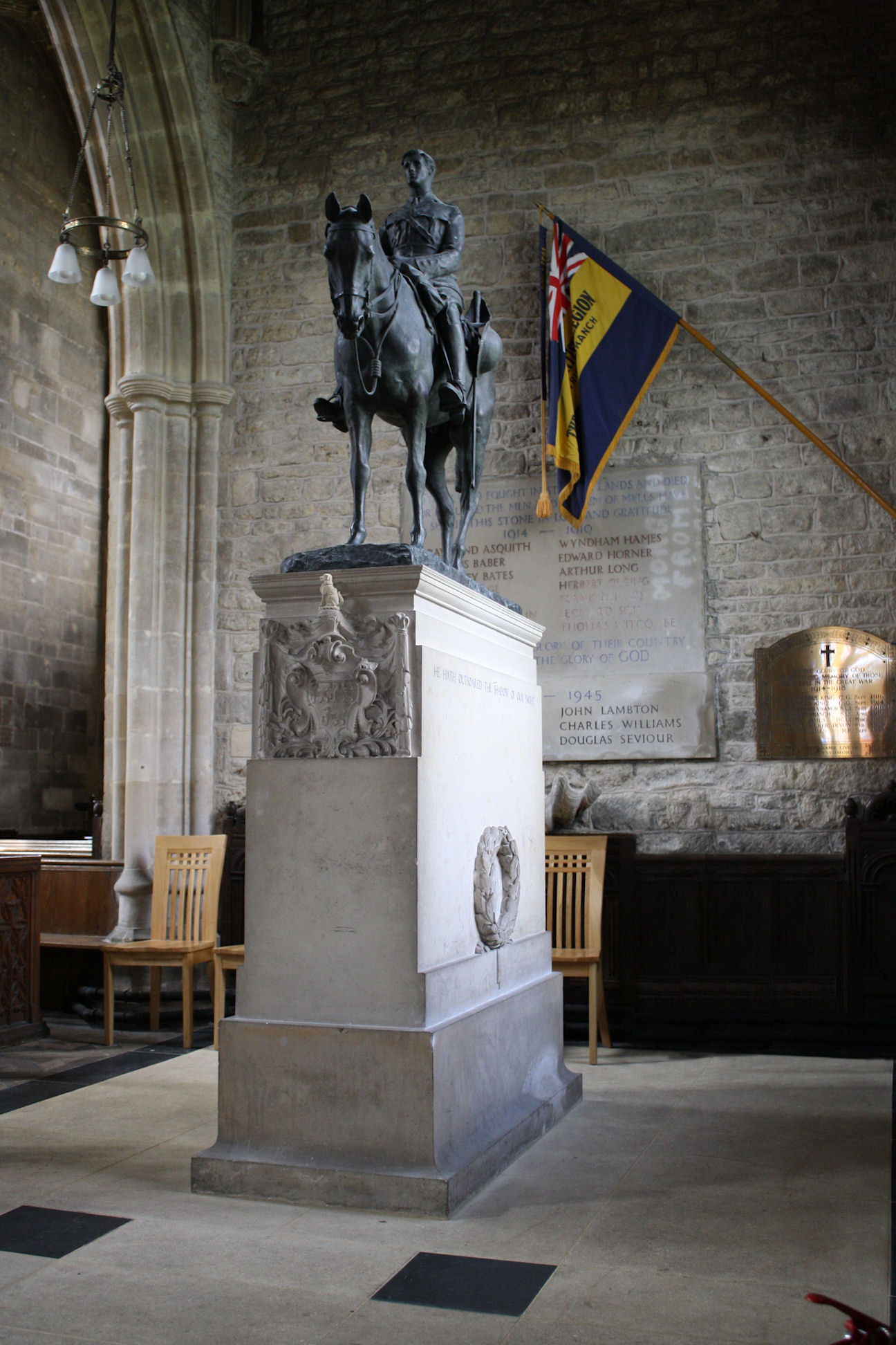
Equestrian statue of Edward Horner

The equestrian statue of Edward Horner stands inside St Andrew's Church in the village of Mells in Somerset, south-western England. It was designed by...
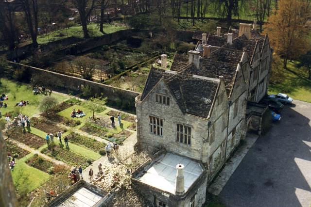
Mells Manor

Mells Manor at Mells, Somerset, England, was built in the 16th century for Edward Horner, altered in the 17th century, partially demolished around 1780...

St Andrew's Church, Mells

St Andrew's Church is a Church of England parish church located in the village of Mells in the English county of Somerset. The church is a grade I listed...

Kingsdown Camp

Kingsdown Camp is an Iron Age hillfort at Buckland Dinham 4.5 kilometres (3 mi) South East of Radstock, Somerset, England. It is a Scheduled Monument....

Nearby Amenities

Located within 500m of 51.254664,-2.3891791
Ele: 165
Source: NPE
Lat/Long: 51.2579371/-2.3859211
Bench
Lat/Long: 51.254456/-2.3900942
Barrier: bollard
Lat/Long: 51.2537314/-2.388196
Barrier: horse_stile
Lat/Long: 51.2540647/-2.3878882
Barrier: stile
Lat/Long: 51.2546893/-2.386799
The data included in this document is from www.openstreetmap.org. The data is made available under ODbL.

Have you been to Conduit Belt?

Leave your review of Conduit Belt below (or comments, questions and feedback).