Sandy Barrow Plantation

Wood, Forest in Dorset

England

Sandy Barrow Plantation

Storage area near sewage works
Storage area near sewage works Credit: JThomas

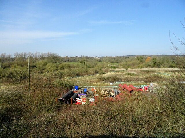
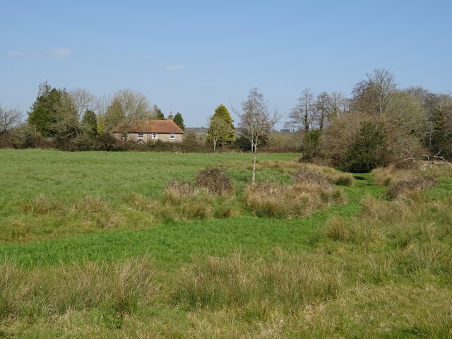
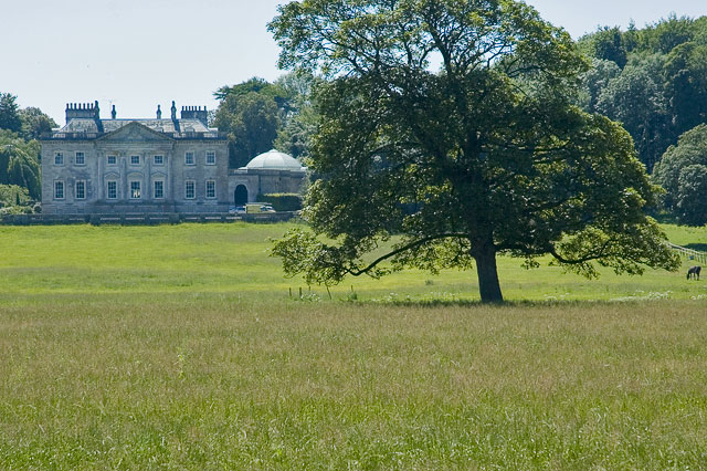
Sandy Barrow Plantation is a woodland area located in the county of Dorset, England. Situated near the town of Dorchester, it covers an area of approximately 100 acres and is known for its diverse range of flora and fauna.

The plantation is primarily composed of oak and beech trees, with occasional patches of coniferous trees such as pine and spruce. The trees form a dense canopy, providing shelter and habitat for a variety of wildlife species. The forest floor is covered with a thick layer of leaf litter, creating a rich environment for small mammals, insects, and fungi.

Sandy Barrow Plantation is a popular destination for nature enthusiasts and hikers, offering numerous walking trails and paths that wind through its picturesque landscape. Visitors can explore the woodland, enjoying the tranquility and peacefulness it offers. The plantation is well-maintained, with clear signage and designated picnic areas for visitors to relax and enjoy the surroundings.

The woodland is home to a diverse range of bird species, including woodpeckers, owls, and thrushes. It is also inhabited by mammals such as deer, foxes, and badgers, which can often be seen foraging or resting amidst the trees. The plantation is particularly renowned for its vibrant display of bluebells during the spring season, attracting photographers and nature enthusiasts from afar.

Overall, Sandy Barrow Plantation is a scenic and ecologically important woodland area in Dorset, offering a peaceful retreat for visitors and providing a valuable habitat for a wide range of plant and animal species.

If you have any feedback on the listing, please let us know in the comments section below.

Sandy Barrow Plantation Images

Images are sourced within 2km of 50.700493/-2.3871481 or Grid Reference SY7289. Thanks to Geograph Open Source API. All images are credited.

Storage area near sewage works
Grazing and drain near Keeper's Cottage
Minor road towards Lower Bockhampton
Defending Dorset in 1940: the Maiden Newton - Poole Harbour Stop Line (45) -
Pillbox (variant): DoB ID: S0000080

Lower Bockhampton -Rectangular Variant Pillbox.  The Stop Line is continued east of Dorchester with this pillbox sited literally within 3 ft of the river. It must have been uninhabitable for much of the year, particularly during the winter months. Currently it is a fixture within the river itself rather than on the river bank, and therefore remains inaccessible. It has a grenade throwing entrance that leads to 3 steps down inside which has an anti-ricochet wall. Its construction appears to be of brick, with a concrete roof.

<a href="https://www.geograph.org.uk/photo/4842324">SY7290 : Defending Dorset in 1940: the Maiden Newton - Poole Harbour Stop Line (46)</a>
Defending Dorset in 1940: the Maiden Newton - Poole Harbour Stop Line (45)
- Pillbox (variant): DoB ID: S0000080 Lower Bockhampton -Rectangular Variant Pillbox. The Stop Line is continued east of Dorchester with this pillbox sited literally within 3 ft of the river. It must have been uninhabitable for much of the year, particularly during the winter months. Currently it is a fixture within the river itself rather than on the river bank, and therefore remains inaccessible. It has a grenade throwing entrance that leads to 3 steps down inside which has an anti-ricochet wall. Its construction appears to be of brick, with a concrete roof. SY7290 : Defending Dorset in 1940: the Maiden Newton - Poole Harbour Stop Line (46)
Defending Dorset in 1940: the Maiden Newton - Poole Harbour Stop Line (46) -
Pillbox (variant): DoB ID: S0000080

Lower Bockhampton -Rectangular Variant Pillbox.  Water, water everywhere in this second view of this pillbox beside the Frome (currently within), whose interior is inaccessible due to flood water and encroaching vegetation.

<a href="https://www.geograph.org.uk/photo/4842330">SY7290 : Defending Dorset in 1940: the Maiden Newton - Poole Harbour Stop Line (47)</a>
Defending Dorset in 1940: the Maiden Newton - Poole Harbour Stop Line (46)
- Pillbox (variant): DoB ID: S0000080 Lower Bockhampton -Rectangular Variant Pillbox. Water, water everywhere in this second view of this pillbox beside the Frome (currently within), whose interior is inaccessible due to flood water and encroaching vegetation. SY7290 : Defending Dorset in 1940: the Maiden Newton - Poole Harbour Stop Line (47)
Defending Dorset in 1940: the Maiden Newton - Poole Harbour Stop Line (47) -
Pillbox (variant): DoB ID: S0000080

Lower Bockhampton - Rectangular Variant Pillbox.  Situated on a bend of the River Frome by a bridge on the road south to West Stafford.

<a href="https://www.geograph.org.uk/photo/4842335">SY7290 : Defending Dorset in 1940: the Maiden Newton - Poole Harbour Stop Line (48)</a>
Defending Dorset in 1940: the Maiden Newton - Poole Harbour Stop Line (47)
- Pillbox (variant): DoB ID: S0000080 Lower Bockhampton - Rectangular Variant Pillbox. Situated on a bend of the River Frome by a bridge on the road south to West Stafford. SY7290 : Defending Dorset in 1940: the Maiden Newton - Poole Harbour Stop Line (48)
Defending Dorset in 1940: the Maiden Newton - Poole Harbour Stop Line (48) -
Pillbox (type FW3/22): DoB ID: S0000097

West Stafford - W of Stafford House - Type 22 Pillbox.  This pillbox under a canopy of brambles and small trees south of Lower Bockhampton, stands in a corner of a field at the junction of the West Stafford to Dorchester road. It has a brick frontage with a concrete roof, and 6 embrasures. The roof was created by first covering the top of the brick walls with asbestos sheets, and then concrete was poured on top. There is also a concrete floor, a T-shape anti-ricochet wall, and a 4 ft deep walled entrance 3 steps down, with an embrasure.

<a href="https://www.geograph.org.uk/photo/4842337">SY7290 : Defending Dorset in 1940: the Maiden Newton - Poole Harbour Stop Line (49)</a>
Defending Dorset in 1940: the Maiden Newton - Poole Harbour Stop Line (48)
- Pillbox (type FW3/22): DoB ID: S0000097 West Stafford - W of Stafford House - Type 22 Pillbox. This pillbox under a canopy of brambles and small trees south of Lower Bockhampton, stands in a corner of a field at the junction of the West Stafford to Dorchester road. It has a brick frontage with a concrete roof, and 6 embrasures. The roof was created by first covering the top of the brick walls with asbestos sheets, and then concrete was poured on top. There is also a concrete floor, a T-shape anti-ricochet wall, and a 4 ft deep walled entrance 3 steps down, with an embrasure. SY7290 : Defending Dorset in 1940: the Maiden Newton - Poole Harbour Stop Line (49)
Defending Dorset in 1940: the Maiden Newton - Poole Harbour Stop Line (49) -
Pillbox (type FW3/22): DoB ID: S0000097

West Stafford - W of Stafford House - Type 22 Pillbox.  Slowly being destroyed by the small trees that are undermining it.

<a href="https://www.geograph.org.uk/photo/4842341">SY7389 : Defending Dorset in 1940: the Maiden Newton - Poole Harbour Stop Line (50)</a>
Defending Dorset in 1940: the Maiden Newton - Poole Harbour Stop Line (49)
- Pillbox (type FW3/22): DoB ID: S0000097 West Stafford - W of Stafford House - Type 22 Pillbox. Slowly being destroyed by the small trees that are undermining it. SY7389 : Defending Dorset in 1940: the Maiden Newton - Poole Harbour Stop Line (50)
Church Lane, Stinsford A delightful wooded lane beside the River Frome.
Church Lane, Stinsford
A delightful wooded lane beside the River Frome.
Lonely lane near Norris Mill Farm The footpath south from the farm just dips into this gridsquare, but I'm not sure where the lane leads to. It's quite an empty gridsquare.
Lonely lane near Norris Mill Farm
The footpath south from the farm just dips into this gridsquare, but I'm not sure where the lane leads to. It's quite an empty gridsquare.
Bridge over River Frome at Lower Bockhampton
Water meadows south of Lower Bockhampton
River Frome at Lower Bockhampton
Boundary Stone on Hardy Way east of Dorchester
Hardy Way east of Dorchester
Old Bridge Marker on Bockhampton Bridge, Lower Bockhampton Bridge Weight Plate by the UC road, in parish of Stinsford (West Dorset District), Bockhampton Bridge, Bockhampton Lane.

Surveyed

Milestone Society National ID: DO_WEIBOCbr.
Old Bridge Marker on Bockhampton Bridge, Lower Bockhampton
Bridge Weight Plate by the UC road, in parish of Stinsford (West Dorset District), Bockhampton Bridge, Bockhampton Lane. Surveyed Milestone Society National ID: DO_WEIBOCbr.
Old Bridge Marker on Lower Bockhampton Bridge Bridge Marker by the UC road, in parish of Stinsford (West Dorset District), Bockhampton Lane, East side of Lower Bockhampton Bridge.

Inscription reads:-
DORSET
ANY PERSON WILFULLY INJURING
ANY PART OF THIS COUNTY BRIDGE
WILL BE GUILTY OF FELONY AND
UPON CONVICTION LIABLE TO BE
TRANSPORTED FOR LIFE
BY THE COURT
7&8 GEO 4 C30 S13 T FOOKS

The bridge is Grade II listed.
List Entry Number: 1425920 <span class="nowrap"><a title="https://historicengland.org.uk/listing/the-list/list-entry/1425920" rel="nofollow ugc noopener" href="https://historicengland.org.uk/listing/the-list/list-entry/1425920">Link</a><img style="margin-left:2px;" alt="External link" title="External link - shift click to open in new window" src="https://s1.geograph.org.uk/img/external.png" width="10" height="10"/></span>

Surveyed

Milestone Society National ID: DO_TRABOCbr
Old Bridge Marker on Lower Bockhampton Bridge
Bridge Marker by the UC road, in parish of Stinsford (West Dorset District), Bockhampton Lane, East side of Lower Bockhampton Bridge. Inscription reads:- DORSET ANY PERSON WILFULLY INJURING ANY PART OF THIS COUNTY BRIDGE WILL BE GUILTY OF FELONY AND UPON CONVICTION LIABLE TO BE TRANSPORTED FOR LIFE BY THE COURT 7&8 GEO 4 C30 S13 T FOOKS The bridge is Grade II listed. List Entry Number: 1425920 LinkExternal link Surveyed Milestone Society National ID: DO_TRABOCbr
Lower Bockhampton buildings [1] Yalbury Cottage, Bockhampton Lane, was formerly two cottages. Built in the late 18th or early 19th century of brick walls on a rubble stone base with a thatched roof.  There is a large 20th century rear extension and operates as a restaurant with rooms. Listed, grade II, with details at: <span class="nowrap"><a title="https://historicengland.org.uk/listing/the-list/list-entry/1323654" rel="nofollow ugc noopener" href="https://historicengland.org.uk/listing/the-list/list-entry/1323654">Link</a><img style="margin-left:2px;" alt="External link" title="External link - shift click to open in new window" src="https://s1.geograph.org.uk/img/external.png" width="10" height="10"/></span>
Lower Bockhampton is a small hamlet on the River Frome about one mile east of Dorchester. The hamlet is home to the school Thomas Hardy first attended as a young boy.
Lower Bockhampton buildings [1]
Yalbury Cottage, Bockhampton Lane, was formerly two cottages. Built in the late 18th or early 19th century of brick walls on a rubble stone base with a thatched roof. There is a large 20th century rear extension and operates as a restaurant with rooms. Listed, grade II, with details at: LinkExternal link Lower Bockhampton is a small hamlet on the River Frome about one mile east of Dorchester. The hamlet is home to the school Thomas Hardy first attended as a young boy.
Show me another place!

Sandy Barrow Plantation is located at Grid Ref: SY7289 (Lat: 50.700493, Lng: -2.3871481)

Unitary Authority: Dorset

Police Authority: Dorset

What 3 Words

///accompany.vast.fermented. Near Dorchester, Dorset

Related Wikis

West Stafford

West Stafford is a village and civil parish in southwest Dorset, England, situated in the Frome valley 2 miles (3.2 km) east of Dorchester. In the 2011...

Frome Billet

Frome Billet is a former village in Dorset, just to the north of West Stafford.It is mentioned in the Domesday Book. There is slight archaeological evidence...

Whitcombe Church

Whitcombe Church in Whitcombe, Dorset, England was built in the 12th century. It is recorded in the National Heritage List for England as a designated...

Whitcombe, Dorset

Whitcombe is a small village and civil parish in the Dorset unitary authority area of Dorset, England, situated 2 miles (3.2 km) southeast of Dorchester...

West Knighton, Dorset

West Knighton is a village and civil parish in Dorset, England, situated 3 miles (4.8 km) southeast of the county town Dorchester. It has an 11th-century...

Old Came Rectory

Old Came Rectory is a former rectory on the A352 road in Winterborne Came, Dorset, England. It was built in the 19th century for the Reverend William England...

Mount Pleasant henge

Mount Pleasant henge is a Neolithic henge enclosure in the English county of Dorset. It lies southeast of Dorchester in the civil parish of West Stafford...

Winterborne Came

Winterborne Came is a small dispersed settlement and civil parish in the county of Dorset in England, situated in the west of the county, approximately...

Nearby Amenities

Located within 500m of 50.700493,-2.3871481
Source: Landsat photo
Lat/Long: 50.7036766/-2.3910296
Source: Landsat photo
Lat/Long: 50.7035239/-2.387799
Source: Landsat photo
Lat/Long: 50.7035949/-2.3855733
Source: Landsat photo
Lat/Long: 50.7037411/-2.3830522
Material: wood
Power: pole
Source: bing
Lat/Long: 50.6966835/-2.3842485
Material: wood
Power: pole
Source: bing
Transformer: distribution
Lat/Long: 50.6968337/-2.3847996
Material: wood
Power: pole
Source: bing
Lat/Long: 50.7045556/-2.3843719
Material: wood
Power: pole
Source: bing
Lat/Long: 50.7045765/-2.3852626
Material: wood
Power: pole
Source: bing
Lat/Long: 50.7046578/-2.3862563
Material: wood
Power: pole
Source: bing
Lat/Long: 50.7024351/-2.3847095
Material: wood
Power: pole
Source: bing
Lat/Long: 50.7032298/-2.3848558
Material: wood
Power: pole
Source: bing
Lat/Long: 50.7035261/-2.3849489
Direction: 185
Generator Method: photovoltaic
Generator Output Electricity: yes
Generator Solar Modules: 2
Generator Source: solar
Generator Type: solar_photovoltaic_panel
Location: roof
Power: generator
Lat/Long: 50.7039358/-2.390835
Direction: 185
Generator Method: photovoltaic
Generator Output Electricity: yes
Generator Solar Modules: 3
Generator Source: solar
Generator Type: solar_photovoltaic_panel
Location: roof
Power: generator
Lat/Long: 50.7039392/-2.3908943
Direction: 185
Generator Method: photovoltaic
Generator Output Electricity: yes
Generator Solar Modules: 10
Generator Source: solar
Generator Type: solar_photovoltaic_panel
Location: roof
Power: generator
Lat/Long: 50.7039279/-2.3907273
Sixpenny Gate
Place: locality
Lat/Long: 50.6991809/-2.3858136
The data included in this document is from www.openstreetmap.org. The data is made available under ODbL.

Have you been to Sandy Barrow Plantation?

Leave your review of Sandy Barrow Plantation below (or comments, questions and feedback).