Norman's Wood

Wood, Forest in Gloucestershire Forest of Dean

England

Norman's Wood

Newent Community School, 1 Main block photographed during the summer holidays, 2021.
Newent Community School, 1 Credit: Jonathan Billinger

Norman's Wood is a picturesque woodland located in the county of Gloucestershire, England. Covering an area of approximately 50 acres, it is a part of the larger Forest of Dean, a renowned ancient woodland. The wood is named after the local landowner, Norman, who generously opened it to the public in 1984.

The woodland is characterized by its diverse array of tree species, including oak, beech, ash, and cherry. These towering trees provide a lush canopy that filters sunlight, creating a serene and tranquil atmosphere. The forest floor is adorned with a rich carpet of wildflowers, such as bluebells and primroses, which bloom in abundance during the spring months.

Norman's Wood is home to a variety of wildlife, making it a haven for nature lovers and wildlife enthusiasts. Visitors may chance upon sightings of deer, badgers, foxes, and a multitude of bird species, including woodpeckers and owls. The wood also boasts a network of walking trails, allowing visitors to explore its hidden corners and discover its natural wonders.

The wood is managed by a dedicated team of conservationists who work tirelessly to maintain its ecological balance and preserve its natural beauty. This includes regular tree maintenance, clearing invasive species, and ensuring the safety of visitors.

Norman's Wood offers a welcome respite from the hustle and bustle of everyday life, inviting visitors to immerse themselves in the tranquility of nature. Whether it is for a leisurely walk, birdwatching, or simply enjoying the peaceful surroundings, Norman's Wood is a true gem for both locals and tourists alike.

If you have any feedback on the listing, please let us know in the comments section below.

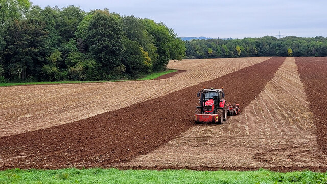
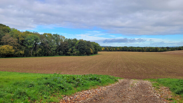
Norman's Wood Images

Images are sourced within 2km of 51.911637/-2.3999533 or Grid Reference SO7223. Thanks to Geograph Open Source API. All images are credited.

Newent Community School, 1 Main block photographed during the summer holidays, 2021.
Newent Community School, 1
Main block photographed during the summer holidays, 2021.
Newent Community School, 2 Main block photographed during the summer holidays, 2021.
Newent Community School, 2
Main block photographed during the summer holidays, 2021.
Crossed lines Cultivation drilling straight into the stubble of the previous maize crop.
Crossed lines
Cultivation drilling straight into the stubble of the previous maize crop.
Emerging arable crop We saw the sowing/cultivation process take place two weeks earlier, see <a href="https://www.geograph.org.uk/photo/6985698">SO7222 : Crossed lines</a>.
Emerging arable crop
We saw the sowing/cultivation process take place two weeks earlier, see SO7222 : Crossed lines.
The start of the 2022 Snowdrops Galanthus nivalis emerging in late January.
The start of the 2022 Snowdrops
Galanthus nivalis emerging in late January.
A fine display of Snowdrops This spot always has a great show of Galanthus nivalis, see <a href="https://www.geograph.org.uk/photo/6758671">SO7222 : Snowdrops by Cugley Cottage, 2</a> from 2021.
A fine display of Snowdrops
This spot always has a great show of Galanthus nivalis, see SO7222 : Snowdrops by Cugley Cottage, 2 from 2021.
A fine display of wild daffodils This spot near Ploddy House was the scene of an equally fine carpet of snowdrops six weeks earlier. See <a href="https://www.geograph.org.uk/photo/7097861">SO7222 : A fine display of Snowdrops</a>.
A fine display of wild daffodils
This spot near Ploddy House was the scene of an equally fine carpet of snowdrops six weeks earlier. See SO7222 : A fine display of Snowdrops.
A field of broad beans Broad beans beside a footpath in a field to the south of Newent.
A field of broad beans
Broad beans beside a footpath in a field to the south of Newent.
Footpath approaching Brook Farm Footpath approaching Brook Farm to the south of Newent.
Footpath approaching Brook Farm
Footpath approaching Brook Farm to the south of Newent.
Footpath through trees Footpath through trees on the southern side of Newent.
Footpath through trees
Footpath through trees on the southern side of Newent.
The Green
The Green
Vanishing Point Power lines vanish into the dense fog
Vanishing Point
Power lines vanish into the dense fog
Anthony's Cross
Anthony's Cross
Gated Field South of Newent
Snowdrops at The Ploddy The roadside here always has a great display of snowdrops. Looking towards Newent.
Snowdrops at The Ploddy
The roadside here always has a great display of snowdrops. Looking towards Newent.
Snowdrops in sunshine A close-up of the plants in <a href="https://www.geograph.org.uk/photo/7397502">SO7223 : Snowdrops at The Ploddy</a>.
Snowdrops in sunshine
A close-up of the plants in SO7223 : Snowdrops at The Ploddy.
Arable land at Kent's Green View across arable land at Kent's Green, Taynton Court Farm can be seen on the left in the middle distance.
Arable land at Kent's Green
View across arable land at Kent's Green, Taynton Court Farm can be seen on the left in the middle distance.
Arable land at Kent's Green The Landranger series of OS map indicate this is patly wood, in fact the Explorer series is correct and showing the land as clear as is evident in this view towards Newent.
Arable land at Kent's Green
The Landranger series of OS map indicate this is patly wood, in fact the Explorer series is correct and showing the land as clear as is evident in this view towards Newent.
Show me another place!

Norman's Wood is located at Grid Ref: SO7223 (Lat: 51.911637, Lng: -2.3999533)

Administrative County: Gloucestershire

District: Forest of Dean

Police Authority: Gloucestershire

What 3 Words

///creamed.cyber.neatly. Near Newent, Gloucestershire

Nearby Locations

Norman's Wood

Related Wikis

Anthony's Cross

Anthony's Cross is a hamlet in Gloucestershire, England. == External links == Media related to Anthony's Cross at Wikimedia Commons

Newent Community School

Newent Community School is a secondary school in Newent, Gloucestershire, England. It is an Academy of 1,340 students, serving the town and the rural...

Taynton, Gloucestershire

Taynton is a village and civil parish in the Forest of Dean district of Gloucestershire, England. It lies about 2.5 miles (4.0 km) south-east of Newent...

Newent

Newent (; originally called "Noent") is a market town and civil parish in the Forest of Dean in Gloucestershire, England. The town is 11 miles (18 km)...

Related Videos

llama Walking 31-12-2021

llama Walking at Briery Hill Farm. 31-12-2021.

Two Hours in Newent

Newent a small town in the county of Gloucestershire, well worth a two hour visit. This small market town lies 10 miles north west ...

Taking the snowdrop trail at Home Farm

It's that time of year again, Snowdrop season! We're always on the look out for new places to see the white carpets fill the ...

Thatched Cottage Heaven | Taynton, ENGLAND - Charming English Village WALK

A Early morning walk in the village of Taynton which lies in the extreme west of the District, close to the Gloucestershire border ...

Nearby Amenities

Located within 500m of 51.911637,-2.3999533
Power: tower
Source: Bing
Lat/Long: 51.9073624/-2.4004844
Battle Ridge
Place: isolated_dwelling
Lat/Long: 51.9145169/-2.3953432
Normans Lodge
Place: isolated_dwelling
Lat/Long: 51.9137407/-2.3969433
Moat House
Power: pole
Transformer: distribution
Voltage Primary: 11000
Lat/Long: 51.9132424/-2.4013945
Power: pole
Lat/Long: 51.9133967/-2.4002639
Power: pole
Lat/Long: 51.9135696/-2.3990569
Power: pole
Lat/Long: 51.9137896/-2.3975649
Norman's Wood
Power: pole
Transformer: distribution
Voltage Primary: 11000
Lat/Long: 51.9135642/-2.397178
Power: pole
Lat/Long: 51.9129334/-2.3969407
Power: pole
Lat/Long: 51.9122861/-2.3967026
Power: pole
Lat/Long: 51.9116466/-2.3964646
Power: pole
Lat/Long: 51.91101/-2.3962272
Norman's Farm
Power: pole
Transformer: distribution
Voltage Primary: 11000
Lat/Long: 51.909987/-2.3951697
Power: pole
Lat/Long: 51.9102335/-2.3958322
Power: pole
Lat/Long: 51.910459/-2.3964431
Power: pole
Lat/Long: 51.9099109/-2.3966771
Power: pole
Lat/Long: 51.909587/-2.3976716
Power: pole
Lat/Long: 51.9092531/-2.398674
Power: pole
Lat/Long: 51.9088465/-2.3999347
Power: pole
Lat/Long: 51.9085755/-2.4007534
Power: pole
Lat/Long: 51.9082376/-2.4017827
Power: pole
Lat/Long: 51.9079285/-2.4027684
The data included in this document is from www.openstreetmap.org. The data is made available under ODbL.

Have you been to Norman's Wood?

Leave your review of Norman's Wood below (or comments, questions and feedback).