Oak Coppice
Wood, Forest in Cheshire
England
Oak Coppice

Oak Coppice is a woodland area located in Cheshire, England. Covering a total area of approximately 200 acres, it is known for its dense population of oak trees, which dominate the landscape. The woodland is situated on gently undulating terrain, with the oak trees providing a picturesque canopy that filters sunlight and creates a serene and tranquil atmosphere.
The oak trees in Oak Coppice are predominantly sessile oaks (Quercus petraea) and English oaks (Quercus robur), which are native to the region. These trees can reach impressive heights, with some specimens in the woodland standing over 30 meters tall. The oaks are characterized by their sturdy trunks, gnarled branches, and lobed leaves, which turn vibrant shades of red and gold during the autumn months.
The woodland floor of Oak Coppice is covered in a diverse array of flora, including bluebells, wood anemones, and wild garlic, which bloom in the spring and create a stunning carpet of color. The undergrowth is also home to a variety of ferns, mosses, and fungi, adding to the rich biodiversity of the area.
Oak Coppice is not only a haven for flora but also provides a habitat for numerous animal species. The woodland is home to a variety of birds, such as great tits, woodpeckers, and tawny owls, which nest in the old oaks. Mammals such as foxes, badgers, and squirrels can also be spotted within the woodland, making it a popular destination for wildlife enthusiasts and nature lovers.
Overall, Oak Coppice in Cheshire offers a captivating natural landscape, characterized by its majestic oak trees, vibrant flora, and diverse wildlife. It provides a serene escape from the hustle and bustle of daily life, making it a cherished gem in the region.
If you have any feedback on the listing, please let us know in the comments section below.
Oak Coppice Images
Images are sourced within 2km of 53.081667/-2.412989 or Grid Reference SJ7253. Thanks to Geograph Open Source API. All images are credited.


Oak Coppice is located at Grid Ref: SJ7253 (Lat: 53.081667, Lng: -2.412989)
Unitary Authority: Cheshire East
Police Authority: Cheshire
What 3 Words
///clings.city.rules. Near Weston, Cheshire
Nearby Locations
Related Wikis

Whitby Morrison
Whitby Morrison, doing business as Whitby Specialist Vehicles Ltd, is a family-run British engineering company based in Crewe, Cheshire. It has been described...

Crewe Hall
Crewe Hall is a Jacobean mansion located near Crewe Green, east of Crewe, in Cheshire, England. Described by Nikolaus Pevsner as one of the two finest...

Crewe Carriage Sidings
Crewe Carriage Sidings (alternatively Crewe Carriage Depot, and also as Crewe L&NWR) is a stabling point located in Crewe, Cheshire, England, on the eastern...

Basford Hall Yard
Basford Hall Yard is a railway marshalling yard near the town of Crewe, Cheshire, England. The yard, which is 0.93 miles (1.5 km) south of Crewe railway...

Crewe Diesel TMD
Crewe Diesel Depot is a former diesel-electric locomotive traction maintenance depot, formerly Crewe Diesel Traction Maintenance Depot or Crewe Diesel...

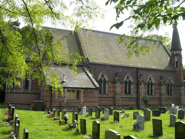
St Michael and All Angels Church, Crewe Green
St Michael and All Angels Church is in the village of Crewe Green, Cheshire, England. The church is recorded in the National Heritage List for England...
Crewe Green
Crewe Green is a small village and former civil parish, now in the parish of Weston and Crewe Green, in the unitary authority area of Cheshire East and...
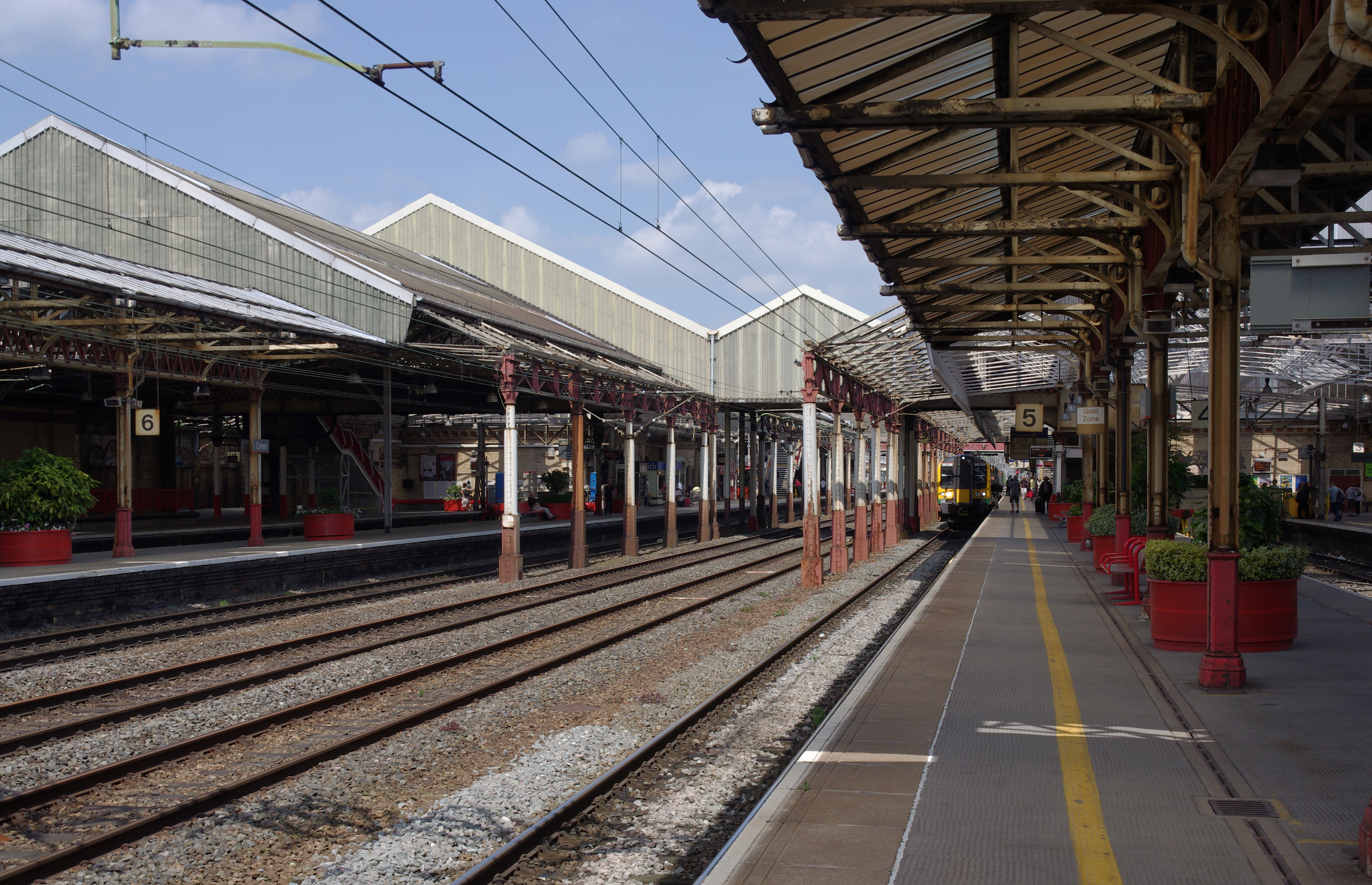
Crewe railway station
Crewe railway station serves the railway town of Crewe, in Cheshire, England. It opened in 1837 and is one of the most historically significant railway...
Nearby Amenities
Located within 500m of 53.081667,-2.412989Have you been to Oak Coppice?
Leave your review of Oak Coppice below (or comments, questions and feedback).