Blackhouse Rough

Wood, Forest in Herefordshire

England

Blackhouse Rough

A pair of dwellings in Longley Green Two identical dwellings side by side opposite The Nelson Inn.
A pair of dwellings in Longley Green Credit: Peter Whatley

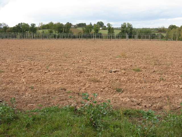
Blackhouse Rough is a dense and sprawling woodland located in Herefordshire, England. Covering an area of approximately 100 hectares, it is known for its rich biodiversity and natural beauty. The woodland is situated on a gently sloping terrain, with some areas being more undulating than others.

The forest is predominantly composed of native broadleaf trees such as oak, beech, and ash, creating a diverse and vibrant ecosystem. The dense canopy provides ample shade, resulting in a cool and tranquil atmosphere within the woodland. The forest floor is covered with a thick layer of leaf litter, creating a soft and cushioned ground.

Several streams and small rivers meander through Blackhouse Rough, adding to the picturesque scenery. These water bodies provide a habitat for various aquatic species, including fish and amphibians. The forest is also home to a wide array of wildlife, including deer, foxes, badgers, and numerous bird species.

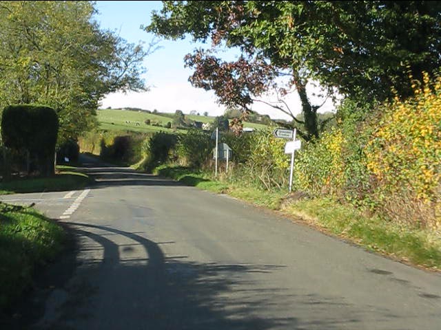
Blackhouse Rough is a popular destination for nature lovers and outdoor enthusiasts. The woodland offers numerous walking and hiking trails, allowing visitors to explore its vast expanse and enjoy the tranquility of nature. The dense vegetation provides ample opportunities for birdwatching and wildlife spotting.

As a protected nature reserve, Blackhouse Rough is managed by local conservation organizations to preserve its natural heritage. The woodland serves as an important habitat for rare and endangered species, contributing to the overall biodiversity of the region.

If you have any feedback on the listing, please let us know in the comments section below.

Blackhouse Rough Images

Images are sourced within 2km of 52.140101/-2.415353 or Grid Reference SO7149. Thanks to Geograph Open Source API. All images are credited.

A pair of dwellings in Longley Green Two identical dwellings side by side opposite The Nelson Inn.
A pair of dwellings in Longley Green
Two identical dwellings side by side opposite The Nelson Inn.
The new field entrance Planning regulations no longer permit direct access from fields onto a public highway.  New accesses such as this one opposite The Nelson Inn - constructed in 2011 - must provide a holding area off the highway for vehicles to stand while gates are opened or shut. The requirement applies irrespective of the cost involved, the loss of productive land or the volume of traffic on the highway: in this instance minimal.
The new field entrance
Planning regulations no longer permit direct access from fields onto a public highway. New accesses such as this one opposite The Nelson Inn - constructed in 2011 - must provide a holding area off the highway for vehicles to stand while gates are opened or shut. The requirement applies irrespective of the cost involved, the loss of productive land or the volume of traffic on the highway: in this instance minimal.
Triangular junction west of Longley Green The small shelter is primarily intended for pupils awaiting the school buses to Malvern's two secondary schools, though buses to Worcester and Malvern also operate through the hamlet once per day each way.
Triangular junction west of Longley Green
The small shelter is primarily intended for pupils awaiting the school buses to Malvern's two secondary schools, though buses to Worcester and Malvern also operate through the hamlet once per day each way.
Hops no more Where once there were these <a title="https://www.geograph.org.uk/photo/813175" href="https://www.geograph.org.uk/photo/813175">Link</a> there is now simply a ploughed field.  Farming economics can be brutal.
Hops no more
Where once there were these Link there is now simply a ploughed field. Farming economics can be brutal.
The big field in October A huge field extending from Stocks Cross to Down's Bridge.
The big field in October
A huge field extending from Stocks Cross to Down's Bridge.
Lower half of Stocks Crossroads, Suckley Although always referred to as a crossroads, on the ground there are two T-junctions separated by this short stretch of road.
Lower half of Stocks Crossroads, Suckley
Although always referred to as a crossroads, on the ground there are two T-junctions separated by this short stretch of road.
Lane junction for Lower Barrow
The big field in November
Stocks Cottages, looking south Although it may not appear so, the houses in the foreground are rather older than those in the background.
Stocks Cottages, looking south
Although it may not appear so, the houses in the foreground are rather older than those in the background.
Stocks Cottages, looking north Appearances can be deceptive.  The foreground building is newer than those in the background.
Stocks Cottages, looking north
Appearances can be deceptive. The foreground building is newer than those in the background.
West Country Ales plaque at The Nelson Inn This ceramic plaque is fixed on the roadside wall of the pub.  West Country Brewery was a Gloucestershire concern founded in 1958 by merger of the Stroud and Cheltenham breweries. It was taken over by Whitbread in 1963.  The Nelson Inn is now a free house.
West Country Ales plaque at The Nelson Inn
This ceramic plaque is fixed on the roadside wall of the pub. West Country Brewery was a Gloucestershire concern founded in 1958 by merger of the Stroud and Cheltenham breweries. It was taken over by Whitbread in 1963. The Nelson Inn is now a free house.
Oast Houses west of Stocks Cross Converted oast houses on the road to Acton Beauchamp.  They are now apartments and a pre-school facility.
Oast Houses west of Stocks Cross
Converted oast houses on the road to Acton Beauchamp. They are now apartments and a pre-school facility.
Suckley Road at the Old Post Office
Access to Grove Hill farm, Suckley
Jubilee Party in the Suckley Hills All you need is a farmer's field, a sheep byre, a makeshift flagpole, friends & neighbours and considerable quantities of food and drink.
Jubilee Party in the Suckley Hills
All you need is a farmer's field, a sheep byre, a makeshift flagpole, friends & neighbours and considerable quantities of food and drink.
The Nelson Inn at the Diamond Jubilee The gazebos and straw bales were for a beer festival and general fun and games for the community.
The Nelson Inn at the Diamond Jubilee
The gazebos and straw bales were for a beer festival and general fun and games for the community.
The new crop Where once there were tall hop poles, apples are now being grown for cider pressing.  For earlier photos of this large field, see: <a title="https://www.geograph.org.uk/photo/813179" href="https://www.geograph.org.uk/photo/813179">Link</a> and <a title="https://www.geograph.org.uk/photo/2656180" href="https://www.geograph.org.uk/photo/2656180">Link</a>.
The new crop
Where once there were tall hop poles, apples are now being grown for cider pressing. For earlier photos of this large field, see: Link and Link.
Longley Green quarry on a snowy day The local school was shut and only a few hardy souls ventured out during one of the heaviest falls of snow for many years.
Longley Green quarry on a snowy day
The local school was shut and only a few hardy souls ventured out during one of the heaviest falls of snow for many years.
Show me another place!

Blackhouse Rough is located at Grid Ref: SO7149 (Lat: 52.140101, Lng: -2.415353)

Unitary Authority: County of Herefordshire

Police Authority: West Mercia

What 3 Words

///soggy.popped.submitted. Near Evesbatch, Herefordshire

Related Wikis

Acton Green, Herefordshire

Acton Green is a village in the north east of the English county of Herefordshire (historically Worcestershire) between Bromyard and Great Malvern. �...

Suckley

Suckley is a village and civil parish in the Malvern Hills District in the county of Worcestershire, England, close to the border with Herefordshire....

Cradley, Herefordshire

Cradley () is a village in the civil parish of Cradley and Storridge, in Herefordshire, England. The nearest Herefordshire to Cradley towns are Ledbury...

Evesbatch

Evesbatch is a village and civil parish 12 miles (19 km) north east of Hereford, in the county of Herefordshire, England. In 2001 the parish had a population...

A4103 road

The A4103 is an A-road which runs from Worcester to the A480 in Stretton Sugwas, a village 2 miles (3.2 km) west of Hereford. The road is a primary route...

Stanford Bishop

Stanford Bishop is a village and civil parish 13 miles (21 km) north east of Hereford, in the county of Herefordshire, England. In 2011 the parish had...

Mathon, Herefordshire

Mathon is a small village and civil parish in eastern Herefordshire, England, lying just to the west of the Malvern Hills between Malvern and Ledbury....

Alfrick Pound

Alfrick Pound is a small village in the county of Worcestershire, England, in the United Kingdom. == Location == Alfrick Pound village is located on the...

Nearby Amenities

Located within 500m of 52.140101,-2.415353
Pimple Hill
Ele: 205
Natural: peak
Source: NPE
Lat/Long: 52.1385696/-2.4214551
Blackhouse
Power: pole
Transformer: distribution
Voltage Primary: 11000
Lat/Long: 52.1389595/-2.4107011
Power: pole
Lat/Long: 52.1385237/-2.4098186
Power: pole
Lat/Long: 52.1380961/-2.4089496
The data included in this document is from www.openstreetmap.org. The data is made available under ODbL.

Have you been to Blackhouse Rough?

Leave your review of Blackhouse Rough below (or comments, questions and feedback).