Worcester Walk Coppice

Wood, Forest in Herefordshire

England

Worcester Walk Coppice

River Leadon Weir
River Leadon Weir Credit: Mr M Evison

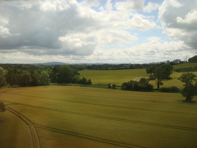
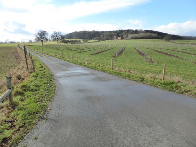
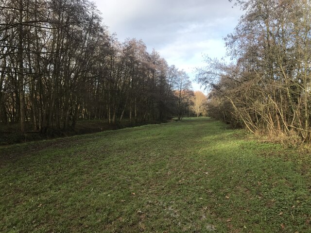
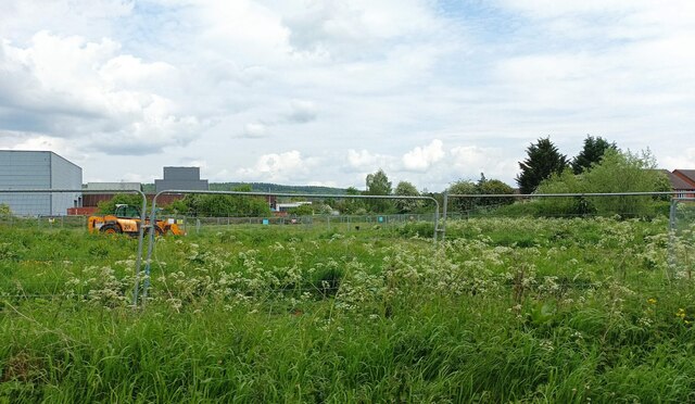
Worcester Walk Coppice is a picturesque woodland located in the county of Herefordshire, England. Covering an area of approximately 50 acres, it is a popular destination for nature enthusiasts and outdoor adventurers alike.

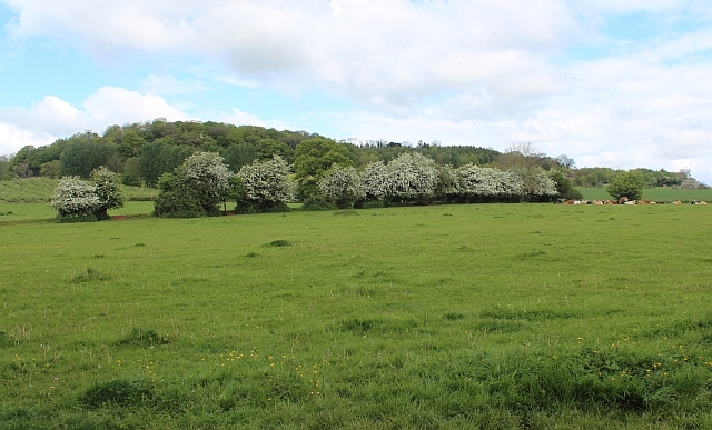
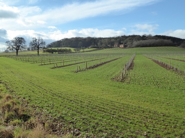
The coppice is primarily composed of oak and beech trees, which create a dense and vibrant canopy throughout the forest. This diverse woodland ecosystem supports a wide variety of flora and fauna, making it an ideal habitat for many species of birds, mammals, and insects.

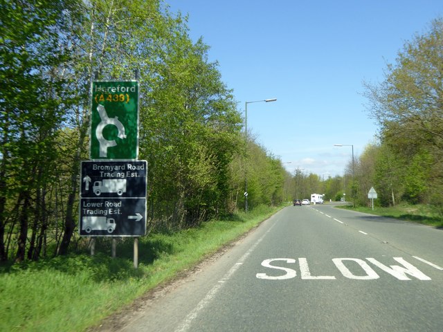
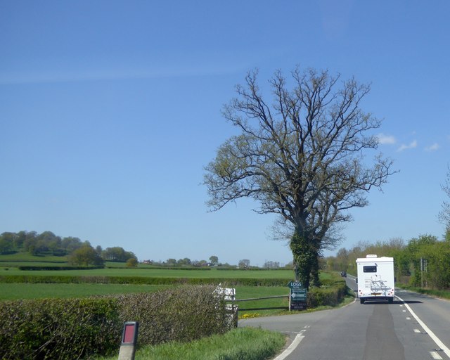
Visitors to Worcester Walk Coppice can enjoy a network of well-maintained footpaths, allowing for easy exploration of the forest. These paths wind through the trees, providing stunning views of the surrounding landscape and glimpses of wildlife along the way.

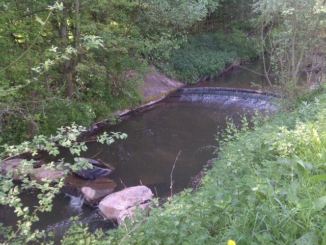
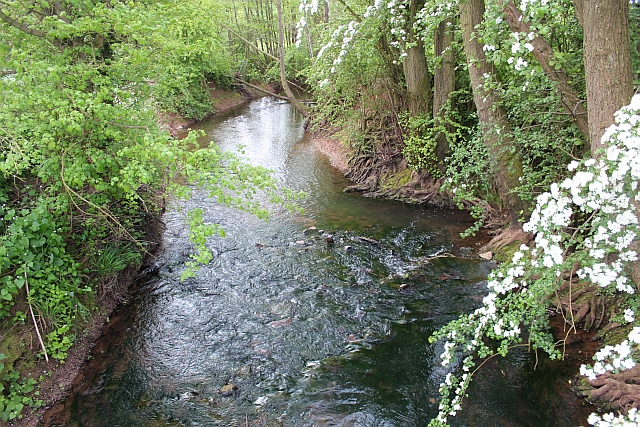
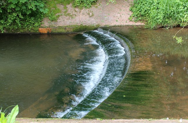
The coppice also features a small stream that runs through its heart, adding to the tranquility and natural beauty of the area. This stream attracts a range of aquatic life, including frogs, newts, and small fish.

Worcester Walk Coppice is a designated Site of Special Scientific Interest (SSSI), highlighting its importance for conservation and preservation of biodiversity. The woodland is carefully managed to enhance its ecological value and protect its unique features.

Throughout the year, the coppice offers a changing display of colors and textures, with springtime bringing a burst of wildflowers and autumn painting the forest floor with a tapestry of fallen leaves. This natural beauty, combined with the peaceful ambiance, makes Worcester Walk Coppice a popular destination for walks, picnics, and photography.

If you have any feedback on the listing, please let us know in the comments section below.

Worcester Walk Coppice Images

Images are sourced within 2km of 52.040719/-2.415218 or Grid Reference SO7138. Thanks to Geograph Open Source API. All images are credited.

River Leadon Weir
River Leadon Weir
Arable Fields, Ledbury
Hawthorn hedge, Wall Hills, Ledbury Startlingly white with May blossom.
The hill in the background, known as Wall Hills, was an iron age hill fort.
Hawthorn hedge, Wall Hills, Ledbury
Startlingly white with May blossom. The hill in the background, known as Wall Hills, was an iron age hill fort.
River Leadon Flowing through the strip of parkland formed by the construction of the Ledbury by pass.
River Leadon
Flowing through the strip of parkland formed by the construction of the Ledbury by pass.
Weir on the river Leadon Viewed from the riverside park formed when the Ledbury bypass was constructed.
Weir on the river Leadon
Viewed from the riverside park formed when the Ledbury bypass was constructed.
Ledbury bypass approaching industrial estate roundabout Approaching the access roads to Galebreaker House New Mills estate
Ledbury bypass approaching industrial estate roundabout
Approaching the access roads to Galebreaker House New Mills estate
Turning for Wallhills from Hereford Road, Ledbury
Wallhills Farm and young orchard This farmland has been photographed over the years recording the land use <a href="https://www.geograph.org.uk/photo/4144">SO6938 : Wall Hills Farm and Iron Age Hill Fort, Ledbury</a> <a href="https://www.geograph.org.uk/photo/318187">SO6938 : Wallhills Farm, Ledbury</a> <a href="https://www.geograph.org.uk/photo/2228090">SO6938 : Wallhills</a>, in the past twelve months fruit trees have been planted in this field.
Wallhills Farm and young orchard
This farmland has been photographed over the years recording the land use SO6938 : Wall Hills Farm and Iron Age Hill Fort, Ledbury SO6938 : Wallhills Farm, Ledbury SO6938 : Wallhills, in the past twelve months fruit trees have been planted in this field.
Drive to Wallhills Farm Entrance and drive to Wallhills Farm viewed from the A438.
Drive to Wallhills Farm
Entrance and drive to Wallhills Farm viewed from the A438.
New Orchard at Wallhills The arrow-straight rows of young apple trees must be fairly new. I wonder if this will be their first season in production?
New Orchard at Wallhills
The arrow-straight rows of young apple trees must be fairly new. I wonder if this will be their first season in production?
Muddy riverside grass
Grazing near Ledbury
Hereford Road (A438) Towards Hereford.
Hereford Road (A438)
Towards Hereford.
Roundabout on Leadon Way, Ledbury This is the Ledbury Bypass, named after the local river.
Roundabout on Leadon Way, Ledbury
This is the Ledbury Bypass, named after the local river.
Ledbury Viaduct Ledbury Viaduct, taken from the Ledbury Allotments.
Ledbury Viaduct
Ledbury Viaduct, taken from the Ledbury Allotments.
Road to Wallhills Farm Entrance and access road off the A438 near Ledbury leading to Wallhills Farm.  The orchard of apple trees was planted about five years ago.
Road to Wallhills Farm
Entrance and access road off the A438 near Ledbury leading to Wallhills Farm. The orchard of apple trees was planted about five years ago.
Orchard at Wallhills Farm This is the same view of Wallhills Farm as this one I took more than fifteen years ago in January 2007 <a href="https://www.geograph.org.uk/photo/318187">SO6938 : Wallhills Farm, Ledbury</a>.  Wallhills Farm is now only just visible beyond the apple trees.  It is also very similar to the first picture uploaded from this grid square taken in April 2005 <a href="https://www.geograph.org.uk/photo/4144">SO6938 : Wall Hills Farm and Iron Age Hill Fort, Ledbury</a>.
Orchard at Wallhills Farm
This is the same view of Wallhills Farm as this one I took more than fifteen years ago in January 2007 SO6938 : Wallhills Farm, Ledbury. Wallhills Farm is now only just visible beyond the apple trees. It is also very similar to the first picture uploaded from this grid square taken in April 2005 SO6938 : Wall Hills Farm and Iron Age Hill Fort, Ledbury.
Land starting to be developed A patch of grassland which has suddenly become home to metal fencing and diggers as it is prepared to be built on.
Land starting to be developed
A patch of grassland which has suddenly become home to metal fencing and diggers as it is prepared to be built on.
Show me another place!

Worcester Walk Coppice is located at Grid Ref: SO7138 (Lat: 52.040719, Lng: -2.415218)

Unitary Authority: County of Herefordshire

Police Authority: West Mercia

What 3 Words

///licks.majority.elastic. Near Ledbury, Herefordshire

Related Wikis

Church of St Michael and All Angels, Ledbury

The Church of St Michael and All Angels is an Anglican church in Ledbury, in Herefordshire, England. The oldest parts date from the 12th century, and most...

Ledbury Tunnel

Ledbury Tunnel is a single-track railway tunnel immediately to the east of Ledbury railway station on the Cotswold Line, in Herefordshire, England. The...

Ledbury Market Hall

Ledbury Market Hall, also known as Ledbury Town Hall, is a municipal building in the High Street in Ledbury, Herefordshire, England. The structure, which...

Ledbury Signal Box

Ledbury Signal Box is a typical Great Western Railway traditional lever frame signal box which remains in daily use at Ledbury Station, Herefordshire,...

Nearby Amenities

Located within 500m of 52.040719,-2.415218
Power: substation
Source: survey
Lat/Long: 52.0419105/-2.4214375
Barrier: kissing_gate
Lat/Long: 52.0370058/-2.4118973
Description: Air Shaft
Man Made: shaft
Source: OS 1:25k
Lat/Long: 52.0447845/-2.4156043
Barrier: stile
Material: wood
Stile: stepover
Lat/Long: 52.0399721/-2.419742
Dog Hill
Fixme: Should this be called Dog Hil or Doghill?
Natural: peak
Lat/Long: 52.0435388/-2.4200129
Power: pole
Lat/Long: 52.0432464/-2.4139372
Power: pole
Lat/Long: 52.0433462/-2.4125276
Barrier: stile
Lat/Long: 52.043962/-2.4132756
Bench
Lat/Long: 52.0433412/-2.4182227
Bench
Lat/Long: 52.0446956/-2.4171747
Bench
Backrest: yes
Colour: Green
Material: metal
Lat/Long: 52.0396858/-2.420663
Generator Method: photovoltaic
Generator Output Electricity: yes
Generator Source: solar
Generator Type: solar_photovoltaic_panel
Location: roof
Power: generator
Lat/Long: 52.0420007/-2.4216941
Generator Method: photovoltaic
Generator Output Electricity: yes
Generator Source: solar
Generator Type: solar_photovoltaic_panel
Location: roof
Power: generator
Lat/Long: 52.038965/-2.4209082
Generator Method: photovoltaic
Generator Output Electricity: yes
Generator Source: solar
Generator Type: solar_photovoltaic_panel
Location: roof
Power: generator
Lat/Long: 52.0389419/-2.420994
Generator Method: photovoltaic
Generator Output Electricity: yes
Generator Source: solar
Generator Type: solar_photovoltaic_panel
Location: roof
Power: generator
Lat/Long: 52.0397817/-2.4211657
Generator Method: photovoltaic
Generator Output Electricity: yes
Generator Source: solar
Generator Type: solar_photovoltaic_panel
Location: roof
Power: generator
Lat/Long: 52.0404582/-2.4216941
Power: pole
Lat/Long: 52.0427728/-2.4157155
Power: pole
Lat/Long: 52.0429436/-2.4150355
Power: pole
Lat/Long: 52.0434541/-2.4110202
Power: pole
Lat/Long: 52.0433004/-2.4104496
Stony Hill Bradlow
Power: pole
Transformer: distribution
Voltage Primary: 11000
Lat/Long: 52.0415075/-2.4165342
Power: pole
Lat/Long: 52.0421764/-2.4160709
The Elms
Power: pole
Transformer: distribution
Voltage Primary: 11000
Lat/Long: 52.0412295/-2.4116506
Power: pole
Lat/Long: 52.0424256/-2.4101941
The Geology of Dog Wood Hill
Information: board
Tourism: information
Lat/Long: 52.0396402/-2.4207254
Waste Basket
Colour: Green
Material: metal
Waste: trash
Lat/Long: 52.0395558/-2.4203883
Leisure: picnic_table
Lat/Long: 52.0395165/-2.4203617
Bench
Lat/Long: 52.039643/-2.4202115
Bench
Lat/Long: 52.0395912/-2.4202906
Bench
Lat/Long: 52.0395536/-2.4204382
Fixme: incomplete
Lat/Long: 52.036856/-2.4174777
Waste Basket
Colour: Black
Material: metal
Waste: trash
Lat/Long: 52.039684/-2.4206836
The data included in this document is from www.openstreetmap.org. The data is made available under ODbL.

Have you been to Worcester Walk Coppice?

Leave your review of Worcester Walk Coppice below (or comments, questions and feedback).