Cross Wood

Wood, Forest in Northumberland

England

Cross Wood

View towards River South Tyne
View towards River South Tyne Credit: Les Hull

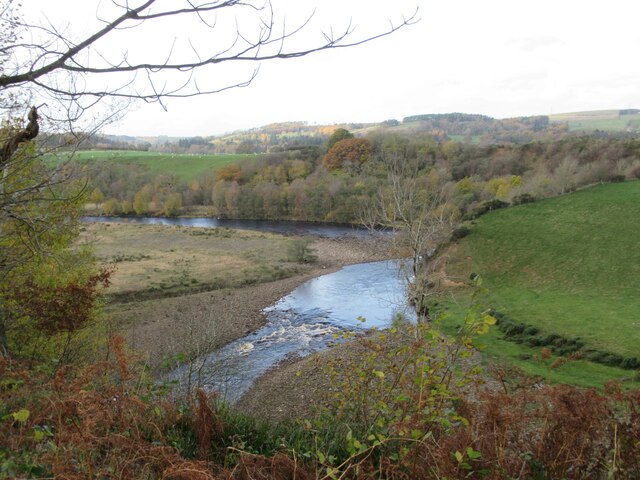
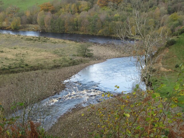
Cross Wood is a picturesque forest located in Northumberland, a county in the northeast of England. Spanning over a vast area of land, this woodland offers a tranquil and serene escape from the hustle and bustle of daily life.

The wood is known for its diverse range of tree species, including oak, birch, and beech, creating a rich and vibrant ecosystem. The dense canopy provides a shady refuge during the summer months, while the forest floor is adorned with an array of wildflowers and ferns.

Cross Wood is a haven for wildlife enthusiasts, as it is home to a variety of animal species. Visitors may catch a glimpse of red squirrels darting through the trees or hear the enchanting song of woodland birds such as nightingales and woodpeckers. Additionally, the forest is inhabited by deer, badgers, and foxes, adding to the natural charm of the area.

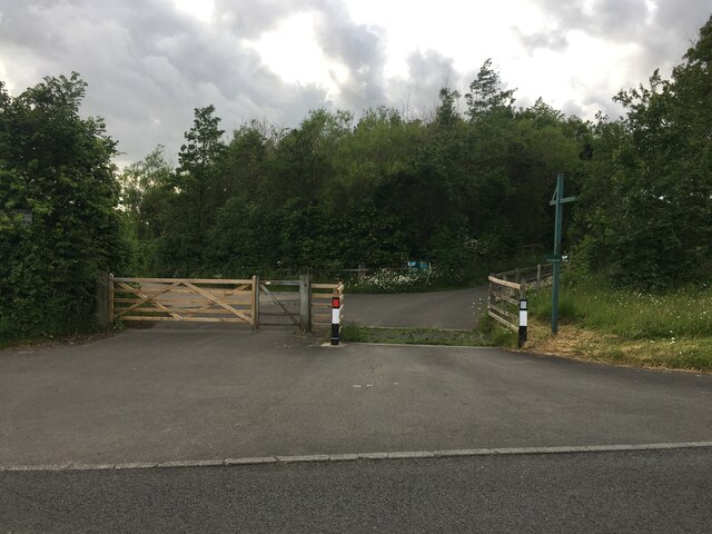
The wood offers a network of well-maintained trails, allowing visitors to explore its beauty on foot or by bicycle. There are picnic areas scattered throughout the forest, inviting visitors to enjoy a leisurely lunch surrounded by nature.

Aside from its natural beauty, Cross Wood is also historically significant. The remains of an ancient Roman road can be found within the woodland, serving as a testament to the area's rich heritage.

Overall, Cross Wood is a captivating destination for nature lovers and history enthusiasts alike. Its peaceful atmosphere and abundance of wildlife make it a must-visit location for those seeking a peaceful retreat in the heart of Northumberland.

If you have any feedback on the listing, please let us know in the comments section below.
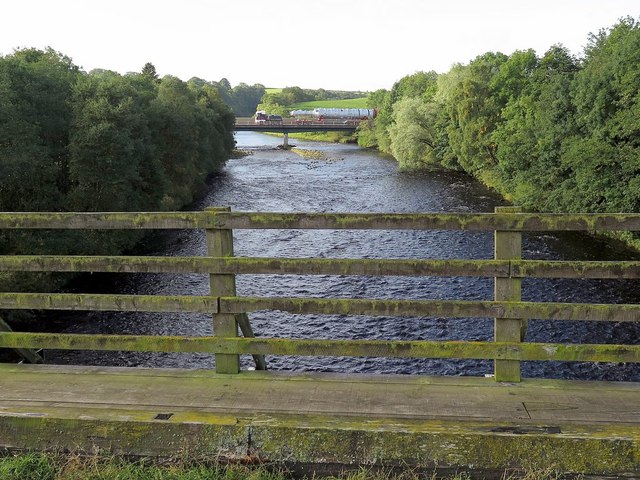
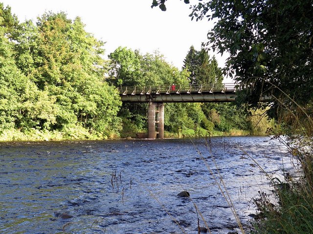
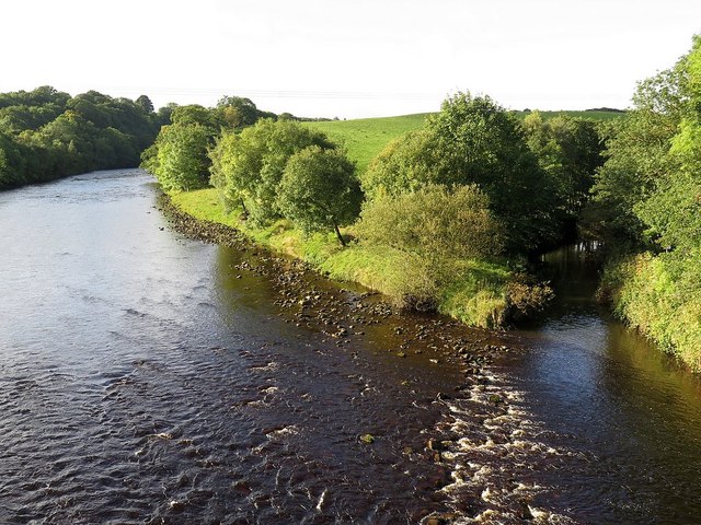
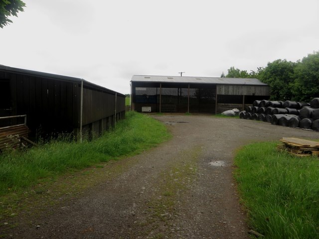
Cross Wood Images

Images are sourced within 2km of 54.957791/-2.4469274 or Grid Reference NY7162. Thanks to Geograph Open Source API. All images are credited.

View towards River South Tyne
River South Tyne
River South Tyne
River South Tyne
River South Tyne
Footpath through Bellister Bank Wood
Road to Wydon Farm
Road to Wydon Farm
Benchmark on pier of boundary wall of cemetery on south side of Tyne View Road Ordnance Survey cut mark benchmark levelled at 125.041m above Newlyn Datum verified 1954
Benchmark on pier of boundary wall of cemetery on south side of Tyne View Road
Ordnance Survey cut mark benchmark levelled at 125.041m above Newlyn Datum verified 1954
A69 road bridge from Bellister Bridge The 'rocket' crossing the road bridge in the distance is part of a convey of heavy loads described here <a href="https://www.geograph.org.uk/photo/4582651">NZ1267 : Heavy load parked near Heddon on the Wall</a>

The same load was photographed near Heddon on the Wall on the following day: <a href="https://www.geograph.org.uk/photo/4675201">NZ1267 : 'Rocket' travels by road</a>
A69 road bridge from Bellister Bridge
The 'rocket' crossing the road bridge in the distance is part of a convey of heavy loads described here NZ1267 : Heavy load parked near Heddon on the Wall The same load was photographed near Heddon on the Wall on the following day: NZ1267 : 'Rocket' travels by road
Bellister Bridge Bellister Bridge was a temporary bridge built in 1967 to replace the Tyne Bridge near the station (which was no longer in use for vehicles) to give access to a plastics factory and to Plenmeller. It has now been made unnecessary since the opening of the Haltwhistle By-pass and serves as a footbridge from a residential area to the old road on the south side of the Tyne, from where the other pedestrian bridge, the Blue bridge, can be reached. It carried traffic until 1997 when the by-pass was opened. 
<span class="nowrap"><a title="http://www.bridgesonthetyne.co.uk/haltbell.html" rel="nofollow ugc noopener" href="http://www.bridgesonthetyne.co.uk/haltbell.html">Link</a><img style="margin-left:2px;" alt="External link" title="External link - shift click to open in new window" src="https://s1.geograph.org.uk/img/external.png" width="10" height="10"/></span>
Bellister Bridge
Bellister Bridge was a temporary bridge built in 1967 to replace the Tyne Bridge near the station (which was no longer in use for vehicles) to give access to a plastics factory and to Plenmeller. It has now been made unnecessary since the opening of the Haltwhistle By-pass and serves as a footbridge from a residential area to the old road on the south side of the Tyne, from where the other pedestrian bridge, the Blue bridge, can be reached. It carried traffic until 1997 when the by-pass was opened. LinkExternal link
River South Tyne from Haltwhistle by-pass bridge The confluence of the Tipalt Burn is on the right.
River South Tyne from Haltwhistle by-pass bridge
The confluence of the Tipalt Burn is on the right.
A69 bridge over River South Tyne Bellister Bridge can be seen behind. Pedestrians are protected from the fast traffic on a separate parallel roadway using the same bridge.
A69 bridge over River South Tyne
Bellister Bridge can be seen behind. Pedestrians are protected from the fast traffic on a separate parallel roadway using the same bridge.
Tipalt Burn
Tipalt Burn
Farm road to Wydon near Tipalt Burn
Farm buildings at Broomhouse A couple of modern agricultural buildings at Broomhouse farm. A stack of wrapped bales, possibly haylage sits in the corner of the yard.
Farm buildings at Broomhouse
A couple of modern agricultural buildings at Broomhouse farm. A stack of wrapped bales, possibly haylage sits in the corner of the yard.
Stone farm buildings at Broomhouse One part of the traditional range of farm buildings at Broomhouse.
Stone farm buildings at Broomhouse
One part of the traditional range of farm buildings at Broomhouse.
The South Tyne Trail near Broomhouse The South Tyne Trail is also part of National Cycle Network Route 68 and follows the course of the former Haltwhistle to Alston railway
The South Tyne Trail near Broomhouse
The South Tyne Trail is also part of National Cycle Network Route 68 and follows the course of the former Haltwhistle to Alston railway
Haltwhistle Bellister Bridge This was a temporary bridge built in 1967 to replace the Haltwhistle Tyne Bridge near the station (which was no longer in use for vehicles) to give access to a plastics factory and to Plenmeller. It has now been made unnecessary since the opening of the Haltwhistle By-pass and serves as a footbridge from a residential area to the old road on the south side of the Tyne, from where the other pedestrian bridge, the Blue Bridge, can be reached. It carried traffic until 1997 when the by-pass was opened.  It is a beam bridge standing on concrete piers with a concrete deck carried on steel girders.
<span class="nowrap"><a title="http://www.bridgesonthetyne.co.uk/haltbell.html" rel="nofollow ugc noopener" href="http://www.bridgesonthetyne.co.uk/haltbell.html">Link</a><img style="margin-left:2px;" alt="External link" title="External link - shift click to open in new window" src="https://s1.geograph.org.uk/img/external.png" width="10" height="10"/></span>
Haltwhistle Bellister Bridge
This was a temporary bridge built in 1967 to replace the Haltwhistle Tyne Bridge near the station (which was no longer in use for vehicles) to give access to a plastics factory and to Plenmeller. It has now been made unnecessary since the opening of the Haltwhistle By-pass and serves as a footbridge from a residential area to the old road on the south side of the Tyne, from where the other pedestrian bridge, the Blue Bridge, can be reached. It carried traffic until 1997 when the by-pass was opened. It is a beam bridge standing on concrete piers with a concrete deck carried on steel girders. LinkExternal link
River Tyne west of Haltwhistle A69 West Bridge
Riverside footpath below Bellister Bank
Show me another place!

Cross Wood is located at Grid Ref: NY7162 (Lat: 54.957791, Lng: -2.4469274)

Unitary Authority: Northumberland

Police Authority: Northumbria

What 3 Words

///pelt.professes.select. Near Haltwhistle, Northumberland

Related Wikis

Plenmeller

Plenmeller is a village and former civil parish, now in the parish of Plenmeller with Whitfield, in Northumberland, England about a mile (1½ km) southeast...

Haltwhistle Burn

The Haltwhistle Burn is a river which lies to the east of the Northumbrian town of Haltwhistle. Rising in the peaty uplands below the ridge of the Whin...

Unthank, Haltwhistle

Unthank is a village near Haltwhistle in Northumberland, England. It is first mentioned in writing as Unthanc around 1200. == Governance == Unthank is...

Bellister Castle

Bellister Castle is a National Trust owned castellated 19th-century mansion house attached to the ruinous remains of a 14th-century tower house, near...

Haltwhistle Castle

Haltwhistle Castle Hill is a ruined Norman earth and timber ringwork fortress in Haltwhistle, Northumberland, England. There are no extant stone remains...

Haltwhistle railway station

Haltwhistle is a railway station on the Tyne Valley Line, which runs between Newcastle and Carlisle via Hexham. The station, situated 22 miles 66 chains...

Haltwhistle

Haltwhistle is a market town and civil parish in Northumberland, England, 22.9 miles (36.9 kilometres) east of Carlisle and 36.8 miles (59.2 kilometres...

Unthank Hall

Unthank Hall is a Grade II listed property now serving as commercial offices, situated on the southern bank of the River South Tyne east of Plenmeller...

Nearby Amenities

Located within 500m of 54.957791,-2.4469274
Plenmeller
Place: locality
Wikidata: Q7204546
Lat/Long: 54.9611436/-2.4470661
Post Box
Ref: NE49 66
Lat/Long: 54.9618195/-2.4472038
The data included in this document is from www.openstreetmap.org. The data is made available under ODbL.

Have you been to Cross Wood?

Leave your review of Cross Wood below (or comments, questions and feedback).