Nap Wood

Wood, Forest in Somerset Mendip

England

Nap Wood

Direction Sign – Signpost by the B3139 in Kilmersdon Located on the northeast side of the junction of the B3139 and Church Street in the village centre, Kilmersdon parish. 1 arm and pyramid finial. See <a title="https://www.geograph.org.uk/photo/6035483" href="https://www.geograph.org.uk/photo/6035483">Link</a> to see it before it was refurbished and the finial replaced.

Milestone Society National ID: SO_ST6952
Direction Sign – Signpost by the B3139 in Kilmersdon Credit: G Fawcett

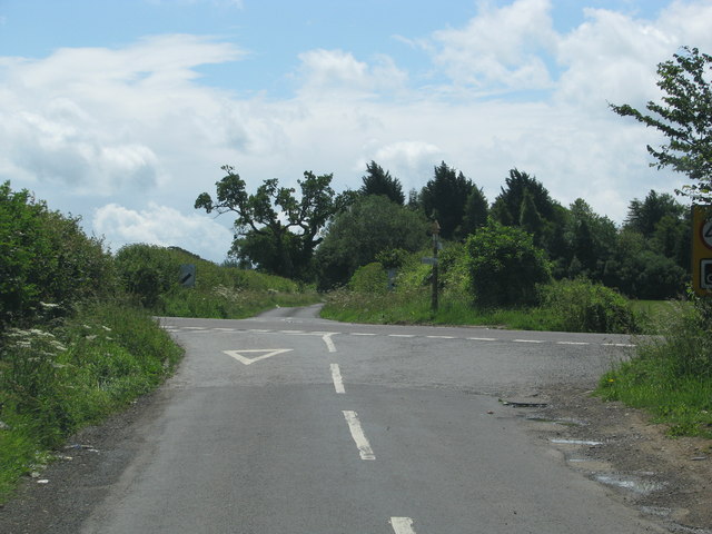
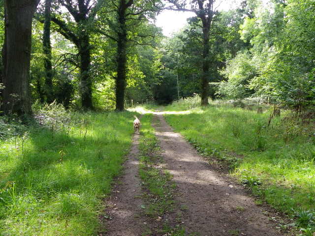
Nap Wood is a picturesque woodland located in the county of Somerset, England. Situated on the outskirts of the charming village of Wood, the forest spans an area of approximately 100 acres. Known for its natural beauty and tranquil atmosphere, Nap Wood is a popular destination for nature lovers, hikers, and wildlife enthusiasts.

The woodland is predominantly composed of native broadleaf trees, including oak, beech, and ash, which create a diverse and vibrant ecosystem. The dense canopy provides shelter for a variety of bird species, such as woodpeckers, owls, and songbirds, making it a haven for birdwatchers.

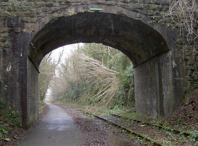
Nap Wood is crisscrossed by a network of well-maintained footpaths, allowing visitors to explore the forest at their own pace. The trails wind through ancient woodland, carpeted with bluebells and wildflowers during the springtime, creating a stunning display of color.

The forest also boasts a rich history, with evidence of human habitation dating back to the Iron Age. Archeological remains, including ancient earthworks and burial sites, can still be found within the woodland, offering a glimpse into the region's past.

In addition to its natural and historical significance, Nap Wood is actively managed for conservation purposes. Regular tree planting initiatives and selective harvesting ensure the sustainable management of the forest, preserving its biodiversity for future generations to enjoy.

Overall, Nap Wood in Somerset is a hidden gem, offering a peaceful retreat and a chance to reconnect with nature. With its stunning landscapes, abundant wildlife, and fascinating history, it is a must-visit destination for anyone seeking a serene and immersive woodland experience.

If you have any feedback on the listing, please let us know in the comments section below.

Nap Wood Images

Images are sourced within 2km of 51.275323/-2.411603 or Grid Reference ST7152. Thanks to Geograph Open Source API. All images are credited.

Direction Sign – Signpost by the B3139 in Kilmersdon Located on the northeast side of the junction of the B3139 and Church Street in the village centre, Kilmersdon parish. 1 arm and pyramid finial. See <a title="https://www.geograph.org.uk/photo/6035483" href="https://www.geograph.org.uk/photo/6035483">Link</a> to see it before it was refurbished and the finial replaced.

Milestone Society National ID: SO_ST6952
Direction Sign – Signpost by the B3139 in Kilmersdon
Located on the northeast side of the junction of the B3139 and Church Street in the village centre, Kilmersdon parish. 1 arm and pyramid finial. See Link to see it before it was refurbished and the finial replaced. Milestone Society National ID: SO_ST6952
Direction Sign – Signpost on the B3139 in Kilmersdon parish Located on the west side of the junction of the B3139 and Knobsbury Hill in Kilmersdon parish. 4 arms and pyramid finial.

Milestone Society National ID: SO_ST7052B
Direction Sign – Signpost on the B3139 in Kilmersdon parish
Located on the west side of the junction of the B3139 and Knobsbury Hill in Kilmersdon parish. 4 arms and pyramid finial. Milestone Society National ID: SO_ST7052B
Direction Sign – Signpost on the B3139, Frome Road, A366 and A362 crossroads in Hemington parish Located on the west side of the crossroads of the B3139, Frome Road, A366 and A362 in Hemington parish. 6 arms and lost finial.

Milestone Society National ID: SO_ST7153
Direction Sign – Signpost on the B3139, Frome Road, A366 and A362 crossroads in Hemington parish
Located on the west side of the crossroads of the B3139, Frome Road, A366 and A362 in Hemington parish. 6 arms and lost finial. Milestone Society National ID: SO_ST7153
Old Milestone by A366, North of Hemington, just West of Crossroads The Milestone is located on grass verge on the South of the road.  Parish of Hemington (Mendip District). Metal plate attached to stone post, Radstock iron plate design, erected by the Radstock turnpike trust in the 18th century, top right corner of plate gone; chips on top left of stone. An earlier photograph can be found here: <a title="https://www.geograph.org.uk/photo/6035396" href="https://www.geograph.org.uk/photo/6035396">Link</a> 

Inscription reads:-  
RADSTOCK / 3 / P. NORTON / 3   

Grade II listed. List Entry Number: 1408656 <span class="nowrap"><a title="https://historicengland.org.uk/listing/the-list/list-entry/1408656" rel="nofollow ugc noopener" href="https://historicengland.org.uk/listing/the-list/list-entry/1408656">Link</a><img style="margin-left:2px;" alt="External link" title="External link - shift click to open in new window" src="https://s1.geograph.org.uk/img/external.png" width="10" height="10"/></span> 

Milestone Society National ID: SO_FRPN11
Old Milestone by A366, North of Hemington, just West of Crossroads
The Milestone is located on grass verge on the South of the road.  Parish of Hemington (Mendip District). Metal plate attached to stone post, Radstock iron plate design, erected by the Radstock turnpike trust in the 18th century, top right corner of plate gone; chips on top left of stone. An earlier photograph can be found here: Link  Inscription reads:- RADSTOCK / 3 / P. NORTON / 3 Grade II listed. List Entry Number: 1408656 LinkExternal link Milestone Society National ID: SO_FRPN11
Old Milestone by A362, Buckland Down, North of Lodge to Ammerdown Park The Milestone is located on grass verge on the West of the road.  Parish of Hemington (Mendip  District). Metal plate attached to stone post, Radstock iron plate design, erected by the Radstock turnpike trust in the 18th century. Re-erected after being uprooted in 2001; repainted by a member of the public. An earlier photograph can be found here: <a title="https://www.geograph.org.uk/photo/6060915" href="https://www.geograph.org.uk/photo/6060915">Link</a> 

Inscription reads:-   
FROME / 5 / RADSTOCK / 3 

Grade II listed. List Entry Number: 1175774 <span class="nowrap"><a title="https://historicengland.org.uk/listing/the-list/list-entry/1175774" rel="nofollow ugc noopener" href="https://historicengland.org.uk/listing/the-list/list-entry/1175774">Link</a><img style="margin-left:2px;" alt="External link" title="External link - shift click to open in new window" src="https://s1.geograph.org.uk/img/external.png" width="10" height="10"/></span> 

Milestone Society National ID: SO_FRRS05
Old Milestone by A362, Buckland Down, North of Lodge to Ammerdown Park
The Milestone is located on grass verge on the West of the road.  Parish of Hemington (Mendip District). Metal plate attached to stone post, Radstock iron plate design, erected by the Radstock turnpike trust in the 18th century. Re-erected after being uprooted in 2001; repainted by a member of the public. An earlier photograph can be found here: Link  Inscription reads:- FROME / 5 / RADSTOCK / 3 Grade II listed. List Entry Number: 1175774 LinkExternal link Milestone Society National ID: SO_FRRS05
Country Lane Minor road near Writhlington.
Country Lane
Minor road near Writhlington.
Road from Foxcote meets the A366
Track, Napp Wood The woodland, part of the Ammerdown Estate is open for the public.
Track, Napp Wood
The woodland, part of the Ammerdown Estate is open for the public.
Church of St. Peter and St. Paul The origin of the church is in the Norman period, but the main fabric dates from the 15th and 16th centuries with major restoration taking place in the 19th century.  The four stage tower has an embattled top with pinnacles.
Church of St. Peter and St. Paul
The origin of the church is in the Norman period, but the main fabric dates from the 15th and 16th centuries with major restoration taking place in the 19th century. The four stage tower has an embattled top with pinnacles.
Lychgate, Church of St Peter and St Paul The design of the lychgate symbolizes the Trinity and it was designed in 1900 by Sir Edwin Lutyens (29 March 1869 – 1 January 1944) for the Hylton family.

Many churches have a lych gate built over the main entrance to the enclosed area round the church. The name, also spelt lich or lytch, is from the Anglo Saxon 'lich' meaning corpse. The gate marks the division between consecrated and unconsecrated ground, where the bearers sheltered with the coffin, waiting for the clergyman to lead the procession before the burial. The original lych gates had seats, a lych cross and a lych stone - a slab on which the coffin rested.
Lychgate, Church of St Peter and St Paul
The design of the lychgate symbolizes the Trinity and it was designed in 1900 by Sir Edwin Lutyens (29 March 1869 – 1 January 1944) for the Hylton family. Many churches have a lych gate built over the main entrance to the enclosed area round the church. The name, also spelt lich or lytch, is from the Anglo Saxon 'lich' meaning corpse. The gate marks the division between consecrated and unconsecrated ground, where the bearers sheltered with the coffin, waiting for the clergyman to lead the procession before the burial. The original lych gates had seats, a lych cross and a lych stone - a slab on which the coffin rested.
Door, Church of St Peter and St Paul This is the west door to the church which is to be found under the tower.  For a wider view of the church <a href="https://www.geograph.org.uk/photo/2690088">ST6952 : Church of St. Peter and St. Paul</a>
Door, Church of St Peter and St Paul
This is the west door to the church which is to be found under the tower. For a wider view of the church ST6952 : Church of St. Peter and St. Paul
Detail, Church of St Peter and St Paul The boot scraper is set beside the west door.  For a wider view <a href="https://www.geograph.org.uk/photo/2690158">ST6952 : Door, Church of St Peter and St Paul</a>

These metal objects are prized by antique dealers, revered by history buffs, but are an object of puzzlement to many a 21st century pedestrian.
Detail, Church of St Peter and St Paul
The boot scraper is set beside the west door. For a wider view ST6952 : Door, Church of St Peter and St Paul These metal objects are prized by antique dealers, revered by history buffs, but are an object of puzzlement to many a 21st century pedestrian.
Bench Mark, Church of St Peter and St Paul The Ordnance Survey bench mark is to be found on the south west face of the church.  For a wider view <a href="https://www.geograph.org.uk/photo/2690088">ST6952 : Church of St. Peter and St. Paul</a> and for further information on the cut mark and others in the area <span class="nowrap"><a title="http://www.bench-marks.org.uk/bm31103" rel="nofollow ugc noopener" href="http://www.bench-marks.org.uk/bm31103">Link</a><img style="margin-left:2px;" alt="External link" title="External link - shift click to open in new window" src="https://s1.geograph.org.uk/img/external.png" width="10" height="10"/></span>
Bench Mark, Church of St Peter and St Paul
The Ordnance Survey bench mark is to be found on the south west face of the church. For a wider view ST6952 : Church of St. Peter and St. Paul and for further information on the cut mark and others in the area LinkExternal link
Gargoyle, Church of St Peter and St Paul The gargoyle is to be found on the church tower.
Gargoyle, Church of St Peter and St Paul
The gargoyle is to be found on the church tower.
Blessed Virgin Mary, Hemington
Cornish's Grave Projecting Bracket An old style of survey marker in the structure of a railway bridge near Kilmersdon. These were fairly short-lived, being used from the Second Geodetic Levelling from 1912 but replaced by Flush Brackets. Most surviving examples are often found along railway lines, like this one. See <a href="https://www.geograph.org.uk/photo/3328686">ST7151 : Cornish's Grave bridge</a> for a wider view and <span class="nowrap"><a title="http://www.bench-marks.org.uk/bm2509" rel="nofollow ugc noopener" href="http://www.bench-marks.org.uk/bm2509">Link</a><img style="margin-left:2px;" alt="External link" title="External link - shift click to open in new window" src="https://s1.geograph.org.uk/img/external.png" width="10" height="10"/></span> for the listing in the Benchmark Database and nearby ones too.
Cornish's Grave Projecting Bracket
An old style of survey marker in the structure of a railway bridge near Kilmersdon. These were fairly short-lived, being used from the Second Geodetic Levelling from 1912 but replaced by Flush Brackets. Most surviving examples are often found along railway lines, like this one. See ST7151 : Cornish's Grave bridge for a wider view and LinkExternal link for the listing in the Benchmark Database and nearby ones too.
Cornish's Grave bridge Once the old colliers' line saw trains running along the tracks but today is now National Cycle Network Route 24. A projecting bracket can be found low down on the corner of the wall to the left of shot - see <a href="https://www.geograph.org.uk/photo/3328661">ST7151 : Cornish's Grave Projecting Bracket</a>.
Cornish's Grave bridge
Once the old colliers' line saw trains running along the tracks but today is now National Cycle Network Route 24. A projecting bracket can be found low down on the corner of the wall to the left of shot - see ST7151 : Cornish's Grave Projecting Bracket.
Is it me? Along the old coal railway line from Radstock to Frome are a number of bridges. Having been closed to traffic in 1988, the line was converted into National Cycle Network Route 24 and artists Elizabeth Turrell and Imi Murf have placed artworks into the high arches in order to recount the days of steam. These enamel fingers are arranged differently at each bridge. See <a href="https://www.geograph.org.uk/photo/3328686">ST7151 : Cornish's Grave bridge</a> for a view of the bridge and <a href="https://www.geograph.org.uk/photo/3330196">ST7549 : A curious mixture</a> for another example further down the line.
Is it me?
Along the old coal railway line from Radstock to Frome are a number of bridges. Having been closed to traffic in 1988, the line was converted into National Cycle Network Route 24 and artists Elizabeth Turrell and Imi Murf have placed artworks into the high arches in order to recount the days of steam. These enamel fingers are arranged differently at each bridge. See ST7151 : Cornish's Grave bridge for a view of the bridge and ST7549 : A curious mixture for another example further down the line.
Show me another place!

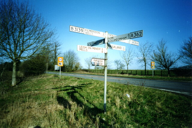
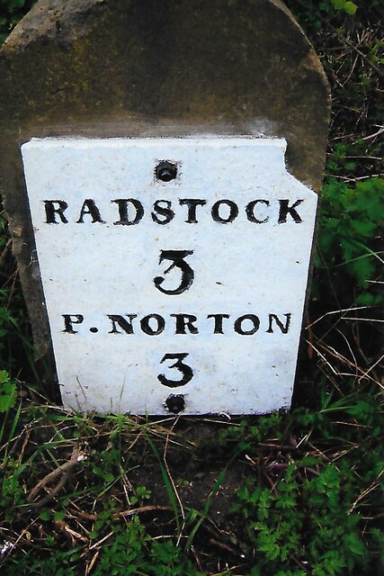
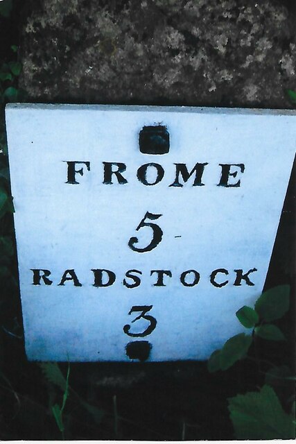
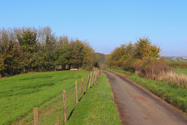
Nap Wood is located at Grid Ref: ST7152 (Lat: 51.275323, Lng: -2.411603)

Administrative County: Somerset

District: Mendip

Police Authority: Avon and Somerset

What 3 Words

///coughed.shot.shepherds. Near Radstock, Somerset

Related Wikis

Ammerdown House, Kilmersdon

Ammerdown House in Kilmersdon, Somerset, England, was built in 1788. It has been designated as Grade I listed building.It was built as a country house...

St Mary's Church, Hemington

St. Mary's Hemington is an Anglican church in Hemington, Somerset, England. The Norman church underwent major renovation in the 14th, 15th, 17th and 19th...

Kingsdown Camp

Kingsdown Camp is an Iron Age hillfort at Buckland Dinham 4.5 kilometres (3 mi) South East of Radstock, Somerset, England. It is a Scheduled Monument.It...

Hemington, Somerset

Hemington is a village and civil parish 5.5 miles (8.9 km) north west of Frome, in the Mendip district of Somerset, England. It is located just off the...

Writhlington School

Writhlington School is a secondary school for pupils aged 11–18 in Writhlington, Bath and North East Somerset, England. It is the main secondary school...

Mells Road railway station

Mells Road railway station served the village of Mells, Somerset, England from 1875 to 1959 linking Radstock to Frome, Somerset on the Heart of Wessex...

Kilmersdon

Kilmersdon is a village and civil parish on the north eastern slopes of the Mendip Hills in Somerset between the towns of Radstock and Frome. It is located...

Babington, Somerset

Babington is a small village between Radstock and Frome, Somerset, England, which has now largely disappeared. == History == In 1233 or 1234 much of the...

Nearby Amenities

Located within 500m of 51.275323,-2.411603
Note: National speed limit sign SW-bound
Traffic Sign Backward: GB:671
Lat/Long: 51.2787064/-2.410536
Parking
Lat/Long: 51.2729442/-2.4159352
The data included in this document is from www.openstreetmap.org. The data is made available under ODbL.

Have you been to Nap Wood?

Leave your review of Nap Wood below (or comments, questions and feedback).