Red Wood

Wood, Forest in Gloucestershire Stroud

England

Red Wood

The Wetlands at Slimbridge Looking south from one of the hides at the Wildfowl and Wetlands Trust. The River Severn is to the right of the picture.
The Wetlands at Slimbridge Credit: Bob Embleton

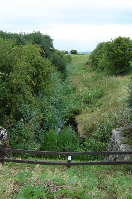
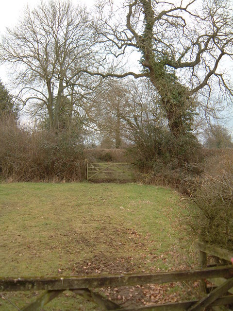
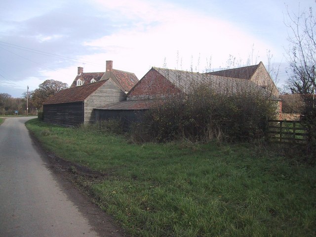
Red Wood is a picturesque forest located in the county of Gloucestershire, England. It is renowned for its stunning beauty and rich biodiversity, attracting nature enthusiasts and visitors from all around the world. The forest covers an area of approximately 100 hectares and is part of the larger Forest of Dean, a historic woodland area.

The name "Red Wood" is derived from the vibrant hues that the trees exhibit during autumn, when the leaves turn a striking red color. The forest primarily consists of oak and beech trees, providing a diverse and vibrant ecosystem. It is home to a wide variety of wildlife, including deer, foxes, badgers, and a plethora of bird species.

The forest offers a range of recreational activities for visitors to enjoy. There are numerous walking trails and hiking paths that allow visitors to explore the beauty of the woodland, immersing themselves in nature's tranquility. The forest is also a popular destination for cycling and horse riding enthusiasts, with designated tracks and trails catering to these activities.

Red Wood is managed and maintained by the Forestry Commission, ensuring its preservation and sustainability. The commission works diligently to protect the forest's natural resources and promote responsible tourism. Additionally, they organize educational programs and events to raise awareness about the importance of conservation and the forest's ecological significance.

Overall, Red Wood in Gloucestershire is a haven for nature lovers, offering breathtaking landscapes, diverse flora and fauna, and a range of outdoor activities. It is a must-visit destination for anyone seeking to escape the hustle and bustle of city life and reconnect with nature.

If you have any feedback on the listing, please let us know in the comments section below.

Red Wood Images

Images are sourced within 2km of 51.72573/-2.4255135 or Grid Reference SO7003. Thanks to Geograph Open Source API. All images are credited.

The Wetlands at Slimbridge Looking south from one of the hides at the Wildfowl and Wetlands Trust. The River Severn is to the right of the picture.
The Wetlands at Slimbridge
Looking south from one of the hides at the Wildfowl and Wetlands Trust. The River Severn is to the right of the picture.
Drainage Ditch used as a wildlife sanctuary However, most of the wildlife appeared on the canal this joins on to.
Drainage Ditch used as a wildlife sanctuary
However, most of the wildlife appeared on the canal this joins on to.
Milestone, Gloucester and Sharpness Canal 13 miles to Gloucester, the other side indicated 3 miles to Sharpness
Milestone, Gloucester and Sharpness Canal
13 miles to Gloucester, the other side indicated 3 miles to Sharpness
Gloucester and Sharpness Canal Plenty of water traffic, both human and avian. The swan was heading away from lunch at the pub, the narrowboat, and us, were heading towards it.
Gloucester and Sharpness Canal
Plenty of water traffic, both human and avian. The swan was heading away from lunch at the pub, the narrowboat, and us, were heading towards it.
Ship moored on Gloucester and Sharpness Canal Quite a feat of achievement to get a vessel this big up the canal, and pointing downstream.
Ship moored on Gloucester and Sharpness Canal
Quite a feat of achievement to get a vessel this big up the canal, and pointing downstream.
Pool Farm, Halmore Looking northwards on Slimbridge Lane, the aptly named Pool Farm is on the left.
Pool Farm, Halmore
Looking northwards on Slimbridge Lane, the aptly named Pool Farm is on the left.
Hurst Farm Hurst Farm (looking north) is almost the only set of buildings in this square. Despite looking fairly dilapidated, the building on the right was housing calves at the time.
Hurst Farm
Hurst Farm (looking north) is almost the only set of buildings in this square. Despite looking fairly dilapidated, the building on the right was housing calves at the time.
Hunting Country Looking southwest from Hurst Farm over the undulating farmland of the Vale of Berkeley. The hedge on the right hides the quaintly named Gilgal Brook, the boundary between Halmore and Gossington.
Hunting Country
Looking southwest from Hurst Farm over the undulating farmland of the Vale of Berkeley. The hedge on the right hides the quaintly named Gilgal Brook, the boundary between Halmore and Gossington.
Old Hurst Farm & Twyditch Lane
Manor Farm, Breadstone This partly mediaeval house is approached through rusticated 18th century gate piers with enormous ball finials.
Manor Farm, Breadstone
This partly mediaeval house is approached through rusticated 18th century gate piers with enormous ball finials.
Green Lane This public footpath crosses the square diagonally from north-west to south-east. This view is as the path leaves the road in the top north-western corner of the square, just south of Halmore and heads south-east to Breadstone.
Green Lane
This public footpath crosses the square diagonally from north-west to south-east. This view is as the path leaves the road in the top north-western corner of the square, just south of Halmore and heads south-east to Breadstone.
Wildfowl and Wetlands Trust, Slimbridge Visitors are encouraged to feed the birds with appropriate food in a series of feeding ponds at the centre.
Wildfowl and Wetlands Trust, Slimbridge
Visitors are encouraged to feed the birds with appropriate food in a series of feeding ponds at the centre.
Flamingo roundup Flamingos being rounded up by the staff of the Wildfowl and Wetlands Trust, Slimbridge, before being persuaded to enter the overnight shelter.
Flamingo roundup
Flamingos being rounded up by the staff of the Wildfowl and Wetlands Trust, Slimbridge, before being persuaded to enter the overnight shelter.
Barn Complex at Pool Farm
Quaint electricity pylon This pylon caught my eye with its solid dependability.
Quaint electricity pylon
This pylon caught my eye with its solid dependability.
Wet and muddy bridleway It gets better round the corner.
Wet and muddy bridleway
It gets better round the corner.
Teasel in the winter sun. The only moment of sunshine we had all day.
Teasel in the winter sun.
The only moment of sunshine we had all day.
Show me another place!

Red Wood is located at Grid Ref: SO7003 (Lat: 51.72573, Lng: -2.4255135)

Administrative County: Gloucestershire

District: Stroud

Police Authority: Gloucestershire

What 3 Words

///denote.nicknames.brother. Near Sharpness, Gloucestershire

Nearby Locations

Red Wood

Related Wikis

Purton, Berkeley

Purton is a village on the east bank of the River Severn, 3 miles north of Berkeley, in Gloucestershire, England. The village is in the civil parish of...

Berkeley Arms, Purton

The Berkeley Arms is a public house at Purton, Gloucestershire GL13 9HU. It is on the Campaign for Real Ale's National Inventory of Historic Pub Interiors...

WWT Slimbridge

WWT Slimbridge is a wetland wildlife reserve near Slimbridge in Gloucestershire, England. It is midway between Bristol and Gloucester on the eastern side...
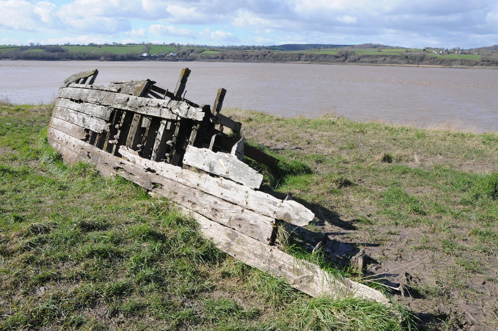
Purton Hulks

The Purton Hulks or Purton Ships' Graveyard is a number of abandoned boats and ships, deliberately beached beside the River Severn near Purton in Gloucestershire...

Hamfallow

Hamfallow is a civil parish in the district of Stroud, Gloucestershire. There is no village centre, the parish consists of farms and hamlets such as Abwell...

Sharpness railway station

Sharpness railway station served the village and docks of Sharpness in Gloucestershire, England from 1875 to 1964. == History == The station was on the...

Berkeley Road railway station

Berkeley Road railway station served the towns of Berkeley and Dursley in Gloucestershire, England. == History == The station was one of the first six...

Slimbridge

Slimbridge is a village and civil parish near Dursley in Gloucestershire, England. It is best known as the home of the Wildfowl and Wetlands Trust's Slimbridge...

Nearby Amenities

Located within 500m of 51.72573,-2.4255135
The data included in this document is from www.openstreetmap.org. The data is made available under ODbL.

Have you been to Red Wood?

Leave your review of Red Wood below (or comments, questions and feedback).