Ardendrain

Settlement in Inverness-shire

Scotland

Ardendrain

Log stacks, Boblainy Forest Stacks of timber alongside the track, on a grey evening.
Log stacks, Boblainy Forest Credit: Craig Wallace

Ardendrain is a small village located in the Inverness-shire region of Scotland. Situated in the heart of the Scottish Highlands, this picturesque village is surrounded by stunning natural landscapes, making it an ideal destination for nature enthusiasts and outdoor adventurers.

The village itself is characterized by its quaint charm and peaceful atmosphere. It consists of a cluster of traditional stone cottages, some of which date back several centuries. The village is home to a close-knit community of residents who take great pride in maintaining the beauty and authenticity of their surroundings.

Nature lovers are drawn to Ardendrain for its proximity to several natural wonders. The village is nestled in close proximity to the renowned Loch Ness, known for its legendary Loch Ness Monster. Visitors can explore the area by embarking on scenic hikes along the Loch Ness Trail, or by taking a boat tour to marvel at the spectacular views.

In addition to its natural beauty, Ardendrain offers a range of outdoor activities and recreational opportunities. Fishing enthusiasts can try their luck in the nearby rivers and lochs, while hikers and cyclists can explore the surrounding hills and glens. The village is also a popular destination for birdwatching, with a wide variety of bird species inhabiting the area.

Although Ardendrain is a small village, it boasts a strong sense of community spirit. The locals often come together for social events and gatherings, creating a warm and welcoming atmosphere for both residents and visitors alike.

Overall, Ardendrain is a hidden gem in the Scottish Highlands, offering a unique blend of natural beauty, outdoor activities, and community spirit.

If you have any feedback on the listing, please let us know in the comments section below.
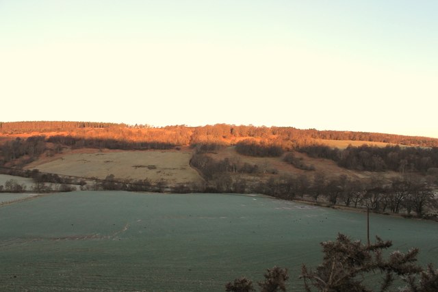
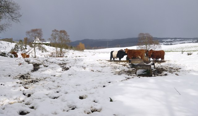
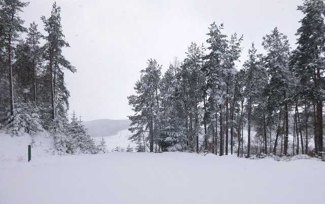
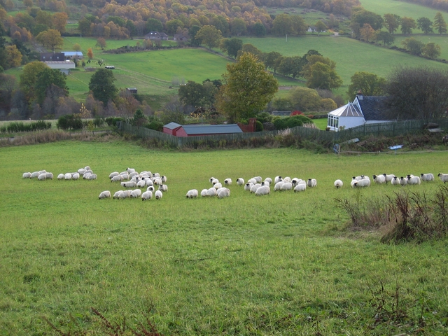
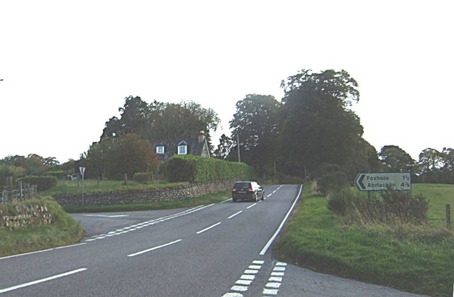
Ardendrain Images

Images are sourced within 2km of 57.409597/-4.48137 or Grid Reference NH5138. Thanks to Geograph Open Source API. All images are credited.

Log stacks, Boblainy Forest Stacks of timber alongside the track, on a grey evening.
Log stacks, Boblainy Forest
Stacks of timber alongside the track, on a grey evening.
Minor track, Boblainy Forest Much of the surrounding area has been felled recently, but the smaller trees alongside the track have been left.
Minor track, Boblainy Forest
Much of the surrounding area has been felled recently, but the smaller trees alongside the track have been left.
Bench with a view, Boblainy Forest A view north towards Ben Wyvis. The cleared area in the foreground is now getting covered by bracken and gorse.

A similar view last year. <a href="https://www.geograph.org.uk/photo/6419555">NH4937 : Bench with a view, Boblainy Forest</a>
Bench with a view, Boblainy Forest
A view north towards Ben Wyvis. The cleared area in the foreground is now getting covered by bracken and gorse. A similar view last year. NH4937 : Bench with a view, Boblainy Forest
Road down to Whitebridge
Glen Convinth
Glen Convinth
Minor road by Ruifour This road goes along past a few houses and small farms.
Minor road by Ruifour
This road goes along past a few houses and small farms.
Forest track into Battan
Forest track down the hill This track was upgraded last year, with this gate added. The gate is usually locked, but there is space around the sides for pedestrians or cyclists. There is a sign warning of "Timber Operations Ahead", but there didn't seem to be much happening today.
Some houses and fields near Femnock and Boblainy are visible in the distance.
Forest track down the hill
This track was upgraded last year, with this gate added. The gate is usually locked, but there is space around the sides for pedestrians or cyclists. There is a sign warning of "Timber Operations Ahead", but there didn't seem to be much happening today. Some houses and fields near Femnock and Boblainy are visible in the distance.
Valley of the Bruiach Burn Much of the forest on the slopes either side of the burn was felled a few years ago. It looks like not much has been replanted - instead the area is becoming covered with bushes, heather, and a few small trees.
Valley of the Bruiach Burn
Much of the forest on the slopes either side of the burn was felled a few years ago. It looks like not much has been replanted - instead the area is becoming covered with bushes, heather, and a few small trees.
Footbridge over the Bruiach Burn This bridge was built here fairly recently, probably sometime last year. 
I'm not sure why it is here, as it doesn't seem to lead to anywhere on the west side. Though you could cut across fields to the road or houses at Femnock.
Footbridge over the Bruiach Burn
This bridge was built here fairly recently, probably sometime last year. I'm not sure why it is here, as it doesn't seem to lead to anywhere on the west side. Though you could cut across fields to the road or houses at Femnock.
Abandoned van, in Boblainy forest It looks like this van has been pushed off the forest track and down the hill. It has been here for quite a few years now, and is now rather rusty.
The van is a Ford Escort Mk3 or Mk4, dating from the 1980s.

The fence on the right is the boundary of the Forestry Commission land.
Abandoned van, in Boblainy forest
It looks like this van has been pushed off the forest track and down the hill. It has been here for quite a few years now, and is now rather rusty. The van is a Ford Escort Mk3 or Mk4, dating from the 1980s. The fence on the right is the boundary of the Forestry Commission land.
Lone Tree A lone tree in a field by Cnoc an t-Sithean.
Lone Tree
A lone tree in a field by Cnoc an t-Sithean.
Convinth Cemetery The abandoned church and old graveyard by White Bridge, Convinth.
Convinth Cemetery
The abandoned church and old graveyard by White Bridge, Convinth.
Glen Convinth Tree lined fields in Glen Convinth.
Glen Convinth
Tree lined fields in Glen Convinth.
Wooded Layby An improvised layby by woodland in Glen Convith.
Wooded Layby
An improvised layby by woodland in Glen Convith.
Field by Fanblair Fields near Fanblair and Boblainy Forest on the hilltop behind.
Field by Fanblair
Fields near Fanblair and Boblainy Forest on the hilltop behind.
Cattle in the snow, by Achnacloich A group of cattle gathered around a feeder.
The track along the side of the field is often rather muddy, today it is also covered by snow. The house and farm buildings at Achnacloich are in the distance on the left of the photo.
Cattle in the snow, by Achnacloich
A group of cattle gathered around a feeder. The track along the side of the field is often rather muddy, today it is also covered by snow. The house and farm buildings at Achnacloich are in the distance on the left of the photo.
Track junction in the snow The main track through Boblainy Forest - between Ardendrain and Culburnie - is on the left of the photo. This route is marked by a red Forestry Commission marker post. Another track branches off to the right.
Track junction in the snow
The main track through Boblainy Forest - between Ardendrain and Culburnie - is on the left of the photo. This route is marked by a red Forestry Commission marker post. Another track branches off to the right.
Show me another place!

Ardendrain is located at Grid Ref: NH5138 (Lat: 57.409597, Lng: -4.48137)

Unitary Authority: Highland

Police Authority: Highlands and Islands

What 3 Words

///handwriting.incisions.daffodils. Near Beauly, Highland

Nearby Locations

Ardendrain

Related Wikis

Nearby Amenities

Located within 500m of 57.409597,-4.48137
Ardendrain
Place: hamlet
Lat/Long: 57.4128654/-4.4781167
Glenview Chalet Park
Tourism: chalet
Lat/Long: 57.4118201/-4.4767711
Addr Housename: Ardenvale
Building: house
Lat/Long: 57.4129523/-4.4766032
Addr Housename: Hillcroft
Addr Housenumber: 6
Building: house
Lat/Long: 57.4104277/-4.4779158
Power: pole
Lat/Long: 57.4059179/-4.4788402
Power: pole
Lat/Long: 57.4064047/-4.4787474
Power: pole
Lat/Long: 57.407357/-4.4787562
Power: pole
Lat/Long: 57.4082795/-4.4787717
Power: pole
Lat/Long: 57.4089103/-4.4787695
Power: pole
Lat/Long: 57.4098923/-4.4792601
Power: pole
Lat/Long: 57.4106861/-4.4796534
Power: pole
Lat/Long: 57.4112872/-4.4799473
Power: pole
Lat/Long: 57.4123905/-4.4804887
Power: pole
Lat/Long: 57.4131177/-4.4808776
Power: pole
Lat/Long: 57.4138591/-4.4812732
Power: pole
Lat/Long: 57.405869/-4.4784712
Power: pole
Lat/Long: 57.4078724/-4.4785198
Power: pole
Lat/Long: 57.4085532/-4.4785441
Power: pole
Lat/Long: 57.4098006/-4.478575
Power: pole
Lat/Long: 57.4105207/-4.4786082
Power: pole
Lat/Long: 57.4112848/-4.4784977
Power: pole
Lat/Long: 57.4119644/-4.4783916
Material: wood
Power: pole
Lat/Long: 57.4126047/-4.4783298
Power: pole
Lat/Long: 57.4056714/-4.4843414
Power: pole
Lat/Long: 57.4057113/-4.4830642
Power: pole
Lat/Long: 57.4057619/-4.481682
Power: pole
Lat/Long: 57.4057929/-4.4807892
Power: pole
Lat/Long: 57.405825/-4.4797352
Power: pole
Lat/Long: 57.4059119/-4.4771542
Power: pole
Lat/Long: 57.4059559/-4.4767608
Blue Bonnet Hill
Place: locality
Lat/Long: 57.4081551/-4.4880223
The data included in this document is from www.openstreetmap.org. The data is made available under ODbL.

Have you been to Ardendrain?

Leave your review of Ardendrain below (or comments, questions and feedback).