Summerhouse Wood

Wood, Forest in Somerset

England

Summerhouse Wood

Saltford - Mead Lane & the River Avon
Saltford - Mead Lane & the River Avon Credit: Colin Park

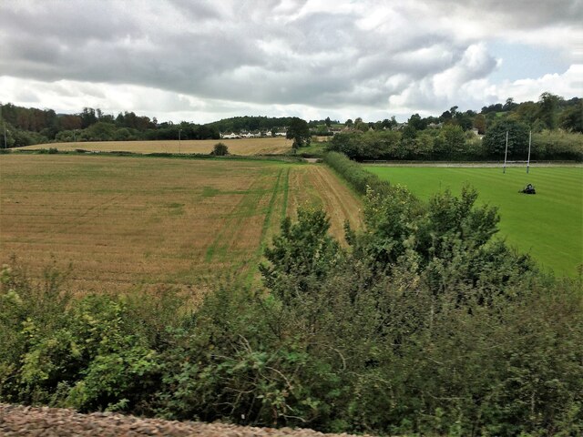
Summerhouse Wood is a picturesque woodland located in the county of Somerset, England. Covering an area of approximately 100 acres, it is a haven for nature enthusiasts and those seeking a peaceful retreat from the hustle and bustle of everyday life.

The wood is predominantly made up of native broadleaf trees such as oak, ash, and beech, which create a rich and diverse ecosystem. The dense canopy provides a cool and shady respite during hot summer months, making it an ideal place for leisurely walks or picnics with family and friends.

As one explores deeper into the wood, they will discover a myriad of flora and fauna. Bluebells carpet the forest floor in spring, creating a stunning display of vibrant colors. The air is filled with the sweet scent of wildflowers, while the gentle chirping of birds provides a soothing soundtrack to one's visit.

Summerhouse Wood is also home to a variety of wildlife, including deer, foxes, and squirrels. The presence of these creatures adds to the enchanting atmosphere of the wood, allowing visitors to connect with nature on a more intimate level.

In addition to its natural beauty, Summerhouse Wood offers several amenities to enhance visitors' experiences. Well-marked trails guide hikers along scenic routes, while designated picnic areas provide a comfortable spot to enjoy a packed lunch. There are also information boards dotted throughout the wood, offering insights into the history and ecology of the area.

Overall, Summerhouse Wood is a captivating destination that showcases the beauty and tranquility of the Somerset countryside. Whether it is to immerse oneself in nature, embark on a peaceful hike, or simply escape the pressures of modern life, this woodland offers a rejuvenating experience for all who visit.

If you have any feedback on the listing, please let us know in the comments section below.

Summerhouse Wood Images

Images are sourced within 2km of 51.393408/-2.4326118 or Grid Reference ST6966. Thanks to Geograph Open Source API. All images are credited.

Saltford - Mead Lane & the River Avon
Saltford Manor The Saltford Manor is thought to be the oldest continuously occupied private house in England, and has been designated as a Grade II listed building.
The original Norman construction was by William Fitz Robert, 2nd Earl of Gloucester, and was built on an estate owned at the time of the Domesday Book by Geoffrey de Montbray the Bishop of Coutances. It is contemporary with nearby Horton Court which was a prebendary house, therefore it is likely that Saltford had an association with Keynsham Abbey, and has long been associated with St Mary's Church in Saltford. (source Wikipedia)
Saltford Manor
The Saltford Manor is thought to be the oldest continuously occupied private house in England, and has been designated as a Grade II listed building. The original Norman construction was by William Fitz Robert, 2nd Earl of Gloucester, and was built on an estate owned at the time of the Domesday Book by Geoffrey de Montbray the Bishop of Coutances. It is contemporary with nearby Horton Court which was a prebendary house, therefore it is likely that Saltford had an association with Keynsham Abbey, and has long been associated with St Mary's Church in Saltford. (source Wikipedia)
Saltford - The River Avon by the Riverside Inn
Saltford - The River Avon east of Saltford Marina
Flood Relief Railway Tunnels, Saltford. These tunnels cut underneath the disused Midland Railway line (now a cycle path) to stop any flooding from the River Avon nearby damaging it. It allowed flood water through to farm fields on the other side. Access to these tunnels is now available to view since a diverted footpath has been made through woods alongside the original path in the fields to the west.
Flood Relief Railway Tunnels, Saltford.
These tunnels cut underneath the disused Midland Railway line (now a cycle path) to stop any flooding from the River Avon nearby damaging it. It allowed flood water through to farm fields on the other side. Access to these tunnels is now available to view since a diverted footpath has been made through woods alongside the original path in the fields to the west.
Old Boundary Markers beside the A4 on Newton Bridge On Newton Bridge over Corston Brook, on the southwest side of the A4 Bristol Road.

On the left, on the boundary of Newton St Loe and Corston parishes, is Turnpike Parish Boundary Marker SO_BABR03pb. On its left face is NEWT.N / P.H and on its right face is CORST.N / P.H with BRISTOL TURNPIKE TRUST vertically between them and 1823 horizontally above. See also <a title="https://www.geograph.org.uk/photo/6038123" href="https://www.geograph.org.uk/photo/6038123">Link</a>.

On the right, entirely in Corston parish, is bridge marker SO_CORST01br.
Old Boundary Markers beside the A4 on Newton Bridge
On Newton Bridge over Corston Brook, on the southwest side of the A4 Bristol Road. On the left, on the boundary of Newton St Loe and Corston parishes, is Turnpike Parish Boundary Marker SO_BABR03pb. On its left face is NEWT.N / P.H and on its right face is CORST.N / P.H with BRISTOL TURNPIKE TRUST vertically between them and 1823 horizontally above. See also Link. On the right, entirely in Corston parish, is bridge marker SO_CORST01br.
River Avon and Kelston Brass Mill The end of Saltford Lock is seen on the extreme right. There is a heron on the weir. The two annealing furnace chimneys are the remains of a former brass mill and are Listed Grade II.
River Avon and Kelston Brass Mill
The end of Saltford Lock is seen on the extreme right. There is a heron on the weir. The two annealing furnace chimneys are the remains of a former brass mill and are Listed Grade II.
Kelston Brass Mill The outer shells of two former annealing furnaces that are Listed Grade II. There is a good view across the River Avon but no public access to the site.
Kelston Brass Mill
The outer shells of two former annealing furnaces that are Listed Grade II. There is a good view across the River Avon but no public access to the site.
Saltford Lock On the River Avon between Bath and Bristol.
Saltford Lock
On the River Avon between Bath and Bristol.
Saltford Lock On the River Avon. The remains of Kelston Brass Mill are seen on the other side of the weir.
Saltford Lock
On the River Avon. The remains of Kelston Brass Mill are seen on the other side of the weir.
From a Swindon-Bristol train, fields and playing field near Corston
From a Swindon-Bristol train, alongside the River Avon
River Avon and walkway bridge View to the east/north side of the Bristol & Bath Railway path.
River Avon and walkway bridge
View to the east/north side of the Bristol & Bath Railway path.
Old Boundary Marker beside the A39 Wells Road, Corston Turnpike Parish Boundary Marker on the grass verge on the south side of the A39 Wells Road east of Corston village. Corston parish. Grade II Listed details <span class="nowrap"><a title="https://historicengland.org.uk/listing/the-list/list-entry/1320799" rel="nofollow ugc noopener" href="https://historicengland.org.uk/listing/the-list/list-entry/1320799">Link</a><img style="margin-left:2px;" alt="External link" title="External link - shift click to open in new window" src="https://s1.geograph.org.uk/img/external.png" width="10" height="10"/></span>. For an older photo, see <a title="https://www.geograph.org.uk/photo/6048086" href="https://www.geograph.org.uk/photo/6048086">Link</a>. See also <a title="https://www.geograph.org.uk/photo/5883994" href="https://www.geograph.org.uk/photo/5883994">Link</a> and <a title="https://www.geograph.org.uk/photo/1719253" href="https://www.geograph.org.uk/photo/1719253">Link</a>.

Milestone Society National ID: SO_BAMK03pb
Old Boundary Marker beside the A39 Wells Road, Corston
Turnpike Parish Boundary Marker on the grass verge on the south side of the A39 Wells Road east of Corston village. Corston parish. Grade II Listed details LinkExternal link. For an older photo, see Link. See also Link and Link. Milestone Society National ID: SO_BAMK03pb
Old Milestone by the A4, Bath Road, Saltford Metal plate attached to stone post by the A4, in parish of SALTFORD (BATH AND NORTH EAST SOMERSET District), Bath Road, near top of hill going into Saltford from Bath, embedded in stone retaining wall beside pavement, on West side of road. Bristol iron plate, erected by the Bristol turnpike trust in the 19th century. 

Inscription reads:- : 7 / MILES / TO / BRISTOL : 
Serifs. Carved benchmark at base of stone.

Milestone Society National ID: SO_BABR05.
Old Milestone by the A4, Bath Road, Saltford
Metal plate attached to stone post by the A4, in parish of SALTFORD (BATH AND NORTH EAST SOMERSET District), Bath Road, near top of hill going into Saltford from Bath, embedded in stone retaining wall beside pavement, on West side of road. Bristol iron plate, erected by the Bristol turnpike trust in the 19th century. Inscription reads:- : 7 / MILES / TO / BRISTOL : Serifs. Carved benchmark at base of stone. Milestone Society National ID: SO_BABR05.
The marina at Saltford
The River Avon by Saltford
The River Avon by Corston
Show me another place!

Summerhouse Wood is located at Grid Ref: ST6966 (Lat: 51.393408, Lng: -2.4326118)

Unitary Authority: Bath and North East Somerset

Police Authority: Avon and Somerset

What 3 Words

///tapes.ounce.views. Near Corston, Somerset

Related Wikis

Kelston Park

Kelston Park is an 18th-century country house in the village of Kelston, approximately 3 miles from Bath in North East Somerset, England. Altogether the...

Kelston

Kelston is a small village and civil parish in Somerset, 4 miles (6.4 km) north west of Bath, and 8 miles (12.9 km) east of Bristol, on the A431 road....

Corston, Somerset

Corston is a small village and civil parish close to the River Avon and situated on the A39 road in the Bath and North East Somerset unitary authority...

Kelston toll road

The Kelston toll road was a 1,198-foot-long (365 m) private, temporary toll road, built by a private entrepreneur without planning permission between Bath...

Avon County Rowing Club

Avon County Rowing Club is a rowing club on the River Avon based at the Saltford Rowing Centre, Bath Road, Saltford, Bristol. == History == The club was...

University of Bristol Boat Club

University of Bristol Boat Club is a rowing club on the River Avon based at the Saltford Rowing Centre, Bath Road, Saltford, Bristol. == History == The...

Kelston Knoll

Kelston Knoll is a Grade II listed building on the National Heritage List for England, located in the parish of Kelston, a village near Bath, in Somerset...

Church of the Holy Trinity, Newton St Loe

The Anglican Church of the Holy Trinity in Newton St Loe within the English county of Somerset is a Grade II* listed building.A church has stood on the...

Nearby Amenities

Located within 500m of 51.393408,-2.4326118
Barrier: stile
Lat/Long: 51.3895042/-2.4352838
Bus Stop
Corston Turn
Naptan AtcoCode: 0180BAC30667
Naptan Bearing: E
Naptan CommonName: Corston Turn
Naptan Crossing: Corston Lane
Naptan NaptanCode: bthdgpj
Naptan Street: Bristol Road
Naptan Verified: no
Source: naptan_import
Lat/Long: 51.3905729/-2.4370821
Bus Stop
Corston Turn
Bus: yes
Naptan AtcoCode: 0180BAC30668
Naptan Bearing: NW
Naptan CommonName: Corston Turn
Naptan Crossing: Corston Lane
Naptan NaptanCode: bthdgmp
Naptan Street: Bristol Road
Naptan Verified: no
Public Transport: platform
Source: naptan_import
Lat/Long: 51.3908409/-2.4383259
Barrier: stile
Lat/Long: 51.3905215/-2.4368607
Bench
Backrest: yes
Lat/Long: 51.3914843/-2.4262572
Bench
Lat/Long: 51.3941311/-2.4366813
Man Made: mast
Lat/Long: 51.3921176/-2.4372654
Power: pole
Lat/Long: 51.3969847/-2.4346671
Power: pole
Lat/Long: 51.3975567/-2.4353888
Power: pole
Lat/Long: 51.3963899/-2.4339293
Power: pole
Lat/Long: 51.3964051/-2.4327239
Power: pole
Lat/Long: 51.3958369/-2.4332483
Power: pole
Lat/Long: 51.3964178/-2.4315062
Power: pole
Lat/Long: 51.3964381/-2.4302886
Power: pole
Lat/Long: 51.396447/-2.4290731
Power: pole
Lat/Long: 51.3964647/-2.4278819
Power: pole
Lat/Long: 51.3952776/-2.4325572
Power: pole
Lat/Long: 51.3947043/-2.4318518
Railway: signal
Railway Signal Direction: forward
Railway Signal Main: GB-NR:main
Ref: D0 1934
Lat/Long: 51.3898692/-2.4303197
Railway: signal
Railway Signal Direction: forward
Railway Signal Main: GB-NR:main
Ref: D0 1935
Lat/Long: 51.3898786/-2.4304775
The data included in this document is from www.openstreetmap.org. The data is made available under ODbL.

Have you been to Summerhouse Wood?

Leave your review of Summerhouse Wood below (or comments, questions and feedback).