Badger Ford Wood

Wood, Forest in Yorkshire Craven

England

Badger Ford Wood

Greystonegill Lane approaching High Barn Looking southward. The rounded outline of Burn Moor can be seen in the far distance.
Greystonegill Lane approaching High Barn Credit: Peter Wood

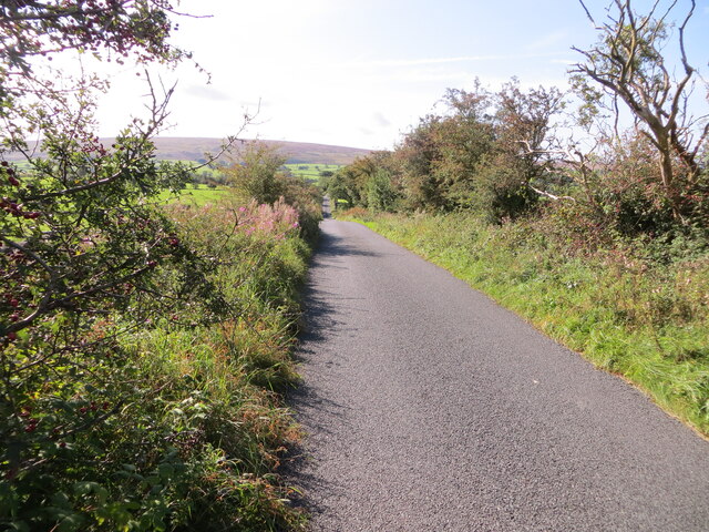
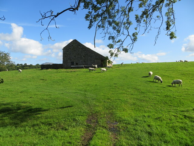
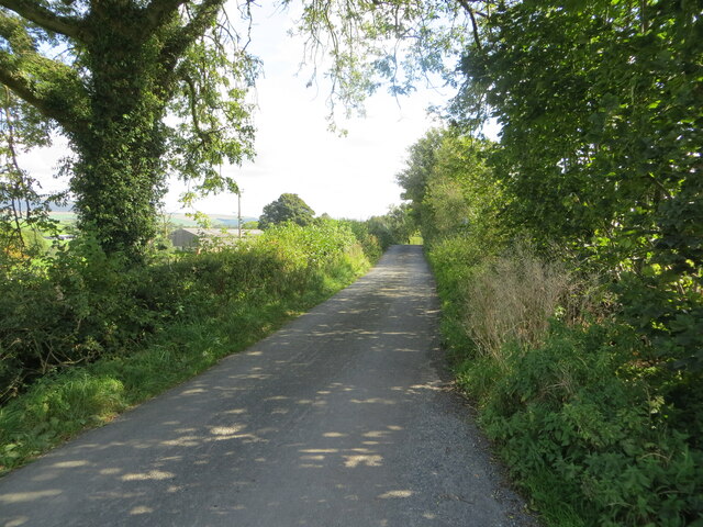
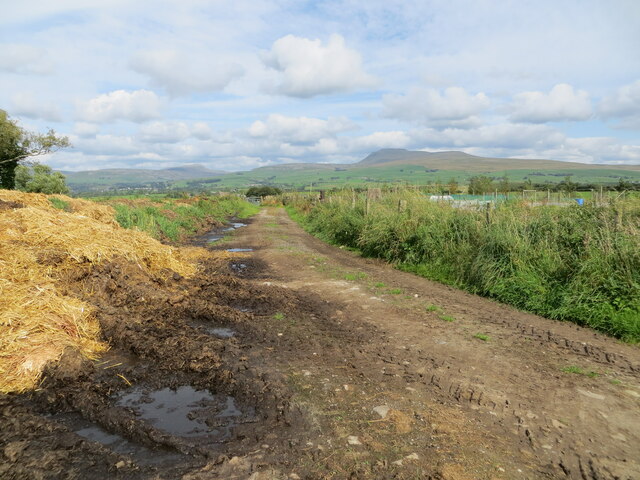
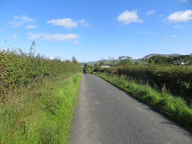
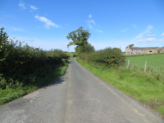
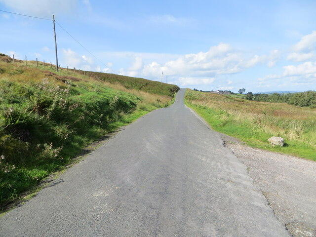
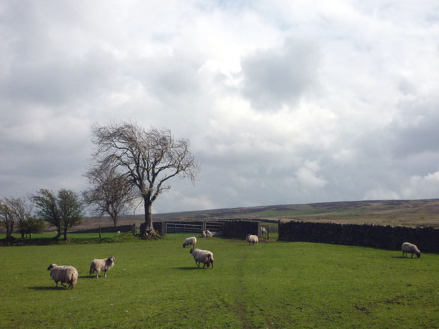
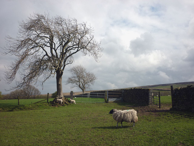
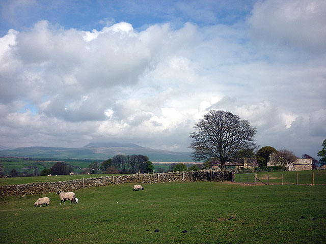
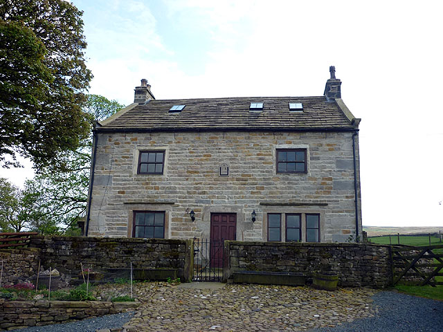
Badger Ford Wood is a charming woodland area located in the county of Yorkshire, England. Situated near the village of Badger Ford, the wood covers an estimated area of 50 acres. It is a part of the larger forested region of Yorkshire known for its natural beauty and diverse flora and fauna.

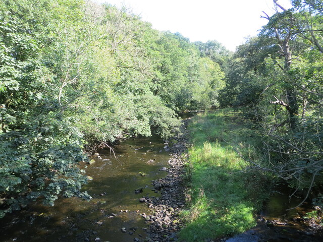
The wood is predominantly composed of deciduous trees, including oak, beech, and birch, which create a vibrant and colorful canopy during the autumn months. The dense foliage provides a habitat for a variety of wildlife, such as badgers, deer, foxes, and numerous bird species. Birdwatchers can spot woodpeckers, owls, and even the elusive kingfisher along the tranquil streams that meander through the wood.

Visitors to Badger Ford Wood can explore its network of well-maintained walking trails, which offer a chance to immerse oneself in the peaceful surroundings and enjoy the sights and sounds of nature. The wood also features a picnic area, allowing visitors to relax and enjoy a meal while surrounded by the beauty of the forest.

In addition to its natural attractions, Badger Ford Wood holds historical significance. The area was once part of a larger ancient woodland that played a vital role in providing timber for construction and fuel for the local communities. Today, remnants of old charcoal hearths can still be found, serving as a reminder of its past.

Badger Ford Wood is a popular destination for nature enthusiasts, hikers, and those seeking a tranquil escape from the hustle and bustle of everyday life. Its rich biodiversity, picturesque landscapes, and historical significance make it a cherished gem in the Yorkshire countryside.

If you have any feedback on the listing, please let us know in the comments section below.

Badger Ford Wood Images

Images are sourced within 2km of 54.105616/-2.4721204 or Grid Reference SD6967. Thanks to Geograph Open Source API. All images are credited.

Greystonegill Lane approaching High Barn Looking southward. The rounded outline of Burn Moor can be seen in the far distance.
Greystonegill Lane approaching High Barn
Looking southward. The rounded outline of Burn Moor can be seen in the far distance.
River Wenning at Greystonegill Bridge Looking north-eastward upstream.
River Wenning at Greystonegill Bridge
Looking north-eastward upstream.
Pastureland and field barn on Buffet Hill Looking north-eastward.
Pastureland and field barn on Buffet Hill
Looking north-eastward.
Mewith Lane approaching New House Looking eastward.
Mewith Lane approaching New House
Looking eastward.
Hedge-lined land approaching Barnfield Looking north-westward.
Hedge-lined land approaching Barnfield
Looking north-westward.
Track between piles of maure and Triangulation Pillar at Lingshaw Cross Looking north-eastward.
Track between piles of maure and Triangulation Pillar at Lingshaw Cross
Looking north-eastward.
Hedge enclosed lane near Chesters Looking north-eastward towards Kiln Lodge. In the far distance (right) Ingleborough can be seen.
Hedge enclosed lane near Chesters
Looking north-eastward towards Kiln Lodge. In the far distance (right) Ingleborough can be seen.
Hedge and fence enclosed lane at Chesters Looking westward.
Hedge and fence enclosed lane at Chesters
Looking westward.
Mewith Lane beside Cinder Hill Looking north-westward.
Mewith Lane beside Cinder Hill
Looking north-westward.
Ridding Lane farmhouse There is a date stone of 1664 with initials RH over the door (Richard Hall). It is Grade II listed <span class="nowrap"><a title="http://www.britishlistedbuildings.co.uk/en-324097-ridding-lane-farmhouse-bentham" rel="nofollow ugc noopener" href="http://www.britishlistedbuildings.co.uk/en-324097-ridding-lane-farmhouse-bentham">Link</a><img style="margin-left:2px;" alt="External link" title="External link - shift click to open in new window" src="https://s1.geograph.org.uk/img/external.png" width="10" height="10"/></span>
Ridding Lane farmhouse
There is a date stone of 1664 with initials RH over the door (Richard Hall). It is Grade II listed LinkExternal link
Spring is in the air! These young cows from Ridding Lane have just been released into the field by Shaky Bridge. They may have been indoors for a while so are glad to be let loose - here come the girls!
Spring is in the air!
These young cows from Ridding Lane have just been released into the field by Shaky Bridge. They may have been indoors for a while so are glad to be let loose - here come the girls!
Seal Style Farm in the Forest of Mewith.
Seal Style
Farm in the Forest of Mewith.
Gruskholme - not to be confused with Gruskham A late 17th/early 18th Century former farmhouse in the Forest of Mewith. It is Grade II listed <span class="nowrap"><a title="http://www.britishlistedbuildings.co.uk/en-324070-gruskholme-bentham" rel="nofollow ugc noopener" href="http://www.britishlistedbuildings.co.uk/en-324070-gruskholme-bentham">Link</a><img style="margin-left:2px;" alt="External link" title="External link - shift click to open in new window" src="https://s1.geograph.org.uk/img/external.png" width="10" height="10"/></span> The footpath coming up from Seal Style to the north appears to be blocked here (naughty!).
Gruskholme - not to be confused with Gruskham
A late 17th/early 18th Century former farmhouse in the Forest of Mewith. It is Grade II listed LinkExternal link The footpath coming up from Seal Style to the north appears to be blocked here (naughty!).
Gruskham - not to be confused with Gruskholme Another converted farmhouse. The postman must get confused up here. This is Grade II listed <span class="nowrap"><a title="http://www.britishlistedbuildings.co.uk/en-324069-gruskham-bentham" rel="nofollow ugc noopener" href="http://www.britishlistedbuildings.co.uk/en-324069-gruskham-bentham">Link</a><img style="margin-left:2px;" alt="External link" title="External link - shift click to open in new window" src="https://s1.geograph.org.uk/img/external.png" width="10" height="10"/></span>
Gruskham - not to be confused with Gruskholme
Another converted farmhouse. The postman must get confused up here. This is Grade II listed LinkExternal link
Sheep at Gruskham There is one more intake field of improved pasture then the open wastes of Burn Moor.
Sheep at Gruskham
There is one more intake field of improved pasture then the open wastes of Burn Moor.
Sheep and lambs at Gruskham Mother keeps an eye on the children while they get on with the important job of checking out the tree.
Sheep and lambs at Gruskham
Mother keeps an eye on the children while they get on with the important job of checking out the tree.
Approaching Crow Trees The footpath from Gruskham heads through sheep pastures with a good view of Ingleborough.
Approaching Crow Trees
The footpath from Gruskham heads through sheep pastures with a good view of Ingleborough.
Crow Trees farmhouse Most of the farmhouses up here in the Forest of Mewith seem to be converted. This one has a 1770 date stone with initials IR. It is Grade II listed <span class="nowrap"><a title="http://www.britishlistedbuildings.co.uk/en-324049-crow-trees-farmhouse-bentham" rel="nofollow ugc noopener" href="http://www.britishlistedbuildings.co.uk/en-324049-crow-trees-farmhouse-bentham">Link</a><img style="margin-left:2px;" alt="External link" title="External link - shift click to open in new window" src="https://s1.geograph.org.uk/img/external.png" width="10" height="10"/></span>
Crow Trees farmhouse
Most of the farmhouses up here in the Forest of Mewith seem to be converted. This one has a 1770 date stone with initials IR. It is Grade II listed LinkExternal link
Show me another place!

Badger Ford Wood is located at Grid Ref: SD6967 (Lat: 54.105616, Lng: -2.4721204)

Division: West Riding

Administrative County: North Yorkshire

District: Craven

Police Authority: North Yorkshire

What 3 Words

///weddings.flattery.roofed. Near High Bentham, North Yorkshire

Related Wikis

Keasden Beck

Keasden Beck is a stream in Yorkshire (formerly the West Riding) rising near Keasden Head, joining the River Wenning south west of Clapham. == References... ==

St Margaret's Church, High Bentham

St Margaret's Church is in Station Road, High Bentham, North Yorkshire, England. It is an Anglican parish church in the deanery of Ewecross, the archdeaconry...

Great Stone of Fourstones

The Great Stone of Fourstones, or the Big Stone as it is known locally, is a glacial deposit on the moorlands of Tatham Fells, England, straddling the...

Bentham railway station

Bentham is a railway station on the Bentham Line, which runs between Leeds and Morecambe via Skipton. The station, situated 19 miles (31 km) east of Lancaster...

Bentham, North Yorkshire

Bentham is a civil parish in North Yorkshire, England, with a population of 3,027 at the 2011 Census. The parish includes the town of High Bentham, occasionally...

Keasden

Keasden is a hamlet in the civil parish of Clapham-cum-Newby, in the Craven district of the county of North Yorkshire, in the north-western England. It...

Clapham railway station

Clapham is a railway station on the Bentham Line, which runs between Leeds and Morecambe via Skipton. The station, situated 48 miles (77 km) north-west...

Ingleton Coalfield

The Ingleton Coalfield is in North Yorkshire, close to its border with Lancashire in north-west England. Isolated from other coal-producing areas, it is...

Nearby Amenities

Located within 500m of 54.105616,-2.4721204
Brown Bank Wood
Natural: wood
Source: OS_OpenData_StreetView
Lat/Long: 54.1075265/-2.4714118
Deaf Head Wood
Natural: wood
Source: OS_OpenData_StreetView
Lat/Long: 54.1053249/-2.4727207
The data included in this document is from www.openstreetmap.org. The data is made available under ODbL.

Have you been to Badger Ford Wood?

Leave your review of Badger Ford Wood below (or comments, questions and feedback).