North Wood

Wood, Forest in Northumberland

England

North Wood

Featherstone Bridge Late 18th century road bridge over the River South Tyne <span class="nowrap"><a title="https://historicengland.org.uk/listing/the-list/list-entry/1045293" rel="nofollow ugc noopener" href="https://historicengland.org.uk/listing/the-list/list-entry/1045293">Link</a><img style="margin-left:2px;" alt="External link" title="External link - shift click to open in new window" src="https://s1.geograph.org.uk/img/external.png" width="10" height="10"/></span>
Featherstone Bridge Credit: Sandy Gerrard

North Wood, located in the county of Northumberland, is a picturesque forest area renowned for its natural beauty and abundant wildlife. Covering an extensive area of approximately 500 acres, North Wood offers a tranquil escape from the bustling city life, attracting nature enthusiasts, hikers, and birdwatchers alike.

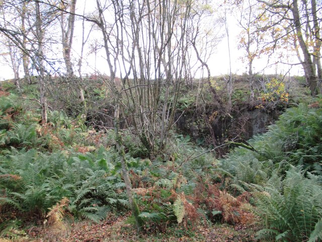
The forest is predominantly made up of native broadleaf trees, including oak, ash, and beech, which create a dense and lush canopy. This provides a habitat for a wide variety of flora and fauna, making North Wood a haven for biodiversity. Visitors can expect to encounter a range of wildlife such as deer, foxes, badgers, and a rich diversity of bird species including woodpeckers, owls, and thrushes.

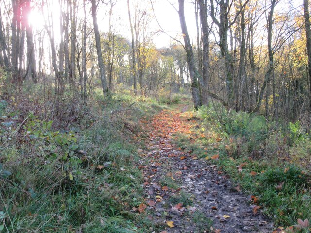
North Wood offers a network of well-maintained walking trails, allowing visitors to explore the forest at their own pace. These trails cater to different levels of difficulty, making the forest accessible to individuals of all ages and fitness levels. The pathways wind through the woodland, offering breathtaking vistas of tranquil ponds, babbling brooks, and ancient trees adorned with moss and lichen.

For those seeking a deeper connection with nature, North Wood also provides camping facilities, allowing visitors to immerse themselves in the forest's serene atmosphere for an extended period. Camping permits can be obtained from the local authorities, ensuring a controlled and sustainable experience for all.

Overall, North Wood in Northumberland is a natural gem, offering a serene and captivating environment for nature lovers to explore, appreciate, and connect with the great outdoors.

If you have any feedback on the listing, please let us know in the comments section below.
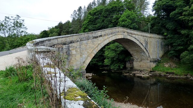
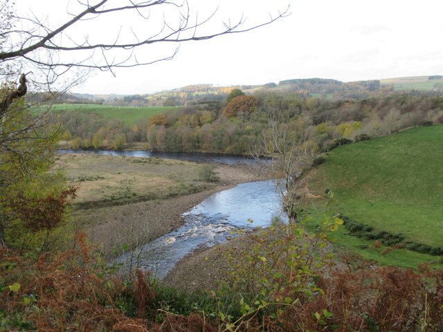
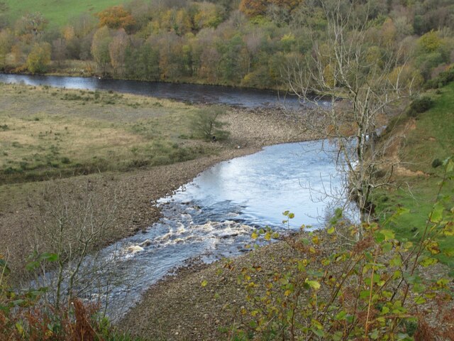
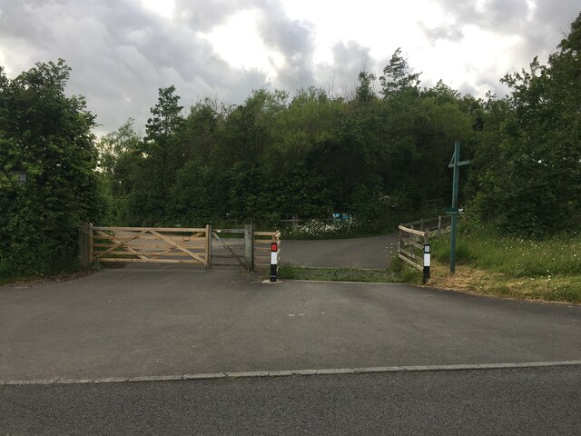
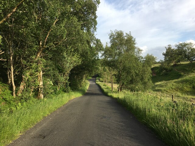
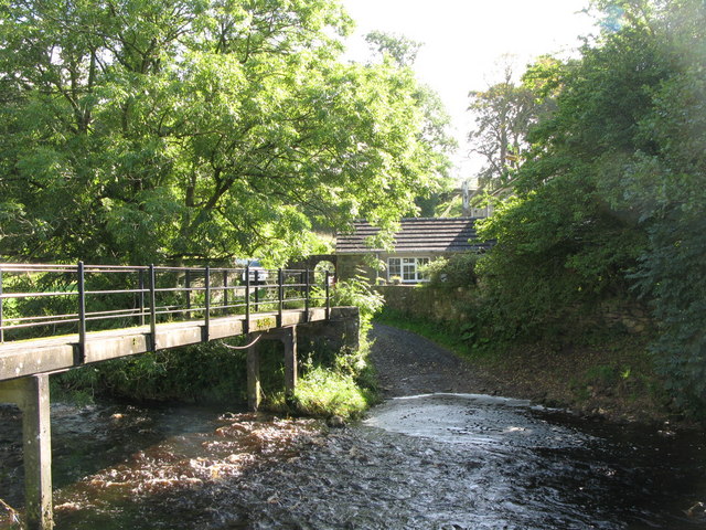
North Wood Images

Images are sourced within 2km of 54.954363/-2.487753 or Grid Reference NY6862. Thanks to Geograph Open Source API. All images are credited.

Featherstone Bridge Late 18th century road bridge over the River South Tyne <span class="nowrap"><a title="https://historicengland.org.uk/listing/the-list/list-entry/1045293" rel="nofollow ugc noopener" href="https://historicengland.org.uk/listing/the-list/list-entry/1045293">Link</a><img style="margin-left:2px;" alt="External link" title="External link - shift click to open in new window" src="https://s1.geograph.org.uk/img/external.png" width="10" height="10"/></span>
Featherstone Bridge
Late 18th century road bridge over the River South Tyne LinkExternal link
Featherstone Park Station
Bridge over Haltwhistle to Alston branch line at Park Village
Waterfall on Park Burn
Park Burnfoot Farm
Park Burnfoot Farm
Footpath through North Wood
View towards River South Tyne
Disused Quarry
Disused Quarry
River South Tyne
River South Tyne
River South Tyne
River South Tyne
Footpath through Bellister Bank Wood
Road to Wydon Farm
Road to Wydon Farm
Minor road near Broomhouse
Road junction near Park Village
Bench beside the river and road near Park Burnfoot
Fields near Featherstone Bridge
Minor road near Featherstone Common
Show me another place!

North Wood is located at Grid Ref: NY6862 (Lat: 54.954363, Lng: -2.487753)

Unitary Authority: Northumberland

Police Authority: Northumbria

What 3 Words

///soups.rucksack.nuance. Near Greenhead, Northumberland

Nearby Locations

North Wood

Related Wikis

Burnfoot River Shingle and Wydon Nabb

Burnfoot River Shingle and Wydon Nabb is the name given to a Site of Special Scientific Interest (SSSI) in Northumberland, North East England. Burnfoot...

Tipalt Burn

Tipalt Burn is a burn which lies to the east of Greenhead, Northumberland. The burn passes several historical sites such as Thirlwall Castle and discharges...

Bellister Castle

Bellister Castle is a National Trust owned castellated 19th-century mansion house attached to the ruinous remains of a 14th-century tower house, near...

Featherstone Park railway station

Featherstone Park was a railway station on the Alston Branch Line, which ran between Haltwhistle and Alston. The station, situated 3 miles (5 km) south...

Nearby Amenities

Located within 500m of 54.954363,-2.487753
Power: pole
Lat/Long: 54.9578671/-2.4832535
Power: pole
Lat/Long: 54.9562893/-2.4821672
Power: pole
Lat/Long: 54.9553683/-2.482033
Power: pole
Lat/Long: 54.9546444/-2.4828753
Power: pole
Lat/Long: 54.9533907/-2.4844095
Power: pole
Lat/Long: 54.9526483/-2.4852839
Power: pole
Lat/Long: 54.9520999/-2.4859437
Power: pole
Lat/Long: 54.9514838/-2.486684
Power: pole
Lat/Long: 54.9509201/-2.4873438
Barrier: stile
Lat/Long: 54.9542704/-2.4832654
Barrier: stile
Lat/Long: 54.9537938/-2.4841539
Barrier: stile
Lat/Long: 54.9503858/-2.4894249
Bench
Lat/Long: 54.9529326/-2.4903413
Tourism: camp_pitch
Lat/Long: 54.9532944/-2.4923435
Tourism: camp_pitch
Lat/Long: 54.953316/-2.4922013
Tourism: camp_pitch
Lat/Long: 54.9532544/-2.4925393
Tourism: camp_pitch
Lat/Long: 54.953202/-2.4927646
Tourism: camp_pitch
Lat/Long: 54.9531789/-2.4928665
Tourism: camp_pitch
Lat/Long: 54.9531389/-2.493065
Tourism: camp_pitch
Lat/Long: 54.9535979/-2.4917641
Tourism: camp_pitch
Lat/Long: 54.9535778/-2.4919412
Tourism: camp_pitch
Lat/Long: 54.9535409/-2.4921691
Tourism: camp_pitch
Lat/Long: 54.9535085/-2.4922523
Tourism: camp_pitch
Lat/Long: 54.9534762/-2.4924213
Tourism: camp_pitch
Lat/Long: 54.9534315/-2.4925822
Tourism: camp_pitch
Lat/Long: 54.9533961/-2.4926975
Tourism: camp_pitch
Lat/Long: 54.9533653/-2.4928209
Tourism: camp_pitch
Lat/Long: 54.953316/-2.4929979
Tourism: camp_pitch
Lat/Long: 54.953279/-2.4931079
Tourism: camp_pitch
Lat/Long: 54.9532221/-2.4932903
Tourism: camp_pitch
Lat/Long: 54.9531712/-2.49347
Tourism: camp_pitch
Lat/Long: 54.9530881/-2.4937114
Tourism: camp_pitch
Lat/Long: 54.9530819/-2.4926063
Tourism: camp_pitch
Lat/Long: 54.9531404/-2.4922738
Tourism: camp_pitch
Lat/Long: 54.9531805/-2.4921235
Tourism: camp_pitch
Lat/Long: 54.9532067/-2.4919492
Tourism: camp_pitch
Lat/Long: 54.9532421/-2.4918017
Tourism: camp_pitch
Lat/Long: 54.9533237/-2.4913859
Tourism: camp_pitch
Lat/Long: 54.9532267/-2.4914905
Tourism: camp_pitch
Lat/Long: 54.9531604/-2.4916542
Tourism: camp_pitch
Lat/Long: 54.9531204/-2.4918097
Tourism: camp_pitch
Lat/Long: 54.9530819/-2.4919948
Tourism: camp_pitch
Lat/Long: 54.9530157/-2.4923059
Tourism: camp_pitch
Lat/Long: 54.9529818/-2.4924454
Tourism: camp_pitch
Lat/Long: 54.9529525/-2.4926224
Tourism: camp_pitch
Lat/Long: 54.9529155/-2.4927941
Tourism: camp_pitch
Lat/Long: 54.9528986/-2.4929765
The data included in this document is from www.openstreetmap.org. The data is made available under ODbL.

Have you been to North Wood?

Leave your review of North Wood below (or comments, questions and feedback).