Croft Plantation
Wood, Forest in Shropshire
England
Croft Plantation
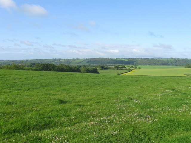
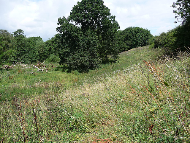
Croft Plantation is a verdant woodland located in Shropshire, a county in the West Midlands region of England. Spanning over a considerable area, it is a thriving forest that boasts a diverse range of plant and animal species, making it a haven for nature enthusiasts and wildlife lovers alike.
The plantation is characterized by its lush canopy of trees, predominantly consisting of oak, beech, and birch. These towering giants provide a picturesque backdrop, particularly during the autumn season when their leaves transform into a vibrant kaleidoscope of colors. The forest floor is adorned with an array of wildflowers and ferns, creating a carpet of natural beauty.
The plantation is home to a plethora of wildlife, including deer, foxes, badgers, and a variety of bird species. Nature enthusiasts can spot these creatures while exploring the numerous walking trails that crisscross the woodland. The plantation also offers designated birdwatching areas, allowing visitors to observe and appreciate the avian inhabitants.
Croft Plantation not only serves as a recreational space but also plays a vital role in the conservation of biodiversity. The forest is managed sustainably, with efforts made to preserve its delicate ecosystem. Regular tree planting initiatives are carried out to maintain the woodland's health and ensure the continued growth of its diverse habitat.
Visitors to Croft Plantation can enjoy a serene and tranquil environment, ideal for relaxation and reconnecting with nature. With its captivating beauty and abundant wildlife, the plantation is a true gem of Shropshire, attracting visitors from far and wide.
If you have any feedback on the listing, please let us know in the comments section below.
Croft Plantation Images
Images are sourced within 2km of 52.54768/-2.4686977 or Grid Reference SO6894. Thanks to Geograph Open Source API. All images are credited.


Croft Plantation is located at Grid Ref: SO6894 (Lat: 52.54768, Lng: -2.4686977)
Unitary Authority: Shropshire
Police Authority: West Mercia
What 3 Words
///flasks.enveloped.jobs. Near Bridgnorth, Shropshire
Nearby Locations
Related Wikis

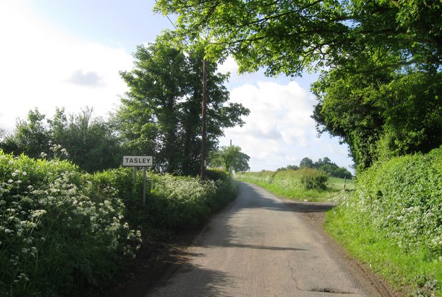
Tasley, Shropshire
Tasley is a village and civil parish in Shropshire, England.It is located to the immediate west of the town of Bridgnorth, and the A458 road passes through...
Morville, Shropshire
Morville is a village and civil parish about 3 miles west of Bridgnorth, in the Shropshire district, in the county of Shropshire, England. In 2011, the...

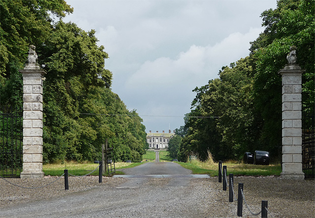
Aldenham Park, Morville
Aldenham Park, also known as Aldenham Hall, is a late 17th-century country house in Morville, near Bridgnorth, Shropshire, England which stands in 12 hectares...

Morville Priory
Morville Priory was a small Benedictine monastery in Shropshire, England, a cell of Shrewsbury Abbey. == Location == Morville today is a hamlet on the...
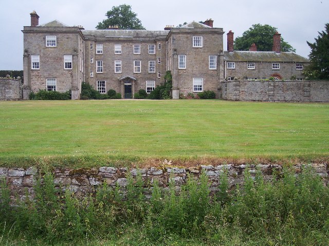
Morville Hall
Morville Hall is a grade I listed country house and gardens in the care of the National Trust in the county of Shropshire, England, United Kingdom. Morville...

Aston Eyre
Aston Eyre is a hamlet and civil parish in Shropshire, England, about four miles west of Bridgnorth. The area has a significant amount of green space....
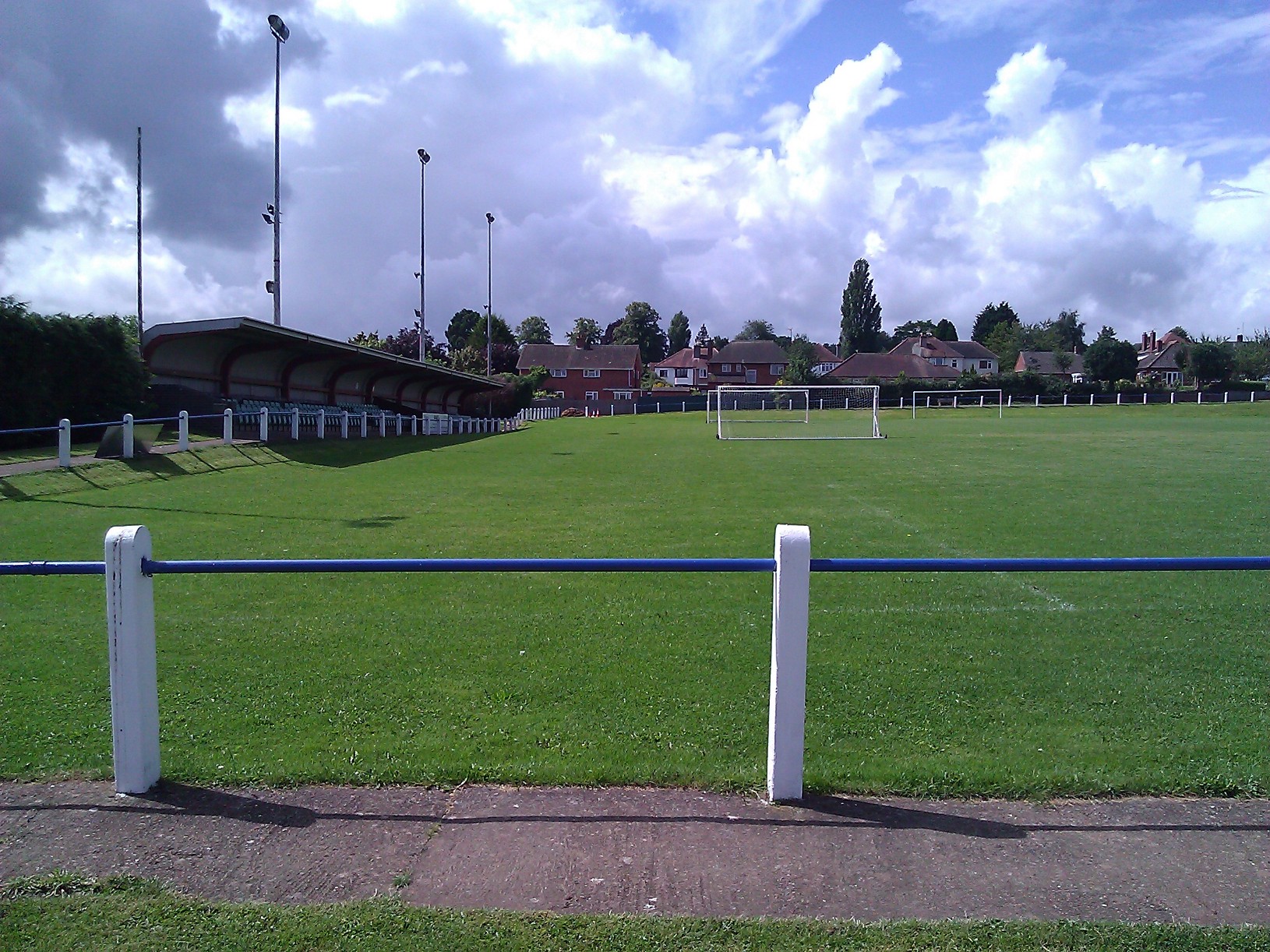
A.F.C. Bridgnorth
AFC Bridgnorth is a football club based in the town of Bridgnorth, Shropshire, England. They are currently members of the Midland League Division One and...

Aston Eyre Hall
Aston Eyre Hall is an unfortified stone manor house at Aston Eyre near Bridgnorth in the English county of Shropshire, United Kingdom. It is a Grade II...
Nearby Amenities
Located within 500m of 52.54768,-2.4686977Have you been to Croft Plantation?
Leave your review of Croft Plantation below (or comments, questions and feedback).