Lowridding Wood

Wood, Forest in Yorkshire South Lakeland

England

Lowridding Wood

Fields Beside Road To Hebblethwaite Hall
Fields Beside Road To Hebblethwaite Hall Credit: David Robinson

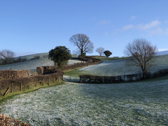
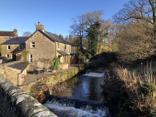
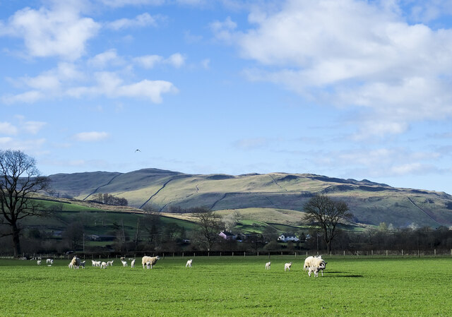
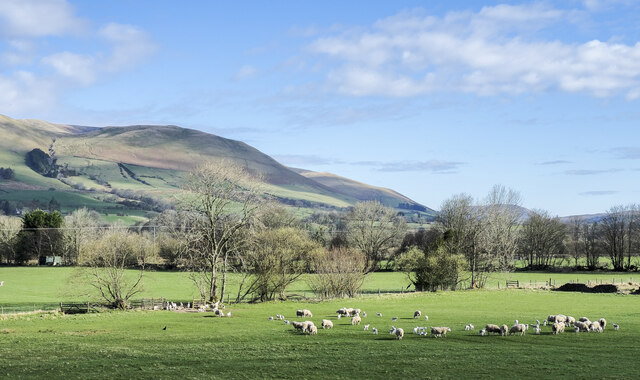
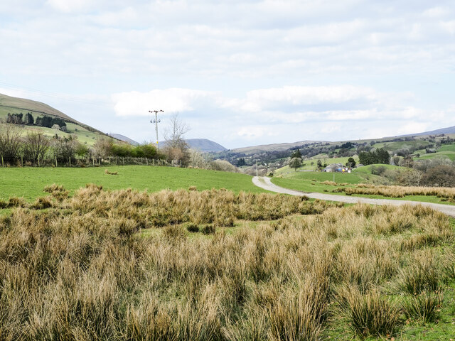
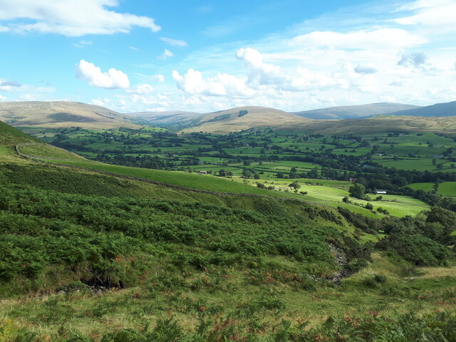
Lowridding Wood is a picturesque forest located in Yorkshire, England. Covering an area of approximately 500 acres, this woodland is a haven for nature enthusiasts and outdoor lovers alike. The forest is situated in the rural countryside, offering a tranquil and serene atmosphere.

Lowridding Wood is characterized by its diverse range of tree species, including oak, beech, and birch. The forest floor is adorned with an array of wildflowers, creating a vibrant and colorful landscape during the spring and summer months.

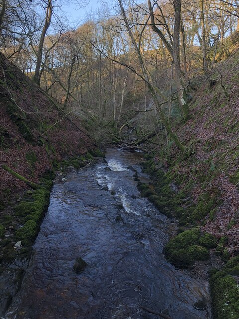
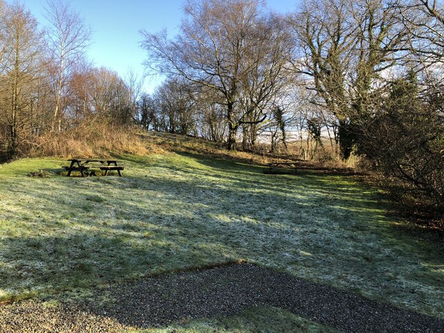
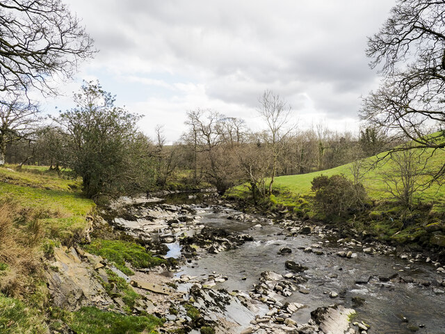
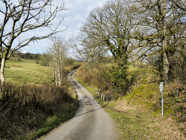
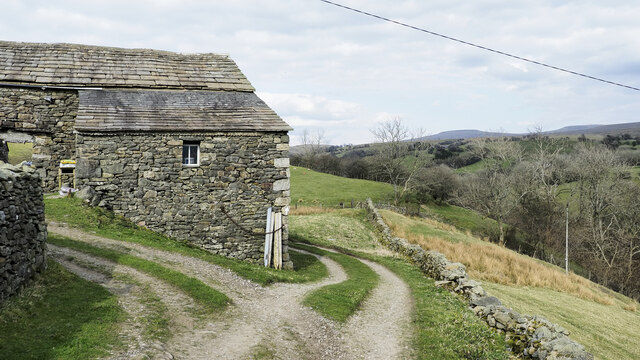
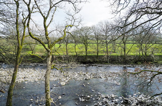
The woodland is intersected by several walking trails, allowing visitors to explore its natural beauty. These well-maintained paths wind through the forest, providing opportunities for hiking, jogging, and nature observation. Along the way, one can discover hidden streams and small ponds, adding to the charm and beauty of the woodland.

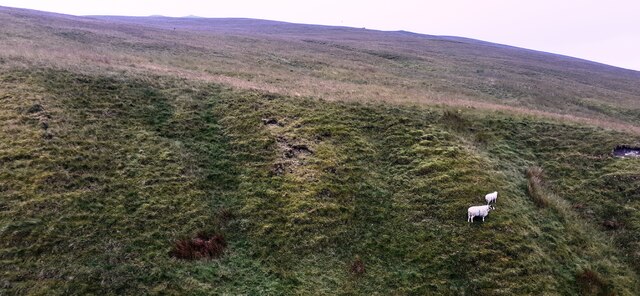
The forest is also home to a wide variety of wildlife, including deer, foxes, and a rich bird population. Birdwatchers can spot species such as woodpeckers, owls, and various songbirds among the treetops.

For those looking to spend more time in Lowridding Wood, there are camping facilities available nearby, enabling visitors to fully immerse themselves in the natural surroundings. The forest is also a popular spot for picnics and family outings, with designated areas for relaxation and outdoor activities.

Overall, Lowridding Wood offers a peaceful and idyllic escape from the hustle and bustle of daily life, providing a chance to reconnect with nature in the heart of Yorkshire.

If you have any feedback on the listing, please let us know in the comments section below.

Lowridding Wood Images

Images are sourced within 2km of 54.333869/-2.492449 or Grid Reference SD6893. Thanks to Geograph Open Source API. All images are credited.

Fields Beside Road To Hebblethwaite Hall
Hebblethwaite Hall Gill
Abandoned Farmhouse at Sarthwaite
Icy Moorland Above Sarthwaite
Weirs on Hebblethwaite Hall Gill at Burntmill Bridge
Picnic Area Beside A 683
Crook Crook is an outlying southern top of Arant Haw; there's a cairn at the summit.
Whernside, Great Coum and Calf Top are the three hills in the distance.
Crook
Crook is an outlying southern top of Arant Haw; there's a cairn at the summit. Whernside, Great Coum and Calf Top are the three hills in the distance.
Sheep on south side of A684 Sheep with new lambs in a field close to Sedbergh.
The gradually rising upland is Middleton Fell which reaches its highest point at The Calf, 610 metres, just on 2000 feet.
Sheep on south side of A684
Sheep with new lambs in a field close to Sedbergh. The gradually rising upland is Middleton Fell which reaches its highest point at The Calf, 610 metres, just on 2000 feet.
Ribs of rock in Clough River The river looking upstream, (to the south at the location), near to Hallbank, where a succession of low rock ribs extend out from the east bank, left in the image.
Ribs of rock in Clough River
The river looking upstream, (to the south at the location), near to Hallbank, where a succession of low rock ribs extend out from the east bank, left in the image.
Sheep and lambs near to Sedbergh Sheep in a field north of Bank Cottage Farm.
The Howgill Fells rise to the left with Knott being the most obvious feature.
Sheep and lambs near to Sedbergh
Sheep in a field north of Bank Cottage Farm. The Howgill Fells rise to the left with Knott being the most obvious feature.
Minor road with passing place The road is seen heading north towards the farm at Thursgill where it ends as a publicly motorable route. It's climbing from a stream crossing near to Ellerthwaite.
Minor road with passing place
The road is seen heading north towards the farm at Thursgill where it ends as a publicly motorable route. It's climbing from a stream crossing near to Ellerthwaite.
Barn at Fawcett Bank Fawcett Bank is a farm in the valley of the River Rawthey. The farm road, also a public footpath, is the course of a named long distance path based on a walk made by Alfred Wainwright in 1938, 'A Pennine Journey'.
Barn at Fawcett Bank
Fawcett Bank is a farm in the valley of the River Rawthey. The farm road, also a public footpath, is the course of a named long distance path based on a walk made by Alfred Wainwright in 1938, 'A Pennine Journey'.
River Rawthey A view across the river from the path on the north bank, east of Sedbergh.
River Rawthey
A view across the river from the path on the north bank, east of Sedbergh.
Route of 'A Pennine Journey' The road is the access route for the farm at Fawcett Bank; it's not a public road for motoring but is a public footpath and is now the route of the long distance walk. The route is not the one followed in 1938 by Alfred Wainwright and recorded by him in a version not originally intended for publication, but a similar one made in 1998 by David and Heather Pitt.
Route of 'A Pennine Journey'
The road is the access route for the farm at Fawcett Bank; it's not a public road for motoring but is a public footpath and is now the route of the long distance walk. The route is not the one followed in 1938 by Alfred Wainwright and recorded by him in a version not originally intended for publication, but a similar one made in 1998 by David and Heather Pitt.
Trees above south bank of River Rawthey The River Rawthey just east of Sedbergh, its water level relatively low, exposing rocks on its north side.
Trees above south bank of River Rawthey
The River Rawthey just east of Sedbergh, its water level relatively low, exposing rocks on its north side.
View over valley of Settlebeck Gill towards Crook
Looking cross valley of Settlebeck Gill towards Crook
View over Settlebeck Gill From the path up Winder Fell from Sedbergh. Dentdale is fairly central and Garsdale to the left.
View over Settlebeck Gill
From the path up Winder Fell from Sedbergh. Dentdale is fairly central and Garsdale to the left.
Show me another place!

Lowridding Wood is located at Grid Ref: SD6893 (Lat: 54.333869, Lng: -2.492449)

Division: West Riding

Administrative County: Cumbria

District: South Lakeland

Police Authority: Cumbria

What 3 Words

///relocated.punctuate.cure. Near Sedbergh, Cumbria

Related Wikis

Clough River

The Clough River is a river in Cumbria, England. A tributary of the River Rawthey, it flows for 21.8 kilometres (13.5 mi) primarily through the Garsdale...

Settlebeck School

Settlebeck School is a small coeducational secondary school with academy status. It is located in Sedbergh in the English county of Cumbria, drawing pupils...

The Bull Hotel, Sedbergh

The Bull Hotel, formerly The Black Bull Hotel, is a 17th-century coaching inn in Sedbergh, Cumbria. It is located in a narrow passage parallel with the...

Sedbergh

Sedbergh ( SED-bər or locally SEB-ər) is a town and civil parish in the ceremonial county of Cumbria. It falls within the historic boundaries of the West...

Related Videos

Walking in The Howgill Fells | Cautley Spout, The Calf & Calders | Stunning Waterfall & Tranquility

Fantastic waterfall and tranquility in the Howgill Fells https://www.youtube.com/@TonysTrails?sub_confirmation=1 #howgill fells ...

Sedbergh to Middleton Bridge Round

Todays bimble is a wander along the River Rawthey from Sedbergh. The weatherman threatened lots of rain and wind following ...

A Walk Up the Fell

Almost in F - Tranquillity by Kevin MacLeod is licensed under a Creative Commons Attribution licence ...

Cautley fell race 2023 - KWL // Descended wrong way :-(

Short but steep race called Cautley fell race, part of Kendal Winter League (KWL) organised by Helm Hill fell running club.

Nearby Amenities

Located within 500m of 54.333869,-2.492449
Passing Place
Lat/Long: 54.3336511/-2.493918
Buckbank Wood
Natural: woodland
Source: OS OpenData StreetView
Lat/Long: 54.3328096/-2.4934625
Rake Wood
Natural: woodland
Source: OS OpenData StreetView
Lat/Long: 54.3357747/-2.4864673
Parking
Access: yes
Fee: no
Parking: layby
Source: survey
Lat/Long: 54.3309161/-2.4888091
Power: pole
Lat/Long: 54.3370779/-2.4888566
Power: pole
Lat/Long: 54.3366213/-2.4897498
Power: pole
Lat/Long: 54.3359942/-2.4908736
Power: pole
Lat/Long: 54.3353327/-2.4921343
Power: pole
Lat/Long: 54.334715/-2.4932769
Power: pole
Lat/Long: 54.3340018/-2.4946582
Power: pole
Lat/Long: 54.3326131/-2.4959323
Power: pole
Lat/Long: 54.331634/-2.4958813
Power: pole
Lat/Long: 54.3300262/-2.4962837
Hiking: yes
Information: guidepost
Source: GPS survey
Tourism: information
Lat/Long: 54.3326506/-2.4965948
Barrier: stile
Lat/Long: 54.3328484/-2.4957432
Barrier: stile
Lat/Long: 54.3314104/-2.497952
Parking
Access: yes
Capacity: 2
Fee: no
Park Ride: no
Parking: lane
Supervised: no
Surface: asphalt
Lat/Long: 54.3356279/-2.4855799
Parking
Access: yes
Capacity: 3
Fee: no
Park Ride: no
Parking: lane
Supervised: no
Surface: asphalt
Lat/Long: 54.3347656/-2.4858053
Addr City: Sedbergh
Addr Housename: Knott House
Addr Postcode: LA10 5LU
Place: isolated_dwelling
Lat/Long: 54.3336082/-2.4880039
Milestone
Lat/Long: 54.3331218/-2.4871893
Give Way
Direction: backward
Lat/Long: 54.3326303/-2.4873927
Waste Basket
Lat/Long: 54.3325005/-2.487503
Waste Basket
Lat/Long: 54.3308609/-2.4890908
Give Way
Direction: backward
Lat/Long: 54.3314651/-2.4886988
Give Way
Direction: forward
Lat/Long: 54.3305717/-2.4904092
Leisure: picnic_table
Lat/Long: 54.3309384/-2.4894487
Leisure: picnic_table
Lat/Long: 54.3308544/-2.4897075
Leisure: picnic_table
Lat/Long: 54.3308837/-2.4896378
Power: pole
Lat/Long: 54.3344918/-2.4924884
Power: pole
Lat/Long: 54.3342069/-2.4915733
Power: pole
Lat/Long: 54.3339904/-2.4900402
Power: pole
Lat/Long: 54.3337906/-2.4885478
Power: pole
Lat/Long: 54.3333339/-2.495926
Power: pole
Lat/Long: 54.3328381/-2.4973514
Power: pole
Lat/Long: 54.3323869/-2.4986162
Power: pole
Lat/Long: 54.329705/-2.4897288
Power: pole
Lat/Long: 54.3300095/-2.4906199
Power: pole
Lat/Long: 54.3304509/-2.491844
Power: pole
Lat/Long: 54.3308769/-2.4927831
Power: pole
Lat/Long: 54.3311926/-2.4934586
The data included in this document is from www.openstreetmap.org. The data is made available under ODbL.

Have you been to Lowridding Wood?

Leave your review of Lowridding Wood below (or comments, questions and feedback).