Cottenham

Settlement in Cambridgeshire South Cambridgeshire

England

Cottenham

Cottenham, the High St looking NNE
Cottenham, the High St looking NNE Credit: mym

Cottenham is a village located in the eastern region of Cambridgeshire, England. Situated about 6 miles north of Cambridge city center, it falls within the administrative district of South Cambridgeshire. With a population of around 6,000 residents, it is a vibrant and close-knit community.

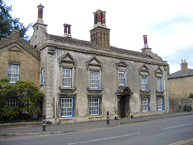
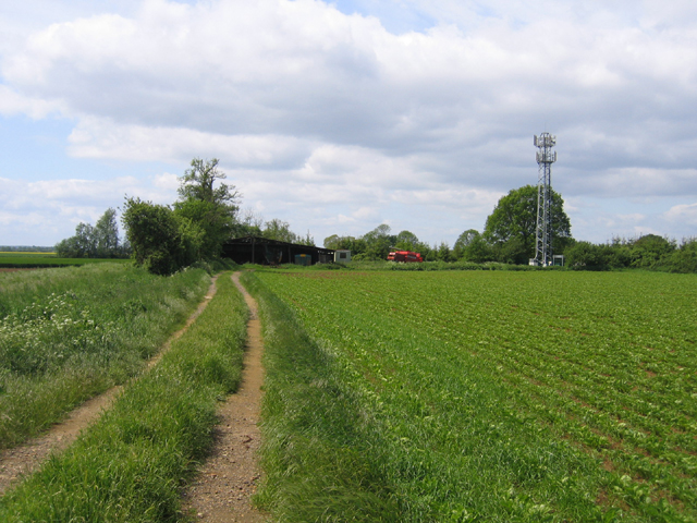
The village boasts a rich history dating back to the Roman era, and there are still remnants of ancient settlements and artifacts found in the area. Cottenham's picturesque landscape is characterized by its flat terrain, dotted with charming thatched cottages and traditional brick houses.

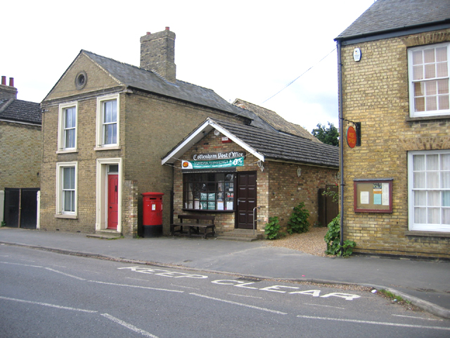
Cottenham offers a range of amenities and services to its residents. The village center features a variety of local shops, including a grocery store, post office, and several boutiques. There are also several pubs and restaurants that cater to different tastes.

Education is well-served in Cottenham, with two primary schools and a secondary school providing excellent learning opportunities for children. Additionally, the village benefits from excellent transport links, including regular bus services to Cambridge and neighboring towns, making it an attractive location for commuters.

Recreational facilities are abundant in Cottenham, with several parks and open spaces for residents to enjoy outdoor activities. The village also has a sports center, which offers a range of amenities such as a swimming pool, gym, and sports courts.

Overall, Cottenham is a charming village that combines its rich history with modern amenities, making it an idyllic place to live for those seeking a peaceful and well-connected community.

If you have any feedback on the listing, please let us know in the comments section below.
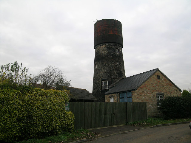
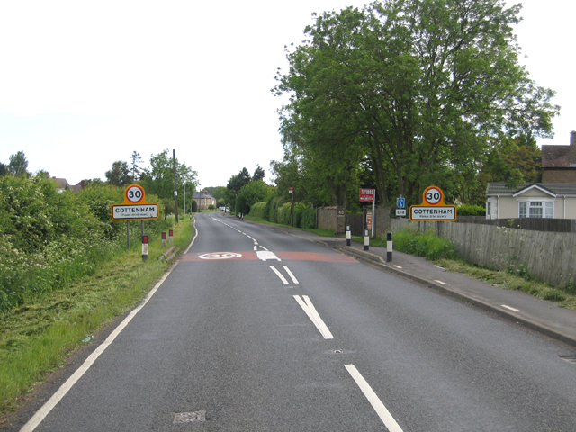
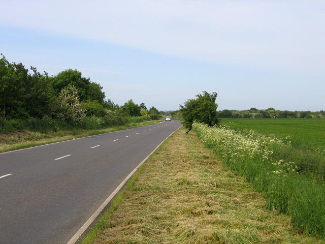
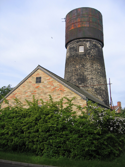
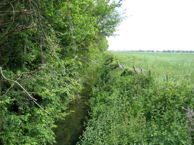
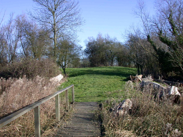
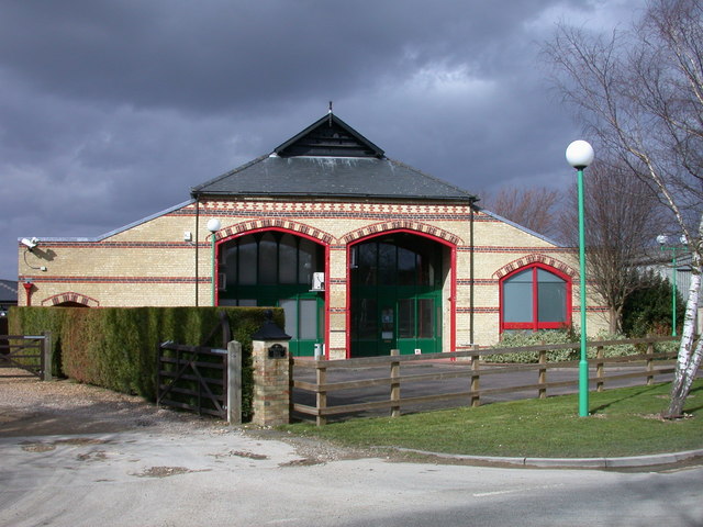
Cottenham Images

Images are sourced within 2km of 52.285057/0.12474 or Grid Reference TL4567. Thanks to Geograph Open Source API. All images are credited.

Cottenham, the High St looking NNE
Converted water tower in Cottenham, Cambridgeshire Brick tower mill converted to water tower with riveted steel tank. Apparently (3/05) undergoing second conversion. Mill was used for the processing of cereals from 1843 until 1898. The cap of the mill was then removed and from 1904 the building had been used as a water tower. 1903 photo is in the NMR.
Converted water tower in Cottenham, Cambridgeshire
Brick tower mill converted to water tower with riveted steel tank. Apparently (3/05) undergoing second conversion. Mill was used for the processing of cereals from 1843 until 1898. The cap of the mill was then removed and from 1904 the building had been used as a water tower. 1903 photo is in the NMR.
Little North Fen, Cottenham CB4 Little North fen, west of Cottenham village, was recorded as early as 1330.
Little North Fen, Cottenham CB4
Little North fen, west of Cottenham village, was recorded as early as 1330.
Entrance to Cottenham, Cambs along the B1049 Histon Road.
Entrance to Cottenham, Cambs
along the B1049 Histon Road.
Oakington Road, Cottenham, Cambs – view towards Westwick as the road crosses Further or Farm Field.
Oakington Road, Cottenham, Cambs
– view towards Westwick as the road crosses Further or Farm Field.
Windmill turned water tower, Cottenham, Cambs – view from Manse Drive.
Windmill turned water tower, Cottenham, Cambs
– view from Manse Drive.
Rampton Bridge, Cambs spanning the Westwick Brook, taken from the footpath forming the parish boundary between Rampton and Cottenham.
Rampton Bridge, Cambs
spanning the Westwick Brook, taken from the footpath forming the parish boundary between Rampton and Cottenham.
New Cut drain, Cottenham, Cambs at the bend where it heads across the North Fen.
New Cut drain, Cottenham, Cambs
at the bend where it heads across the North Fen.
Gothic House, Cottenham, Cambs an individual and distinctive building in a prominent location on the High Street (No. 220).
Gothic House, Cottenham, Cambs
an individual and distinctive building in a prominent location on the High Street (No. 220).
Post Office, Cottenham, Cambs at 230 High Street.
Post Office, Cottenham, Cambs
at 230 High Street.
Broad Lane Amenity Area, Cottenham, Cambs
Broad Lane, Cottenham, Cambs looking NW in the direction of Great North Fen.
Broad Lane, Cottenham, Cambs
looking NW in the direction of Great North Fen.
All Saints' Hall, Cottenham, Cambs erected in 2000 in the High Street opposite the church.
All Saints' Hall, Cottenham, Cambs
erected in 2000 in the High Street opposite the church.
Church Lane, Cottenham, Cambs The lane becomes a track away from the village.
Church Lane, Cottenham, Cambs
The lane becomes a track away from the village.
Long Drove, Cottenham, Cambs
Track to farm buildings and mast, Cottenham, Cambs from Beach Road; to the right is part of the pre-inclosure Dunstall Field, an open arable field, and on the left Mason's Pastures, an old inclosure. <span class="nowrap"><a title="http://www.british-history.ac.uk/report.asp?compid=15322" rel="nofollow ugc noopener" href="http://www.british-history.ac.uk/report.asp?compid=15322">Link</a><img style="margin-left:2px;" alt="External link" title="External link - shift click to open in new window" src="https://s1.geograph.org.uk/img/external.png" width="10" height="10"/></span>
Track to farm buildings and mast, Cottenham, Cambs
from Beach Road; to the right is part of the pre-inclosure Dunstall Field, an open arable field, and on the left Mason's Pastures, an old inclosure. LinkExternal link
Hay Lane, Cottenham, Cambs an unadopted track with locked gates; view from its junction with Beach Road.
Hay Lane, Cottenham, Cambs
an unadopted track with locked gates; view from its junction with Beach Road.
Beach Ditch, between Cottenham and Landbeach, Cambs The parish boundaries in the fens were mostly fixed only in the 13th century; intercommonable pastures between Cottenham and Landbeach were divided in 1235 when the straight Beach Ditch was dug.
Beach Ditch, between Cottenham and Landbeach, Cambs
The parish boundaries in the fens were mostly fixed only in the 13th century; intercommonable pastures between Cottenham and Landbeach were divided in 1235 when the straight Beach Ditch was dug.
Show me another place!

Cottenham is located at Grid Ref: TL4567 (Lat: 52.285057, Lng: 0.12474)

Administrative County: Cambridgeshire

District: South Cambridgeshire

Police Authority: Cambridgeshire

What 3 Words

///sweetener.robot.plots. Near Cottenham, Cambridgeshire

Nearby Locations

Dunstal Field Cottenham

Related Wikis

Cottenham

Cottenham is a village in Cambridgeshire, England. Cottenham is one of the larger villages surrounding the city of Cambridge, located around five miles...

Cottenham Village College

Cottenham Village College is an academy school located in Cottenham, Cambridgeshire, England. The school offers secondary education to pupils from the...

Fen Edge

Fen Edge is an area and collection of villages in the South Cambridgeshire district of Cambridgeshire, England. The five villages in Fen Edge are Cottenham...

Rampton Castle

Rampton Castle, known locally as Giant's Hill, is the earthwork remains of a motte and bailey castle in Rampton, Cambridgeshire. It is believed that the...

Rampton, Cambridgeshire

Rampton is a village in Cambridgeshire, England, situated on the edge of The Fens six miles to the north of Cambridge. == History == The edge of the Fens...
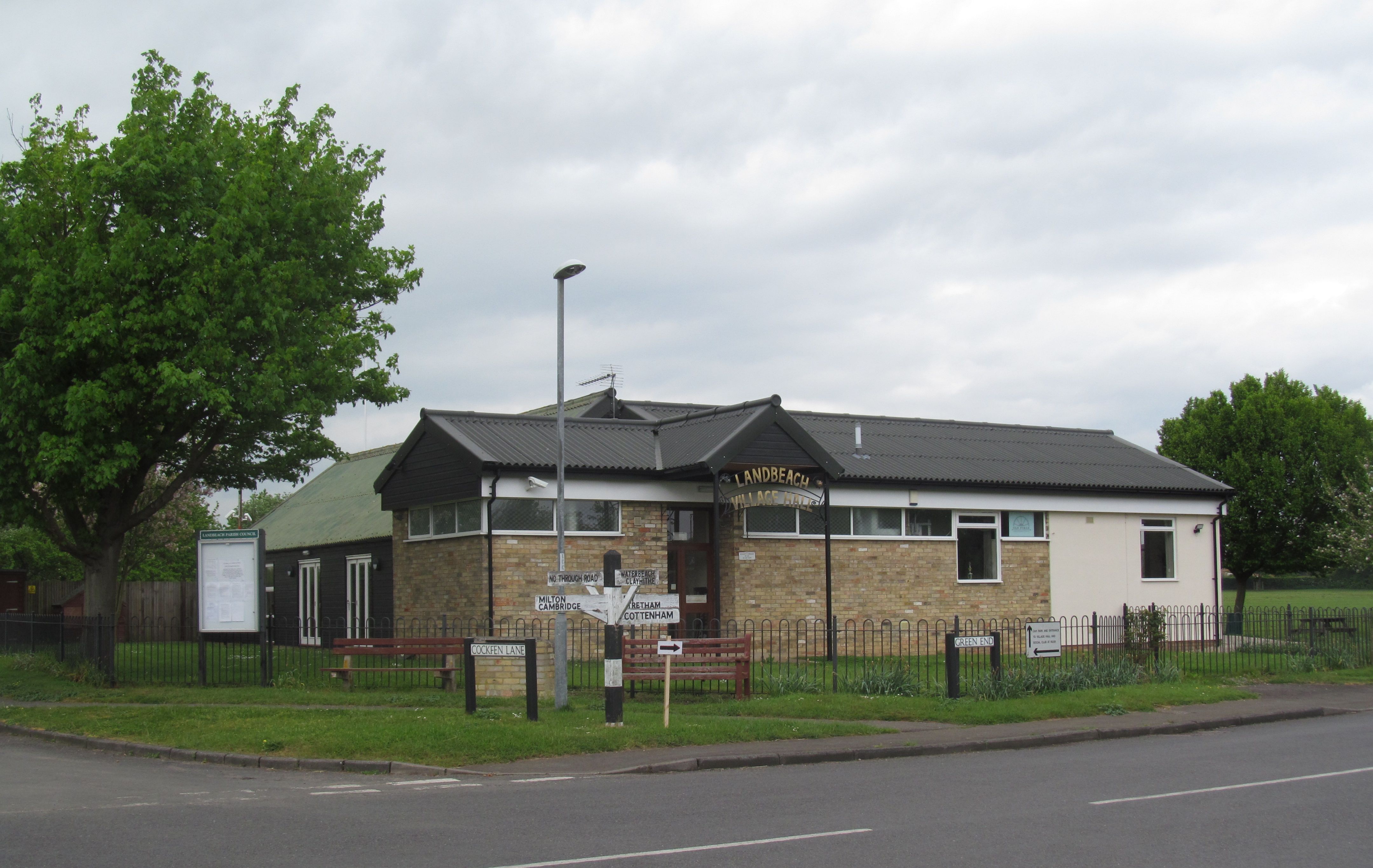
Landbeach

Landbeach is a small fen-edge English village about three miles (5 km) north of Cambridge. The parish covers an area of 9 km2 (3.5 sq mi). == History... ==

Westwick, Cambridgeshire

Westwick is a hamlet and former civil parish, now in the parish of Oakington and Westwick, in the South Cambridgeshire district, in the county of Cambridgeshire...

Histon

Histon is a village and civil parish in the South Cambridgeshire district, in the county of Cambridgeshire, England. It is immediately north of Cambridge...

Nearby Amenities

Located within 500m of 52.285057,0.12474
Mini Roundabout
Direction: clockwise
Wheelchair: limited
Wheelchair Description: Use dropped kerbs well before approaching this roundabout
Lat/Long: 52.2823491/0.1218835
Mini Roundabout
Direction: clockwise
Lat/Long: 52.283771/0.1227553
Crossing
Crossing: zebra
Crossing Island: yes
Tactile Paving: yes
Lat/Long: 52.2840052/0.1230745
Kerb: regular
Lat/Long: 52.2858901/0.1301515
Barrier: kerb
Kerb: lowered
Wheelchair: yes
Lat/Long: 52.2847876/0.1242375
Pub
The Chequers
Addr Housenumber: 297
Addr Postcode: CB24 8QP
Addr Street: High Street
Contact Phone: +44 1954 488201
Food: yes
Real Ale: yes
Source: survey
Website: http://chequers-cottenham.co.uk/
Wikidata: Q26420227
Lat/Long: 52.2853404/0.1252036
Addr Housenumber: 230
Addr Postcode: CB24 8RZ
Addr Street: High Street
Lat/Long: 52.2870879/0.1255401
Barrier: bollard
Bollard: fixed
Source: local_knowledge
Lat/Long: 52.2894655/0.1245954
Barrier: kerb
Kerb: lowered
Lat/Long: 52.2861532/0.129807
Turning Circle
Lat/Long: 52.2806529/0.1243543
Kerb: regular
Lat/Long: 52.2815902/0.1218655
Barrier: kerb
Kerb: lowered
Lat/Long: 52.2816313/0.1215202
Post Box
Collection Times: Mo-Fr 09:00; Sa 07:00
Operator: Royal Mail
Post Box Type: lamp
Ref: CB24 279D
Royal Cypher: EIIR
Royal Cypher Wikidata: Q33102113
Lat/Long: 52.2827677/0.122143
Historic: memorial
Memorial: statue
Source: dictaphone
Lat/Long: 52.2852043/0.1249652
Pharmacy
Well Pharmacy
Addr City: Cottenham
Addr Housenumber: 222
Addr Postcode: CB24 8RZ
Addr Street: High Street
Brand: Well Pharmacy
Brand Wikidata: Q7726524
Brand Wikipedia: en:Well Pharmacy
Dispensing: yes
Drive Through: no
Healthcare: pharmacy
Opening Hours: Mo-Fr 09:00-18:00; Sa 09:00-13:00
Website: https://finder.well.co.uk/store/cottenham-high-street
Lat/Long: 52.2875819/0.1250989
Co-op Food
Addr City: Cottenham
Addr Housenumber: 273
Addr Postcode: CB24 8QP
Addr Street: High Street
Brand: Co-op Food
Brand Wikidata: Q3277439
Fhrs Id: 596535
Opening Hours: Mo-Su 07:00-22:00
Operator: The Co-operative Group
Operator Wikidata: Q117202
Shop: supermarket
Website: https://www.coop.co.uk/store-finder/CB24-8QP/273-high-street
Lat/Long: 52.2862281/0.1263564
Cottenham Tyre and Auto Centre
Addr Housenumber: 210
Addr Postcode: CB24 8RZ
Addr Street: High Street
Opening Hours: Mo-Fr 08:30-12:30,13:00-17:30
Shop: car_repair
Lat/Long: 52.2883975/0.1242862
Community Centre
Cottenham Community Centre
Addr Housenumber: 250a
Addr Postcode: CB24 8RZ
Addr Street: High Street
Lat/Long: 52.2863596/0.1258956
Post Box
Brand: Royal Mail
Brand Wikidata: Q638098
Collection Times: Mo-Fr 09:00; Sa 07:00
Operator: Royal Mail
Operator Wikidata: Q638098
Post Box Type: wall
Ref: CB4 281D
Royal Cypher: EIIR
Royal Cypher Wikidata: Q33102113
Lat/Long: 52.286213/0.1286852
Crossing
Crossing: zebra
Crossing Island: no
Tactile Paving: yes
Traffic Calming: table
Wheelchair: limited
Wheelchair Description: Dead end. This gives access to pavement on one side of the island only. There is no other level access path off the pavement on this side of the island.
Lat/Long: 52.2834003/0.1224306
Bus Stop
Oakington Road
Fixme: This stop is offset somewhat
Naptan AtcoCode: 0500SCOTT003
Naptan Bearing: SE
Naptan BusStopType: CUS
Naptan CommonName: Oakington Road
Naptan Indicator: opp
Naptan Landmark: Oakington Road
Naptan NaptanCode: cmbdwaja
Naptan ShortCommonName: Oakington Road
Naptan Street: Rampton Road
Naptan Verified: no
Source: naptan_import
Lat/Long: 52.2835958/0.1181586
Bus Stop
Oakington Road
Fixme: Also the stop for the 106 bus to Rampton
Naptan AtcoCode: 0500SCOTT004
Naptan Bearing: NW
Naptan CommonName: Oakington Road
Naptan Indicator: near
Naptan Landmark: Oakington Road
Naptan NaptanCode: cmbdwajd
Naptan ShortCommonName: Oakington Road
Naptan Street: Rampton Road
Naptan Verified: no
Source: naptan_import
Lat/Long: 52.2834861/0.118256
Bus Stop
The Green
Fixme: These stops are offset slightly
Naptan AtcoCode: 0500SCOTT005
Naptan Bearing: NW
Naptan BusStopType: CUS
Naptan CommonName: The Green
Naptan Indicator: opp
Naptan Landmark: The Green
Naptan NaptanCode: cmbdwajg
Naptan ShortCommonName: The Green
Naptan Street: High Street
Naptan Verified: no
Source: naptan_import
Lat/Long: 52.2826611/0.1211344
Bus Stop
The Green
Fixme: These stops are offset slightly
Naptan AtcoCode: 0500SCOTT006
Naptan Bearing: SE
Naptan CommonName: The Green
Naptan Indicator: near
Naptan Landmark: The Green
Naptan NaptanCode: cmbdwajm
Naptan ShortCommonName: The Green
Naptan Street: High Street
Naptan Verified: no
Source: naptan_import
Lat/Long: 52.2827583/0.1212269
Bus Stop
Bramley Close
Naptan AtcoCode: 0500SCOTT007
Naptan Bearing: NE
Naptan CommonName: Bramley Close
Naptan Indicator: opp
Naptan Landmark: Bramley Close
Naptan NaptanCode: cmbdwajp
Naptan ShortCommonName: Bramley Close
Naptan Street: High Street
Naptan Verified: no
Source: naptan_import
Lat/Long: 52.2830815/0.1220964
Bus Stop
Lambs Lane
Bench: no
Bin: no
Fixme: These stops are offset slightly
Fixme 106: This is also a 106 stop to Rampton and elsewhere
Fixme X7: This is also an X7 stop
Lit: yes
Naptan AtcoCode: 0500SCOTT011
Naptan Bearing: S
Naptan CommonName: Lambs Lane
Naptan Indicator: opp
Naptan Landmark: Lambs Lane
Naptan NaptanCode: cmbdwamd
Naptan ShortCommonName: Lambs Lane
Naptan Street: High Street
Naptan Verified: no
Shelter: no
Source: naptan_import
Tactile Paving: no
Lat/Long: 52.2883623/0.124618
Bus Stop
Bramley Close
Bench: yes
Bin: yes
Lit: yes
Naptan AtcoCode: 0500SCOTT013
Naptan Bearing: S
Naptan CommonName: Bramley Close
Naptan Indicator: near
Naptan Landmark: Bramley Close
Naptan NaptanCode: cmbdwamj
Naptan ShortCommonName: Bramley Close
Naptan Street: High Street
Naptan Verified: no
Shelter: yes
Source: naptan_import
Tactile Paving: no
Lat/Long: 52.2830273/0.1222775
Bus Stop
Lambs Lane
Bench: no
Bin: no
Fixme: These stops are offset slightly
Lit: no
Naptan AtcoCode: 0500SCOTT023
Naptan Bearing: N
Naptan BusStopType: CUS
Naptan CommonName: Lambs Lane
Naptan Indicator: near
Naptan Landmark: Lambs Lane
Naptan NaptanCode: cmbdwapw
Naptan ShortCommonName: Lambs Lane
Naptan Street: High Street
Naptan Verified: no
Shelter: no
Source: naptan_import
Tactile Paving: no
Lat/Long: 52.2883375/0.1244995
Bus Stop
Telegraph Street
Naptan AtcoCode: 0500SCOTT025
Naptan Bearing: SW
Naptan CommonName: Telegraph Street
Naptan Indicator: opp
Naptan Landmark: Telegraph Street
Naptan NaptanCode: cmbdwatd
Naptan ShortCommonName: Telegraph Street
Naptan Street: Denmark Road
Naptan Verified: no
Shelter: no
Source: naptan_import
Lat/Long: 52.285827/0.1280891
Bus Stop
Denmark Road
Bench: yes
Bin: yes
Lit: no
Naptan AtcoCode: 0500SCOTT030
Naptan Bearing: SW
Naptan CommonName: Denmark Road
Naptan Indicator: near
Naptan Landmark: Denmark Road
Naptan NaptanCode: cmbdwatw
Naptan ShortCommonName: Denmark Road
Naptan Street: High Street
Naptan Verified: no
Shelter: yes
Source: naptan_import
Tactile Paving: no
Lat/Long: 52.2848497/0.1244354
Bus Stop
Denmark Road
Bench: yes
Bin: yes
Naptan AtcoCode: 0500SCOTT031
Naptan Bearing: NE
Naptan BusStopType: CUS
Naptan CommonName: Denmark Road
Naptan Indicator: opp
Naptan Landmark: Denmark Road
Naptan NaptanCode: cmbdwawa
Naptan ShortCommonName: Denmark Road
Naptan Street: High Street
Naptan Verified: no
Shelter: yes
Source: naptan_import
Tactile Paving: no
Lat/Long: 52.2848614/0.1242893
Bus Stop
Telegraph Street
Naptan AtcoCode: 0500SCOTT032
Naptan Bearing: NE
Naptan BusStopType: CUS
Naptan CommonName: Telegraph Street
Naptan Indicator: near
Naptan Landmark: Telegraph Street
Naptan NaptanCode: cmbdwawd
Naptan ShortCommonName: Telegraph Street
Naptan Street: Denmark Road
Naptan Verified: no
Shelter: no
Source: naptan_import
Lat/Long: 52.2858912/0.1280189
Bus Stop
Victory Way
Bench: no
Bin: yes
Lit: yes
Naptan AtcoCode: 0500SCOTT033
Naptan Bearing: NE
Naptan CommonName: Victory Way
Naptan Indicator: near
Naptan Landmark: Victory Way
Naptan NaptanCode: cmbdwawg
Naptan ShortCommonName: Victory Way
Naptan Street: Lambs Lane
Naptan Verified: no
Shelter: yes
Source: naptan_import
Tactile Paving: no
Lat/Long: 52.2873895/0.1212137
Bus Stop
Victory Way
Bench: no
Bin: yes
Lit: yes
Naptan AtcoCode: 0500SCOTT036
Naptan Bearing: SW
Naptan BusStopType: CUS
Naptan CommonName: Victory Way
Naptan Indicator: opp
Naptan Landmark: Victory Way
Naptan NaptanCode: cmbdwawp
Naptan ShortCommonName: Victory Way
Naptan Street: Lambs Lane
Naptan Verified: no
Shelter: yes
Source: naptan_import
Tactile Paving: no
Lat/Long: 52.2873438/0.1212555
Fast Food
Cottenham Fish Shop
Addr Housenumber: 272-274
Addr Postcode: CB24 8RZ
Addr Street: High Street
Check Date Opening Hours: 2023-09-30
Contact Phone: +44 1954 250004
Cuisine: fish_and_chips
Description: Take away serving Fish-and-Chips, and Chinese.
Opening Hours Signed: no
Lat/Long: 52.2856105/0.1251492
Restaurant
Curry Palace
Addr City: Cambridge
Addr Housenumber: 215
Addr Postcode: CB24 8QP
Addr Street: High Street
Contact Phone: +44 1954 250257
Cuisine: indian
Description: Ever since Curry Palace won the Inaugural ARTA Champion trophy, the name has become a favourite amongst local and visiting foodies alike. An Indian restaurant in Cambridge, Curry Palace is in business for almost two decades now and growing in popularity.
Opening Hours: Mo-Su 17:00-23:00
Phone: +44 195 425 0257
Website: https://www.currypalacecottenham.com/
Lat/Long: 52.2883907/0.1246762
Nursing Home
Cottenham Court
Operator: Bupa
Lat/Long: 52.2834673/0.124734
Crossing
Crossing: unmarked
Crossing Island: yes
Kerb: lowered
Tactile Paving: yes
Lat/Long: 52.2888994/0.1244619
Crossing
Crossing: uncontrolled
Crossing Island: no
Kerb: lowered
Tactile Paving: yes
Lat/Long: 52.2872329/0.1256119
Crossing
Crossing: unmarked
Crossing Island: no
Crossing Markings: no
Source: bing
Tactile Paving: no
Lat/Long: 52.2830892/0.1237726
Barrier: kerb
Kerb: lowered
Wheelchair: limited
Lat/Long: 52.2853327/0.1250644
Barrier: kerb
Kerb: lowered
Lat/Long: 52.2861992/0.128926
Baked
Addr Housenumber: 234
Addr Postcode: CB24 8RZ
Addr Street: High Street
Operator: Barkers Bakery
Shop: bakery
Source: bing
Lat/Long: 52.2869784/0.1256572
King & Co
Addr Housenumber: 238
Addr Postcode: CB24 8RZ
Addr Street: High Street
Lawyer: solicitor
Office: lawyer
Opening Hours: Mo-Fr 09:00-13:00,14:00-16:00, Mo-Th 16:00-17:00
Source: bing
Lat/Long: 52.2869019/0.1257422
Bank
Cambridge Building Society
Addr Housenumber: 236
Addr Postcode: CB24 8RZ
Addr Street: High Street
Brand: The Cambridge Building Society
Brand Wikidata: Q5025370
Source: bing
Website: https://www.cambridgebs.co.uk/contact/cottenham
Lat/Long: 52.2869376/0.1257082
Bicycle Parking
Check Date: 2023-09-30
Covered: yes
Lat/Long: 52.2828981/0.1247481
Bicycle Parking
Bicycle Parking: stands
Capacity: 8
Covered: no
Source: local_knowledge
Lat/Long: 52.2893424/0.1245944
Addr Housenumber: 267
Addr Street: High Street
Lat/Long: 52.2864702/0.1264009
Les Ward
Addr Housenumber: 216a
Addr Postcode: CB24 8RZ
Addr Street: High Street
Opening Hours: Mo-We 07:00-17:30, Fr,Sa 07:00-18:00, Sa 07:00-16:00
Shop: greengrocer
Lat/Long: 52.2880322/0.1246332
Addr Housenumber: 214
Addr Postcode: CB24 8RZ
Addr Street: High Street
Wikidata: Q26420240
Lat/Long: 52.2881873/0.1244723
Addr Housenumber: 261
Addr Street: High Street
Lat/Long: 52.2865966/0.1263043
Addr Housenumber: 268
Addr Postcode: CB24 8RZ
Addr Street: High Street
Lat/Long: 52.2856966/0.1252556
Cottenham Barbers
Addr Housenumber: 270
Addr Postcode: CB24 8RZ
Addr Street: High Street
Male: yes
Opening Hours: Mo,We 09:30-17:30; Th 09:30-19:30; Fr 09:30-18:00; Sa 08:30-16:00
Shop: hairdresser
Lat/Long: 52.2856663/0.125214
Addr Housenumber: 1
Addr Postcode: CB24 8TZ
Addr Street: Lacks Close
Lat/Long: 52.2850747/0.1240553
Addr Housenumber: 254
Addr Postcode: CB24 8RZ
Addr Street: High Street
Lat/Long: 52.2861601/0.1257303
Addr Housenumber: 232
Addr Postcode: CB24 8RZ
Addr Street: High Street
Lat/Long: 52.2870503/0.1255841
Addr Housenumber: 7
Addr Postcode: CB24 8YY
Addr Street: Eastlands Close
Lat/Long: 52.2866163/0.1246815
Addr Housenumber: 260
Addr Postcode: CB24 8RZ
Addr Street: High Street
Lat/Long: 52.2859477/0.1255734
Addr Housenumber: 3
Addr Postcode: CB24 8YY
Addr Street: Eastlands Close
Lat/Long: 52.2863775/0.1249767
Addr Housenumber: 226-228
Addr Postcode: CB24 8RZ
Addr Street: High Street
Lat/Long: 52.287325/0.1253642
Addr Housenumber: 17
Addr Postcode: CB24 8YY
Addr Street: Eastlands Close
Lat/Long: 52.2862849/0.1254487
Addr Housenumber: 8
Addr Postcode: CB24 8TZ
Addr Street: Lacks Close
Lat/Long: 52.2853734/0.1236315
Addr Housenumber: 5
Addr Postcode: CB24 8YY
Addr Street: Eastlands Close
Lat/Long: 52.2864965/0.1248196
Addr Housenumber: 15
Addr Postcode: CB24 8YY
Addr Street: Eastlands Close
Lat/Long: 52.286444/0.1253454
Addr Housenumber: 16
Addr Postcode: CB24 8YY
Addr Street: Eastlands Close
Lat/Long: 52.2863939/0.1254084
Addr Housenumber: 301
Addr Postcode: CB24 8TX
Addr Street: High Street
Lat/Long: 52.2850961/0.1252368
Addr Housenumber: 13
Addr Postcode: CB24 8YY
Addr Street: Eastlands Close
Lat/Long: 52.2865761/0.1252046
Addr Housenumber: 256
Addr Postcode: CB24 8RZ
Addr Street: High Street
Lat/Long: 52.2861109/0.1258148
Addr Housenumber: 14
Addr Postcode: CB24 8YY
Addr Street: Eastlands Close
Lat/Long: 52.2865276/0.1252609
Addr Housenumber: 258
Addr Postcode: CB24 8RZ
Addr Street: High Street
Lat/Long: 52.2860519/0.1257665
Addr Housenumber: 4
Addr Postcode: CB24 8YY
Addr Street: Eastlands Close
Lat/Long: 52.2864514/0.124876
Addr Housenumber: 1
Addr Postcode: CB24 8YY
Addr Street: Eastlands Close
Lat/Long: 52.286234/0.1250611
Addr Housenumber: 8
Addr Postcode: CB24 8YY
Addr Street: Eastlands Close
Lat/Long: 52.2866745/0.124656
Addr Housenumber: 303
Addr Postcode: CB24 8TX
Addr Street: High Street
Lat/Long: 52.2850772/0.1251523
Addr Housenumber: 11
Addr Postcode: CB24 8YY
Addr Street: Eastlands Close
Lat/Long: 52.2866672/0.1250852
Addr Housenumber: 252
Addr Postcode: CB24 8RZ
Addr Street: High Street
Lat/Long: 52.2861749/0.1259248
Addr Housenumber: 266
Addr Postcode: CB24 8RZ
Addr Street: High Street
Lat/Long: 52.2857704/0.125328
Addr Housenumber: 6
Addr Postcode: CB24 8YY
Addr Street: Eastlands Close
Lat/Long: 52.2865827/0.1247271
Addr Housenumber: 9
Addr Postcode: CB24 8YY
Addr Street: Eastlands Close
Lat/Long: 52.2867926/0.1249403
Addr Housenumber: 10
Addr Postcode: CB24 8YY
Addr Street: Eastlands Close
Lat/Long: 52.2867443/0.1250007
Addr Housename: Windsor House
Addr Housenumber: 224
Addr Postcode: CB24 8RZ
Addr Street: High Street
Lat/Long: 52.2874916/0.1252207
Addr Housenumber: 2
Addr Postcode: CB24 8YY
Addr Street: Eastlands Close
Lat/Long: 52.2862848/0.1250853
Addr Housenumber: 12
Addr Postcode: CB24 8YY
Addr Street: Eastlands Close
Lat/Long: 52.2866286/0.1251322
Addr Housename: Dunstal House
Addr Housenumber: 193
Addr Postcode: CB24 8RX
Addr Street: High Street
Lat/Long: 52.2891265/0.1248935
Addr Housenumber: 195
Addr Postcode: CB24 8RX
Addr Street: High Street
Office: estate_agent
Lat/Long: 52.2889903/0.1247353
Addr Housenumber: 327
Addr Postcode: CB24 8TX
Addr Street: High Street
Lat/Long: 52.2842076/0.1236649
Cottenham Cutz
Addr Housenumber: 276
Addr Postcode: CB24 8RZ
Addr Street: High Street
Shop: hairdresser
Lat/Long: 52.2855605/0.1250101
Addr Housenumber: 327a
Addr Postcode: CB24 8TX
Addr Street: High Street
Lat/Long: 52.2841674/0.1236019
Addr Housenumber: 24
Addr Street: Denmark Road
Lat/Long: 52.2854273/0.1268496
Addr Housenumber: 26
Addr Street: Denmark Road
Lat/Long: 52.2854486/0.1269421
Addr Housenumber: 33
Addr Postcode: CB24 8QS
Addr Street: Denmark Road
Lat/Long: 52.285815/0.1276599
Addr Housenumber: 35
Addr Postcode: CB24 8QS
Addr Street: Denmark Road
Lat/Long: 52.285856/0.1277658
Crossing
Crossing: marked
Crossing Island: no
Tactile Paving: no
Lat/Long: 52.2880846/0.1248766
Cottenham
Place: village
Lat/Long: 52.2871405/0.1252382
Cafe
The Coffee Shop
Check Date Opening Hours: 2023-09-30
Internet Access: wlan
Internet Access Fee: no
Opening Hours: Mo 10:00-16:30; Tu-Sa 10:00-14:00
Outdoor Seating: no
Source: survey
Lat/Long: 52.2863143/0.1260173
Addr City: Cottenham
Addr Housenumber: 25
Addr Postcode: CB24 8QU
Addr Street: Telegraph Street
Lat/Long: 52.2872757/0.1273954
Addr City: Cottenham
Addr Housenumber: 31
Addr Postcode: CB24 8QU
Addr Street: Telegraph Street
Lat/Long: 52.2871813/0.1276188
Waste Basket
Waste: dog_excrement
Lat/Long: 52.2856744/0.1209449
Waste Basket
Waste: dog_excrement
Lat/Long: 52.2861502/0.1212275
Waste Basket
Waste: dog_excrement
Lat/Long: 52.2843921/0.1228326
Generator Method: photovoltaic
Generator Output Electricity: yes
Generator Source: solar
Generator Type: solar_photovoltaic_panel
Location: roof
Power: generator
Lat/Long: 52.288759/0.120627
Generator Method: photovoltaic
Generator Output Electricity: yes
Generator Source: solar
Generator Type: solar_photovoltaic_panel
Location: roof
Power: generator
Lat/Long: 52.2887984/0.1206994
Generator Method: photovoltaic
Generator Output Electricity: yes
Generator Source: solar
Generator Type: solar_photovoltaic_panel
Location: roof
Power: generator
Lat/Long: 52.2887541/0.1208201
Generator Method: photovoltaic
Generator Output Electricity: yes
Generator Source: solar
Generator Type: solar_photovoltaic_panel
Location: roof
Power: generator
Lat/Long: 52.2887049/0.1208925
Generator Method: photovoltaic
Generator Output Electricity: yes
Generator Source: solar
Generator Type: solar_photovoltaic_panel
Location: roof
Power: generator
Lat/Long: 52.2886638/0.1209462
Generator Method: photovoltaic
Generator Output Electricity: yes
Generator Source: solar
Generator Type: solar_photovoltaic_panel
Location: roof
Power: generator
Lat/Long: 52.2885556/0.1210293
Generator Method: photovoltaic
Generator Output Electricity: yes
Generator Source: solar
Generator Type: solar_photovoltaic_panel
Location: roof
Power: generator
Lat/Long: 52.2884998/0.1208764
Generator Method: photovoltaic
Generator Output Electricity: yes
Generator Source: solar
Generator Type: solar_photovoltaic_panel
Location: roof
Power: generator
Lat/Long: 52.288467/0.1207691
Generator Method: photovoltaic
Generator Output Electricity: yes
Generator Source: solar
Generator Type: solar_photovoltaic_panel
Location: roof
Power: generator
Lat/Long: 52.2881831/0.1211286
Generator Method: photovoltaic
Generator Output Electricity: yes
Generator Source: solar
Generator Type: solar_photovoltaic_panel
Location: roof
Power: generator
Lat/Long: 52.2883045/0.1213056
Generator Method: photovoltaic
Generator Output Electricity: yes
Generator Source: solar
Generator Type: solar_photovoltaic_panel
Location: roof
Power: generator
Lat/Long: 52.2882717/0.1214316
Generator Method: photovoltaic
Generator Output Electricity: yes
Generator Source: solar
Generator Type: solar_photovoltaic_panel
Location: roof
Power: generator
Lat/Long: 52.2882504/0.1214612
Generator Method: photovoltaic
Generator Output Electricity: yes
Generator Source: solar
Generator Type: solar_photovoltaic_panel
Location: roof
Power: generator
Lat/Long: 52.2882028/0.1215389
Generator Method: photovoltaic
Generator Output Electricity: yes
Generator Source: solar
Generator Type: solar_photovoltaic_panel
Location: roof
Power: generator
Lat/Long: 52.2880223/0.1211768
Generator Method: photovoltaic
Generator Output Electricity: yes
Generator Source: solar
Generator Type: solar_photovoltaic_panel
Location: roof
Power: generator
Lat/Long: 52.2874547/0.123733
Generator Method: photovoltaic
Generator Output Electricity: yes
Generator Source: solar
Generator Type: solar_photovoltaic_panel
Location: roof
Power: generator
Lat/Long: 52.2875154/0.1238778
Generator Method: photovoltaic
Generator Output Electricity: yes
Generator Source: solar
Generator Type: solar_photovoltaic_panel
Location: roof
Power: generator
Lat/Long: 52.2875531/0.1240575
Generator Method: photovoltaic
Generator Output Electricity: yes
Generator Source: solar
Generator Type: solar_photovoltaic_panel
Location: roof
Power: generator
Lat/Long: 52.2876105/0.1239958
Generator Method: photovoltaic
Generator Output Electricity: yes
Generator Source: solar
Generator Type: solar_photovoltaic_panel
Location: roof
Power: generator
Lat/Long: 52.2876958/0.1239422
Generator Method: photovoltaic
Generator Output Electricity: yes
Generator Source: solar
Generator Type: solar_photovoltaic_panel
Location: roof
Power: generator
Lat/Long: 52.28775/0.1238725
Generator Method: photovoltaic
Generator Output Electricity: yes
Generator Source: solar
Generator Type: solar_photovoltaic_panel
Location: roof
Power: generator
Lat/Long: 52.2875794/0.1233387
Generator Method: photovoltaic
Generator Output Electricity: yes
Generator Source: solar
Generator Type: solar_photovoltaic_panel
Location: roof
Power: generator
Lat/Long: 52.2874153/0.1230517
Generator Method: photovoltaic
Generator Output Electricity: yes
Generator Source: solar
Generator Type: solar_photovoltaic_panel
Location: roof
Power: generator
Lat/Long: 52.2871807/0.1229525
Generator Method: photovoltaic
Generator Output Electricity: yes
Generator Source: solar
Generator Type: solar_photovoltaic_panel
Location: roof
Power: generator
Lat/Long: 52.2870941/0.1235741
Generator Method: photovoltaic
Generator Output Electricity: yes
Generator Source: solar
Generator Type: solar_photovoltaic_panel
Location: roof
Power: generator
Lat/Long: 52.2870371/0.1236345
Generator Method: photovoltaic
Generator Output Electricity: yes
Generator Source: solar
Generator Type: solar_photovoltaic_panel
Location: roof
Power: generator
Lat/Long: 52.2869755/0.1236572
Generator Method: photovoltaic
Generator Output Electricity: yes
Generator Source: solar
Generator Type: solar_photovoltaic_panel
Location: roof
Power: generator
Lat/Long: 52.2870707/0.1240817
Generator Method: photovoltaic
Generator Output Electricity: yes
Generator Source: solar
Generator Type: solar_photovoltaic_panel
Location: roof
Power: generator
Lat/Long: 52.2867754/0.1245055
Generator Method: photovoltaic
Generator Output Electricity: yes
Generator Source: solar
Generator Type: solar_photovoltaic_panel
Location: roof
Power: generator
Lat/Long: 52.2868345/0.1241299
Generator Method: photovoltaic
Generator Output Electricity: yes
Generator Source: solar
Generator Type: solar_photovoltaic_panel
Location: roof
Power: generator
Lat/Long: 52.2867885/0.1239744
Generator Method: photovoltaic
Generator Output Electricity: yes
Generator Source: solar
Generator Type: solar_photovoltaic_panel
Location: roof
Power: generator
Lat/Long: 52.2867557/0.1238939
Generator Method: photovoltaic
Generator Output Electricity: yes
Generator Source: solar
Generator Type: solar_photovoltaic_panel
Location: roof
Power: generator
Lat/Long: 52.2869465/0.1234842
Generator Method: photovoltaic
Generator Output Electricity: yes
Generator Source: solar
Generator Type: solar_photovoltaic_panel
Location: roof
Power: generator
Lat/Long: 52.2868316/0.1232348
Generator Method: photovoltaic
Generator Output Electricity: yes
Generator Source: solar
Generator Type: solar_photovoltaic_panel
Location: roof
Power: generator
Lat/Long: 52.2857532/0.1236606
Generator Method: photovoltaic
Generator Output Electricity: yes
Generator Source: solar
Generator Type: solar_photovoltaic_panel
Location: roof
Power: generator
Lat/Long: 52.2857959/0.1235908
Generator Method: photovoltaic
Generator Output Electricity: yes
Generator Source: solar
Generator Type: solar_photovoltaic_panel
Location: roof
Power: generator
Lat/Long: 52.2855448/0.121783
Generator Method: photovoltaic
Generator Output Electricity: yes
Generator Source: solar
Generator Type: solar_photovoltaic_panel
Location: roof
Power: generator
Lat/Long: 52.2854365/0.1208362
Cambridge Audio Visual Services
Lat/Long: 52.2844988/0.1259015
Generator Method: photovoltaic
Generator Output Electricity: yes
Generator Source: solar
Generator Type: solar_photovoltaic_panel
Location: roof
Power: generator
Lat/Long: 52.2890396/0.1276195
Generator Method: photovoltaic
Generator Output Electricity: yes
Generator Source: solar
Generator Type: solar_photovoltaic_panel
Location: roof
Power: generator
Lat/Long: 52.2882931/0.1202287
Generator Method: photovoltaic
Generator Output Electricity: yes
Generator Source: solar
Generator Type: solar_photovoltaic_panel
Location: roof
Power: generator
Lat/Long: 52.2882102/0.1202582
Generator Method: photovoltaic
Generator Output Electricity: yes
Generator Source: solar
Generator Type: solar_photovoltaic_panel
Location: roof
Power: generator
Lat/Long: 52.2880256/0.1204365
Generator Method: photovoltaic
Generator Output Electricity: yes
Generator Source: solar
Generator Type: solar_photovoltaic_panel
Location: roof
Power: generator
Lat/Long: 52.2877631/0.1208764
Generator Method: photovoltaic
Generator Output Electricity: yes
Generator Source: solar
Generator Type: solar_photovoltaic_panel
Location: roof
Power: generator
Lat/Long: 52.287791/0.1191142
Generator Method: photovoltaic
Generator Output Electricity: yes
Generator Source: solar
Generator Type: solar_photovoltaic_panel
Location: roof
Power: generator
Lat/Long: 52.2878255/0.1192108
Generator Method: photovoltaic
Generator Output Electricity: yes
Generator Source: solar
Generator Type: solar_photovoltaic_panel
Location: roof
Power: generator
Lat/Long: 52.2858549/0.1187441
Generator Method: photovoltaic
Generator Output Electricity: yes
Generator Source: solar
Generator Type: solar_photovoltaic_panel
Location: roof
Power: generator
Lat/Long: 52.2864062/0.1185697
Generator Method: photovoltaic
Generator Output Electricity: yes
Generator Source: solar
Generator Type: solar_photovoltaic_panel
Location: roof
Power: generator
Lat/Long: 52.2868115/0.1189211
Generator Method: photovoltaic
Generator Output Electricity: yes
Generator Source: solar
Generator Type: solar_photovoltaic_panel
Location: roof
Power: generator
Lat/Long: 52.2862356/0.1226118
Generator Method: photovoltaic
Generator Output Electricity: yes
Generator Source: solar
Generator Type: solar_photovoltaic_panel
Location: roof
Power: generator
Lat/Long: 52.2862865/0.121673
Generator Method: photovoltaic
Generator Output Electricity: yes
Generator Source: solar
Generator Type: solar_photovoltaic_panel
Location: roof
Power: generator
Lat/Long: 52.2868443/0.121083
Generator Method: photovoltaic
Generator Output Electricity: yes
Generator Source: solar
Generator Type: solar_photovoltaic_panel
Location: roof
Power: generator
Lat/Long: 52.2866884/0.1212519
Generator Method: photovoltaic
Generator Output Electricity: yes
Generator Source: solar
Generator Type: solar_photovoltaic_panel
Location: roof
Power: generator
Lat/Long: 52.2868066/0.1225662
Generator Method: photovoltaic
Generator Output Electricity: yes
Generator Source: solar
Generator Type: solar_photovoltaic_panel
Location: roof
Power: generator
Lat/Long: 52.2871643/0.1260558
Generator Method: photovoltaic
Generator Output Electricity: yes
Generator Source: solar
Generator Type: solar_photovoltaic_panel
Location: roof
Power: generator
Lat/Long: 52.2869329/0.1296177
Generator Method: photovoltaic
Generator Output Electricity: yes
Generator Source: solar
Generator Type: solar_photovoltaic_panel
Location: roof
Power: generator
Lat/Long: 52.285759/0.131679
Generator Method: photovoltaic
Generator Output Electricity: yes
Generator Source: solar
Generator Type: solar_photovoltaic_panel
Location: roof
Power: generator
Lat/Long: 52.2858008/0.1315892
Generator Method: photovoltaic
Generator Output Electricity: yes
Generator Source: solar
Generator Type: solar_photovoltaic_panel
Location: roof
Power: generator
Lat/Long: 52.2863409/0.1315271
Generator Method: photovoltaic
Generator Output Electricity: yes
Generator Source: solar
Generator Type: solar_photovoltaic_panel
Location: roof
Power: generator
Lat/Long: 52.2862907/0.1314414
Generator Method: photovoltaic
Generator Output Electricity: yes
Generator Source: solar
Generator Type: solar_photovoltaic_panel
Location: roof
Power: generator
Lat/Long: 52.286207/0.1311838
Generator Method: photovoltaic
Generator Output Electricity: yes
Generator Source: solar
Generator Type: solar_photovoltaic_panel
Location: roof
Power: generator
Lat/Long: 52.2865957/0.1311961
Generator Method: photovoltaic
Generator Output Electricity: yes
Generator Source: solar
Generator Type: solar_photovoltaic_panel
Location: roof
Power: generator
Lat/Long: 52.2854923/0.1273459
Generator Method: photovoltaic
Generator Output Electricity: yes
Generator Source: solar
Generator Type: solar_photovoltaic_panel
Location: roof
Power: generator
Lat/Long: 52.2839894/0.1240495
Generator Method: photovoltaic
Generator Output Electricity: yes
Generator Source: solar
Generator Type: solar_photovoltaic_panel
Location: roof
Power: generator
Lat/Long: 52.2843241/0.1257366
Generator Method: photovoltaic
Generator Output Electricity: yes
Generator Source: solar
Generator Type: solar_photovoltaic_panel
Location: roof
Power: generator
Lat/Long: 52.284146/0.1199336
Generator Method: photovoltaic
Generator Output Electricity: yes
Generator Source: solar
Generator Type: solar_photovoltaic_panel
Location: roof
Power: generator
Lat/Long: 52.2843996/0.1217213
Generator Method: photovoltaic
Generator Output Electricity: yes
Generator Source: solar
Generator Type: solar_photovoltaic_panel
Location: roof
Power: generator
Lat/Long: 52.2830344/0.1183149
Generator Method: photovoltaic
Generator Output Electricity: yes
Generator Source: solar
Generator Type: solar_photovoltaic_panel
Location: roof
Power: generator
Lat/Long: 52.2829851/0.1182586
Generator Method: photovoltaic
Generator Output Electricity: yes
Generator Source: solar
Generator Type: solar_photovoltaic_panel
Location: roof
Power: generator
Lat/Long: 52.282908/0.1192859
Generator Method: photovoltaic
Generator Output Electricity: yes
Generator Source: solar
Generator Type: solar_photovoltaic_panel
Location: roof
Power: generator
Lat/Long: 52.2826914/0.1184839
Generator Method: photovoltaic
Generator Output Electricity: yes
Generator Source: solar
Generator Type: solar_photovoltaic_panel
Location: roof
Power: generator
Lat/Long: 52.2824962/0.1189613
Generator Method: photovoltaic
Generator Output Electricity: yes
Generator Source: solar
Generator Type: solar_photovoltaic_panel
Location: roof
Power: generator
Lat/Long: 52.2836349/0.1185992
Generator Method: photovoltaic
Generator Output Electricity: yes
Generator Source: solar
Generator Type: solar_photovoltaic_panel
Location: roof
Power: generator
Lat/Long: 52.2816347/0.1234648
Generator Method: photovoltaic
Generator Output Electricity: yes
Generator Source: solar
Generator Type: solar_photovoltaic_panel
Location: roof
Power: generator
Lat/Long: 52.2811785/0.1237544
Generator Method: photovoltaic
Generator Output Electricity: yes
Generator Source: solar
Generator Type: solar_photovoltaic_panel
Location: roof
Power: generator
Lat/Long: 52.2815362/0.1207155
Generator Method: photovoltaic
Generator Output Electricity: yes
Generator Source: solar
Generator Type: solar_photovoltaic_panel
Location: roof
Power: generator
Lat/Long: 52.2811055/0.1235747
Generator Method: photovoltaic
Generator Output Electricity: yes
Generator Source: solar
Generator Type: solar_photovoltaic_panel
Location: roof
Power: generator
Lat/Long: 52.28079/0.1224408
Crossing
Crossing: unmarked
Kerb: lowered
Tactile Paving: yes
Lat/Long: 52.2859496/0.1303287
Crossing
Crossing: unmarked
Kerb: lowered
Tactile Paving: yes
Lat/Long: 52.285705/0.1303544
Waste Basket
Lat/Long: 52.2859986/0.1302637
Advertising: board
Lat/Long: 52.2860109/0.1303185
Waste Basket
Waste: dog_excrement
Lat/Long: 52.2860006/0.1302783
Crossing
Crossing: unmarked
Crossing Island: no
Kerb: lowered
Tactile Paving: yes
Lat/Long: 52.2849644/0.1244757
Crossing
Crossing: unmarked
Crossing Island: no
Kerb: lowered
Tactile Paving: no
Lat/Long: 52.283548/0.1227157
Telephone
Defibrillator
Booth: K6
Covered: booth
Defibrillator Location: inside red phone box, High Street, Cottenham - near war memorial
Emergency: defibrillator
Indoor: no
Man Made: telephone_box
Lat/Long: 52.2849405/0.1247301
Cottenham
Man Made: village_sign
Source: survey
Tourism: artwork
Lat/Long: 52.2888755/0.1243525
Bench
Backrest: yes
Inscription: In memory of Hugh Keith Gautrey 1931~2008
Material: wood
Openbenches Id: 23156
Lat/Long: 52.2827571/0.1212506
Bench
Backrest: yes
Material: wood
Lat/Long: 52.2826088/0.1215328
Bench
Backrest: yes
Lat/Long: 52.2827402/0.1218549
Bench
Backrest: yes
Lat/Long: 52.2831659/0.1220773
Bench
Backrest: yes
Lat/Long: 52.2831083/0.1212541
Barrier: cycle_barrier
Lat/Long: 52.2831014/0.1207796
Bench
Backrest: yes
Lat/Long: 52.2832026/0.1215429
Bench
Backrest: yes
Lat/Long: 52.2833341/0.1218773
Addr City: Cambridge
Addr Housenumber: 205
Addr Postcode: CB24 8RH
Addr Street: Coolidge Gardens
Addr Village: Cottenham
Lat/Long: 52.2858687/0.1308032
Addr City: Cambridge
Addr Housenumber: 199
Addr Postcode: CB24 8RH
Addr Street: Coolidge Gardens
Addr Village: Cottenham
Lat/Long: 52.2859186/0.1308953
Addr City: Cambridge
Addr Housenumber: 197
Addr Postcode: CB24 8RH
Addr Street: Coolidge Gardens
Addr Village: Cottenham
Lat/Long: 52.285919/0.1312151
Addr City: Cambridge
Addr Housenumber: 191
Addr Postcode: CB24 8RH
Addr Street: Coolidge Gardens
Addr Village: Cottenham
Lat/Long: 52.285969/0.1313072
School
The Centre School
Addr City: Cambridge
Addr Postcode: CB24 8UA
Addr Street: High Street
Addr Village: Cottenham
Capacity: 130
Isced Level: 2;3
Max Age: 19
Min Age: 11
Operator: Astrea
Phone: +44 1954 288789
Ref GB Uprn: 100091421303
Ref Edubase: 137594
Ref Edubase Group: 16104
School Trust: yes
School Trust Name: Astrea Academy Trust
School Trust Type: multi_academy
School Type: academy
Website: https://www.astreacentreschool.org/
Lat/Long: 52.2820843/0.126037
Cottenham Sports Centre
Leisure: sports_centre
Operator: Vivify
Operator Type: private
Website: http://cottenhamsportscentre.co.uk/
Lat/Long: 52.2818905/0.1261864
Entrance: main
Lat/Long: 52.2825704/0.1246105
The data included in this document is from www.openstreetmap.org. The data is made available under ODbL.

Have you been to Cottenham?

Leave your review of Cottenham below (or comments, questions and feedback).