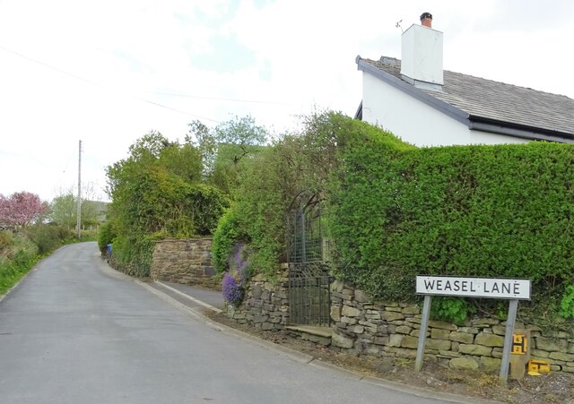
Sunnyhurst Wood

Wood, Forest in Lancashire

England

Sunnyhurst Wood

Top of the climb, Darwen Moor Lancashire Way signpost at the top of the climb from Stepback Plantation.
Top of the climb, Darwen Moor Credit: Greum

Sunnyhurst Wood is a charming woodland located in Darwen, Lancashire, England. Covering an area of approximately 85 acres, it is a popular destination for nature enthusiasts, hikers, and families seeking a peaceful retreat from the bustling city life. The wood is owned and managed by Blackburn with Darwen Borough Council.

The woodland is characterized by a diverse range of trees, including oak, birch, and beech, which provide a rich canopy of shade during the summer months. The forest floor is adorned with a vibrant display of wildflowers, adding to the beauty of the surroundings. A network of well-maintained footpaths and trails wind through the wood, allowing visitors to explore its hidden corners and discover its natural wonders.

Sunnyhurst Wood is home to a variety of wildlife, making it a haven for nature lovers. Birdwatchers can spot species such as woodpeckers, nuthatches, and treecreepers, while squirrels and rabbits can often be seen darting through the undergrowth. The wood is also known for its population of native butterflies, with species such as the comma and peacock fluttering among the flowers.

The wood is equipped with several amenities to enhance visitors' experience. There are picnic areas dotted throughout the woodland, providing a perfect spot for a leisurely lunch or a family gathering. Additionally, a small café near the entrance offers refreshments for those in need of a break.

Overall, Sunnyhurst Wood offers a tranquil and picturesque escape, where visitors can immerse themselves in the beauty of nature and enjoy the serenity of Lancashire's woodlands.

If you have any feedback on the listing, please let us know in the comments section below.

Sunnyhurst Wood Images

Images are sourced within 2km of 53.699993/-2.4920889 or Grid Reference SD6722. Thanks to Geograph Open Source API. All images are credited.

Top of the climb, Darwen Moor Lancashire Way signpost at the top of the climb from Stepback Plantation.
Top of the climb, Darwen Moor
Lancashire Way signpost at the top of the climb from Stepback Plantation.
Footpath towards the Jubilee Tower, Darwen Moor Approaching Darwen Tower, under renovation during the summer of 2021.
Footpath towards the Jubilee Tower, Darwen Moor
Approaching Darwen Tower, under renovation during the summer of 2021.
The Waterhouse, Sunnyhurst Hey The Waterhouse associated with the (now much depleted and disused) Sunnyhurst Hey Reservoir.
The Waterhouse, Sunnyhurst Hey
The Waterhouse associated with the (now much depleted and disused) Sunnyhurst Hey Reservoir.
Earnsdale Reservoir
Earnsdale Reservoir
Green Hill The ruins of Green Hill, a former farm in the Ryal Fold area of Tockholes.
Green Hill
The ruins of Green Hill, a former farm in the Ryal Fold area of Tockholes.
Higher Garstangs, Ryal Fold The ruins of a wall at Higher Garstangs, a former home in Ryal Fold, Tockholes.
Higher Garstangs, Ryal Fold
The ruins of a wall at Higher Garstangs, a former home in Ryal Fold, Tockholes.
Car park, Ryal Fold The Tockholes woodland is over the road.
Car park, Ryal Fold
The Tockholes woodland is over the road.
Olive Lane, Darwen Residential thoroughfare in the old Lancashire town of Darwen
Olive Lane, Darwen
Residential thoroughfare in the old Lancashire town of Darwen
Darwen Station This is Platform 1 on Darwen Station.
Currently on the Clitheroe or Ribble Valley Line, which runs services from Manchester through Blackburn, terminating in Clitheroe
Darwen Station
This is Platform 1 on Darwen Station. Currently on the Clitheroe or Ribble Valley Line, which runs services from Manchester through Blackburn, terminating in Clitheroe
Back Alley behind Sarah Street, Darwen A rather untidy back alley running north from Kay Street in Darwen
Back Alley behind Sarah Street, Darwen
A rather untidy back alley running north from Kay Street in Darwen
Punch Hotel, Darwen Located at 25, Chapels - in Darwen
Punch Hotel, Darwen
Located at 25, Chapels - in Darwen
Moor Lane leading into Knowle Lane, Darwen
On Witton Weavers Way, Darwen Moor heading towards Jubilee Tower
Jubilee Tower under restoration, Darwen Hill These restoration works are taking longer than originally planned.
Jubilee Tower under restoration, Darwen Hill
These restoration works are taking longer than originally planned.
Jubilee Tower in 1996 Celebrations were in progress re 100 years access to Darwen Moor. A brass band performed at the base of the tower
Jubilee Tower in 1996
Celebrations were in progress re 100 years access to Darwen Moor. A brass band performed at the base of the tower
Tockholes Road North of Ryal Fold.
Tockholes Road
North of Ryal Fold.
Approaching Tockholes A sharp bend just south of the village.
Approaching Tockholes
A sharp bend just south of the village.
Weasel Lane At Tockholes.
Weasel Lane
At Tockholes.
Show me another place!

Sunnyhurst Wood is located at Grid Ref: SD6722 (Lat: 53.699993, Lng: -2.4920889)

Unitary Authority: Blackburn with Darwen

Police Authority: Lancashire

What 3 Words

///civil.dangerously.wounds. Near Darwen, Lancashire

Related Wikis

Earcroft

Earcroft is the northern ward in the town of Darwen, Lancashire, England. It borders Blackburn on the A666. It has a mix of residential, manufacturing...

Barley Bank

Barley Bank was a cricket and football ground in Darwen in England. It was the home ground of Darwen F.C. during their time in the Football League. �...

St Cuthbert's Church, Darwen

St Cuthbert's Church is an Anglican church in the English market town of Darwen, Lancashire. It is an active parish church in the Diocese of Blackburn...
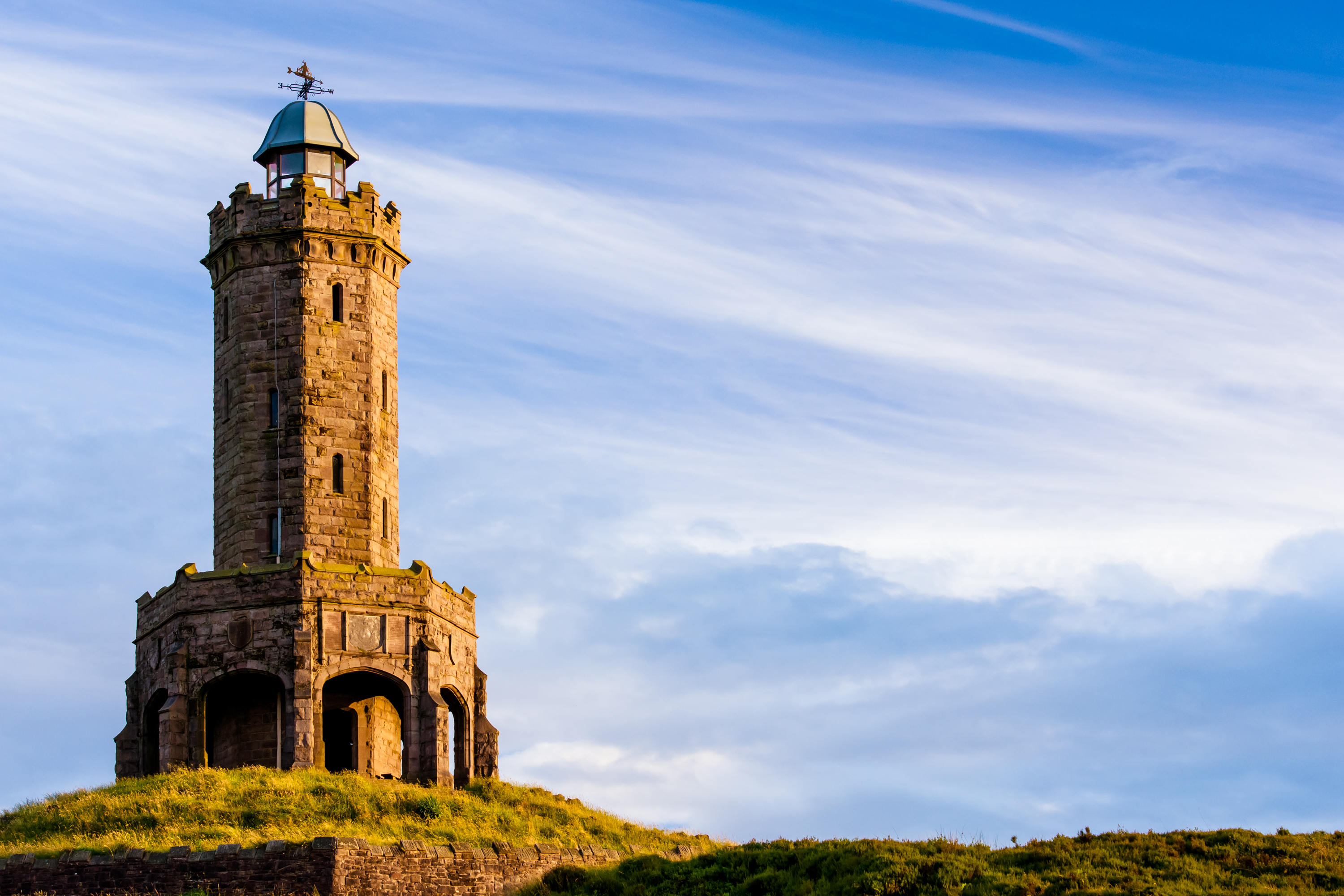
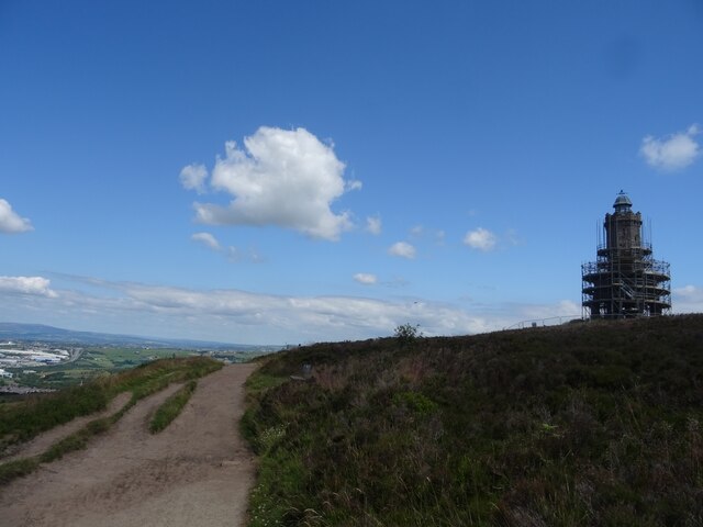
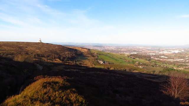
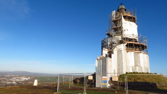
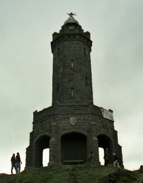
Jubilee Tower

The octagonal Jubilee Tower (officially called Darwen Tower) at grid reference SD678215 on Darwen Hill overlooking the town of Darwen in Lancashire, England...

Tockholes

Tockholes is a village and civil parish which forms part of the Blackburn with Darwen unitary authority in the English county of Lancashire, England. Tockholes...

Darwen Aldridge Enterprise Studio

Darwen Aldridge Enterprise Studio (DAES) is a mixed studio school located in Lancashire, UK. It opened in September 2013. It is part of the Aldridge Education...

Darwen F.C.

Darwen Football Club is a football club from Darwen, Lancashire, England. The club was formed in 2009 as A.F.C. Darwen, a successor to the original Darwen...

Darwen Town Hall

Darwen Town Hall is a municipal building in Croft Street, Darwen, Lancashire, England. It is the meeting place of Darwen Town Council. == History == After...

Nearby Amenities

Located within 500m of 53.699993,-2.4920889
Parking
Parking: surface
Lat/Long: 53.6970254/-2.4873725
Pub
Sunnyhurst
Addr City: Darwen
Addr Housenumber: 9
Addr Postcode: BB3 1JX
Addr Street: Sunnyhurst
Fhrs Id: 211341
Source Addr: FHRS Open Data
Lat/Long: 53.6978742/-2.4866138
Cafe
The Kiosk
Source: local_knowledge
Website: http://www.sunnyhurstwood.co.uk/
Lat/Long: 53.7021609/-2.4891063
Bench
Backrest: yes
Colour: green
Material: metal
Seats: 4
Lat/Long: 53.6977011/-2.4896232
Bench
Backrest: yes
Colour: green
Material: metal
Seats: 4
Lat/Long: 53.6998666/-2.4914562
Waste Basket
Colour: black
Material: plastic
Waste: litter
Lat/Long: 53.6972978/-2.4877918
Bench
Backrest: yes
Colour: green
Material: metal
Seats: 4
Lat/Long: 53.6973462/-2.4876019
Bench: yes
Colour: green
Covered: no
Leisure: picnic_table
Material: metal
Lat/Long: 53.701014/-2.4907936
Waste Basket
Colour: green
Material: metal
Waste: litter
Lat/Long: 53.7009905/-2.4908295
Bench
Backrest: yes
Colour: green
Material: metal
Seats: 4
Lat/Long: 53.6984865/-2.4908519
Bench
Backrest: yes
Colour: green
Material: metal
Seats: 4
Lat/Long: 53.6975072/-2.4872351
Bench
Backrest: yes
Colour: green
Material: metal
Seats: 4
Lat/Long: 53.6974982/-2.487129
Bench
Backrest: yes
Colour: green
Material: metal
Seats: 4
Lat/Long: 53.6972703/-2.4890678
Defibrillator
Defibrillator Location: left of pub front door yellow wall box
Emergency: defibrillator
Indoor: no
Lat/Long: 53.6978432/-2.486619
Letter Box
Access: yes
Operator: Royal Mail
Post Box Type: wall
Ref: BB3 342D
Royal Cypher: GR
Lat/Long: 53.6978812/-2.4865635
Waste Basket
Colour: black
Material: metal
Waste: litter
Lat/Long: 53.6974885/-2.4869905
Post Box
Collection Times: Mo-Fr 09:00; Sa 07:00
Drive Through: no
Operator: Royal Mail
Operator Wikidata: Q638098
Post Box Type: pillar
Ref: BB3 338D
Royal Cypher: EIIR
Royal Cypher Wikidata: Q33102113
Lat/Long: 53.7021664/-2.4863346
The data included in this document is from www.openstreetmap.org. The data is made available under ODbL.

Have you been to Sunnyhurst Wood?

Leave your review of Sunnyhurst Wood below (or comments, questions and feedback).