Hill Plantation

Wood, Forest in Westmorland Eden

England

Hill Plantation

Pasture, Milburn Viewed from just outside of the access land crossed by the footpath south of Wythwaite.
Pasture, Milburn Credit: Andrew Smith

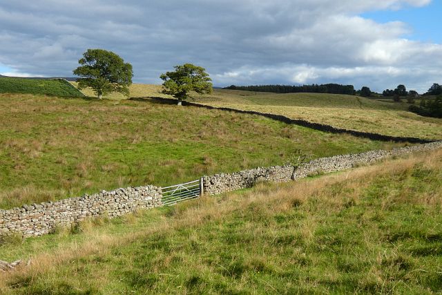
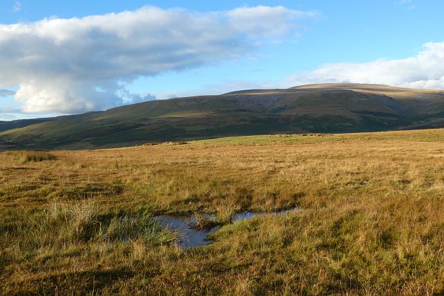
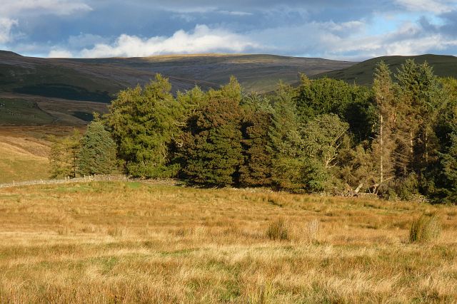
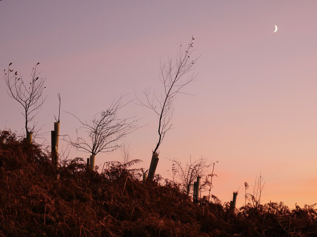
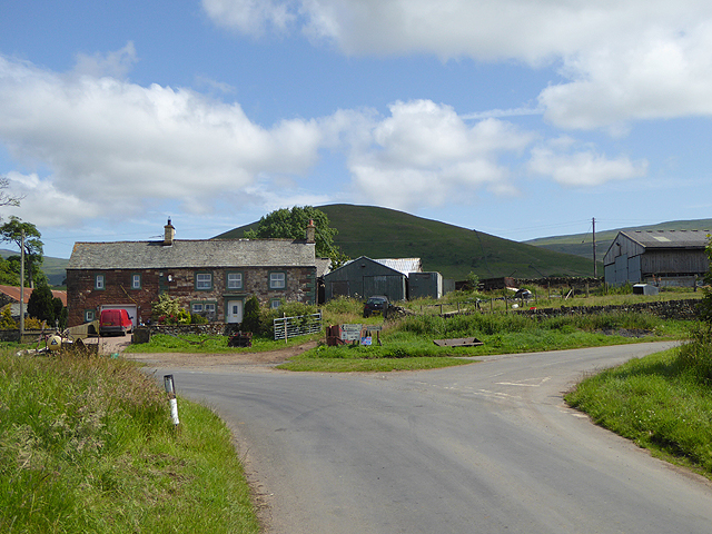
Hill Plantation, located in Westmorland, is a captivating and picturesque woodland area known for its abundant natural beauty. Situated amidst rolling hills and lush greenery, this plantation is a haven for nature enthusiasts and outdoor lovers alike.

Covering a vast expanse, Hill Plantation boasts a diverse array of tree species, including oak, pine, and beech, among others. The forest floor is adorned with a carpet of ferns and wildflowers, adding color and vibrancy to the landscape. The air is filled with the sweet fragrance of the surrounding flora, making every visit a sensory delight.

The woodland is intersected by various well-maintained trails, enabling visitors to explore the plantation at their own pace. These trails offer breathtaking views of the surrounding countryside, with glimpses of distant hills and valleys. Birdwatchers can also rejoice, as Hill Plantation is home to a wide variety of avian species, making it a haven for birdwatching enthusiasts.

In addition to its natural offerings, Hill Plantation also serves as a vital habitat for many mammals, such as deer, rabbits, and foxes. The presence of these creatures further enhances the plantation's allure, providing visitors with the opportunity to observe and appreciate the local wildlife.

Hill Plantation is not only a place of natural beauty but also plays a crucial role in environmental conservation efforts. The woodland is managed sustainably, ensuring the preservation of its ecosystem for future generations to enjoy.

With its stunning scenery and abundant wildlife, Hill Plantation is a must-visit destination for nature lovers seeking tranquility and a deep connection with the natural world.

If you have any feedback on the listing, please let us know in the comments section below.

Hill Plantation Images

Images are sourced within 2km of 54.665547/-2.5047339 or Grid Reference NY6730. Thanks to Geograph Open Source API. All images are credited.

Pasture, Milburn Viewed from just outside of the access land crossed by the footpath south of Wythwaite.
Pasture, Milburn
Viewed from just outside of the access land crossed by the footpath south of Wythwaite.
Moorland, Milburn On Red Carle with Cross Fell in the background.
Moorland, Milburn
On Red Carle with Cross Fell in the background.
Wood and moorland, Milburn The north-western edge of Hill Plantation is seen from Red Carle.
Wood and moorland, Milburn
The north-western edge of Hill Plantation is seen from Red Carle.
Moorland, Milburn From the north-western shoulder of Burney Hill, Cross Fell and intervening slopes are caught in late sunshine.
Moorland, Milburn
From the north-western shoulder of Burney Hill, Cross Fell and intervening slopes are caught in late sunshine.
Rusting remains of the Silverband Mine aerial ropeway A late afternoon shot of remains of the Silverband Mine aerial ropeway at approximately 480 metres above sea level.
Rusting remains of the Silverband Mine aerial ropeway
A late afternoon shot of remains of the Silverband Mine aerial ropeway at approximately 480 metres above sea level.
Silverband Mine aerial ropeway brake house Some of the more substantial remains of the former aerial ropeway, on the lower slopes of Great Dun Fell.
Silverband Mine aerial ropeway brake house
Some of the more substantial remains of the former aerial ropeway, on the lower slopes of Great Dun Fell.
Aerial ropeway remains above the Knock Ore Gill Remains of the Silverband Mine aerial ropeway high above the Knock Ore Gill on the lower slopes of Great Dun Fell.
Aerial ropeway remains above the Knock Ore Gill
Remains of the Silverband Mine aerial ropeway high above the Knock Ore Gill on the lower slopes of Great Dun Fell.
Aerial ropeway pylon base Another example of a partially-removed pylon base of the former Silverband Mine aerial ropeway.
Aerial ropeway pylon base
Another example of a partially-removed pylon base of the former Silverband Mine aerial ropeway.
Knock Ore Gill A view of the Knock Ore Gill from a makeshift bridge of telegraph poles.
Knock Ore Gill
A view of the Knock Ore Gill from a makeshift bridge of telegraph poles.
Approaching sunset on the lower slopes of Great Dun Fell One of the best preserved examples of an aerial ropeway pylon which once enabled barytes from Silverband Mine to be carried down to Milburn Grange for processing.
Approaching sunset on the lower slopes of Great Dun Fell
One of the best preserved examples of an aerial ropeway pylon which once enabled barytes from Silverband Mine to be carried down to Milburn Grange for processing.
Heading down from Great Dun Fell A beautiful end to a spectacular day on Great Dun Fell above the Eden valley which remained cloaked in freezing fog.
Heading down from Great Dun Fell
A beautiful end to a spectacular day on Great Dun Fell above the Eden valley which remained cloaked in freezing fog.
Approaching the Knock Ore Gill Adjacent to the Knock Ore Gill, the area has been extensively planted with deciduous trees, and as is commonplace in Cumbria, the area also features extensive Bracken growth.
Approaching the Knock Ore Gill
Adjacent to the Knock Ore Gill, the area has been extensively planted with deciduous trees, and as is commonplace in Cumbria, the area also features extensive Bracken growth.
Aerial ropeway pylon on the lower slopes of Great Dun Fell A wonderful example of our industrial heritage, still standing after nearly 80 years.
Aerial ropeway pylon on the lower slopes of Great Dun Fell
A wonderful example of our industrial heritage, still standing after nearly 80 years.
Bridleway into Littledale Cutting down from Wildboar Scar, the bridleway to Blencarn traverses the north western slopes of Grumply Hill. Although much firmer underfoot than on the open Kirklands Fell, the bridleway does flatter to deceive and has some patches of very slippery mud just ahead (as I found to my cost).
Bridleway into Littledale
Cutting down from Wildboar Scar, the bridleway to Blencarn traverses the north western slopes of Grumply Hill. Although much firmer underfoot than on the open Kirklands Fell, the bridleway does flatter to deceive and has some patches of very slippery mud just ahead (as I found to my cost).
Littledale Beck jigs sideways as it crosses a fault Littledale Beck, formed on the lowest of the Carboniferous rocks on Wildboar Scar, has now cut down into the much older Ordovician Kirklands formation. At this point it crosses a fault which has juxtaposed a volcanic tuff within the formation against harder rocks forming the visible outcrop. It has exploited the weakness along the fault to jig sideways before finding a way to cut through the harder strata to continue its course. The small isolated summit in the distance in the centre of the view is Tottle Hill, the end of a spur cut off by one of the characteristic glacial overflow channels that abound on this side of the Eden Valley.
Littledale Beck jigs sideways as it crosses a fault
Littledale Beck, formed on the lowest of the Carboniferous rocks on Wildboar Scar, has now cut down into the much older Ordovician Kirklands formation. At this point it crosses a fault which has juxtaposed a volcanic tuff within the formation against harder rocks forming the visible outcrop. It has exploited the weakness along the fault to jig sideways before finding a way to cut through the harder strata to continue its course. The small isolated summit in the distance in the centre of the view is Tottle Hill, the end of a spur cut off by one of the characteristic glacial overflow channels that abound on this side of the Eden Valley.
Red Carle This area of sheep pasture is on the lower slopes of Cross Fell to the north-east of Milburn village. The ruined building was once a house known as 'Windy Hall'.
Red Carle
This area of sheep pasture is on the lower slopes of Cross Fell to the north-east of Milburn village. The ruined building was once a house known as 'Windy Hall'.
Farmland near Milburn To the north-east of Milburn village.
Farmland near Milburn
To the north-east of Milburn village.
Littledale Looking up valley: bridleway to Crowdundle Head on right of stream, ruined sheepfold centre.
Littledale
Looking up valley: bridleway to Crowdundle Head on right of stream, ruined sheepfold centre.
Show me another place!

Hill Plantation is located at Grid Ref: NY6730 (Lat: 54.665547, Lng: -2.5047339)

Administrative County: Cumbria

District: Eden

Police Authority: Cumbria

What 3 Words

///decorator.adjuster.almost. Near Appleby-in-Westmorland, Cumbria

Nearby Locations

Red Carle Hill Plantation

Related Wikis

Milburn, Cumbria

Milburn is a small village and civil parish in the Eden district of Cumbria, England. It is located on the northern side of the Eden Valley, about 9 miles...

Knock, Cumbria

Knock is a small village in the Eden district of Cumbria, England, and 1.9 km northwest of the larger village of Dufton and 3.1 km south of the village...

Kirkland, Culgaith

Kirkland is a village in the Eden district of the English county of Cumbria. It is in the historic county of Cumberland. There is a fell called Kirkland...

Blencarn

Blencarn is a small village located in the Eden District of Cumbria, England. The village is situated at the foot of the Pennines. In Blencarn there is...

Nearby Amenities

Located within 500m of 54.665547,-2.5047339
Ford: yes
Lat/Long: 54.667136/-2.5059834
The data included in this document is from www.openstreetmap.org. The data is made available under ODbL.

Have you been to Hill Plantation?

Leave your review of Hill Plantation below (or comments, questions and feedback).