Swinethwaite Plantation

Wood, Forest in Westmorland Eden

England

Swinethwaite Plantation

Moorland, Milburn On Red Carle with Cross Fell in the background.
Moorland, Milburn Credit: Andrew Smith

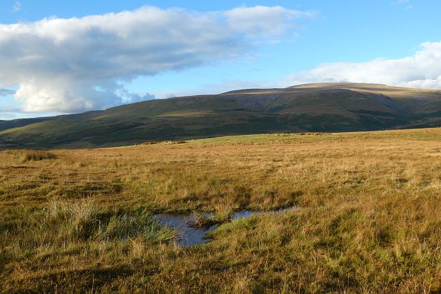
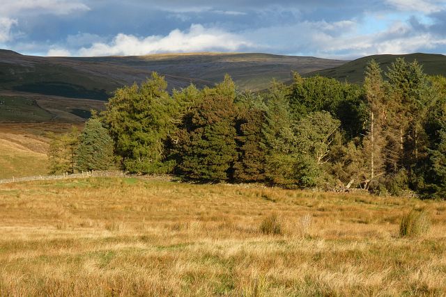
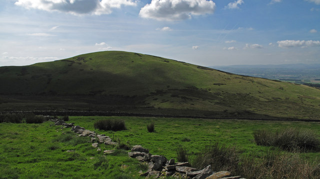
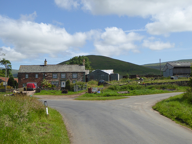
Swinethwaite Plantation is a charming woodland located in the historic county of Westmorland in northwest England. Nestled within the picturesque landscape of the Lake District National Park, this enchanting forest covers an area of approximately 100 acres.

The plantation is predominantly composed of diverse species of trees, including oak, beech, ash, and birch. These towering giants provide a lush and verdant canopy, casting dappled sunlight on the forest floor. The rich variety of flora and fauna found within Swinethwaite Plantation makes it a haven for nature enthusiasts and wildlife lovers alike.

Walking through the plantation, visitors can enjoy a serene and peaceful atmosphere, surrounded by the tranquil sounds of birdsong and rustling leaves. The forest paths wind their way through the woodland, offering scenic views of the surrounding hills and valleys.

Swinethwaite Plantation is not only a natural sanctuary but also holds cultural significance. Its roots can be traced back to the medieval times when it was a part of the Swinethwaite Manor. The plantation has since been managed by the Forestry Commission, ensuring its preservation and accessibility to the public.

Whether it's a leisurely stroll, a family picnic, or a birdwatching adventure, Swinethwaite Plantation offers a delightful escape from the hustle and bustle of modern life. Its tranquil beauty and idyllic setting make it a true gem within the Westmorland countryside, inviting visitors to connect with nature and experience the timeless allure of a woodland retreat.

If you have any feedback on the listing, please let us know in the comments section below.

Swinethwaite Plantation Images

Images are sourced within 2km of 54.656029/-2.5048639 or Grid Reference NY6729. Thanks to Geograph Open Source API. All images are credited.

Moorland, Milburn On Red Carle with Cross Fell in the background.
Moorland, Milburn
On Red Carle with Cross Fell in the background.
Wood and moorland, Milburn The north-western edge of Hill Plantation is seen from Red Carle.
Wood and moorland, Milburn
The north-western edge of Hill Plantation is seen from Red Carle.
Moorland, Milburn From the north-western shoulder of Burney Hill, Cross Fell and intervening slopes are caught in late sunshine.
Moorland, Milburn
From the north-western shoulder of Burney Hill, Cross Fell and intervening slopes are caught in late sunshine.
Mudgill Sike, Milburn Snow-capped Cross Fell is in the background.
Mudgill Sike, Milburn
Snow-capped Cross Fell is in the background.
Moorland, Milburn A view from Red Carle across the Eden valley towards the Lake District. On the skyline are snow-free Clough Head and Great Mell Fell to the left and snow-capped Blencathra and Skiddaw to the right. More distantly (left of centre) are the fells around Grasmoor and Grisdeale Pike.
Moorland, Milburn
A view from Red Carle across the Eden valley towards the Lake District. On the skyline are snow-free Clough Head and Great Mell Fell to the left and snow-capped Blencathra and Skiddaw to the right. More distantly (left of centre) are the fells around Grasmoor and Grisdeale Pike.
Red Carle This area of sheep pasture is on the lower slopes of Cross Fell to the north-east of Milburn village. The ruined building was once a house known as 'Windy Hall'.
Red Carle
This area of sheep pasture is on the lower slopes of Cross Fell to the north-east of Milburn village. The ruined building was once a house known as 'Windy Hall'.
Farmland near Milburn To the north-east of Milburn village.
Farmland near Milburn
To the north-east of Milburn village.
Two small dams Below Hill Plantation - anyone know if they have names?
Two small dams
Below Hill Plantation - anyone know if they have names?
Mudgill Sike A glacial meltwater channel (?) at foot of Pennine escarpment. Kirkland Fell in background. (The camera was horizontal!)
Mudgill Sike
A glacial meltwater channel (?) at foot of Pennine escarpment. Kirkland Fell in background. (The camera was horizontal!)
Path from Silverband Mine to Milburn
Burney Hill Image taken from the road up to the Great Dunn Fell radar station.
Burney Hill
Image taken from the road up to the Great Dunn Fell radar station.
Summit of Burney Hill A fine small hill with great views.
Summit of Burney Hill
A fine small hill with great views.
Mudgill Sike Mudgill Sike flows slowly along its marshy course to join Crowdundle Beck which has its origin between the two skyline hills, Cross Fell and Little Dun Fell.
Mudgill Sike
Mudgill Sike flows slowly along its marshy course to join Crowdundle Beck which has its origin between the two skyline hills, Cross Fell and Little Dun Fell.
Burney Hill Burney Hill is a minor rise on the western side of the north Pennines; it's photographed here from a bridleway to the north as a ruined wall is crossed.
Burney Hill
Burney Hill is a minor rise on the western side of the north Pennines; it's photographed here from a bridleway to the north as a ruined wall is crossed.
Knock Ore Gill A view of the Knock Ore Gill from a makeshift bridge of telegraph poles.
Knock Ore Gill
A view of the Knock Ore Gill from a makeshift bridge of telegraph poles.
Concrete pillars below quarry The quarry on the north side of Knock Pike is surprisingly large. The concrete pillars must obviously have played a part in the quarrying or transportation of quarried material.
Concrete pillars below quarry
The quarry on the north side of Knock Pike is surprisingly large. The concrete pillars must obviously have played a part in the quarrying or transportation of quarried material.
Pasture, Milburn Fields beside the bridleway climbing eastward from the village.
Pasture, Milburn
Fields beside the bridleway climbing eastward from the village.
Ordnance Survey Pivot This OS pivot can be found on the wall NW side of the track. It marks a point 1325.4ft above mean sea level.
Ordnance Survey Pivot
This OS pivot can be found on the wall NW side of the track. It marks a point 1325.4ft above mean sea level.
Show me another place!

Swinethwaite Plantation is located at Grid Ref: NY6729 (Lat: 54.656029, Lng: -2.5048639)

Administrative County: Cumbria

District: Eden

Police Authority: Cumbria

What 3 Words

///bank.conquests.arrow. Near Appleby-in-Westmorland, Cumbria

Nearby Locations

Swinethwaite Plantation

Related Wikis

Milburn, Cumbria

Milburn is a small village and civil parish in the Eden district of Cumbria, England. It is located on the northern side of the Eden Valley, about 9 miles...

Knock, Cumbria

Knock is a small village in the Eden district of Cumbria, England, and 1.9 km northwest of the larger village of Dufton and 3.1 km south of the village...

St Cuthbert's Church, Dufton

St Cuthbert's Church is situated 3⁄4 mile (1.2 km) north of the village of Dufton, Cumbria, England. It should not be confused with the nearby St Cuthbert...

Dufton Pike

Dufton Pike is a hill in the northern Pennines, in Cumbria, England. It is classed as a Marilyn (a hill with topographic prominence of at least 150m)....

Related Videos

Milburn Village Primary School performance at the village Christmas Party Dec 2018

MIlburn Village Primary School Christmas performance at the village christmas party in December 2018 with teacher in charge ...

Tornado Twister over Cumbria 9th June 2018

Short video of a tornado on a bike ride.

Have you been to Swinethwaite Plantation?

Leave your review of Swinethwaite Plantation below (or comments, questions and feedback).