Coton Clanford

Settlement in Staffordshire Stafford

England

Coton Clanford

Footpath line across fields Oooh! I need to wander off down there then...
Footpath line across fields Credit: Jeremy Bolwell

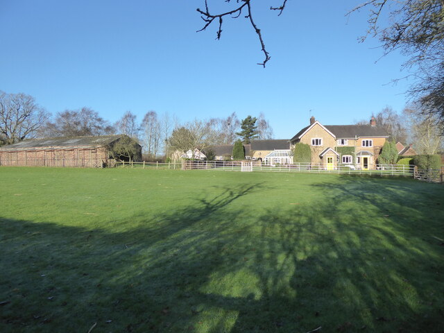
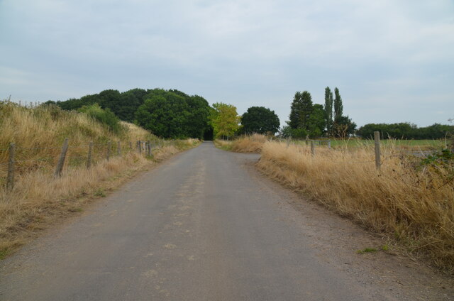
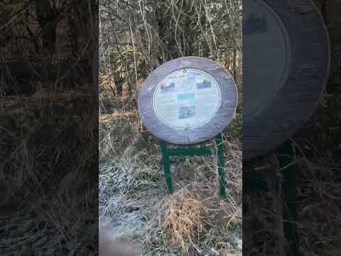
Coton Clanford is a small village located in the county of Staffordshire, England. Situated approximately 8 miles north of Stafford, the village is nestled in the picturesque countryside, surrounded by rolling hills, lush green fields, and charming rural landscapes.

The village has a rich history that dates back centuries. It is believed to have been established during the Anglo-Saxon period and is mentioned in the Domesday Book of 1086. Throughout its history, Coton Clanford has been primarily an agricultural community, with farming playing a significant role in the local economy.

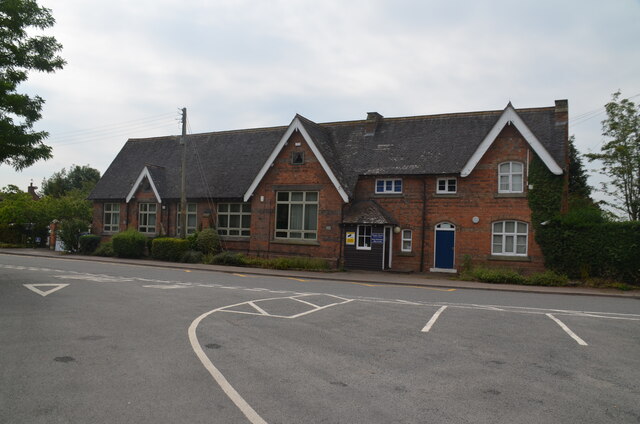
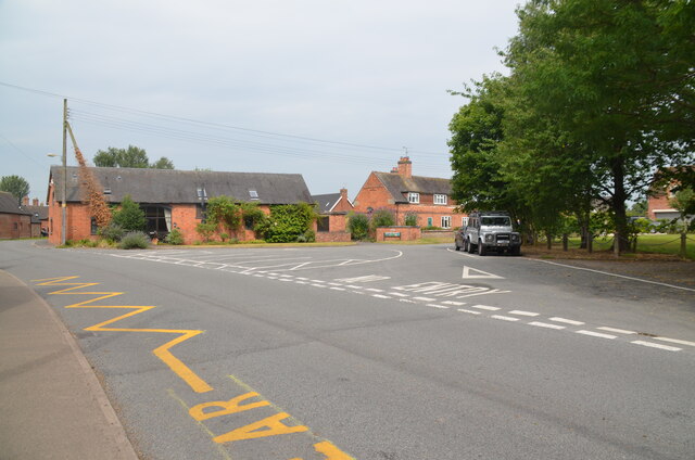
Today, the village retains much of its traditional charm and character. It is a close-knit community with a population of around 300 residents. The village is known for its quaint cottages, many of which are built with local stone, creating a distinct architectural style.

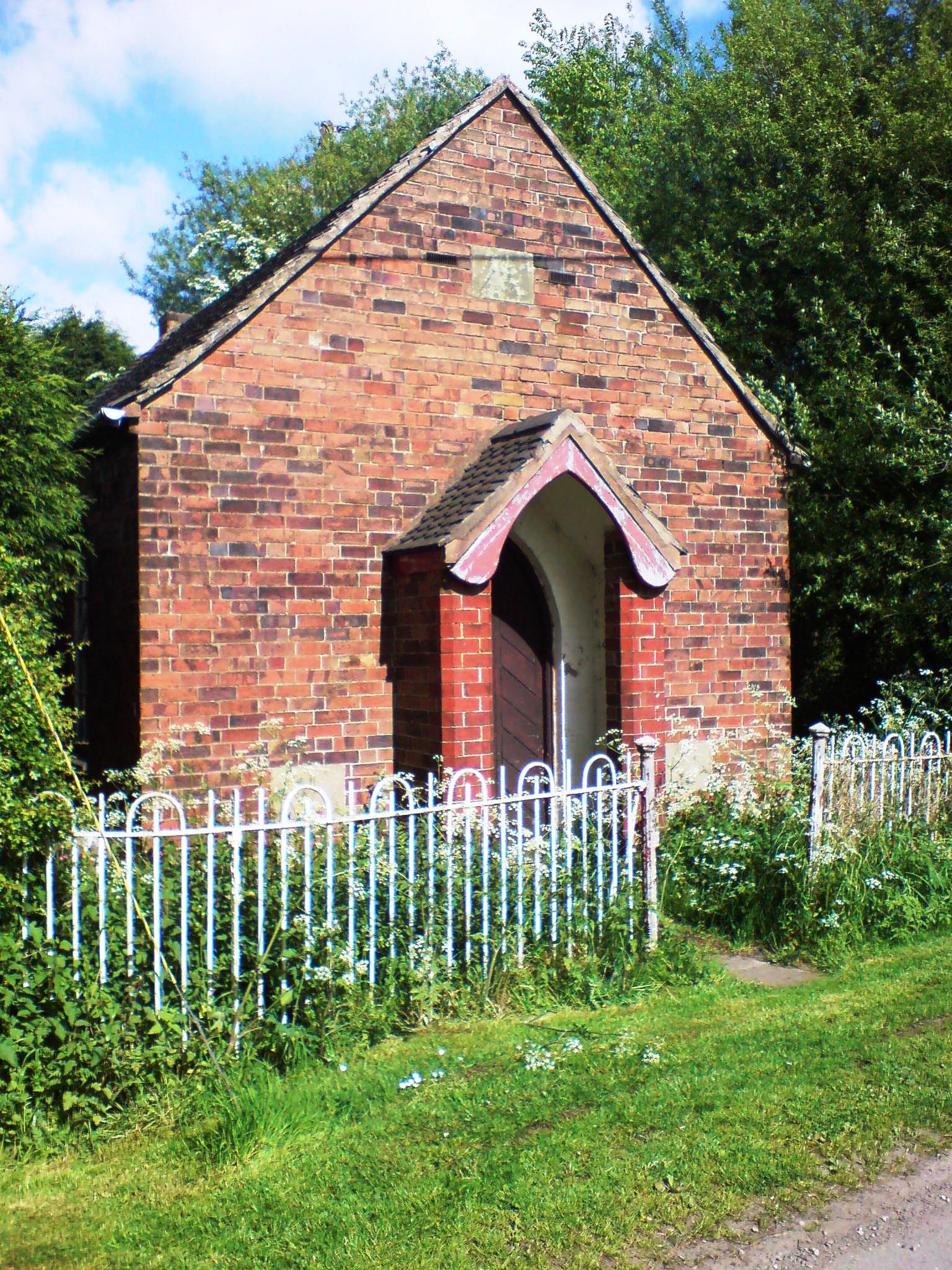
Coton Clanford is home to the St. James' Church, a beautiful Grade II listed building that dates back to the 13th century. The church is a focal point of the village and hosts regular services and community events.

Despite its small size, the village offers a range of amenities to its residents, including a village hall that serves as a gathering place for social events and activities. The surrounding countryside provides ample opportunities for outdoor pursuits, such as hiking, cycling, and horse riding.

In summary, Coton Clanford is a charming village in Staffordshire, known for its agricultural heritage, traditional architecture, and close-knit community. It offers a peaceful and picturesque setting for residents and visitors alike.

If you have any feedback on the listing, please let us know in the comments section below.

Coton Clanford Images

Images are sourced within 2km of 52.806624/-2.191333 or Grid Reference SJ8723. Thanks to Geograph Open Source API. All images are credited.

Footpath line across fields Oooh! I need to wander off down there then...
Footpath line across fields
Oooh! I need to wander off down there then...
View to Brook House Farm from the nearby footpath Really nice place.
View to Brook House Farm from the nearby footpath
Really nice place.
Reed bed in sunshine I really love a reedbed, especially in a good light.
Reed bed in sunshine
I really love a reedbed, especially in a good light.
Frozen patch of ice on the lane that looks like a map of Wales Is it just me or does this patch of ice resemble a view of Wales from space?
Frozen patch of ice on the lane that looks like a map of Wales
Is it just me or does this patch of ice resemble a view of Wales from space?
House on the lane Nice place.
House on the lane
Nice place.
Former RAF Seighford  / 6th Gear Car Driving Experience, Seighford Built in 1942 as a satellite/relief landing ground for RAF Hixon, 7.5 miles (12.1 km) to the east. It is currently used as a car driving experience day. I was there to lap in an Audi R8 / Aston Martin Vantage V8 Roadster / Lamborghini Gallardo LP570-4 Superleggera.. Good fun :)
Former RAF Seighford / 6th Gear Car Driving Experience, Seighford
Built in 1942 as a satellite/relief landing ground for RAF Hixon, 7.5 miles (12.1 km) to the east. It is currently used as a car driving experience day. I was there to lap in an Audi R8 / Aston Martin Vantage V8 Roadster / Lamborghini Gallardo LP570-4 Superleggera.. Good fun :)
Cooper Perry Primary School, Seighford near Stafford Cooper Perry Primary School, Seighford near Stafford is named after Sir Edwin Cooper Perry, GCVO (1856-1938) who was a physician and became Vice-Chancellor of the University of London. His father was the vicar of St Chad's Church, Seighford.
Cooper Perry Primary School, Seighford near Stafford
Cooper Perry Primary School, Seighford near Stafford is named after Sir Edwin Cooper Perry, GCVO (1856-1938) who was a physician and became Vice-Chancellor of the University of London. His father was the vicar of St Chad's Church, Seighford.
The Green, Seighford, near Stafford A view across The Green, Seighford, towards a barn conversion in the centre-left. Cooper Perry Junior School is behind the photographer. St Chad's church is off-picture to the right. The Green has a number of parking places in its centre. Clearly it's not seen grass for some time.
The Green, Seighford, near Stafford
A view across The Green, Seighford, towards a barn conversion in the centre-left. Cooper Perry Junior School is behind the photographer. St Chad's church is off-picture to the right. The Green has a number of parking places in its centre. Clearly it's not seen grass for some time.
Road crossing end of Seighford Airfield disused runway Clanford Lane near Seighford crossing the south-west end of the former RAF Airfield runway. Tarmac covers the original concrete slabs of the runway and their outline can be seen in the tarmac. On the left, hidden from view by an earth bank, is the main part of the runway, which is used for driving experiences in top-of-the-range cars.
Road crossing end of Seighford Airfield disused runway
Clanford Lane near Seighford crossing the south-west end of the former RAF Airfield runway. Tarmac covers the original concrete slabs of the runway and their outline can be seen in the tarmac. On the left, hidden from view by an earth bank, is the main part of the runway, which is used for driving experiences in top-of-the-range cars.
Disused runway of Seighford airfield, Staffordshire Looking south-west to the end of the runway. The outline of the original concrete slabs making up the runway can be seen in the pattern of weeds and raised parts of the surface (or by looking on Google Earth). This part was used for HGV (trucks) and PSV (buses and coaches) training. There were portable offices on-site. All that remains are some abandoned traffic cones
Disused runway of Seighford airfield, Staffordshire
Looking south-west to the end of the runway. The outline of the original concrete slabs making up the runway can be seen in the pattern of weeds and raised parts of the surface (or by looking on Google Earth). This part was used for HGV (trucks) and PSV (buses and coaches) training. There were portable offices on-site. All that remains are some abandoned traffic cones
The Holly Bush, Seighford, near Stafford The Holly Bush PH is a grade II listed building situated on The Cumbers, Seighford. The building dates back to the 17th Century with later changes and additions. It has been an inn since that time.
The Holly Bush, Seighford, near Stafford
The Holly Bush PH is a grade II listed building situated on The Cumbers, Seighford. The building dates back to the 17th Century with later changes and additions. It has been an inn since that time.
Victorian wall-mounted postbox, Seighford near Stafford A Victorian wall-mounted postbox on Clanford Road, Seighford near Stafford.
Victorian wall-mounted postbox, Seighford near Stafford
A Victorian wall-mounted postbox on Clanford Road, Seighford near Stafford.
Approaching Little Aston Farm This is on the lane from Doxey.
Approaching Little Aston Farm
This is on the lane from Doxey.
Glen Farm It was difficult to see behind the hedge. Stafford Castle is on the hill on the right.
Glen Farm
It was difficult to see behind the hedge. Stafford Castle is on the hill on the right.
The beginning of Blackhole Lane This leads the short distance into Derrington.
The beginning of Blackhole Lane
This leads the short distance into Derrington.
Approaching Derrington This sign on Blackhole Lane is a little way out of the village, but there is horse accommodation on the right.
Approaching Derrington
This sign on Blackhole Lane is a little way out of the village, but there is horse accommodation on the right.
Bridge over the former railway Blackhole Lane crosses the Way for the Millennium here, where it is following the former railway from Stafford to Newport.
Bridge over the former railway
Blackhole Lane crosses the Way for the Millennium here, where it is following the former railway from Stafford to Newport.
The Red Lion, Derrington It was too early in the day for it to be open, so I haven't seen the interior or the beer range.
The Red Lion, Derrington
It was too early in the day for it to be open, so I haven't seen the interior or the beer range.
Show me another place!

Coton Clanford is located at Grid Ref: SJ8723 (Lat: 52.806624, Lng: -2.191333)

Administrative County: Staffordshire

District: Stafford

Police Authority: Staffordshire

What 3 Words

///trainers.cropping.positive. Near Gnosall, Staffordshire

Nearby Locations

Butter Bank Coton Clanford

Related Wikis

Coton Clanford

Coton Clanford is a small dispersed Staffordshire village lying in gently rolling countryside 3 miles due west of Stafford, England, and 1 mile southeast...

Seighford

Seighford ( SY-fərd) is a village and civil parish about 3 miles (5 km) west of Stafford in Staffordshire, England. The population of this civil parish...

Ranton, Staffordshire

Ranton is a small hamlet in Staffordshire, England, situated 3.5 miles (5.6 km) west of Stafford, 2.5 miles (4.0 km) east of Woodseaves and 2 miles (3...

Derrington

Derrington is a village west of the town of Stafford, in Staffordshire, England. For population details from the 2011 Census see under Seighford. Derrington...

Haughton railway station

Haughton railway station was a station in Haughton, Staffordshire, England. The station was opened on 1 June 1849 and closed in May 1949. == References... ==

Stafford Rural District

Stafford Rural District was a rural district in the county of Staffordshire. It was created in 1894 and abolished in 1974 by virtue of the Local Government...

Aston, Stafford

Aston is a hamlet in the county of Staffordshire, England. Aston was recorded in the Domesday Book as Estone. == References ==

Seighford Hall

Seighford Hall is a house that lies slightly to north-west of the core of Seighford, England. It appears to have later- 16th to early-17th origins but...

Related Videos

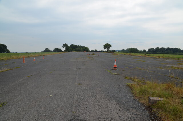
Staffordshire Gliding Club | Celebrating 60 years of gliding

60 years since the club was formed and 30 years since it moved to Seighford airfield - so we celebrated by sharing the joy of ...

Glider experience day with Bill.

My first experience of a winch glider launch to 1000 feet.

Haughton Christmas lights still need your donations please.

We are so sad that we will not have the Christmas lights up this year but we know its for the best to keep everyone safe. However ...
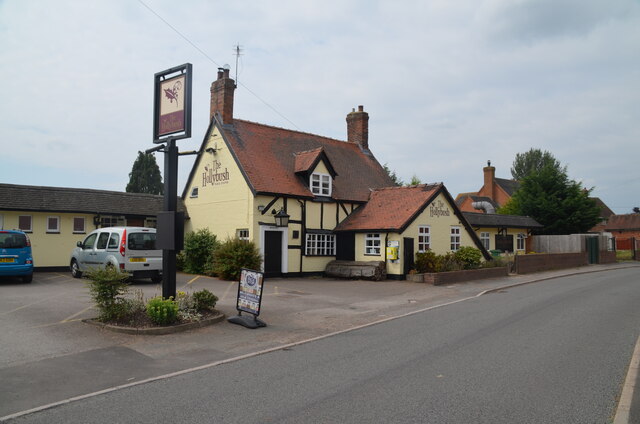
Nearby Amenities

Located within 500m of 52.806624,-2.191333
Bus Stop
Coton Clanford Farm
Bus: yes
Naptan AtcoCode: 3800C792100
Naptan Bearing: N
Naptan CommonName: Coton Clanford Farm
Naptan Indicator: Adj
Naptan Landmark: Coton Clanford Fm
Naptan Street: Oldford Ln
Naptan Verified: no
Public Transport: platform
Source: naptan_import
Lat/Long: 52.8071712/-2.1907608
Post Box
Brand: Royal Mail
Brand Wikidata: Q638098
Operator: Royal Mail
Operator Wikidata: Q638098
Post Box Type: wall
Postal Code: ST18
Royal Cypher: GR
Royal Cypher Wikidata: Q33102273
Lat/Long: 52.8066145/-2.191006
The data included in this document is from www.openstreetmap.org. The data is made available under ODbL.

Have you been to Coton Clanford?

Leave your review of Coton Clanford below (or comments, questions and feedback).