Coton

Settlement in Cambridgeshire South Cambridgeshire

England

Coton

Madingley, St Mary Magdalene <span class="nowrap"><a title="http://www.druidic.org/camchurch/churches/madingley.htm" rel="nofollow ugc noopener" href="http://www.druidic.org/camchurch/churches/madingley.htm">Link</a><img style="margin-left:2px;" alt="External link" title="External link - shift click to open in new window" src="https://s1.geograph.org.uk/img/external.png" width="10" height="10"/></span>
Madingley, St Mary Magdalene Credit: mym

Coton is a small village located in Cambridgeshire, England. Situated approximately three miles west of Cambridge city center, it is nestled in the picturesque countryside of the county. With a population of around 1,200 residents, Coton offers a peaceful and tight-knit community atmosphere.

The village is renowned for its charming thatched cottages and historic buildings, which provide a glimpse into its rich heritage. One of the notable landmarks is the 13th-century All Saints Church, known for its beautiful stained glass windows and impressive architecture.

Coton is also famous for its proximity to the University of Cambridge's West Cambridge site, which houses various research institutions and departments. This connection to the prestigious university has led to the village becoming a popular residential area for academics and professionals working in the university.

The village boasts a range of amenities to cater to its residents' needs. These include a village hall, a primary school, a post office, and a pub. Furthermore, Coton benefits from its picturesque surroundings, with numerous green spaces and walking trails nearby. The nearby Coton Countryside Reserve offers an ideal spot for nature enthusiasts to explore and enjoy the beautiful scenery.

Transport links in Coton are convenient, with regular bus services connecting the village to Cambridge city center and other nearby towns. The village's proximity to major road networks, such as the M11 motorway, ensures easy access to other parts of the country.

Overall, Coton, Cambridgeshire, offers a tranquil and idyllic living environment, combining the charm of a traditional English village with modern amenities and convenient access to nearby urban centers.

If you have any feedback on the listing, please let us know in the comments section below.

Coton Images

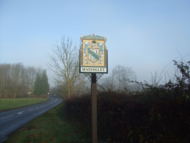
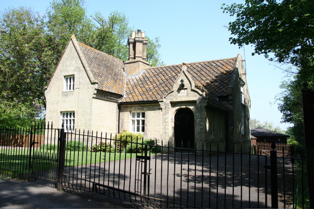
Images are sourced within 2km of 52.209622/0.057524097 or Grid Reference TL4058. Thanks to Geograph Open Source API. All images are credited.

Madingley, St Mary Magdalene <span class="nowrap"><a title="http://www.druidic.org/camchurch/churches/madingley.htm" rel="nofollow ugc noopener" href="http://www.druidic.org/camchurch/churches/madingley.htm">Link</a><img style="margin-left:2px;" alt="External link" title="External link - shift click to open in new window" src="https://s1.geograph.org.uk/img/external.png" width="10" height="10"/></span>
Madingley, St Mary Magdalene
Scratch sundial on Madingley church This dial is located on the outside East wall of the chancel (a location where it could never have worked and therefore must have been moved at some point).
Scratch sundial on Madingley church
This dial is located on the outside East wall of the chancel (a location where it could never have worked and therefore must have been moved at some point).
Madingley village sign
Madingley Hall, the iron gates
Madingley village mini roundabout
Church of St Mary Magdalene, Madingley
Madingley Pre-Preparatory School Building dated at 1840
Madingley Pre-Preparatory School
Building dated at 1840
Madingley Pre-Preparatory School
Madingley Church and Hall entrance In front of the church is the Lodge for Madingley Hall, whose entrance is on the right.
Madingley Church and Hall entrance
In front of the church is the Lodge for Madingley Hall, whose entrance is on the right.
Entering Madingley An autumnal scene from the bridge over the A428
Entering Madingley
An autumnal scene from the bridge over the A428
A428 near Madingley <a href="https://www.geograph.org.uk/photo/882967">TL3959 : Madingley TV & radio transmitter</a> is visible in the distance
A428 near Madingley
TL3959 : Madingley TV & radio transmitter is visible in the distance
Home Farm, Madingley
Brook Cottage, Cambridge Road
Road junction in Madingley The village sign can be seen on the right of this photo
Road junction in Madingley
The village sign can be seen on the right of this photo
Madingley village sign - detail I think the arms are those of Col. Thomas Harding, who owned the Madingley estates before they were sold to Cambridge University in 1948. The motto may mean either "I rise through the heights" or "I rise through difficulties".

The sign bears a plate with this inscription:

MINNIE BROWN
1886-1978
THIS SIGN WAS DONATED BY THE
RESIDENTS OF MADINGLEY AND
FRIENDS IN RECOGNITION OF HER
DEVOTED SERVICE TO THE COMMUNITY
FOR SIXTY-ONE YEARS.
ERECTED 1981.
Madingley village sign - detail
I think the arms are those of Col. Thomas Harding, who owned the Madingley estates before they were sold to Cambridge University in 1948. The motto may mean either "I rise through the heights" or "I rise through difficulties". The sign bears a plate with this inscription: MINNIE BROWN 1886-1978 THIS SIGN WAS DONATED BY THE RESIDENTS OF MADINGLEY AND FRIENDS IN RECOGNITION OF HER DEVOTED SERVICE TO THE COMMUNITY FOR SIXTY-ONE YEARS. ERECTED 1981.
Lake at Madingley Hall
Jane Cotton memorial, Madingley church Here lyes ye Body of Dame IANE COTTON
sole Daughter & Heiress of EDWD HINDE Esqr
of this Parish & Relict
of Sr IOHN COTTON Bart.
she departed this Life Oct. 13th. 1692
in the 62D year of her Age.

Sr IOHN dyed March 25th 1689
in the 74th year of his Age
& was buryed amongst his Ancestors
in ye Vault at Lanwade in this County.

They had Issue
IOHN. THOMAS. IANE & ANNE.
THOMAS & ANNE dyed young.
IOHN & IANE surviv'd Them.

This has been the Burying-place
of the Hindes for many Ages
Jane Cotton memorial, Madingley church
Here lyes ye Body of Dame IANE COTTON sole Daughter & Heiress of EDWD HINDE Esqr of this Parish & Relict of Sr IOHN COTTON Bart. she departed this Life Oct. 13th. 1692 in the 62D year of her Age. Sr IOHN dyed March 25th 1689 in the 74th year of his Age & was buryed amongst his Ancestors in ye Vault at Lanwade in this County. They had Issue IOHN. THOMAS. IANE & ANNE. THOMAS & ANNE dyed young. IOHN & IANE surviv'd Them. This has been the Burying-place of the Hindes for many Ages
Show me another place!

Coton is located at Grid Ref: TL4058 (Lat: 52.209622, Lng: 0.057524097)

Administrative County: Cambridgeshire

District: South Cambridgeshire

Police Authority: Cambridgeshire

What 3 Words

///foal.number.swift. Near Girton, Cambridgeshire

Nearby Locations

Coton

Related Wikis

Coton, Cambridgeshire

Coton is a small village and civil parish about three miles (about 5 km) west of Cambridge in Cambridgeshire, England and about the same distance east...

Cambridge American Cemetery and Memorial

Cambridge American Cemetery and Memorial is a World War II American military war grave cemetery, located between the villages of Coton and Madingley, 7...

Madingley Wood

Madingley Wood is a 15.4-hectare (38-acre) biological Site of Special Scientific Interest near Madingley, on the western outskirts of Cambridge.The western...

Department of Chemical Engineering and Biotechnology, University of Cambridge

The Department of Chemical Engineering and Biotechnology (CEB) is one of the teaching and research departments at the University of Cambridge. The department...

Nearby Amenities

Located within 500m of 52.209622,0.057524097
Turning Circle
Lat/Long: 52.2089686/0.0569629
Barrier: kissing_gate
Lat/Long: 52.2097928/0.062768
Man Made: water_well
Pump: manual
Source: survey
Lat/Long: 52.2104385/0.0611887
Post Box
Collection Times: Mo-Fr 16:45; Sa 12:00
Operator: Royal Mail
Post Box Type: wall
Ref: CB23 274
Royal Cypher: GR
Royal Cypher Wikidata: Q33102273
Source: survey
Lat/Long: 52.2105243/0.0611883
Man Made: water_well
Pump: manual
Source: survey
Wikidata: Q26616060
Lat/Long: 52.2104423/0.0606177
Turning Circle
Lat/Long: 52.2084461/0.0588982
Bus Stop
Village Hall
Naptan AtcoCode: 0500SCOTO001
Naptan Bearing: W
Naptan BusStopType: CUS
Naptan CommonName: Baptist Church
Naptan Indicator: opp
Naptan Landmark: Coton Baptist Church
Naptan NaptanCode: cmbdwaga
Naptan PlusbusZoneRef: CAMBDGE
Naptan Street: High Street
Route Ref: 8;14
Source: naptan_import
Lat/Long: 52.210315/0.0620483
Bus Stop
High Street
Naptan AtcoCode: 0500SCOTO002
Naptan Bearing: W
Naptan BusStopType: CUS
Naptan CommonName: The Footpath
Naptan Indicator: near
Naptan Landmark: The Footpath
Naptan NaptanCode: cmbdwagd
Naptan PlusbusZoneRef: CAMBDGE
Naptan Street: High Street
Naptan Verified: no
Source: naptan_import
Lat/Long: 52.2104599/0.0638222
Bus Stop
The Footpath
Bus Stop: shelter
Fixme: No indication whether this is an active bus stop or a relic. Looked in good repair.
Naptan AtcoCode: 0500SCOTO003
Naptan Bearing: E
Naptan CommonName: The Footpath
Naptan Indicator: opp
Naptan Landmark: The Footpath
Naptan NaptanCode: cmbdwagj
Naptan PlusbusZoneRef: CAMBDGE
Naptan Street: High Street
Naptan Verified: no
Source: naptan_import
Lat/Long: 52.2104913/0.0637982
Bus Stop
Silverdale Avenue
Bin: yes
Naptan AtcoCode: 0500SCOTO004
Naptan Bearing: W
Naptan CommonName: Silverdale Avenue
Naptan Indicator: near
Naptan Landmark: Silverdale Avenue
Naptan NaptanCode: cmbdwagm
Naptan PlusbusZoneRef: CAMBDGE
Naptan Street: Whitwell Way
Shelter: yes
Source: naptan_import
Lat/Long: 52.20877/0.0549683
Bus Stop
Village Hall
Naptan AtcoCode: 0500SCOTO005
Naptan Bearing: E
Naptan CommonName: Baptist Church
Naptan Indicator: near
Naptan Landmark: Coton Baptist Church
Naptan NaptanCode: cmbdwagp
Naptan PlusbusZoneRef: CAMBDGE
Naptan Street: High Street
Route Ref: 8;14
Shelter: no
Source: naptan_import
Lat/Long: 52.2103831/0.0620679
Post Box
Collection Times: Mo-Fr 09:00; Sa 07:00
Operator: Royal Mail
Post Box Mounting: telegraph_pole
Post Box Type: lamp
Ref: CB23 275D
Royal Cypher: EIIR
Royal Cypher Wikidata: Q33102113
Source: survey
Lat/Long: 52.2082744/0.0556593
Bench
Backrest: yes
Ele: 22.00
Lat/Long: 52.2103873/0.0613508
Barrier: kissing_gate
Lat/Long: 52.2074056/0.0602424
Grit Bin
Lat/Long: 52.2088991/0.0551429
Abandoned Barrier: gate
Note: this gate is currently off its hinges and resting to the east side of the path up against the fence
Lat/Long: 52.2097608/0.0612064
Addr City: Cambridge
Addr Housenumber: 66
Addr Postcode: CB23 7PP
Addr Street: Silverdale Avenue
Addr Village: Coton
Lat/Long: 52.2084046/0.0558407
Addr City: Cambridge
Addr Housenumber: 63
Addr Postcode: CB23 7PP
Addr Street: Silverdale Avenue
Addr Village: Coton
Lat/Long: 52.2085/0.0557635
Power: pole
Source: Esri
Lat/Long: 52.2123484/0.0572437
Power: pole
Source: Esri
Lat/Long: 52.2114823/0.0622474
Power: pole
Source: Esri
Lat/Long: 52.2116351/0.0577815
Power: pole
Source: Esri
Lat/Long: 52.2116532/0.0591119
Power: pole
Source: Esri
Lat/Long: 52.2116072/0.061314
Coton Village Sign
Historic: monument
Inscription: Coton
Man Made: village_sign
Lat/Long: 52.210384/0.0610672
Public Bookcase
Booth: K6
Colour: red
Disused Amenity: telephone
Man Made: telephone_box
Public Bookcase Type: phone_box
Lat/Long: 52.2104151/0.0622223
Bicycle Parking
Bicycle Parking: stands
Capacity: 6
Covered: no
Lat/Long: 52.210334/0.0620461
Board Title: Coton Parish Council
Board Type: notice
Information: board
Operator: Coton Parish Council
Tourism: information
Lat/Long: 52.2103286/0.061989
Crossing
Crossing: unmarked
Lat/Long: 52.2105027/0.0639809
Barrier: kerb
Kerb: lowered
Lat/Long: 52.2105446/0.0639655
Barrier: kerb
Kerb: lowered
Lat/Long: 52.2104748/0.0639912
Barrier: kerb
Kerb: lowered
Tactile Paving: no
Lat/Long: 52.2101103/0.0648018
Advertising: board
Lat/Long: 52.2103955/0.0621714
Public Bookcase
Booth: K6
Colour: red
Disused Amenity: telephone
Man Made: telephone_box
Public Bookcase Type: phone_box
Lat/Long: 52.2081959/0.0557083
Advertising: board
Lat/Long: 52.2085748/0.0552631
Bicycle Parking
Access: destination
Bicycle Parking: stands
Capacity: 20
Covered: yes
Lat/Long: 52.2101566/0.0590693
Coton A Booster
Man Made: pumping_station
Substance: water
Utility: water
Lat/Long: 52.211374/0.0578204
Power: pole
Source: Esri
Lat/Long: 52.2111318/0.0574092
Power: pole
Source: Esri
Lat/Long: 52.2110018/0.0567939
Power: pole
Source: Esri
Lat/Long: 52.2111832/0.0560412
Power: pole
Source: Esri
Lat/Long: 52.2098305/0.0570426
Power: pole
Source: Esri
Lat/Long: 52.2105289/0.0565336
Coton B Booster
Man Made: pumping_station
Substance: water
Utility: water
Lat/Long: 52.2114/0.0569021
Eversden Booster
Man Made: pumping_station
Substance: water
Utility: water
Lat/Long: 52.2110739/0.0569769
Entrance: main
Lat/Long: 52.2082882/0.0551813
Entrance: main
Lat/Long: 52.2081476/0.0550558
Addr City: Cambridge
Addr Housenumber: 62
Addr Postcode: CB23 7PP
Addr Street: Silverdale Avenue
Addr Village: Coton
Lat/Long: 52.2083339/0.0552556
Addr City: Cambridge
Addr Housenumber: 59
Addr Postcode: CB23 7PP
Addr Street: Silverdale Avenue
Addr Village: Coton
Lat/Long: 52.2082848/0.0550878
Addr City: Cambridge
Addr Housenumber: 58
Addr Postcode: CB23 7PP
Addr Street: Silverdale Avenue
Addr Village: Coton
Lat/Long: 52.2081976/0.0549839
Addr City: Cambridge
Addr Housenumber: 55
Addr Postcode: CB23 7PP
Addr Street: Silverdale Avenue
Addr Village: Coton
Lat/Long: 52.2080965/0.0550698
Entrance: main
Lat/Long: 52.2084476/0.0557774
Image: https://map.atownsend.org.uk/tmp/176731.jpg
Information: guidepost
Tourism: information
Lat/Long: 52.2079921/0.0517196
Information: route_marker
Tourism: information
Lat/Long: 52.2099992/0.0588605
Information: guidepost
Tourism: information
Lat/Long: 52.2105605/0.0639071
Information: guidepost
Tourism: information
Lat/Long: 52.2102793/0.0624999
Bench
Lat/Long: 52.2063221/0.0604181
Board Type: nature
Information: board
Note: this board has a map and details about Coton Countryside Reserve's rewilding project
Tourism: information
Lat/Long: 52.2068995/0.0603336
Information: route_marker
Tourism: information
Lat/Long: 52.2105255/0.0586053
Defibrillator
Defibrillator Location: on the wall on the west side of the school
Emergency: defibrillator
Indoor: no
Ref GB The Circuit: 869B9F37-4972-4F88-88E2-AE3500B66764
Lat/Long: 52.2101861/0.0589794
Information: guidepost
Tourism: information
Lat/Long: 52.2100288/0.0588936
Information: guidepost
Tourism: information
Lat/Long: 52.2074113/0.0602327
Information: map
Tourism: information
Lat/Long: 52.2074112/0.0602378
Watering Place
Lat/Long: 52.2067528/0.0604644
Watering Place
Lat/Long: 52.2067525/0.0604103
Information: route_marker
Tourism: information
Lat/Long: 52.206918/0.0602954
Abandoned Barrier: style
Note: this gate is currently off its hinges and resting to the east side of the path up against the fence
Lat/Long: 52.2080211/0.0643589
Barrier: kissing_gate
Lat/Long: 52.2086746/0.0627298
Waste Basket
Lat/Long: 52.2103977/0.0613508
Note: this 'gate' is horizontal bars that can be removed if access is required, it is not a gate on hinges
Lat/Long: 52.2092037/0.0627637
Waste Basket
Lat/Long: 52.2087724/0.0549239
The data included in this document is from www.openstreetmap.org. The data is made available under ODbL.

Have you been to Coton?

Leave your review of Coton below (or comments, questions and feedback).