Loocombe Wood

Wood, Forest in Somerset Mendip

England

Loocombe Wood

Direction Sign – Signpost at Church Farm, Stratton on the Fosse parish Located at Church Farm on the northwest side of the junction of Church Lane, Stratton Road and Watery Lane in Stratton on the Fosse parish. 4 arms and pyramid finial.

Milestone Society National ID: SO_ST6650
Direction Sign – Signpost at Church Farm, Stratton on the Fosse parish Credit: J Dowding

Loocombe Wood is a picturesque woodland located in Somerset, England. Situated near the village of Loocombe, the wood covers an area of approximately 100 acres and is renowned for its natural beauty and diverse wildlife.

The wood is primarily composed of deciduous trees, including oak, ash, and beech, which create an enchanting canopy overhead. The dense foliage provides a serene and peaceful environment, attracting nature enthusiasts and walkers alike. The forest floor is covered in a carpet of bluebells during the springtime, enhancing its charm and allure.

Loocombe Wood boasts a rich biodiversity, with a variety of flora and fauna calling it home. Visitors might catch a glimpse of deer, foxes, badgers, and a plethora of bird species, including woodpeckers, owls, and warblers. The wood provides a vital habitat for these animals and is designated as a Site of Special Scientific Interest due to its ecological significance.

The wood is intersected by several footpaths, offering visitors the opportunity to explore its hidden treasures. The trails wind through the woodland, passing by babbling brooks, ancient trees, and moss-covered rocks, creating a truly magical experience.

Loocombe Wood is a popular destination for outdoor activities such as hiking, birdwatching, and photography. It also provides a peaceful retreat for those seeking solace in nature. With its breathtaking beauty and abundant wildlife, Loocombe Wood is a must-visit destination for nature lovers in Somerset.

If you have any feedback on the listing, please let us know in the comments section below.

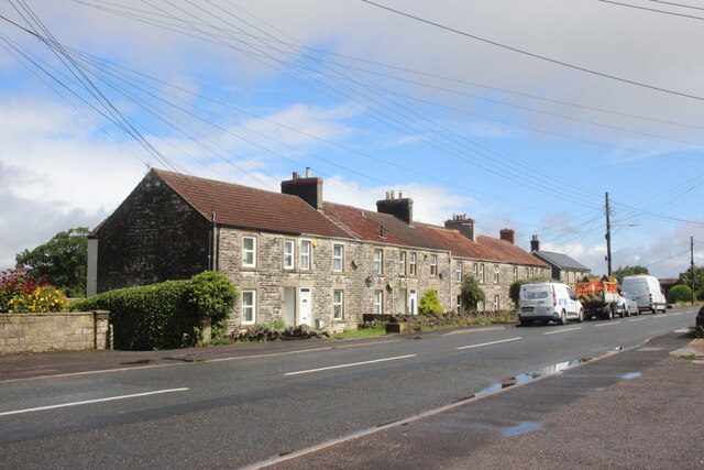
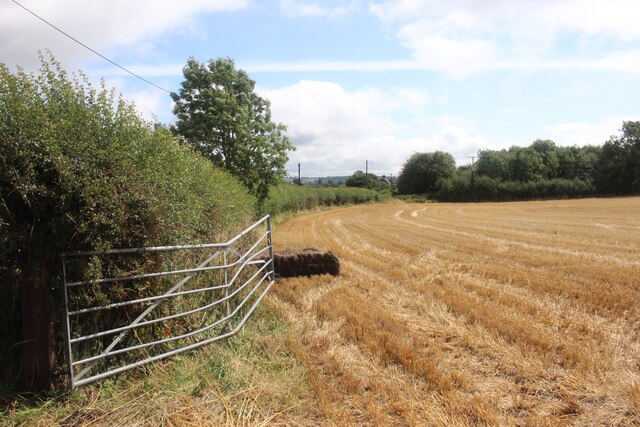
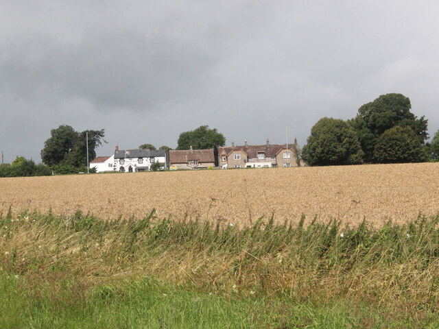
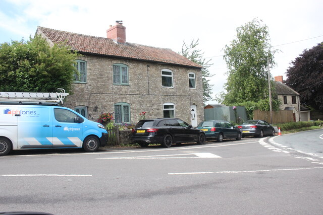
Loocombe Wood Images

Images are sourced within 2km of 51.259525/-2.4754782 or Grid Reference ST6651. Thanks to Geograph Open Source API. All images are credited.

Direction Sign – Signpost at Church Farm, Stratton on the Fosse parish Located at Church Farm on the northwest side of the junction of Church Lane, Stratton Road and Watery Lane in Stratton on the Fosse parish. 4 arms and pyramid finial.

Milestone Society National ID: SO_ST6650
Direction Sign – Signpost at Church Farm, Stratton on the Fosse parish
Located at Church Farm on the northwest side of the junction of Church Lane, Stratton Road and Watery Lane in Stratton on the Fosse parish. 4 arms and pyramid finial. Milestone Society National ID: SO_ST6650
Downside Abbey Despite appearances, most of this abbey was built in the 20th century (see <a href="https://www.geograph.org.uk/photo/4261979">ST6550 : Downside Abbey</a> for full description). The remaining Benedictine monks who have been at Downside since 1814 plan to leave in March 2022.
Downside Abbey
Despite appearances, most of this abbey was built in the 20th century (see ST6550 : Downside Abbey for full description). The remaining Benedictine monks who have been at Downside since 1814 plan to leave in March 2022.
Wells Road at Fry's Well This row of terraced stone cottages is on the north side of the Wells Road, the B3139, on the eastern side of Chilcompton village.
Wells Road at Fry's Well
This row of terraced stone cottages is on the north side of the Wells Road, the B3139, on the eastern side of Chilcompton village.
Field of Stubble near White Post The white post used to stand at a junction on the nearby fosse Way. There is now a pub called the White Post. One or two bales of straw had not been collected from the field.
Field of Stubble near White Post
The white post used to stand at a junction on the nearby fosse Way. There is now a pub called the White Post. One or two bales of straw had not been collected from the field.
The White Post Inn The White Post Inn is on the A37 Fosse Way. This is the rear of the pub viewed from the B3139 , the minor road to Kilmersdon viewed across a field of standing wheat.
The White Post Inn
The White Post Inn is on the A37 Fosse Way. This is the rear of the pub viewed from the B3139 , the minor road to Kilmersdon viewed across a field of standing wheat.
The Old Redhouse Farm  Industrial Estate This is a small rural industrial estate that has a variety of small businesses including ones dedicated to stone memorials, kick boxing classes, care providers, roofing requirements, timber preservation and car repairs.
The Old Redhouse Farm Industrial Estate
This is a small rural industrial estate that has a variety of small businesses including ones dedicated to stone memorials, kick boxing classes, care providers, roofing requirements, timber preservation and car repairs.
House near Charlton This house sits right on the junction where the minor road the B3139 from Charlton meets the minor road from Kilmersdon to Holcombe.
House near Charlton
This house sits right on the junction where the minor road the B3139 from Charlton meets the minor road from Kilmersdon to Holcombe.
Turning for Chilcompton from the A367
The church of St Andrew, Holcombe
The church of St Vigor at Stratton-on-the-Fosse One of only two churches named after St Vigor.
The church of St Vigor at Stratton-on-the-Fosse
One of only two churches named after St Vigor.
Ordnance Survey Cut Mark This mark can be found on the wall of St Andrew's Church.
For more detail see : <span class="nowrap"><a title="http://www.bench-marks.org.uk/bm47754" rel="nofollow ugc noopener" href="http://www.bench-marks.org.uk/bm47754">Link</a><img style="margin-left:2px;" alt="External link" title="External link - shift click to open in new window" src="https://s1.geograph.org.uk/img/external.png" width="10" height="10"/></span>
Ordnance Survey Cut Mark
This mark can be found on the wall of St Andrew's Church. For more detail see : LinkExternal link
Keeping pupils and the public apart These gates close off the grounds of Downside School. Two notices tell the public that this is private property with no right of way; a third tells pupils that they are not to go (in the other direction) past this point.
Keeping pupils and the public apart
These gates close off the grounds of Downside School. Two notices tell the public that this is private property with no right of way; a third tells pupils that they are not to go (in the other direction) past this point.
South porch of Old St Andrew's Church, Holcombe The late Lella Raymond, in her 1996 guide written for the Churches Conservation Trust, tells us that "the south porch holds fascinating evidence of antiquity.  The cut stone is Doulting limestone, used for Bath, Glastonbury and Wells.  The gable incorporates a Norman arch, with zigzag around it and short rolls inserted at intervals in the hollow beneath the hood.  Above the arch, in place of the keystone, is a 16th-century carved angel with wings outstretched and arms folded.  The chevron at the apex of the gable could have been carved from the tympanum ...  The walls of the porch are blind, with plain stone benches each side, one inscribed D C 1743.  The inner doorway was continuous quarter-round moulding round a four-centred arch. The door itself is a fine medieval example."
South porch of Old St Andrew's Church, Holcombe
The late Lella Raymond, in her 1996 guide written for the Churches Conservation Trust, tells us that "the south porch holds fascinating evidence of antiquity. The cut stone is Doulting limestone, used for Bath, Glastonbury and Wells. The gable incorporates a Norman arch, with zigzag around it and short rolls inserted at intervals in the hollow beneath the hood. Above the arch, in place of the keystone, is a 16th-century carved angel with wings outstretched and arms folded. The chevron at the apex of the gable could have been carved from the tympanum ... The walls of the porch are blind, with plain stone benches each side, one inscribed D C 1743. The inner doorway was continuous quarter-round moulding round a four-centred arch. The door itself is a fine medieval example."
Old St Andrew's Church, Holcombe In parkland a mile north of the village, the old church ceased to be used for regular worship when the new church in the village centre <a href="https://www.geograph.org.uk/photo/137605">ST6749 : Holcombe St Andrew</a> was opened in 1884.  It is now vested in the Churches Conservation Trust.  The 14th-century west tower shows the emerging Perpendicular style and is unbuttressed. To its west can be seen one of an avenue of Lawson cypresses.
Old St Andrew's Church, Holcombe
In parkland a mile north of the village, the old church ceased to be used for regular worship when the new church in the village centre ST6749 : Holcombe St Andrew was opened in 1884. It is now vested in the Churches Conservation Trust. The 14th-century west tower shows the emerging Perpendicular style and is unbuttressed. To its west can be seen one of an avenue of Lawson cypresses.
Downside Abbey The Basilica of St Gregory the Great is the largest neo-Gothic church, not a cathedral, in England and home to the senior community of English Benedictines.  The brothers came to Downside from Douai in northern France in 1814, as refugees from the Napoleonic regime, but most of what we see today was built in the 20th century. The cluster of eastern chapels and the transept were constructed between 1882 and 1890, the architects being Archibald Dunn and Edward Hansom.  The quire was designed by Thomas Garner and completed in 1905; the tower beyond, placed over the south transept rather than the central crossing, was completed by Sir Giles Gilbert Scott in 1938.  At 166 feet it is the tallest tower in Somerset after Wells Cathedral at 182 ft (Bath Abbey's tower is 162 ft). The great church is 74 feet high (Bath 75 ft, Exeter Cathedral 69 ft, Wells 73 ft)  and 328 feet long at present (Bristol Cathedral 338 ft), but Scott's nave still awaits its final two western bays.
Downside Abbey
The Basilica of St Gregory the Great is the largest neo-Gothic church, not a cathedral, in England and home to the senior community of English Benedictines. The brothers came to Downside from Douai in northern France in 1814, as refugees from the Napoleonic regime, but most of what we see today was built in the 20th century. The cluster of eastern chapels and the transept were constructed between 1882 and 1890, the architects being Archibald Dunn and Edward Hansom. The quire was designed by Thomas Garner and completed in 1905; the tower beyond, placed over the south transept rather than the central crossing, was completed by Sir Giles Gilbert Scott in 1938. At 166 feet it is the tallest tower in Somerset after Wells Cathedral at 182 ft (Bath Abbey's tower is 162 ft). The great church is 74 feet high (Bath 75 ft, Exeter Cathedral 69 ft, Wells 73 ft) and 328 feet long at present (Bristol Cathedral 338 ft), but Scott's nave still awaits its final two western bays.
Open hardstanding near Ropewalk Farm Some man-made surfacing, close to the old reservoir.
Open hardstanding near Ropewalk Farm
Some man-made surfacing, close to the old reservoir.
A sunny landscape on a wall A vertical depiction of a pastoral scene.
A sunny landscape on a wall
A vertical depiction of a pastoral scene.
St Cuthbert's Roman Catholic Church, Holcombe
Show me another place!

Loocombe Wood is located at Grid Ref: ST6651 (Lat: 51.259525, Lng: -2.4754782)

Administrative County: Somerset

District: Mendip

Police Authority: Avon and Somerset

What 3 Words

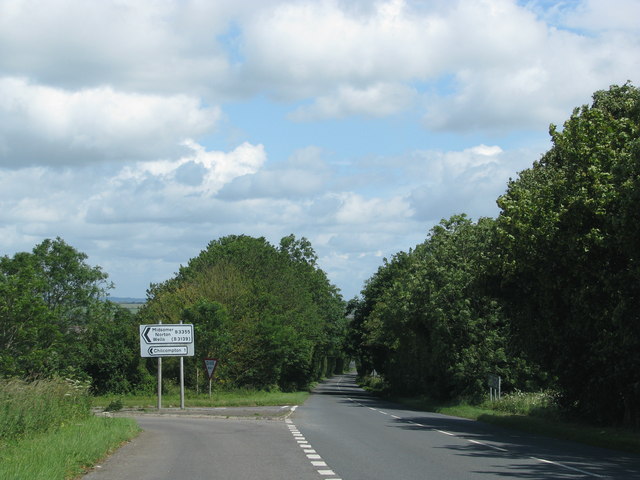
///bonfires.clues.views. Near Chilcompton, Somerset

Related Wikis

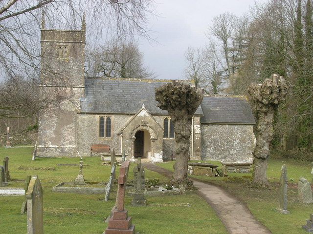
Church of St Andrew, Holcombe

The Church of St. Andrew close to Downside Abbey in Holcombe, Somerset, England has late Saxon-early Norman origins and was rebuilt in the 16th century...

Downside School

Downside School is a co-educational Catholic independent boarding and day school in the English public school tradition for pupils aged 11 to 18. It is...

Downside Abbey

Downside Abbey is a Benedictine monastery in England and the senior community of the English Benedictine Congregation. Until 2019, the community had close...

Stratton-on-the-Fosse

Stratton-on-the-Fosse is a village and civil parish located on the edge of the Mendip Hills, 2 miles (3 km) south-west of Westfield, 6 miles (10 km) north...

Holcombe, Somerset

Holcombe is a small village and civil parish (population 936) in the Mendip local government district of Somerset, England. The parish contains the hamlets...

F. Pratten and Co Ltd

F. Pratten and Co Ltd, commonly known as Prattens, was a business located in Midsomer Norton that manufactured prefabricated buildings. Production included...

Chilcompton

Chilcompton is a village and civil parish in Somerset, England, situated in the Mendip Hills two miles south of Midsomer Norton and 3.0 miles south-west...

Somer Valley FM

Somer Valley FM is a local community radio station in North East Somerset that serves Midsomer Norton, Radstock, Westfield and surrounding areas. It was...

Have you been to Loocombe Wood?

Leave your review of Loocombe Wood below (or comments, questions and feedback).