Milton Wood

Wood, Forest in Somerset Mendip

England

Milton Wood

2011 : Drive to Fosse Combe Cottage OS Explorer 142 calls it a cottage but looks more like a farm to me.
The hill in the background keeps itself in the shadow because it is in the next grid square.
2011 : Drive to Fosse Combe Cottage Credit: Maurice Pullin

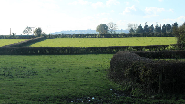
Milton Wood, Somerset, also known as Wood or Forest, is a small village located in the county of Somerset, England. Situated in the scenic countryside, the village is surrounded by lush greenery and has a tranquil and serene atmosphere.

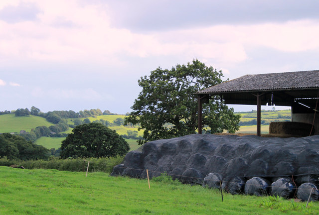
Milton Wood is known for its picturesque landscapes and beautiful woodland areas. The village is home to a variety of trees, including oak, beech, and ash, which make it an ideal spot for nature lovers and outdoor enthusiasts. The woodlands provide an excellent habitat for a diverse range of flora and fauna, attracting birdwatchers and wildlife enthusiasts from far and wide.

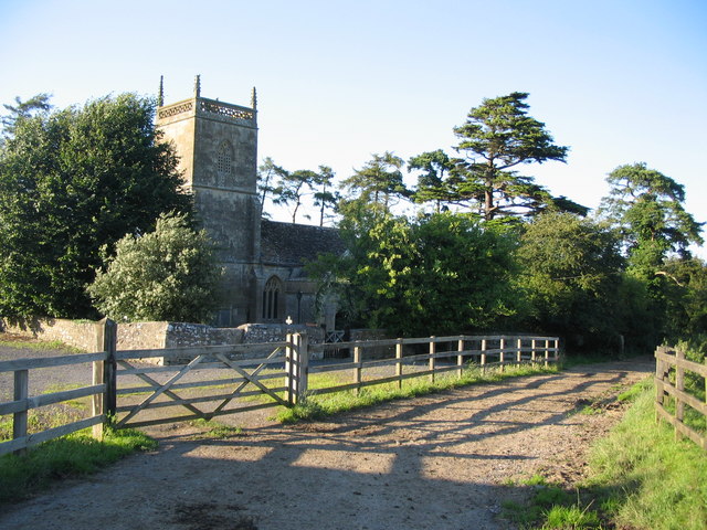
The village itself is small and tight-knit, with a close community of residents who take pride in their surroundings. The local amenities in Milton Wood include a village hall, a church, and a small primary school, making it an attractive location for families.

Despite its rural location, Milton Wood is conveniently situated near several larger towns and cities. The bustling market town of Taunton is just a short drive away, offering a wide range of shops, restaurants, and leisure facilities. The village is also well-connected to the rest of the country, with good transport links via nearby roads and rail connections.

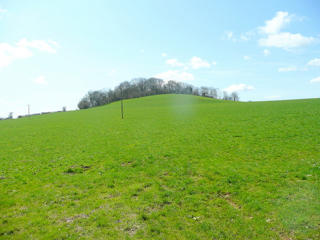
Overall, Milton Wood, Somerset, is a charming village that offers a peaceful and idyllic setting for those seeking a rural lifestyle. With its stunning woodlands, close-knit community, and convenient access to amenities, it is a place that combines the best of both worlds: a tranquil countryside retreat with easy access to modern conveniences.

If you have any feedback on the listing, please let us know in the comments section below.
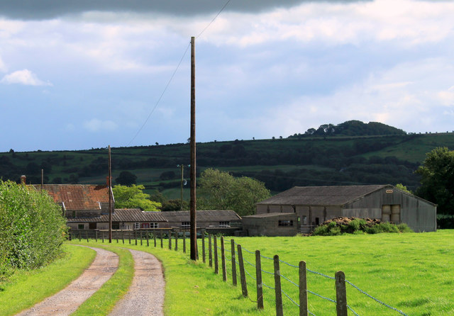
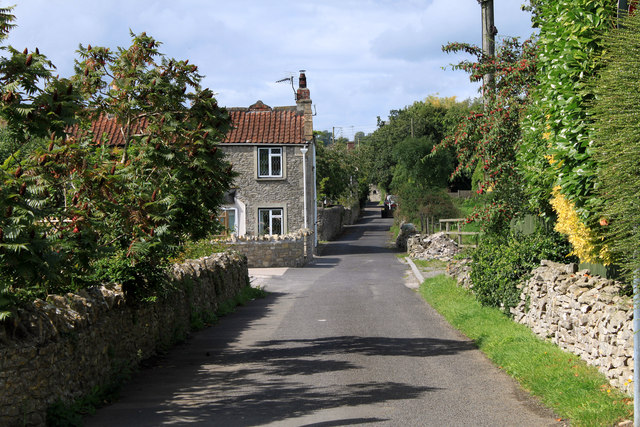
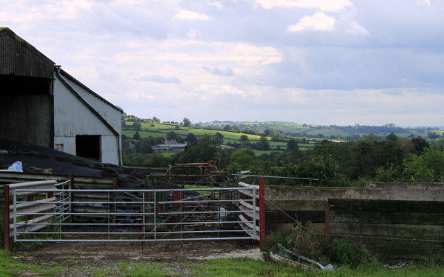
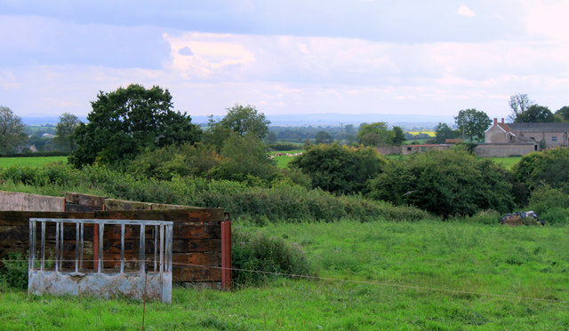
Milton Wood Images

Images are sourced within 2km of 51.135571/-2.4773762 or Grid Reference ST6637. Thanks to Geograph Open Source API. All images are credited.

2011 : Drive to Fosse Combe Cottage OS Explorer 142 calls it a cottage but looks more like a farm to me.
The hill in the background keeps itself in the shadow because it is in the next grid square.
2011 : Drive to Fosse Combe Cottage
OS Explorer 142 calls it a cottage but looks more like a farm to me. The hill in the background keeps itself in the shadow because it is in the next grid square.
2011 : Back Lane, Stoney Stratton Stoney Stratton is a village well blessed with farms, five in one grid square. Home Farm is at the end of Back Lane, about as far along as you can see, Heaven Farm is to the right of the camera position, Stratton Farm and Higher Farm are on High Street and Broad Street Farm is on Broad Street (where else?).
2011 : Back Lane, Stoney Stratton
Stoney Stratton is a village well blessed with farms, five in one grid square. Home Farm is at the end of Back Lane, about as far along as you can see, Heaven Farm is to the right of the camera position, Stratton Farm and Higher Farm are on High Street and Broad Street Farm is on Broad Street (where else?).
2011 : Farm buildings south of Westcombe Road Looking south between Stoney Stratton and Westcombe.
Fosse Combe Gully is beyond the farm buildings with Manor Farm beyond that, a church tower is almost hidden by trees, visible in the enlarged version. Seems to be connected to the farm, possibly all that is left of a lost village.
2011 : Farm buildings south of Westcombe Road
Looking south between Stoney Stratton and Westcombe. Fosse Combe Gully is beyond the farm buildings with Manor Farm beyond that, a church tower is almost hidden by trees, visible in the enlarged version. Seems to be connected to the farm, possibly all that is left of a lost village.
2011 : South west from Westcombe Road The corner of a farmyard with a cattle feeder. Recycled railway sleepers form the wall.
Fosse Combe Gully crosses the frame, Fosse Combe Cottage is to the right.
2011 : South west from Westcombe Road
The corner of a farmyard with a cattle feeder. Recycled railway sleepers form the wall. Fosse Combe Gully crosses the frame, Fosse Combe Cottage is to the right.
2011 : Corner of a barn seen from Westcombe Road With plastic wrapped hay bales covered with a mesh for further protection (could be straw).
The view beyond is to the hill above Milton Clevedon.
2011 : Corner of a barn seen from Westcombe Road
With plastic wrapped hay bales covered with a mesh for further protection (could be straw). The view beyond is to the hill above Milton Clevedon.
2011 : Westcombe Road looking east Toward Westcombe.
A maizefield shows its rigid lines and cows scatter themselves across a field.
2011 : Westcombe Road looking east
Toward Westcombe. A maizefield shows its rigid lines and cows scatter themselves across a field.
2011 : Farmland with barn North west from Westcombe Road.
2011 : Farmland with barn
North west from Westcombe Road.
2011 : Trailer with tractor, Stoney Stratton On the Westcombe Road.
The signpost is on the Doulting to Milton Clevedon Road at the junction with the road to Evercreech.
Stratton Farm is to the right.
2011 : Trailer with tractor, Stoney Stratton
On the Westcombe Road. The signpost is on the Doulting to Milton Clevedon Road at the junction with the road to Evercreech. Stratton Farm is to the right.
2011 : Brook House, Stoney Stratton Private drive with a public footpath.
2011 : Brook House, Stoney Stratton
Private drive with a public footpath.
2011 : Pasture and barn south of Stoney Stratton Seen from Westcombe Road. Near Heaven Farm.
2011 : Pasture and barn south of Stoney Stratton
Seen from Westcombe Road. Near Heaven Farm.
2012 : Limekiln Farm with Creech Hill behind On the minor road south east from Evercreech.
Take a walk, cycle ride or even drive along here, first left, explore the lanes beyond and you cannot fail to be delighted. 
OS Explorer 142 will be useful.
2012 : Limekiln Farm with Creech Hill behind
On the minor road south east from Evercreech. Take a walk, cycle ride or even drive along here, first left, explore the lanes beyond and you cannot fail to be delighted. OS Explorer 142 will be useful.
2012 : Lane to Stoney Stratton Evercreech to the left.
Maes Down appears in the background hiding its top behind a tree.
2012 : Lane to Stoney Stratton
Evercreech to the left. Maes Down appears in the background hiding its top behind a tree.
2012 : Fields and well trimmed hedgerows South of Evercreech, whose environs are just out of the frame to the right.
Easton Hill and Ditcheat Hill appear mistily in the background.

The worst picture I took on 5.11.2012
2012 : Fields and well trimmed hedgerows
South of Evercreech, whose environs are just out of the frame to the right. Easton Hill and Ditcheat Hill appear mistily in the background. The worst picture I took on 5.11.2012
2012 : Over field and hedgerow to a small cemetery On the Bruton road south of Evercreech.
The cemetery is populated by conifers (mostly).
2012 : Over field and hedgerow to a small cemetery
On the Bruton road south of Evercreech. The cemetery is populated by conifers (mostly).
2012 : Minor road to Spargrove Five years after <a href="https://www.geograph.org.uk/photo/492359">ST6638 : Bridge on the lane to Spargrove</a>
Taken after a night of heavy rain, the brook under the bridge was swollen and running fast.
2012 : Minor road to Spargrove
Five years after ST6638 : Bridge on the lane to Spargrove Taken after a night of heavy rain, the brook under the bridge was swollen and running fast.
2012 : Lane junction between Stoney Stratton and Spargrove Found the right viewpoint, set the camera up, looking through the viewfinder, about to press the button when this kind gentleman arrived in his tractor right on cue. Thank you sir.

Was somewhat intrigued by the stone pillars, look like entrance to a minor estate. A quick look at the www revealed Thomas Moore (1618 - 95) had property in Spargrove. A possible explanation.
2012 : Lane junction between Stoney Stratton and Spargrove
Found the right viewpoint, set the camera up, looking through the viewfinder, about to press the button when this kind gentleman arrived in his tractor right on cue. Thank you sir. Was somewhat intrigued by the stone pillars, look like entrance to a minor estate. A quick look at the www revealed Thomas Moore (1618 - 95) had property in Spargrove. A possible explanation.
2012 : The little brook a-babbling Looking toward Spargrove. The stream passes under a minor road bridge a few yards to the right then joins the River Alham.
2012 : The little brook a-babbling
Looking toward Spargrove. The stream passes under a minor road bridge a few yards to the right then joins the River Alham.
2012 : Double five bar gate on the road to Spargrove Creech Hill in the background.
What does it say on the notice?
2012 : Double five bar gate on the road to Spargrove
Creech Hill in the background. What does it say on the notice?
Show me another place!

Milton Wood is located at Grid Ref: ST6637 (Lat: 51.135571, Lng: -2.4773762)

Administrative County: Somerset

District: Mendip

Police Authority: Avon and Somerset

What 3 Words

///mysteries.shunning.guests. Near Evercreech, Somerset

Related Wikis

Milton Clevedon

Milton Clevedon is a village and civil parish 1 mile (1.6 km) south of Evercreech in the Mendip district of Somerset, England. == History == The name of...

Church of St James, Milton Clevedon

The Anglican Church of St James in Milton Clevedon, within the English county of Somerset, was rebuilt in 1790. It is a Grade II* listed building.The first...

Church of St Mary and St John, Lamyat

The Anglican Church Of St Mary and St John in Lamyatt, within the English county of Somerset, was built in the 13th century. It is a Grade II* listed building...

Creech Hill

Creech Hill is a hill in south east Somerset, England, which is notable for a univallate Iron Age hill fort. The hill is situated approximately 1.2 miles...

Lamyatt

Lamyatt is a village and civil parish in the Mendip district of Somerset, England. It lies 5 miles (8 km) south east of Shepton Mallet, 2 miles (3 km)...

Evercreech

Evercreech is a village and civil parish in Somerset, England. The village is 3 miles (4.8 km) southeast of Shepton Mallet, and 5 miles (8.0 km) northeast...

Evercreech New railway station

Evercreech New, originally called "Evercreech Village", was a railway station at Evercreech on the Somerset and Dorset Joint Railway. The station opened...

Evercreech Junction railway station

Evercreech Junction was a railway station at Evercreech on the Somerset and Dorset Joint Railway. Originally opened in 1862 as "Evercreech" on the original...

Nearby Amenities

Located within 500m of 51.135571,-2.4773762
Milton Clevedon
Place: village
Source: npe
Lat/Long: 51.1358643/-2.4825601
Post Box
Mapillary: 404593991404730
Operator: Royal Mail
Operator Wikidata: Q638098
Post Box Mounting: building
Post Box Type: wall
Lat/Long: 51.1321179/-2.4773236
The data included in this document is from www.openstreetmap.org. The data is made available under ODbL.

Have you been to Milton Wood?

Leave your review of Milton Wood below (or comments, questions and feedback).