Manor Road Community Wood

Wood, Forest in Somerset

England

Manor Road Community Wood

Saltford Manor The Saltford Manor is thought to be the oldest continuously occupied private house in England, and has been designated as a Grade II listed building.
The original Norman construction was by William Fitz Robert, 2nd Earl of Gloucester, and was built on an estate owned at the time of the Domesday Book by Geoffrey de Montbray the Bishop of Coutances. It is contemporary with nearby Horton Court which was a prebendary house, therefore it is likely that Saltford had an association with Keynsham Abbey, and has long been associated with St Mary's Church in Saltford. (source Wikipedia)
Saltford Manor Credit: Colin Park

Manor Road Community Wood, located in Somerset, England, is a charming woodland area that serves as a valuable community resource. Situated near the village of Ubley, this wood is a popular destination for nature enthusiasts, offering a tranquil escape from the bustle of everyday life.

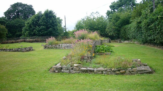
Covering an area of approximately 5 acres, Manor Road Community Wood boasts a diverse range of trees, including oak, ash, beech, and hazel, among others. These trees provide a rich habitat for a variety of wildlife, making it an ideal spot for birdwatchers and nature lovers alike. Visitors can expect to spot species such as woodpeckers, nuthatches, and various woodland mammals.

The wood is well-maintained, with footpaths that wind through the trees, allowing visitors to explore its natural beauty at their leisure. Along these paths, visitors may come across benches and picnic areas, providing opportunities for relaxation and enjoying the peaceful surroundings.

Manor Road Community Wood is managed by a dedicated team of volunteers who work tirelessly to preserve its natural habitat and enhance its ecological value. Regular community events, such as tree planting and woodland management workshops, are organized to engage the local community and foster a sense of ownership and stewardship for the wood.

In addition to its ecological significance, Manor Road Community Wood serves as an educational resource, providing opportunities for school visits and environmental education programs. These activities aim to raise awareness about the importance of woodland conservation and the value of preserving natural habitats.

Overall, Manor Road Community Wood is a treasured natural gem in Somerset, offering a haven of tranquility and a chance to connect with nature for visitors of all ages.

If you have any feedback on the listing, please let us know in the comments section below.

Manor Road Community Wood Images

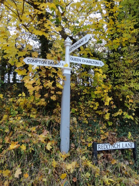
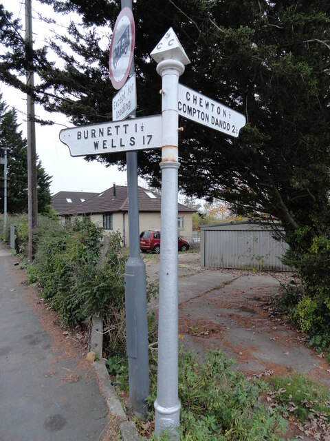
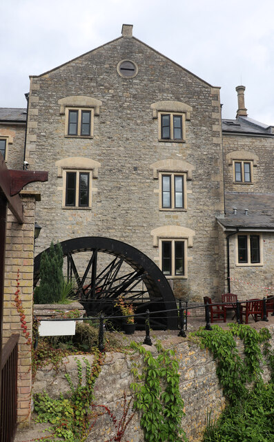
Images are sourced within 2km of 51.402663/-2.4803688 or Grid Reference ST6667. Thanks to Geograph Open Source API. All images are credited.

Saltford Manor The Saltford Manor is thought to be the oldest continuously occupied private house in England, and has been designated as a Grade II listed building.
The original Norman construction was by William Fitz Robert, 2nd Earl of Gloucester, and was built on an estate owned at the time of the Domesday Book by Geoffrey de Montbray the Bishop of Coutances. It is contemporary with nearby Horton Court which was a prebendary house, therefore it is likely that Saltford had an association with Keynsham Abbey, and has long been associated with St Mary's Church in Saltford. (source Wikipedia)
Saltford Manor
The Saltford Manor is thought to be the oldest continuously occupied private house in England, and has been designated as a Grade II listed building. The original Norman construction was by William Fitz Robert, 2nd Earl of Gloucester, and was built on an estate owned at the time of the Domesday Book by Geoffrey de Montbray the Bishop of Coutances. It is contemporary with nearby Horton Court which was a prebendary house, therefore it is likely that Saltford had an association with Keynsham Abbey, and has long been associated with St Mary's Church in Saltford. (source Wikipedia)
Keynsham Abbey Remains <span class="nowrap"><a title="https://historicengland.org.uk/listing/the-list/list-entry/1384577?section=official-listing" rel="nofollow ugc noopener" href="https://historicengland.org.uk/listing/the-list/list-entry/1384577?section=official-listing">Link</a><img style="margin-left:2px;" alt="External link" title="External link - shift click to open in new window" src="https://s1.geograph.org.uk/img/external.png" width="10" height="10"/></span>
Keynsham Abbey Remains
Direction Sign – Signpost on Redlynch Lane, Chewton Keynsham Located on the southwest side of the T junction of Chewton Road and Redlynch Lane in Chewton Keynsham, Compton Dando parish. 3 arms and pyramid finial. All three arms can be seen in <a title="https://www.geograph.org.uk/photo/6594047" href="https://www.geograph.org.uk/photo/6594047">Link</a> and  <a title="https://www.geograph.org.uk/photo/4822892" href="https://www.geograph.org.uk/photo/4822892">Link</a> , were gone by July 2019 and have now been restored, along with the finial. 

Milestone Society National ID: SO_ST6566
Direction Sign – Signpost on Redlynch Lane, Chewton Keynsham
Located on the southwest side of the T junction of Chewton Road and Redlynch Lane in Chewton Keynsham, Compton Dando parish. 3 arms and pyramid finial. All three arms can be seen in Link and Link , were gone by July 2019 and have now been restored, along with the finial. Milestone Society National ID: SO_ST6566
Direction Sign – Signpost on the B3116 in Keynsham Located on the southwest side of the junction of the B3116 Wellsway and Chewton Road in Keynsham parish. 2 arms and restored pyramid finial. See also <a title="https://www.geograph.org.uk/photo/6094137" href="https://www.geograph.org.uk/photo/6094137">Link</a>.

Milestone Society National ID: SO_ST6567A
Direction Sign – Signpost on the B3116 in Keynsham
Located on the southwest side of the junction of the B3116 Wellsway and Chewton Road in Keynsham parish. 2 arms and restored pyramid finial. See also Link. Milestone Society National ID: SO_ST6567A
Direction Sign – Signpost on the B3116 in Keynsham Located at the northern corner of a grass triangle in the centre of the junction of the B3116 Wellsway and Manor Road in Keynsham parish. 2 arms and pyramid finial. See also <a title="https://www.geograph.org.uk/photo/6049840" href="https://www.geograph.org.uk/photo/6049840">Link</a> and <span class="nowrap"><a title="https://www.flickr.com/photos/13171205@N08/8370994413" rel="nofollow ugc noopener" href="https://www.flickr.com/photos/13171205@N08/8370994413">Link</a><img style="margin-left:2px;" alt="External link" title="External link - shift click to open in new window" src="https://s1.geograph.org.uk/img/external.png" width="10" height="10"/></span>.

Milestone Society National ID: SO_ST6567B
Direction Sign – Signpost on the B3116 in Keynsham
Located at the northern corner of a grass triangle in the centre of the junction of the B3116 Wellsway and Manor Road in Keynsham parish. 2 arms and pyramid finial. See also Link and LinkExternal link. Milestone Society National ID: SO_ST6567B
Broadmead Lane Railway bridge in Keynsham.
Broadmead Lane
Railway bridge in Keynsham.
Avon Valley Farm Field near Keynsham.
Avon Valley Farm
Field near Keynsham.
Bath Road Impressive building on Bath Road, in Keynsham.
Bath Road
Impressive building on Bath Road, in Keynsham.
Albert Mill, Keynsham Now converted to housing with several adjoining new buildings. The old core has been retained and was open for Heritage Open Days. The mill has had a variety of uses but was latterly used for grinding woods for use in natural dyes. These included logwood that produces the dye haematoxylin that is still is used in cellular pathology laboratories the world over and provides the purple colour in the classic H & E stain. The mill has a very long history and was recorded in the Domesday Book. The current incarnation is a rebuilding following a fire in 1873. It ceased production in 1964 and was converted to accommodation in 1992.
Albert Mill, Keynsham
Now converted to housing with several adjoining new buildings. The old core has been retained and was open for Heritage Open Days. The mill has had a variety of uses but was latterly used for grinding woods for use in natural dyes. These included logwood that produces the dye haematoxylin that is still is used in cellular pathology laboratories the world over and provides the purple colour in the classic H & E stain. The mill has a very long history and was recorded in the Domesday Book. The current incarnation is a rebuilding following a fire in 1873. It ceased production in 1964 and was converted to accommodation in 1992.
Albert Mill, Keynsham - wood chipper This water wheel powered device may well be unique. The sloping device on the left receives woods used in dye production and uses a rack driven plunger to force them against a revolving disc carrying four blades that slice slivers of the end of the wood. The disc is driven by step-up gearing from a large external waterwheel. A flywheel provides momentum in the system. One of the woods that was chipped is logwood that is used to produce the purple dye haematoxylin. This is used in cellular pathology laboratories around the world as a nuclear stain. The mill is now accommodation but retains some machinery and was open for Heritage Open Days.
Albert Mill, Keynsham - wood chipper
This water wheel powered device may well be unique. The sloping device on the left receives woods used in dye production and uses a rack driven plunger to force them against a revolving disc carrying four blades that slice slivers of the end of the wood. The disc is driven by step-up gearing from a large external waterwheel. A flywheel provides momentum in the system. One of the woods that was chipped is logwood that is used to produce the purple dye haematoxylin. This is used in cellular pathology laboratories around the world as a nuclear stain. The mill is now accommodation but retains some machinery and was open for Heritage Open Days.
Albert Mill, Keynsham This former water mill was last used for processing dye woods such as logwood. This external breastshot wheel powered at least a chipper that still survives inside. Power is transmitted via the shaft and it has quite an unusual construction with curved lightweight spokes on the outer edges and a more robust cast central spider and radial arms. I do not recall seeing one quite like this. The mill was converted to housing in 1992 but retains features of interest and was open for Heritage Open Days.
Albert Mill, Keynsham
This former water mill was last used for processing dye woods such as logwood. This external breastshot wheel powered at least a chipper that still survives inside. Power is transmitted via the shaft and it has quite an unusual construction with curved lightweight spokes on the outer edges and a more robust cast central spider and radial arms. I do not recall seeing one quite like this. The mill was converted to housing in 1992 but retains features of interest and was open for Heritage Open Days.
Entrance to Albert Mill, Keynsham This housing development dates from 1992 and includes modern multistorey blocks adjoining the original water powered mill. The current incarnation is a rebuilding following a fire in 1873. It ceased production in 1964 and was converted to accommodation in 1992. The mill has had a variety of uses but was latterly used for grinding woods for use in natural dyes. These included logwood that produces the dye haematoxylin that is still is used in cellular pathology laboratories the world over and provides the purple colour in the classic H & E stain. The edge runner stones are part of the original plant. More machinery survives inside and there are two waterwheels - one internal and one external.
Entrance to Albert Mill, Keynsham
This housing development dates from 1992 and includes modern multistorey blocks adjoining the original water powered mill. The current incarnation is a rebuilding following a fire in 1873. It ceased production in 1964 and was converted to accommodation in 1992. The mill has had a variety of uses but was latterly used for grinding woods for use in natural dyes. These included logwood that produces the dye haematoxylin that is still is used in cellular pathology laboratories the world over and provides the purple colour in the classic H & E stain. The edge runner stones are part of the original plant. More machinery survives inside and there are two waterwheels - one internal and one external.
Albert Mill, Keynsham - waterwheel This mill was latterly used to produce dye woods but was converted to accommodation in 1992. This is one of two surviving wheels and is a breastshot wheel with ventilated buckets. The drive is taken via the shaft. The construction is unusual with curved spokes supporting the shrouds at the sides bit a more robust central cast spider and radial arms carrying the inner ends of the two rows of buckets.
Albert Mill, Keynsham - waterwheel
This mill was latterly used to produce dye woods but was converted to accommodation in 1992. This is one of two surviving wheels and is a breastshot wheel with ventilated buckets. The drive is taken via the shaft. The construction is unusual with curved spokes supporting the shrouds at the sides bit a more robust central cast spider and radial arms carrying the inner ends of the two rows of buckets.
Albert Mill, Keynsham - waterwheel This is the external waterwheel that has been preserved and may date from c1870. It is a breastshot wheel with ventilated buckets and measures 18' 1.25" diameter x 9' 11" wide. It is of an unusual design with three sets of spokes. The inner set is robust and consists of a cast spider and eight radial spokes. The outer rims are supported by sixteen very light radial spokes tied in with the same number of curved members of equally light construction. Writing in 1974 Joan Day stated that this construction appeared to be unique.
Albert Mill, Keynsham - waterwheel
This is the external waterwheel that has been preserved and may date from c1870. It is a breastshot wheel with ventilated buckets and measures 18' 1.25" diameter x 9' 11" wide. It is of an unusual design with three sets of spokes. The inner set is robust and consists of a cast spider and eight radial spokes. The outer rims are supported by sixteen very light radial spokes tied in with the same number of curved members of equally light construction. Writing in 1974 Joan Day stated that this construction appeared to be unique.
Albert Mill, Keynsham - machinery Now converted to housing with several adjoining new buildings. The old core has been retained and was open for Heritage Open Days. The mill has had a variety of uses but was latterly used for grinding woods for use in natural dyes. These included logwood that produces the dye haematoxylin that is still is used in cellular pathology laboratories the world over and provides the purple colour in the classic H & E stain. The mill has a very long history and was recorded in the Domesday Book. The current incarnation is a rebuilding following a fire in 1873. It ceased production in 1964 and was converted to accommodation in 1992.

This shows a pair of edge runner stones that are now 4' 6" diameter and were driven by the internal waterwheel. The edge of the latter is seen behind glass on the left.
Albert Mill, Keynsham - machinery
Now converted to housing with several adjoining new buildings. The old core has been retained and was open for Heritage Open Days. The mill has had a variety of uses but was latterly used for grinding woods for use in natural dyes. These included logwood that produces the dye haematoxylin that is still is used in cellular pathology laboratories the world over and provides the purple colour in the classic H & E stain. The mill has a very long history and was recorded in the Domesday Book. The current incarnation is a rebuilding following a fire in 1873. It ceased production in 1964 and was converted to accommodation in 1992. This shows a pair of edge runner stones that are now 4' 6" diameter and were driven by the internal waterwheel. The edge of the latter is seen behind glass on the left.
More new things in Keynsham High Street After many months of change and roadworks, the shopping street has a different set of ways to use it.
More new things in Keynsham High Street
After many months of change and roadworks, the shopping street has a different set of ways to use it.
The Saturday market Held on the second Saturday of the month in among the new civic offices. Various offerings of food, drink, crafts and the like.
The Saturday market
Held on the second Saturday of the month in among the new civic offices. Various offerings of food, drink, crafts and the like.
A time capsule in the new steps Keynsham civic centre was rebuilt in recent years and this set of steps now holds a secret. Buried under the nearest flagstone is a time capsule, laid down in 2016, that has 'reflection of our town' inside.
A time capsule in the new steps
Keynsham civic centre was rebuilt in recent years and this set of steps now holds a secret. Buried under the nearest flagstone is a time capsule, laid down in 2016, that has 'reflection of our town' inside.
Show me another place!

Manor Road Community Wood is located at Grid Ref: ST6667 (Lat: 51.402663, Lng: -2.4803688)

Unitary Authority: Bath and North East Somerset

Police Authority: Avon and Somerset

What 3 Words

///asset.chefs.curl. Near Saltford, Somerset

Nearby Locations

Manor Road Community Wood

Related Wikis

Wellsway School

Wellsway School is a mixed comprehensive school on the eastern side of Keynsham, Somerset, England, for students aged 11 to 18. In November 2021, there...

Saltford

Saltford is a large English village and civil parish in the Bath and North East Somerset unitary authority, Somerset. It lies between the cities of Bristol...

Chewton Keynsham

Chewton Keynsham (grid reference ST652664) is a hamlet on the River Chew in the Chew Valley, Somerset, England. It is 7 miles from Bristol, 7 miles from...

Avon Valley Country Park

Avon Valley Country Park is a 50-acre (20 ha) country park in Keynsham, Somerset, England. The park offers a variety of rides for children including Chair...

Nearby Amenities

Located within 500m of 51.402663,-2.4803688
Barrier: entrance
Lat/Long: 51.4025735/-2.4777328
Barrier: entrance
Lat/Long: 51.4017687/-2.4761664
Barrier: stile
Lat/Long: 51.4068115/-2.4818902
Barrier: stile
Lat/Long: 51.4040349/-2.4796072
Bus Stop
Minsmere Rd
Bus: yes
Naptan AtcoCode: 0180BAC30718
Naptan Bearing: NE
Naptan CommonName: Minsmere Rd
Naptan Crossing: Hurn Lane
Naptan NaptanCode: bthatwt
Naptan PlusbusZoneRef: BRSTLTM
Naptan Street: Minsmere Road
Naptan Verified: no
Public Transport: platform
Shelter: yes
Source: naptan_import
Lat/Long: 51.4060979/-2.4839458
Bus Stop
Minsmere Rd
Bus: yes
Naptan AtcoCode: 0180BAC30719
Naptan Bearing: SW
Naptan BusStopType: CUS
Naptan CommonName: Minsmere Rd
Naptan Crossing: Hurn Lane
Naptan NaptanCode: bthawaj
Naptan PlusbusZoneRef: BRSTLTM
Naptan Street: Minsmere Road
Naptan Verified: no
Public Transport: platform
Source: naptan_import
Lat/Long: 51.4053164/-2.484384
Bus Stop
Hurn Lane
Bus: yes
Naptan AtcoCode: 0180BAC30723
Naptan Bearing: S
Naptan CommonName: Hurn Lane
Naptan Crossing: Manor Road
Naptan NaptanCode: bthawam
Naptan Street: Hurn Lane
Naptan Verified: no
Public Transport: platform
Shelter: no
Source: naptan_import
Lat/Long: 51.4029971/-2.4842445
Bus Stop
Hurn Lane
Naptan AtcoCode: 0180BAC30724
Naptan Bearing: N
Naptan CommonName: Hurn Lane
Naptan Crossing: Manor Road
Naptan NaptanCode: bthawag
Naptan Street: Hurn Lane
Naptan Verified: no
Source: naptan_import
Lat/Long: 51.4029152/-2.4844737
Bus Stop
Martock Road
Bus: yes
Naptan AtcoCode: 0180BAC30725
Naptan Bearing: N
Naptan CommonName: Martock Road
Naptan Crossing: Martock Road
Naptan NaptanCode: bthatpw
Naptan PlusbusZoneRef: BRSTLTM
Naptan Street: Lytes Cary Road
Naptan Verified: no
Public Transport: platform
Source: naptan_import
Lat/Long: 51.4023493/-2.4864947
Bus Stop
Rhode Close
Bus: yes
Naptan AtcoCode: 0180BAC30726
Naptan Bearing: S
Naptan CommonName: Rhode Close
Naptan Crossing: Martock Road
Naptan NaptanCode: bthatwa
Naptan PlusbusZoneRef: BRSTLTM
Naptan Street: Lytes Cary Road
Naptan Verified: no
Public Transport: platform
Source: naptan_import
Lat/Long: 51.4018825/-2.4863172
Barrier: kissing_gate
Lat/Long: 51.4046337/-2.4828248
Noexit: yes
Lat/Long: 51.4061805/-2.4841767
Power: pole
Lat/Long: 51.4022118/-2.4831153
Power: pole
Lat/Long: 51.40196/-2.4829772
Power: pole
Lat/Long: 51.4012438/-2.4826393
Power: pole
Lat/Long: 51.400449/-2.4822074
Power: pole
Lat/Long: 51.3999687/-2.4810782
Power: pole
Lat/Long: 51.3984878/-2.4778274
Power: pole
Lat/Long: 51.3989463/-2.4788868
Power: pole
Lat/Long: 51.3994332/-2.4799463
Power: pole
Lat/Long: 51.4014162/-2.4819043
Power: pole
Lat/Long: 51.4006523/-2.4812995
Power: pole
Lat/Long: 51.3998031/-2.4806276
Power: pole
Lat/Long: 51.398794/-2.479831
Power: pole
Lat/Long: 51.3999925/-2.4758428
Power: pole
Lat/Long: 51.4001217/-2.4753473
Power: pole
Lat/Long: 51.400263/-2.4748075
Power: pole
Lat/Long: 51.3998578/-2.476409
Power: pole
Lat/Long: 51.3993743/-2.4765382
Power: pole
Lat/Long: 51.3989004/-2.4766553
Direction: 270
Generator Method: photovoltaic
Generator Output Electricity: yes
Generator Solar Modules: 14
Generator Source: solar
Generator Type: solar_photovoltaic_panel
Location: roof
Power: generator
Lat/Long: 51.4004503/-2.4852764
Direction: 270
Generator Method: photovoltaic
Generator Output Electricity: yes
Generator Solar Modules: 16
Generator Source: solar
Generator Type: solar_photovoltaic_panel
Location: roof
Power: generator
Lat/Long: 51.4008293/-2.4852761
Direction: 180
Generator Method: photovoltaic
Generator Output Electricity: yes
Generator Solar Modules: 16
Generator Source: solar
Generator Type: solar_photovoltaic_panel
Location: roof
Power: generator
Lat/Long: 51.4004742/-2.4857427
Direction: 185
Generator Method: photovoltaic
Generator Output Electricity: yes
Generator Solar Modules: 20
Generator Source: solar
Generator Type: solar_photovoltaic_panel
Location: roof
Power: generator
Lat/Long: 51.4005217/-2.4859419
Direction: 100
Generator Method: photovoltaic
Generator Output Electricity: yes
Generator Solar Modules: 12
Generator Source: solar
Generator Type: solar_photovoltaic_panel
Location: roof
Power: generator
Lat/Long: 51.4009319/-2.4847687
Direction: 190
Generator Method: photovoltaic
Generator Output Electricity: yes
Generator Solar Modules: 14
Generator Source: solar
Generator Type: solar_photovoltaic_panel
Location: roof
Power: generator
Lat/Long: 51.4011279/-2.4854009
Direction: 190
Generator Method: photovoltaic
Generator Output Electricity: yes
Generator Solar Modules: 18
Generator Source: solar
Generator Type: solar_photovoltaic_panel
Location: roof
Power: generator
Lat/Long: 51.4010987/-2.4857982
Direction: 100
Generator Method: photovoltaic
Generator Output Electricity: yes
Generator Solar Modules: 16
Generator Source: solar
Generator Type: solar_photovoltaic_panel
Location: roof
Power: generator
Lat/Long: 51.4015316/-2.4852777
Direction: 280
Generator Method: photovoltaic
Generator Output Electricity: yes
Generator Solar Modules: 5
Generator Source: solar
Generator Type: solar_photovoltaic_panel
Location: roof
Power: generator
Lat/Long: 51.4015383/-2.4853362
Direction: 230
Generator Method: photovoltaic
Generator Output Electricity: yes
Generator Solar Modules: 16
Generator Source: solar
Generator Type: solar_photovoltaic_panel
Location: roof
Power: generator
Lat/Long: 51.4019627/-2.4846527
Direction: 210
Generator Method: photovoltaic
Generator Output Electricity: yes
Generator Solar Modules: 16
Generator Source: solar
Generator Type: solar_photovoltaic_panel
Location: roof
Power: generator
Lat/Long: 51.4019932/-2.4848461
Direction: 95
Generator Method: photovoltaic
Generator Output Electricity: yes
Generator Solar Modules: 8
Generator Source: solar
Generator Type: solar_photovoltaic_panel
Location: roof
Power: generator
Lat/Long: 51.4020959/-2.4856569
Direction: 190
Generator Method: photovoltaic
Generator Output Electricity: yes
Generator Solar Modules: 14
Generator Source: solar
Generator Type: solar_photovoltaic_panel
Location: roof
Power: generator
Lat/Long: 51.4026086/-2.4854783
Direction: 200
Generator Method: photovoltaic
Generator Output Electricity: yes
Generator Solar Modules: 16
Generator Source: solar
Generator Type: solar_photovoltaic_panel
Location: roof
Power: generator
Lat/Long: 51.4025577/-2.4838754
Direction: 95
Generator Method: photovoltaic
Generator Output Electricity: yes
Generator Solar Modules: 6
Generator Source: solar
Generator Type: solar_photovoltaic_panel
Location: roof
Power: generator
Lat/Long: 51.4032019/-2.4838715
Direction: 250
Generator Method: photovoltaic
Generator Output Electricity: yes
Generator Solar Modules: 16
Generator Source: solar
Generator Type: solar_photovoltaic_panel
Location: roof
Power: generator
Lat/Long: 51.4042274/-2.4844714
Power: substation
Lat/Long: 51.4042155/-2.4848133
Direction: 195
Generator Method: photovoltaic
Generator Output Electricity: yes
Generator Solar Modules: 16
Generator Source: solar
Generator Type: solar_photovoltaic_panel
Location: roof
Power: generator
Lat/Long: 51.4042111/-2.4859812
Direction: 195
Generator Method: photovoltaic
Generator Output Electricity: yes
Generator Solar Modules: 16
Generator Source: solar
Generator Type: solar_photovoltaic_panel
Location: roof
Power: generator
Lat/Long: 51.4043221/-2.4859419
Direction: 195
Generator Method: photovoltaic
Generator Output Electricity: yes
Generator Solar Modules: 18
Generator Source: solar
Generator Type: solar_photovoltaic_panel
Location: roof
Power: generator
Lat/Long: 51.4045513/-2.4858402
Direction: 205
Generator Method: photovoltaic
Generator Output Electricity: yes
Generator Solar Modules: 10
Generator Source: solar
Generator Type: solar_photovoltaic_panel
Location: roof
Power: generator
Lat/Long: 51.4053969/-2.4858364
Direction: 190
Generator Method: photovoltaic
Generator Output Electricity: yes
Generator Solar Modules: 10
Generator Source: solar
Generator Type: solar_photovoltaic_panel
Location: roof
Power: generator
Lat/Long: 51.4035524/-2.4864788
Direction: 190
Generator Method: photovoltaic
Generator Output Electricity: yes
Generator Solar Modules: 30
Generator Source: solar
Generator Type: solar_photovoltaic_panel
Location: roof
Power: generator
Lat/Long: 51.4035684/-2.486638
Power: substation
Lat/Long: 51.4045973/-2.4867196
Street Lamp
Lat/Long: 51.406482/-2.483759
Street Lamp
Lat/Long: 51.4062505/-2.4837625
Street Lamp
Lat/Long: 51.405906/-2.4845494
Street Lamp
Lat/Long: 51.4053408/-2.4845657
Street Lamp
Lat/Long: 51.4050342/-2.4838442
Post Box
Operator: Royal Mail
Operator Wikidata: Q638098
Lat/Long: 51.4062097/-2.4839271
Street Lamp
Lat/Long: 51.4059497/-2.483836
Street Lamp
Lat/Long: 51.405788/-2.4841069
Street Lamp
Lat/Long: 51.4054129/-2.4840789
Street Lamp
Lat/Long: 51.4055069/-2.4841489
Street Lamp
Lat/Long: 51.4058003/-2.4849949
Street Lamp
Lat/Long: 51.4048464/-2.4858442
Street Lamp
Lat/Long: 51.4048312/-2.4855658
Street Lamp
Lat/Long: 51.4046854/-2.4861187
Street Lamp
Lat/Long: 51.4044337/-2.4860994
Street Lamp
Lat/Long: 51.4046644/-2.4850169
Street Lamp
Lat/Long: 51.4041414/-2.486327
Street Lamp
Lat/Long: 51.403896/-2.4862518
Street Lamp
Lat/Long: 51.4037001/-2.4863951
Street Lamp
Lat/Long: 51.403709/-2.4858199
Street Lamp
Lat/Long: 51.4035416/-2.4854448
Street Lamp
Lat/Long: 51.4034205/-2.4863494
Street Lamp
Lat/Long: 51.4031434/-2.48645
Street Lamp
Lat/Long: 51.403014/-2.4860156
Street Lamp
Lat/Long: 51.402924/-2.4856074
Street Lamp
Lat/Long: 51.4031754/-2.4868396
Street Lamp
Lat/Long: 51.4026111/-2.4864996
Street Lamp
Lat/Long: 51.4029086/-2.4862988
Barrier: kerb
Kerb: lowered
Lat/Long: 51.4029849/-2.4864087
Barrier: kerb
Kerb: lowered
Lat/Long: 51.403082/-2.4867366
Street Lamp
Lat/Long: 51.4022793/-2.4863457
Street Lamp
Lat/Long: 51.4022341/-2.4858166
Street Lamp
Lat/Long: 51.4020878/-2.4863174
Street Lamp
Lat/Long: 51.4020889/-2.486581
Street Lamp
Lat/Long: 51.4018642/-2.4863182
Street Lamp
Lat/Long: 51.4018184/-2.4859864
Street Lamp
Lat/Long: 51.4015899/-2.4860785
Direction: 180
Generator Method: photovoltaic
Generator Output Electricity: yes
Generator Solar Modules: 12
Generator Source: solar
Generator Type: solar_photovoltaic_panel
Location: roof
Power: generator
Lat/Long: 51.4016274/-2.4858077
Direction: 270
Generator Method: photovoltaic
Generator Output Electricity: yes
Generator Solar Modules: 9
Generator Source: solar
Generator Type: solar_photovoltaic_panel
Location: roof
Power: generator
Lat/Long: 51.40149/-2.4862767
Street Lamp
Lat/Long: 51.4013172/-2.486604
Street Lamp
Lat/Long: 51.4016644/-2.4865474
Street Lamp
Lat/Long: 51.4010887/-2.4867438
Street Lamp
Lat/Long: 51.4010379/-2.486458
Street Lamp
Lat/Long: 51.4008039/-2.4866474
Street Lamp
Lat/Long: 51.4005847/-2.4866996
Street Lamp
Lat/Long: 51.4001039/-2.4860342
Direction: 180
Generator Method: photovoltaic
Generator Output Electricity: yes
Generator Solar Modules: 12
Generator Source: solar
Generator Type: solar_photovoltaic_panel
Location: roof
Power: generator
Lat/Long: 51.400296/-2.486205
Street Lamp
Lat/Long: 51.403772/-2.4869108
Street Lamp
Lat/Long: 51.4050743/-2.486238
Street Lamp
Lat/Long: 51.4050324/-2.4857949
Street Lamp
Lat/Long: 51.3994282/-2.4853372
Street Lamp
Lat/Long: 51.3995828/-2.484824
Street Lamp
Lat/Long: 51.3996198/-2.4851567
Street Lamp
Lat/Long: 51.3996507/-2.4855194
Colour: grey
Man Made: street_cabinet
Lat/Long: 51.3996468/-2.4855017
Street Lamp
Lat/Long: 51.4046489/-2.4838039
Street Lamp
Lat/Long: 51.4048978/-2.4836756
Street Lamp
Lat/Long: 51.4040773/-2.484116
Street Lamp
Lat/Long: 51.4043577/-2.4843637
Street Lamp
Lat/Long: 51.4045233/-2.4845867
Street Lamp
Lat/Long: 51.402982/-2.4842503
Street Lamp
Lat/Long: 51.4032753/-2.4841445
Street Lamp
Lat/Long: 51.4027785/-2.4843962
Street Lamp
Lat/Long: 51.4054481/-2.4855266
Street Lamp
Lat/Long: 51.4052407/-2.4852522
Street Lamp
Lat/Long: 51.4053162/-2.4848798
Street Lamp
Lat/Long: 51.4054965/-2.4851212
Street Lamp
Lat/Long: 51.4037281/-2.4851504
Street Lamp
Lat/Long: 51.4025237/-2.4847412
Street Lamp
Lat/Long: 51.4024714/-2.4854636
Street Lamp
Lat/Long: 51.4025782/-2.4858781
Street Lamp
Lat/Long: 51.4015492/-2.4851589
Street Lamp
Lat/Long: 51.4018909/-2.4850932
Street Lamp
Lat/Long: 51.40212/-2.4848691
Street Lamp
Lat/Long: 51.4023669/-2.4850934
Noexit: yes
Lat/Long: 51.4023893/-2.486841
Street Lamp
Lat/Long: 51.4016046/-2.486774
Street Lamp
Lat/Long: 51.4015248/-2.4870734
Street Lamp
Lat/Long: 51.4018283/-2.4869928
Street Lamp
Lat/Long: 51.4021327/-2.4869578
Street Lamp
Lat/Long: 51.4024292/-2.4868639
Street Lamp
Lat/Long: 51.4027166/-2.4867991
Street Lamp
Lat/Long: 51.403039/-2.4867202
Power: substation
Lat/Long: 51.4010904/-2.4864172
Street Lamp
Lat/Long: 51.4013202/-2.48603
Street Lamp
Lat/Long: 51.4007187/-2.4857081
Street Lamp
Lat/Long: 51.4007534/-2.4861876
Street Lamp
Lat/Long: 51.4012999/-2.4851215
Street Lamp
Lat/Long: 51.4000155/-2.4854556
Street Lamp
Lat/Long: 51.4001941/-2.4851325
Street Lamp
Lat/Long: 51.3998084/-2.485714
Street Lamp
Lat/Long: 51.4004985/-2.4850671
Street Lamp
Lat/Long: 51.4007715/-2.4850965
Street Lamp
Lat/Long: 51.4007642/-2.4854049
Street Lamp
Lat/Long: 51.4011158/-2.4870447
Street Lamp
Lat/Long: 51.4027759/-2.4847846
Street Lamp
Lat/Long: 51.4032214/-2.487216
Street Lamp
Lat/Long: 51.4040033/-2.4851016
Barrier: bollard
Lat/Long: 51.4036758/-2.4862448
Barrier: bollard
Lat/Long: 51.4036725/-2.4862198
Barrier: bollard
Lat/Long: 51.4031437/-2.4864217
Barrier: bollard
Lat/Long: 51.4031416/-2.4864007
The data included in this document is from www.openstreetmap.org. The data is made available under ODbL.

Have you been to Manor Road Community Wood?

Leave your review of Manor Road Community Wood below (or comments, questions and feedback).