Berkeley's Plantation

Wood, Forest in Dorset

England

Berkeley's Plantation

The turning to Leigh on the A352 near Holnest
The turning to Leigh on the A352 near Holnest Credit: Val Ghose

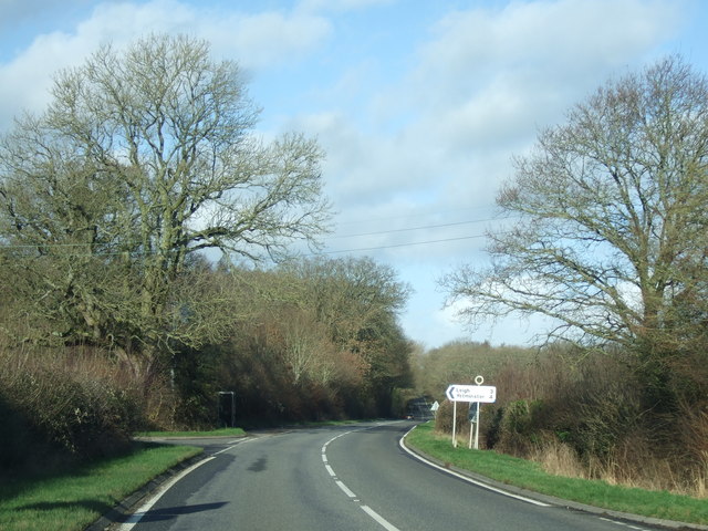
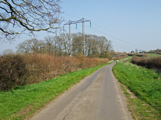
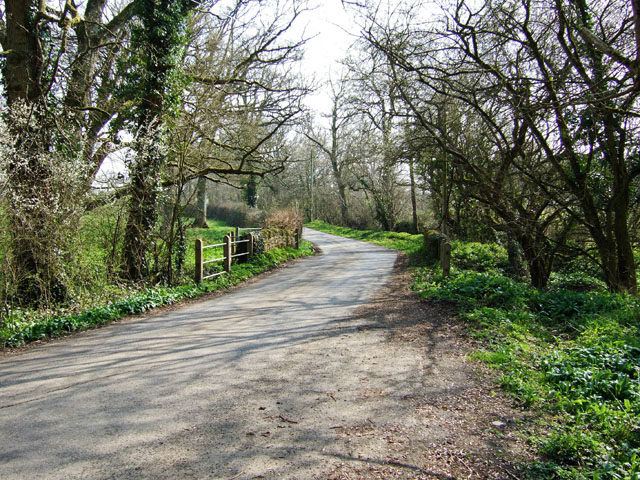
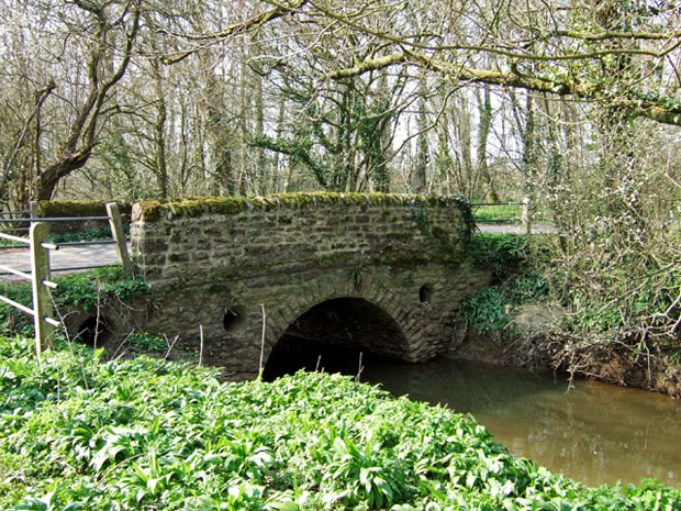
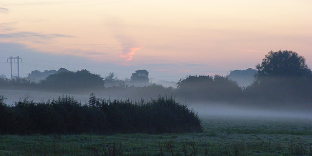
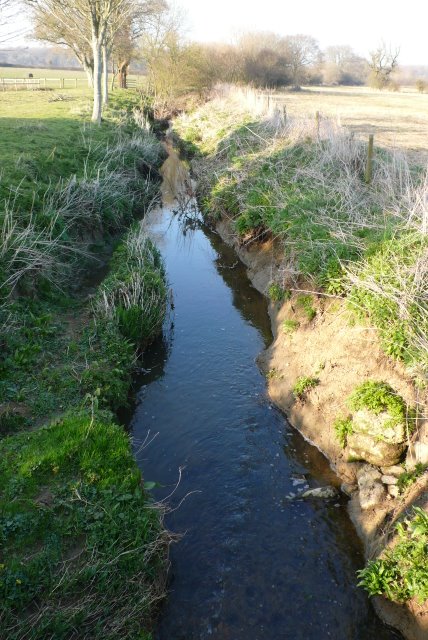
Berkeley's Plantation, located in Dorset, England, is a picturesque woodland area renowned for its diverse plant and animal life. Covering a vast expanse, the plantation is situated in a lush forest, providing a serene and tranquil environment for visitors.

The plantation boasts an array of tree species, such as oak, beech, and chestnut, which create a stunning canopy overhead. The rich undergrowth is adorned with a variety of plants, including bluebells, ferns, and wildflowers, adding vibrant colors to the landscape throughout the seasons.

The plantation is home to a wide range of wildlife, making it a haven for nature enthusiasts. Visitors may catch glimpses of deer gracefully roaming through the woods, rabbits hopping between the trees, and squirrels playfully darting through the branches. The air is often filled with the melodic songs of birds, including thrushes, woodpeckers, and robins.

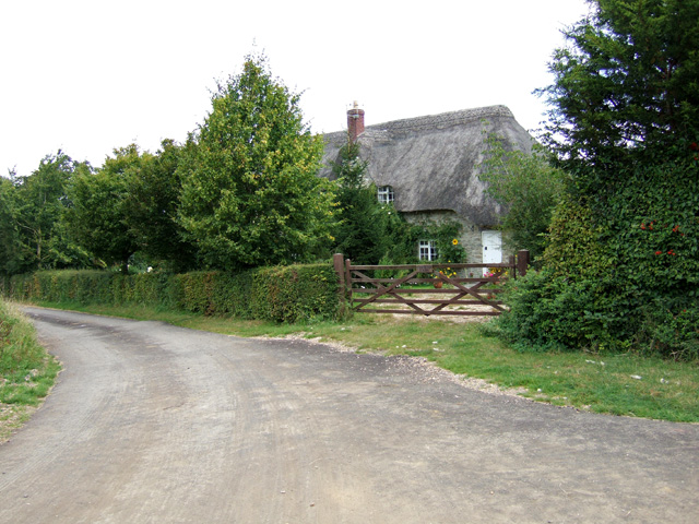
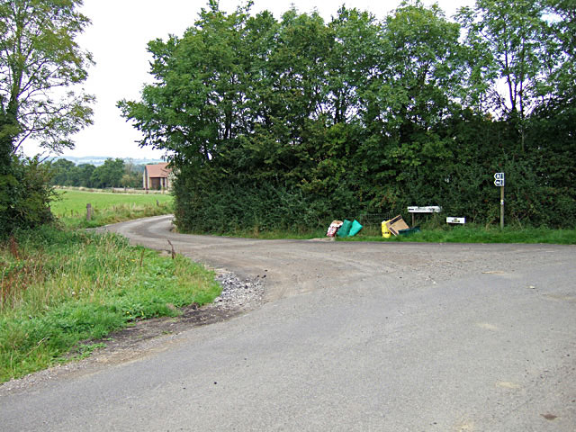
For those wishing to explore the plantation, there are numerous walking trails and paths winding through the forest. These paths offer visitors the opportunity to immerse themselves in the natural beauty of the woodland, providing a peaceful and meditative experience. Along the way, there are several designated picnic areas, allowing visitors to relax and enjoy the tranquil surroundings.

Berkeley's Plantation is not only a haven for nature lovers but also a valuable ecosystem that contributes to the overall biodiversity of the region. Its preservation and conservation efforts ensure that future generations can continue to enjoy the beauty and serenity that this woodland sanctuary offers.

If you have any feedback on the listing, please let us know in the comments section below.

Berkeley's Plantation Images

Images are sourced within 2km of 50.88372/-2.4763033 or Grid Reference ST6609. Thanks to Geograph Open Source API. All images are credited.

The turning to Leigh on the A352 near Holnest
Pylons near Boys Hill
Hunters Bridge Road bridge over The Cam southeast of Longburton.
Hunters Bridge
Road bridge over The Cam southeast of Longburton.
Hunters Bridge (2)
Hunters Bridge (2)
Daybreak in the Blackmore Vale Looking east from the A352 at Holnest at 6am on an autumnal August bank holiday morning. Here the flat pastures are drained by The Cam and its tributaries, the waters of which make their way to the Stour via Caundle Brook and the River Lydden. This is the western end of Hardy's "Vale of the Little Dairies".
Daybreak in the Blackmore Vale
Looking east from the A352 at Holnest at 6am on an autumnal August bank holiday morning. Here the flat pastures are drained by The Cam and its tributaries, the waters of which make their way to the Stour via Caundle Brook and the River Lydden. This is the western end of Hardy's "Vale of the Little Dairies".
Fosters Farm B & B Boys Hill
Boys Hill
Boys Hill
Hunter's Bridge (3) near Longburton, Dorset The bridge is where Broke Lane, one of the old roads running south from Sherborne crosses the River Cam
Hunter's Bridge (3) near Longburton, Dorset
The bridge is where Broke Lane, one of the old roads running south from Sherborne crosses the River Cam
Farmland near Longburton This is on Broke Laneclose to Folly Wood just south of Hunters Bridge
Farmland near Longburton
This is on Broke Laneclose to Folly Wood just south of Hunters Bridge
Broke Lane near Longburton This is the view north along Broke Lane on the edge of Folly Wood looking towards Hunters Bridge and the River Cam
Broke Lane near Longburton
This is the view north along Broke Lane on the edge of Folly Wood looking towards Hunters Bridge and the River Cam
Holnest: postbox № DT9 92 and phone box The postbox is emptied finally at 12:30 on weekdays and at 9am on Saturdays. Just beyond, the turning to the right is Seven Oaks Common Road.
Holnest: postbox № DT9 92 and phone box
The postbox is emptied finally at 12:30 on weekdays and at 9am on Saturdays. Just beyond, the turning to the right is Seven Oaks Common Road.
Footpath near Holnest The footpath takes walkers to Hunters Bridge Coppice from the A352.
Footpath near Holnest
The footpath takes walkers to Hunters Bridge Coppice from the A352.
Stream Near Holnest. This small stream is crossed by Boyshill Drove in between Elm Farm and Berkeley Farm.
Stream Near Holnest.
This small stream is crossed by Boyshill Drove in between Elm Farm and Berkeley Farm.
Stream at Holnest This small stream runs adjacent to Boyshill Drove before passing under it in a culvert just east of Elme Farm.
Stream at Holnest
This small stream runs adjacent to Boyshill Drove before passing under it in a culvert just east of Elme Farm.
Boys Hill This cottage and barn conversion at Boys Hill are in the southeast corner of this very rural square
Boys Hill
This cottage and barn conversion at Boys Hill are in the southeast corner of this very rural square
Ryewater Farm This field is part of Ryewater farm in the centre of the grid square near the southern end of Broke Lane.
Ryewater Farm
This field is part of Ryewater farm in the centre of the grid square near the southern end of Broke Lane.
Glanvilles Wootton Manor House This is the view of the manor house from the field behind the house showing the rear of the buildings. The original house was 17th C but it has been much altered and added to. It is Grade 2 listed.
Glanvilles Wootton Manor House
This is the view of the manor house from the field behind the house showing the rear of the buildings. The original house was 17th C but it has been much altered and added to. It is Grade 2 listed.
Glanvilles Wootton, footpath From Middlemarsh: the path seems to have been diverted to field margins, judging from tracks.
Glanvilles Wootton, footpath
From Middlemarsh: the path seems to have been diverted to field margins, judging from tracks.
Show me another place!

Berkeley's Plantation is located at Grid Ref: ST6609 (Lat: 50.88372, Lng: -2.4763033)

Unitary Authority: Dorset

Police Authority: Dorset

What 3 Words

///tuned.sand.variation. Near Yetminster, Dorset

Related Wikis

Holnest

Holnest is a village and civil parish in the county of Dorset in southern England. It lies in the Blackmore Vale 4 miles (6.4 km) south of Sherborne. It...

Holnest SSSI, Dorset

Holnest SSSI, Dorset (grid reference ST667106) is a 54.83 hectare biological Site of Special Scientific Interest in Dorset, notified in 2004.The site has...

Glanvilles Wootton

Glanvilles Wootton, or Wootton Glanville, is a village and civil parish in the county of Dorset in southern England. It is situated in the Blackmore Vale...

Dungeon Hill

Dungeon Hill is an Iron Age hillfort, about 1+1⁄4 miles (2 kilometres) north of the village of Buckland Newton in Dorset, England. It is a scheduled monument...

Hermitage, Dorset

Hermitage is a small village and civil parish in the county of Dorset in southern England. It is situated in the Blackmore Vale under the scarp of the...

Longburton

Longburton or Long Burton is a village in Dorset, England, three miles (5 km) south of Sherborne. It is sited on a narrow outcrop of Cornbrash limestone...

Holwell, Dorset

Holwell is a village and civil parish in the county of Dorset in southern England, situated approximately 5 miles (8.0 km) south-east of Sherborne. It...

St Peter and St Paul's Church, Caundle Marsh

St Peter and St Paul's Church is a Church of England parish church in Caundle Marsh, Dorset, England. It was designed by Robert Howard Shout and built...

Nearby Amenities

Located within 500m of 50.88372,-2.4763033
Barrier: yes
Lat/Long: 50.880176/-2.4726852
Power: pole
Source: bing
Lat/Long: 50.8801489/-2.4733615
Power: pole
Source: bing
Lat/Long: 50.8800237/-2.4740267
Power: pole
Source: bing
Lat/Long: 50.8797994/-2.4748541
Power: pole
Source: bing
Lat/Long: 50.8798976/-2.474712
Power: pole
Source: bing
Lat/Long: 50.8794339/-2.4756467
Poles: bipole
Power: pole
Source: bing
Transformer: distribution
Lat/Long: 50.8796674/-2.4751975
Power: pole
Source: bing
Lat/Long: 50.87967/-2.4759994
Power: pole
Source: bing
Lat/Long: 50.879692/-2.4770643
Power: pole
Source: bing
Lat/Long: 50.8796928/-2.478105
Power: pole
Source: bing
Lat/Long: 50.879692/-2.4793991
The data included in this document is from www.openstreetmap.org. The data is made available under ODbL.

Have you been to Berkeley's Plantation?

Leave your review of Berkeley's Plantation below (or comments, questions and feedback).