Cotes

Settlement in Leicestershire Charnwood

England

Cotes

Footpath off Loughborough Road Going past Mere Hill Spinney on the left
Footpath off Loughborough Road Credit: Tim Heaton

Cotes is a small village located in the county of Leicestershire, England. Situated approximately 3 miles north of the market town of Loughborough, Cotes is a rural community with a population of around 300 residents. The village is surrounded by picturesque countryside and provides a tranquil and idyllic setting.

Cotes is known for its historic charm, with many of its buildings dating back to the 17th and 18th centuries. The village is characterized by its quaint thatched cottages and traditional brick houses, giving it a traditional English village feel.

While Cotes is a small village, it offers its residents a range of amenities and services. The village has a primary school, providing education for local children, and a village hall that hosts various community events and activities. There is also a pub in Cotes, serving as a social hub for both residents and visitors.

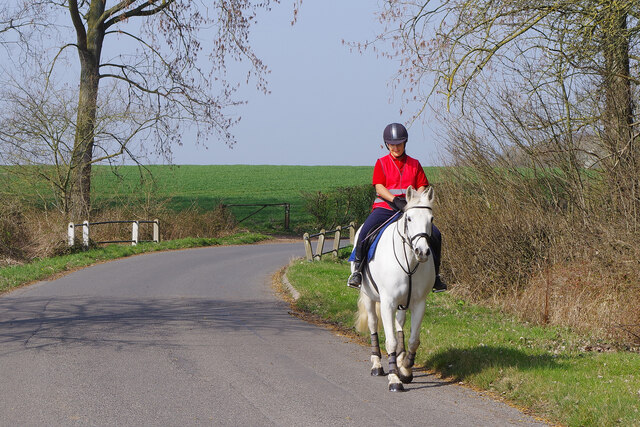
The surrounding countryside provides ample opportunities for outdoor activities, including walking, cycling, and horse riding. Cotes is also conveniently located near the popular Charnwood Forest, offering stunning natural landscapes and wildlife.

For those seeking more amenities and services, the nearby town of Loughborough provides a wider range of shops, supermarkets, restaurants, and leisure facilities. Loughborough is easily accessible from Cotes, either by car or public transport.

Overall, Cotes offers a peaceful and charming village lifestyle, with a close-knit community and easy access to both rural and urban amenities.

If you have any feedback on the listing, please let us know in the comments section below.
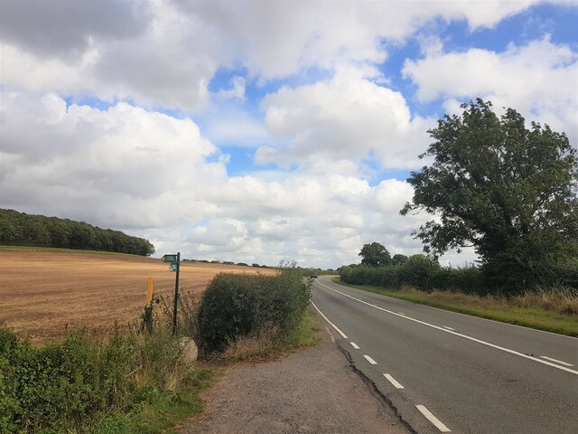
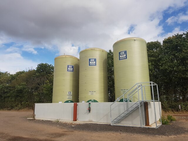
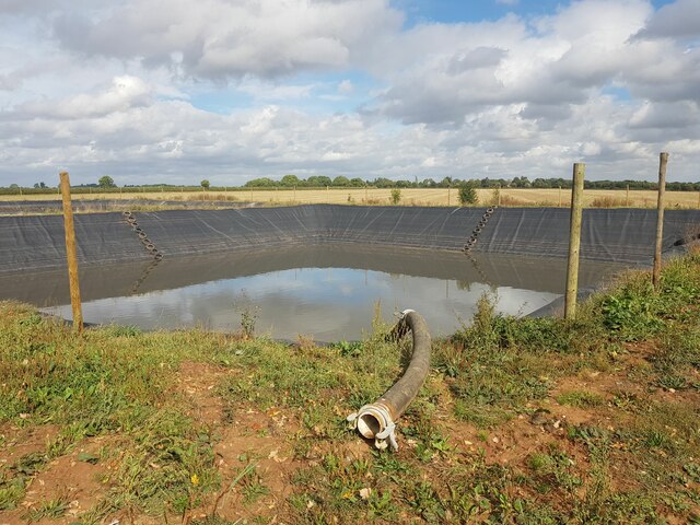
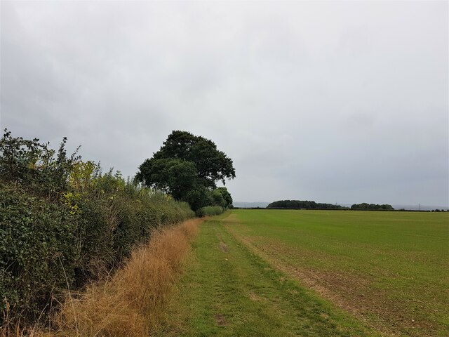
Cotes Images

Images are sourced within 2km of 52.780244/-1.1757271 or Grid Reference SK5520. Thanks to Geograph Open Source API. All images are credited.

Footpath off Loughborough Road Going past Mere Hill Spinney on the left
Footpath off Loughborough Road
Going past Mere Hill Spinney on the left
Liquid fertilizer tanks and bund "Chafer 35N + 7SO3". Mainly ammonium nitrate with urea and sulfate. I don't know if bund protection against leakage is a statutory requirement. This one looks well made.
Liquid fertilizer tanks and bund
"Chafer 35N + 7SO3". Mainly ammonium nitrate with urea and sulfate. I don't know if bund protection against leakage is a statutory requirement. This one looks well made.
'Prestwold Lagoons' slurry pit One of two pits operated by Whites Recycling
'Prestwold Lagoons' slurry pit
One of two pits operated by Whites Recycling
The Cross Britain Way on Moat Hill The Cross Britain Way is a 279 mile, east-west trail across England and Wales, created to help raise money for Macmillan Cancer Support. Starting at Boston (where the original Macmillan Way starts), it crosses the Fens, the Vale of Belvoir, the Leicestershire/Nottinghamshire Wolds, the National Forest, Cannock Chase, East Shropshire along the Iron Bridge Gorge, the Shropshire Hills, the hills of mid Wales, the Berwyn Mountains, and Snowdonia National Park, to its end at Barmouth. <span class="nowrap"><a title="https://ldwa.org.uk/ldp/members/show_path.php?path_name=Macmillan+Way+-+Cross+Britain+Way" rel="nofollow ugc noopener" href="https://ldwa.org.uk/ldp/members/show_path.php?path_name=Macmillan+Way+-+Cross+Britain+Way">Link</a><img style="margin-left:2px;" alt="External link" title="External link - shift click to open in new window" src="https://s1.geograph.org.uk/img/external.png" width="10" height="10"/></span>
The Cross Britain Way on Moat Hill
The Cross Britain Way is a 279 mile, east-west trail across England and Wales, created to help raise money for Macmillan Cancer Support. Starting at Boston (where the original Macmillan Way starts), it crosses the Fens, the Vale of Belvoir, the Leicestershire/Nottinghamshire Wolds, the National Forest, Cannock Chase, East Shropshire along the Iron Bridge Gorge, the Shropshire Hills, the hills of mid Wales, the Berwyn Mountains, and Snowdonia National Park, to its end at Barmouth. LinkExternal link
Telephone box at Loughborough Station Public telephones are becoming more and more of a rarity but railway stations are good places to find them. It is especially pleasing to find one housed in a traditional K6 box as here outside Loughborough station - but it could do with a lick of paint.
Telephone box at Loughborough Station
Public telephones are becoming more and more of a rarity but railway stations are good places to find them. It is especially pleasing to find one housed in a traditional K6 box as here outside Loughborough station - but it could do with a lick of paint.
Loughborough Station Loughborough station can be a busy place, not least because of the number of students travelling to and from the town's university. The newer section of building covers the ticket gates. There is also a substantial bicycle rack.
Loughborough Station
Loughborough station can be a busy place, not least because of the number of students travelling to and from the town's university. The newer section of building covers the ticket gates. There is also a substantial bicycle rack.
Loughborough Station The present station was opened in 1872 (replacing an earlier facility built in 1840) and its grade II listed status means that the best of its buildings and delightful traditional canopies have been retained. It was at one time one of three stations serving the town but this is the only one left on the National Rail network. Note the Brush works behind - the prominent sign has long been an iconic sight for travellers on the Midland Main Line.
Loughborough Station
The present station was opened in 1872 (replacing an earlier facility built in 1840) and its grade II listed status means that the best of its buildings and delightful traditional canopies have been retained. It was at one time one of three stations serving the town but this is the only one left on the National Rail network. Note the Brush works behind - the prominent sign has long been an iconic sight for travellers on the Midland Main Line.
Bridging the Loughborough Gap The bridge over the Midland Main Line is a reinstatement of the Great Central Railway's old route north of Loughborough Central station. The intention is that this will allow GCR heritage trains to run north of Loughborough as well as south. It is a complicated project but the construction of this bridge is a significant step forward.
Bridging the Loughborough Gap
The bridge over the Midland Main Line is a reinstatement of the Great Central Railway's old route north of Loughborough Central station. The intention is that this will allow GCR heritage trains to run north of Loughborough as well as south. It is a complicated project but the construction of this bridge is a significant step forward.
Brush Works The Brush Works, also known as the Falcon Works, occupies a large site on the northern edge of Loughborough. It has for many years manufactured railway and other transport equipment including some of the more successful diesel locomotives acquired by the British Transport Commission as part of its 1950s modernisation plan. In April 2021 the parent company, Wabtec, who had acquired Brush in 2011, announced the closure of the plant, citing reduced work volumes, putting about 300 jobs at risk. Outside the bus stop is served by three routes including the Kinchbus service to Nottingham via Bunny and the Centrebus service to Melton Mowbray via Wymeswold.
Brush Works
The Brush Works, also known as the Falcon Works, occupies a large site on the northern edge of Loughborough. It has for many years manufactured railway and other transport equipment including some of the more successful diesel locomotives acquired by the British Transport Commission as part of its 1950s modernisation plan. In April 2021 the parent company, Wabtec, who had acquired Brush in 2011, announced the closure of the plant, citing reduced work volumes, putting about 300 jobs at risk. Outside the bus stop is served by three routes including the Kinchbus service to Nottingham via Bunny and the Centrebus service to Melton Mowbray via Wymeswold.
Cotes Bridge Cotes Bridge carries the A60 over the River Soar. The structure dates from the 18th century, although some fragments are of medieval date and the parapet was rebuilt in the 20th century. It is grade II listed. The bridge was the location of a minor battle in 1644 during the Civil War when Royalist forces were trying to reach Newark to relieve the garrison there. They were held up by the Parliamentary army here and initially forced back into Loughborough, but after word was received that the Royalist garrison at Ashby castle had been reinforced, the Parliamentarians withdrew allowing the Royalists to continue on to Newark.
Cotes Bridge
Cotes Bridge carries the A60 over the River Soar. The structure dates from the 18th century, although some fragments are of medieval date and the parapet was rebuilt in the 20th century. It is grade II listed. The bridge was the location of a minor battle in 1644 during the Civil War when Royalist forces were trying to reach Newark to relieve the garrison there. They were held up by the Parliamentary army here and initially forced back into Loughborough, but after word was received that the Royalist garrison at Ashby castle had been reinforced, the Parliamentarians withdrew allowing the Royalists to continue on to Newark.
Footpath to Stanford Lane The footpath cuts a corner off between the A60 and Stanford Lane in Cotes village.
Footpath to Stanford Lane
The footpath cuts a corner off between the A60 and Stanford Lane in Cotes village.
A60 through Cotes Although the A60 is a long distance road, running in full from Loughborough to Doncaster, the southernmost section winds its way through a succession of villages in Leicestershire and Nottinghamshire. The first of these is Cotes, a very small place that most motorists probably barely notice. It's a pleasant enough drive if the traffic isn't too heavy.
A60 through Cotes
Although the A60 is a long distance road, running in full from Loughborough to Doncaster, the southernmost section winds its way through a succession of villages in Leicestershire and Nottinghamshire. The first of these is Cotes, a very small place that most motorists probably barely notice. It's a pleasant enough drive if the traffic isn't too heavy.
Parish notice case at Cotes It is a common arrangement for notices to be displayed in cases such as this one for Burton on the Wolds, Cotes and Prestwold Parish Council. As well as the council meeting agenda there is a variety of miscellaneous items posted including an advertisement for Mr Muck's Garden Supplies Ltd and Happy Waggs canine services.
Parish notice case at Cotes
It is a common arrangement for notices to be displayed in cases such as this one for Burton on the Wolds, Cotes and Prestwold Parish Council. As well as the council meeting agenda there is a variety of miscellaneous items posted including an advertisement for Mr Muck's Garden Supplies Ltd and Happy Waggs canine services.
Riding to Cotes This rather splendid horse and its lady rider were proceeding slowly along Stanford Lane on a beautiful spring day. Life at a nice gentle pace!
Riding to Cotes
This rather splendid horse and its lady rider were proceeding slowly along Stanford Lane on a beautiful spring day. Life at a nice gentle pace!
Bus shelter at Cotes Kinchbus service 9 passes through Cotes on its way from Loughborough to Nottingham via Bunny. For what is essentially a rural service the frequency is pretty good - hourly for much of the day and there is a Sunday service. What's more, the timetable case displays up-to-date information in an easy to read format - this is how it should be! The basically simple bus shelter has rather interesting brackets.
Bus shelter at Cotes
Kinchbus service 9 passes through Cotes on its way from Loughborough to Nottingham via Bunny. For what is essentially a rural service the frequency is pretty good - hourly for much of the day and there is a Sunday service. What's more, the timetable case displays up-to-date information in an easy to read format - this is how it should be! The basically simple bus shelter has rather interesting brackets.
Sprint at Loughborough Station The Sprint service operates on a frequent basis between Loughborough's railway station, the town centre and the university campus. Here, a vehicle is awaiting departure from outside the station.
Sprint at Loughborough Station
The Sprint service operates on a frequent basis between Loughborough's railway station, the town centre and the university campus. Here, a vehicle is awaiting departure from outside the station.
Brush Works Seen from Loughborough Station.
Brush Works
Seen from Loughborough Station.
Loughborough Station This is a classic Victorian Midland Main Line station design. Many have been either demolished or sold off over the last 40 years.
Loughborough Station
This is a classic Victorian Midland Main Line station design. Many have been either demolished or sold off over the last 40 years.
Show me another place!

Cotes is located at Grid Ref: SK5520 (Lat: 52.780244, Lng: -1.1757271)

Administrative County: Leicestershire

District: Charnwood

Police Authority: Leicestershire

What 3 Words

///lance.votes.juices. Near Loughborough, Leicestershire

Nearby Locations

Cotes

Related Wikis

Cotes, Leicestershire

Cotes is a hamlet and very small civil parish near the town of Loughborough in Leicestershire, England. Cotes has a population of about 50. At the 2011...

Cotes Grassland

Cotes Grassland is a 3.3-hectare (8.2-acre) biological Site of Special Scientific Interest in Cotes in Leicestershire.This meadow on the bank of the River...
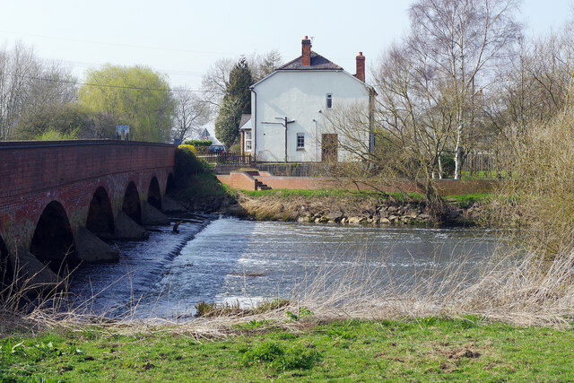
Cotes Mill

Cotes Mill is a Grade II listed 16th-century water mill on the banks of the River Soar in Cotes, Leicestershire. The first recorded mention of the mill...

Tyler's Ground

Tyler's Ground (also known as Tyler's Meadow) was a cricket ground in Loughborough, Leicestershire. It is believed the ground was located along Allsop...

Nearby Amenities

Located within 500m of 52.780244,-1.1757271
Post Box
Collection Times: Mo-Fr 16:00; Sa 09:30
Post Box Manufacturer: Carron Company, Stirlingshire
Post Box Type: lamp
Ref: LE12 47
Royal Cypher: EIIR
Royal Cypher Wikidata: Q33102113
Lat/Long: 52.7821527/-1.1784105
Cotes
Is In Country: UK
Is In County: Leicestershire
Place: village
Lat/Long: 52.7831313/-1.1786049
Bus Stop
Cotes Bridge
Alt Name: Cotes - B676 junction
Bus: yes
Naptan AltCommonName: Cotes - B676 junction
Naptan AtcoCode: 260007700
Naptan Bearing: S
Naptan CommonName: Cotes Bridge
Naptan Indicator: 30m before
Naptan Landmark: bridge over river
Naptan NaptanCode: leidwgag
Naptan Notes: Hourly - County
Naptan Street: Nottingham Road
Naptan Verified: no
Public Transport: platform
Source: naptan_import
Lat/Long: 52.7806978/-1.1791306
Bus Stop
Back Lane
Bus: yes
Naptan AtcoCode: 260007703
Naptan Bearing: NE
Naptan CommonName: Back Lane
Naptan Indicator: opposite
Naptan Landmark: Back Lane
Naptan NaptanCode: leidwgap
Naptan Notes: Hourly - County
Naptan Street: Loughborough Road
Naptan Verified: no
Public Transport: platform
Source: naptan_import
Lat/Long: 52.7823528/-1.1778857
DeVOL
Building: yes
Old Name: Cotes Mill
Source: Bing
Wikidata: Q26643187
Lat/Long: 52.7795831/-1.1819585
Power: pole
Lat/Long: 52.7797279/-1.1687193
Power: pole
Lat/Long: 52.7802127/-1.1693451
The data included in this document is from www.openstreetmap.org. The data is made available under ODbL.

Have you been to Cotes?

Leave your review of Cotes below (or comments, questions and feedback).