Haywood Plantation

Wood, Forest in Gloucestershire Forest of Dean

England

Haywood Plantation

St Anthony's Well Image of the historic well in woodland North-west of Flaxley.
St Anthony's Well Credit: Clint Mann

Haywood Plantation is a historic estate located in the county of Gloucestershire, England. Situated in the heart of the woodlands and forests of the region, the plantation has a rich history dating back several centuries. The estate covers a vast area of land, with dense woodlands and sprawling meadows, making it a haven for nature enthusiasts and wildlife.

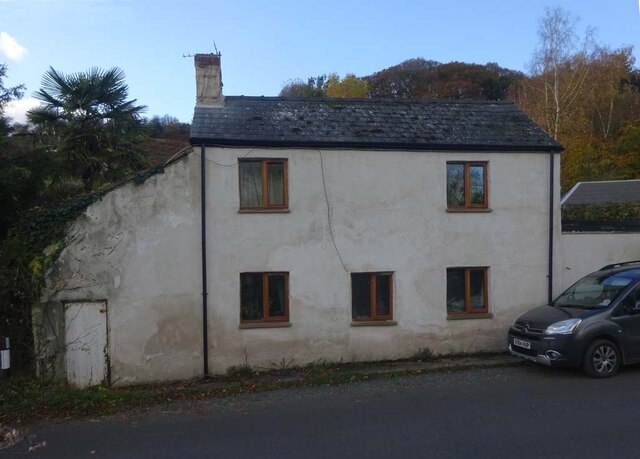
The main house at Haywood Plantation is an impressive Georgian mansion, built in the 18th century. The architecture of the house is a testament to the grandeur and elegance of the period, with its symmetrical design, large windows, and intricate detailing. Surrounding the mansion, there are beautifully landscaped gardens, featuring manicured lawns, flower beds, and ornamental shrubs.

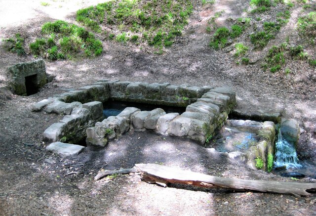
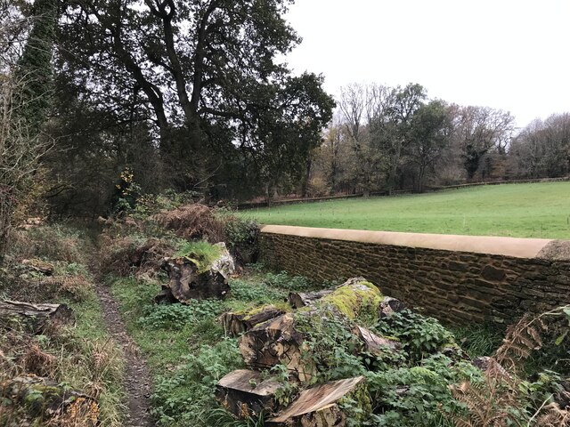
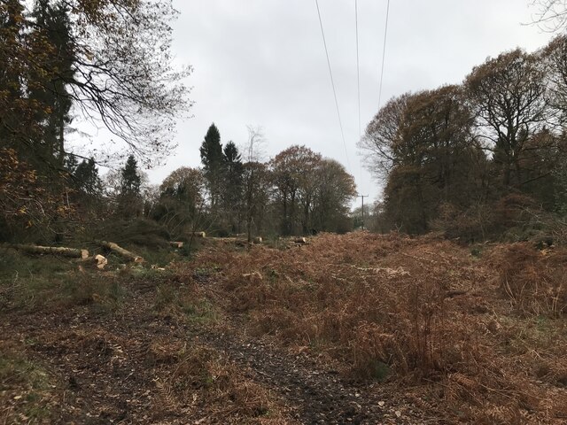
The plantation is renowned for its extensive woodland, which covers a significant portion of the estate. The woodlands are home to a diverse range of tree species, including oak, beech, and ash, providing a habitat for a variety of flora and fauna. Walking trails wind through the woods, allowing visitors to explore the natural beauty of the area.

Haywood Plantation also boasts a functioning farm, with fields dedicated to crop cultivation and livestock rearing. The farm produces a range of agricultural products, including grains, vegetables, and dairy products, which are sold locally.

In addition to its natural beauty and agricultural activities, the plantation offers a range of recreational activities for visitors. These include fishing in the nearby river, horseback riding through the estate, and organized nature walks.

Overall, Haywood Plantation is a picturesque estate that offers a combination of history, natural beauty, and agricultural practices. It is a popular destination for tourists and locals alike, seeking to immerse themselves in the charm of Gloucestershire's woodlands and countryside.

If you have any feedback on the listing, please let us know in the comments section below.

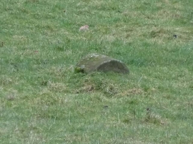
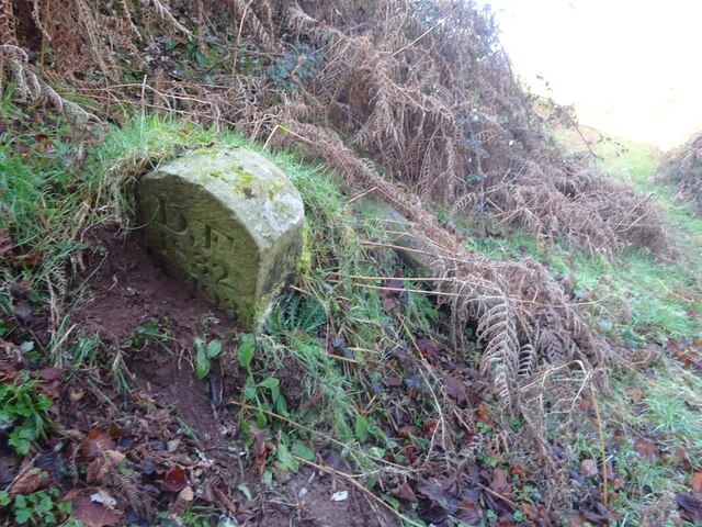
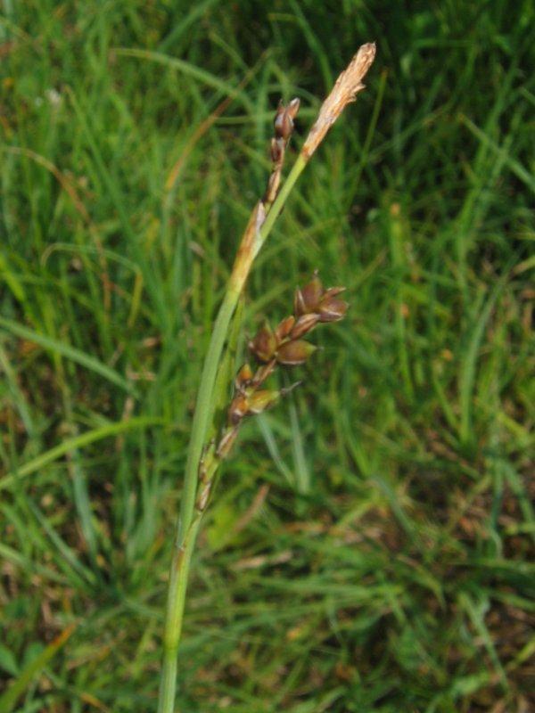
Haywood Plantation Images

Images are sourced within 2km of 51.838555/-2.5019048 or Grid Reference SO6515. Thanks to Geograph Open Source API. All images are credited.

St Anthony's Well Image of the historic well in woodland North-west of Flaxley.
St Anthony's Well
Image of the historic well in woodland North-west of Flaxley.
Overgrown pathway
Overgrown pathway
Repaired wall
Repaired wall
Felled trees
Felled trees
Newtown Road, Steam Mills Post-industrial landscape.
Newtown Road, Steam Mills
Post-industrial landscape.
Machinery in the woods Various pieces of equipment litter the woodland at the end of Jubilee Lane.
Machinery in the woods
Various pieces of equipment litter the woodland at the end of Jubilee Lane.
Commemorative Plate, Cinderford On the wall of a house where Market and Victoria Streets concatenate.

Grade II Listed, details <span class="nowrap"><a title="https://historicengland.org.uk/listing/the-list/list-entry/1186466" rel="nofollow ugc noopener" href="https://historicengland.org.uk/listing/the-list/list-entry/1186466">Link</a><img style="margin-left:2px;" alt="External link" title="External link - shift click to open in new window" src="https://s1.geograph.org.uk/img/external.png" width="10" height="10"/></span>.

Inscription:
V (crown) R
This road for the distance
of 1100 ↢ yards was made
at the expense of the crown
for the benefit of the
inhabitants and district
1897 - 8
E.Stafford Howard Esq
Commissioner
Philip Baylis Esq
Dep Surveyor

Milestone Society National ID: GL_CIND05cm
Commemorative Plate, Cinderford
On the wall of a house where Market and Victoria Streets concatenate. Grade II Listed, details LinkExternal link. Inscription: V (crown) R This road for the distance of 1100 ↢ yards was made at the expense of the crown for the benefit of the inhabitants and district 1897 - 8 E.Stafford Howard Esq Commissioner Philip Baylis Esq Dep Surveyor Milestone Society National ID: GL_CIND05cm
Old Boundary Stone, Littledean Hill In the private garden of "Oak Ridge" in the Ruffitt. An original 1832 Forest of Dean boundary marker. 

Inscription: D.F / 1832 / Nᴼ. 209

Milestone Society National ID: GL_DFCINLIT209em
Old Boundary Stone, Littledean Hill
In the private garden of "Oak Ridge" in the Ruffitt. An original 1832 Forest of Dean boundary marker. Inscription: D.F / 1832 / Nᴼ. 209 Milestone Society National ID: GL_DFCINLIT209em
Boundary Stone, Cinderford On the corner of Littledean Hill Road, and the chamfered corner of the former Royal Forrester pub. Technically on private land but effectively just off the road.
The context view of the ex pub is <a href="https://www.geograph.org.uk/photo/4430088">SO6614 : Former Royal Forester, Cinderford</a>

Inscription: D.F / 2008 / Nᴼ. 211

Milestone Society National ID: GL_DFCINLIT211em
Boundary Stone, Cinderford
On the corner of Littledean Hill Road, and the chamfered corner of the former Royal Forrester pub. Technically on private land but effectively just off the road. The context view of the ex pub is SO6614 : Former Royal Forester, Cinderford Inscription: D.F / 2008 / Nᴼ. 211 Milestone Society National ID: GL_DFCINLIT211em
Boundary Stone, Cinderford In the High Street where the line of the row of shops kinks, near the pedestrian crossing.

Inscription: D.F / 2010 / Nᴼ. 213

Milestone Society National ID: GL_DFCIND213em
Boundary Stone, Cinderford
In the High Street where the line of the row of shops kinks, near the pedestrian crossing. Inscription: D.F / 2010 / Nᴼ. 213 Milestone Society National ID: GL_DFCIND213em
Boundary Stone, Littledean Hill On the Southern side of the road (the Ruffitt) in the driveway of "Stone Cottage".

Inscription: D.F / 2015 / Nᴼ. 210

Milestone Society National ID: GL_DFCINLIT210em
Boundary Stone, Littledean Hill
On the Southern side of the road (the Ruffitt) in the driveway of "Stone Cottage". Inscription: D.F / 2015 / Nᴼ. 210 Milestone Society National ID: GL_DFCINLIT210em
Boundary Stone, Cinderford On the corner of Edge Hills Road and Causeway Road. Just to confuse, the houses above are addressed as being in Wedgewood Crescent. Including 9 and 10, clearly in Edge Hills Road.

Inscription: D.F. / 2011 / Nᴼ. 212

Milestone Society National ID: GL_DFCIND212em
Boundary Stone, Cinderford
On the corner of Edge Hills Road and Causeway Road. Just to confuse, the houses above are addressed as being in Wedgewood Crescent. Including 9 and 10, clearly in Edge Hills Road. Inscription: D.F. / 2011 / Nᴼ. 212 Milestone Society National ID: GL_DFCIND212em
Commemorative Plate, Cinderford On the wall of an empty shop at the junction of High Street and Wesley Road. An older image showing the plaque when the shop was a greengocer's is <a href="https://www.geograph.org.uk/photo/728722">SO6514 : Traditional greengrocer, High Street, Cinderford</a>.
E.Stafford Howard was MP for Thornbury 1885/6. Served as Under-Secretary of State for India under William Ewart Gladstone. Later Senior Commissioner of HM's Woods and Forests.

Inscription:
V (crown) R
This road for the distance
of 670 ↢ yards was made
at the expense of the crown
for the benefit of the
inhabitants and district
1897 - 8
E.Stafford Howard Esq
Commissioner
Philip Baylis Esq
Dep Surveyor

Milestone Society National ID: GL_CIND06cm
Commemorative Plate, Cinderford
On the wall of an empty shop at the junction of High Street and Wesley Road. An older image showing the plaque when the shop was a greengocer's is SO6514 : Traditional greengrocer, High Street, Cinderford. E.Stafford Howard was MP for Thornbury 1885/6. Served as Under-Secretary of State for India under William Ewart Gladstone. Later Senior Commissioner of HM's Woods and Forests. Inscription: V (crown) R This road for the distance of 670 ↢ yards was made at the expense of the crown for the benefit of the inhabitants and district 1897 - 8 E.Stafford Howard Esq Commissioner Philip Baylis Esq Dep Surveyor Milestone Society National ID: GL_CIND06cm
Pike House, George Road, Littledean Former Toll House opposite Greenway. Used by the Forest of Dean Turnpike Trust in the 19th Century. See on the map of GB (UK) Toll houses <span class="nowrap"><a title="http://gbth.mister.red/#13/51.828/-2.47859" rel="nofollow ugc noopener" href="http://gbth.mister.red/#13/51.828/-2.47859">Link</a><img style="margin-left:2px;" alt="External link" title="External link - shift click to open in new window" src="https://s1.geograph.org.uk/img/external.png" width="10" height="10"/></span>

Milestone Society National ID: GL.LIT01
Pike House, George Road, Littledean
Former Toll House opposite Greenway. Used by the Forest of Dean Turnpike Trust in the 19th Century. See on the map of GB (UK) Toll houses LinkExternal link Milestone Society National ID: GL.LIT01
Boundary Stone, field, Morse Road Forest of Dean boundary stone in a field in the area described on old maps as The Morse. Looking from Morse Road the stone is maybe 100 yds from the road, ie private land.

Inscription (assumed): D. F. / 1832 / Nᴼ. 133 

Milestone Society National ID: GL_DFDRRU133em
Boundary Stone, field, Morse Road
Forest of Dean boundary stone in a field in the area described on old maps as The Morse. Looking from Morse Road the stone is maybe 100 yds from the road, ie private land. Inscription (assumed): D. F. / 1832 / Nᴼ. 133 Milestone Society National ID: GL_DFDRRU133em
Boundary Stone, Shapridge Slowly descending the slope beside Gloucestershire footpath DMD35, just North of a gate. The slope is subsiding gently East.

Inscription: D. F. / 1832 / Nᴼ. 193

Milestone Society National ID: GL_DFLIMI193em
Boundary Stone, Shapridge
Slowly descending the slope beside Gloucestershire footpath DMD35, just North of a gate. The slope is subsiding gently East. Inscription: D. F. / 1832 / Nᴼ. 193 Milestone Society National ID: GL_DFLIMI193em
Boundary Stone, Shapridge A Forest of Dean boundary stone at the left hand end of a bridge parapet on the NE verge of the road. The coping stones of the parapet are at 91.2 m Above Sea Level.

Inscription: D. F. / 2009 / Nᴼ. 192

Milestone Society National ID: GL_DFLIMI192em
Boundary Stone, Shapridge
A Forest of Dean boundary stone at the left hand end of a bridge parapet on the NE verge of the road. The coping stones of the parapet are at 91.2 m Above Sea Level. Inscription: D. F. / 2009 / Nᴼ. 192 Milestone Society National ID: GL_DFLIMI192em
Boundary Stone, Horsepool Bottom A Forest of Dean boundary stone in a field adjacent to Jubilee Road 1km South of Mitcheldean.

Inscription: D. F / 1832 / Nᴼ. 189

Milestone Society National ID: GL_DFMITC189em
Boundary Stone, Horsepool Bottom
A Forest of Dean boundary stone in a field adjacent to Jubilee Road 1km South of Mitcheldean. Inscription: D. F / 1832 / Nᴼ. 189 Milestone Society National ID: GL_DFMITC189em
Show me another place!

Haywood Plantation is located at Grid Ref: SO6515 (Lat: 51.838555, Lng: -2.5019048)

Administrative County: Gloucestershire

District: Forest of Dean

Police Authority: Gloucestershire

What 3 Words

///welfare.precluded.thigh. Near Cinderford, Gloucestershire

Related Wikis

Edgehills Bog

Edgehills Bog (grid reference SO660154) is a 0.66-hectare (1.6-acre) nature reserve in Gloucestershire in the Forest of Dean.The site is managed by the...

Steam Mills Crossing Halt railway station

Steam Mills Crossing Halt railway station served the village of Steam Mills, Gloucestershire, England, from 1907 to 1930 on the Mitcheldean Road and Forest...

Steam Mills

Steam Mills is a village in the Forest of Dean, west Gloucestershire, England. During the 18th and 19th centuries there were local coal mines and a steam...

Cinderford Canal

The Cinderford Canal was a private canal, opened in about 1797, in Gloucestershire, England, which was used to provide coke and water to Cinderford Ironworks...

Whimsey Halt railway station

Whimsey Halt railway station served the town of Cinderford, Gloucestershire, England, from 1907 to 1930 on the Mitcheldean Road and Forest of Dean Junction...

Edgehills Quarry

Edgehills Quarry (grid reference SO660167) is a 0.4-hectare (0.99-acre) geological Site of Special Scientific Interest in Gloucestershire, notified in...

The Forest High School, Cinderford

Forest High School is a coeducational secondary school with academy status, located in Cinderford in the English county of Gloucestershire.The school was...

Westbury Brook Ironstone Mine

Westbury Brook Ironstone Mine (grid reference SO662166) is a 15.69-hectare (38.8-acre) biological Site of Special Scientific Interest in Gloucestershire...

Have you been to Haywood Plantation?

Leave your review of Haywood Plantation below (or comments, questions and feedback).